Moosonee Airport
Moosonee Airport, (IATA: YMO, ICAO: CYMO), is located 2 nautical miles (3.7 km; 2.3 mi) north-east of Moosonee, Ontario, Canada.
Moosonee Airport | |||||||||||||||
|---|---|---|---|---|---|---|---|---|---|---|---|---|---|---|---|
 | |||||||||||||||
| Summary | |||||||||||||||
| Airport type | Public | ||||||||||||||
| Operator | The Corporation of the Town of Moosonee | ||||||||||||||
| Location | Moosonee, Ontario | ||||||||||||||
| Time zone | EST (UTC−05:00) | ||||||||||||||
| • Summer (DST) | EDT (UTC−04:00) | ||||||||||||||
| Elevation AMSL | 30 ft / 9 m | ||||||||||||||
| Coordinates | 51°17′31″N 080°36′30″W | ||||||||||||||
| Website | www | ||||||||||||||
| Map | |||||||||||||||
 CYMO Location in Ontario | |||||||||||||||
| Runways | |||||||||||||||
| |||||||||||||||
| Statistics (2010) | |||||||||||||||
| |||||||||||||||
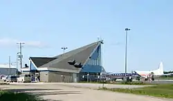
The Moosonee Airport was officially opened in May 1970 and a new terminal building was constructed in July 1991,[4] that houses the airport management office and washrooms. There are several small buildings and hangars at the airport. There are no other facilities at the airport.
The airport handles propeller or turbo prop aircraft only and helicopters from two helipads next to the terminal building.
Airlines and destinations
| Airlines | Destinations |
|---|---|
| Air Creebec | Attawapiskat, Fort Albany, Kashechewan, Peawanuck, Timmins[5] |
| North Star Air | Attawapiskat, Fort Albany, Kashechewan |
| Thunder Airlines | Attawapiskat, Fort Albany, Kashechewan, Peawanuck, Timmins |
Tenants
- CHC Helicopter and Wabusk Air[6] for ORNGE
See also
References
- Canada Flight Supplement. Effective 0901Z 16 July 2020 to 0901Z 10 September 2020.
- Synoptic/Metstat Station Information
- Total aircraft movements by class of operation
- "Moosonee Community Profile" (PDF). Wakenagun Community Futures Development Corporation. Archived from the original (PDF) on 2011-07-06. Retrieved 2010-12-22.
- Air Creebec Archived 2008-01-22 at the Wayback Machine
- Wabusk Air
External links
 Media related to Moosonee Airport at Wikimedia Commons
- Past three hours METARs, SPECI and current TAFs for Moosonee Airport from Nav Canada as available.
- Official website
| By name | |
|---|---|
| By location indicator | |
| By province/territory | |
| By area | |
| National Airports System | |
| Related | |
| |
This article is issued from Wikipedia. The text is licensed under Creative Commons - Attribution - Sharealike. Additional terms may apply for the media files.