National Register of Historic Places listings in Androscoggin County, Maine
This is a list of the National Register of Historic Places listings in Androscoggin County, Maine.
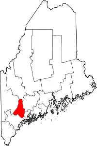
Location of Androscoggin County in Maine
This is intended to be a complete list of the properties and districts on the National Register of Historic Places in Androscoggin County, Maine, United States. Latitude and longitude coordinates are provided for many National Register properties and districts; these locations may be seen together in a map.[1]
There are 107 properties and districts listed on the National Register in the county, including 1 National Historic Landmark. Another 8 sites once listed on the Register have been removed.
- This National Park Service list is complete through NPS recent listings posted February 5, 2021.[2]
| Androscoggin - Aroostook - Cumberland - Franklin - Hancock - Kennebec - Knox - Lincoln - Oxford - Penobscot - Piscataquis - Sagadahoc - Somerset - Waldo - Washington - York |
Current listings
| [3] | Name on the Register[4] | Image | Date listed[5] | Location | City or town | Description |
|---|---|---|---|---|---|---|
| 1 | All Souls Chapel | 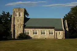 All Souls Chapel |
November 17, 1977 (#77000060) |
South of Mechanic Falls on State Route 26 at Poland Spring 44°01′35″N 70°21′40″W |
Poland | |
| 2 | Androscoggin County Courthouse and Jail | 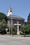 Androscoggin County Courthouse and Jail |
December 29, 1983 (#83003633) |
2 Turner St. 44°05′52″N 70°13′38″W |
Auburn | |
| 3 | Androscoggin Mill Block | 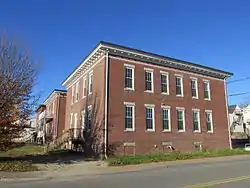 Androscoggin Mill Block |
April 12, 2001 (#01000367) |
269-271 Park St. 44°05′27″N 70°12′49″W |
Lewiston | |
| 4 | Atkinson Building | 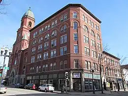 Atkinson Building |
February 2, 1983 (#83000444) |
220 Lisbon St. 44°05′41″N 70°13′00″W |
Lewiston | |
| 5 | Auburn Commercial Historic District | 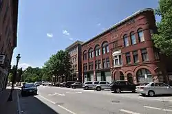 Auburn Commercial Historic District |
December 29, 2014 (#14001087) |
Main & Court Sts. 44°05′50″N 70°13′29″W |
Auburn | |
| 6 | Auburn Public Library |  Auburn Public Library |
March 22, 1984 (#84001357) |
49 Spring St. 44°05′53″N 70°13′47″W |
Auburn | |
| 7 | Bagley-Bliss House | 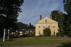 Bagley-Bliss House |
March 22, 1996 (#96000242) |
1290 Royalsborough Rd. 43°56′48″N 70°07′12″W |
South Durham | Now the Royalsborough Inn. |
| 8 | Barker Mill | 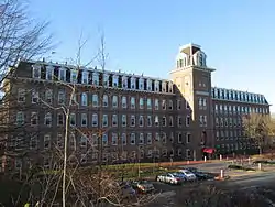 Barker Mill |
May 8, 1979 (#79000123) |
143 Mill St. 44°05′15″N 70°13′39″W |
Auburn | |
| 9 | Bates Mill Historic District | 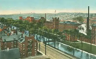 Bates Mill Historic District |
December 15, 2010 (#10001036) |
Roughly bounded by Canal St., Chestnut St,, Lincoln St, and Main St. 44°05′44″N 70°13′11″W |
Lewiston | |
| 10 | Big Ram Site | November 14, 1992 (#92001515) |
On Ram Island[6] 44°19′20″N 70°11′06″W |
Ram Island | ||
| 11 | William Briggs Homestead | 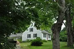 William Briggs Homestead |
March 20, 1986 (#86000477) |
1470 Turner St. 44°07′35″N 70°13′50″W |
Auburn | |
| 12 | Cape Site | November 14, 1992 (#92001511) |
Address Restricted |
West Leeds | ||
| 13 | John D. Clifford House | 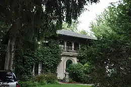 John D. Clifford House |
December 30, 1987 (#87002190) |
14-16 Ware St. 44°06′35″N 70°12′29″W |
Lewiston | |
| 14 | Clough Meeting House | 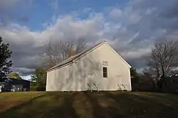 Clough Meeting House |
June 25, 2013 (#13000438) |
32 South Lisbon Road 44°03′49″N 70°08′52″W |
Lewiston | |
| 15 | College Block-Lisbon Block | 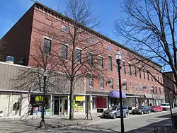 College Block-Lisbon Block |
April 25, 1986 (#86002279) |
248-274 Lisbon St. 44°05′39″N 70°12′58″W |
Lewiston | |
| 16 | Continental Mill Housing |  Continental Mill Housing |
July 10, 1979 (#79000124) |
66-82 Oxford St. 44°05′30″N 70°13′11″W |
Lewiston | |
| 17 | Charles L. Cushman House | 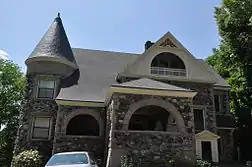 Charles L. Cushman House |
June 16, 1980 (#80000210) |
8 Cushman Pl. 44°05′25″N 70°13′56″W |
Auburn | |
| 18 | Danville Junction Grange #65 | 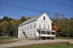 Danville Junction Grange #65 |
April 5, 2016 (#16000138) |
15 Grange St. 44°01′22″N 70°15′53″W |
Auburn | |
| 19 | Holman Day House | 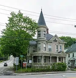 Holman Day House |
January 20, 1978 (#78000155) |
2 Goff St. 44°05′54″N 70°13′57″W |
Auburn | |
| 20 | Frank L. Dingley House | 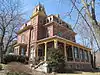 Frank L. Dingley House |
April 23, 1980 (#80000211) |
291 Court St. 44°05′53″N 70°13′58″W |
Auburn | |
| 21 | Dominican Block | 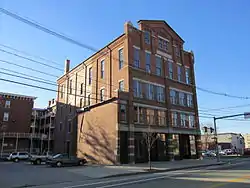 Dominican Block |
January 15, 1980 (#80000212) |
141-145 Lincoln St. 44°05′34″N 70°13′10″W |
Lewiston | |
| 22 | Elms | 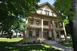 Elms |
March 21, 1985 (#85000610) |
Elm St. 44°06′38″N 70°23′25″W |
Mechanic Falls | |
| 23 | Engine House | 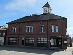 Engine House |
May 22, 1978 (#78000156) |
Court and Spring Sts. 44°05′50″N 70°13′40″W |
Auburn | |
| 24 | Excelsior Grange #5 | 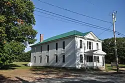 Excelsior Grange #5 |
April 5, 2016 (#16000137) |
446 Harris Hill Rd. 44°04′57″N 70°21′55″W |
Poland | |
| 25 | Farwell Mill | 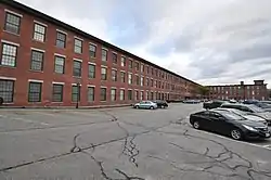 Farwell Mill |
June 20, 1985 (#85001260) |
State Route 196 44°01′52″N 70°06′15″W |
Lisbon | |
| 26 | First Callahan Building | 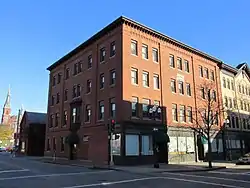 First Callahan Building |
April 25, 1986 (#86002280) |
276 Lisbon St. 44°05′39″N 70°12′58″W |
Lewiston | |
| 27 | First McGillicuddy Block |  First McGillicuddy Block |
April 25, 1986 (#86002281) |
133 Lisbon St. 44°05′47″N 70°13′04″W |
Lewiston | |
| 28 | First National Bank | 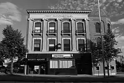 First National Bank |
April 25, 1986 (#86002282) |
157-163 Main St. 44°05′55″N 70°13′06″W |
Lewiston | |
| 29 | First Universalist Church | 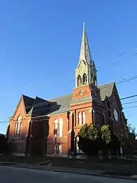 First Universalist Church |
May 7, 1979 (#79000126) |
Elm and Pleasant Sts. 44°05′39″N 70°13′46″W |
Auburn | |
| 30 | Horatio G. Foss House | 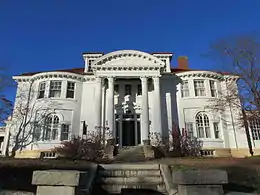 Horatio G. Foss House |
November 21, 1976 (#76000084) |
19 Elm St. 44°05′37″N 70°13′38″W |
Auburn | |
| 31 | Free Baptist Church | %252C_Auburn%252C_Maine.jpg.webp) Free Baptist Church |
July 13, 1989 (#89000843) |
Riverside Dr. 44°03′11″N 70°12′11″W |
Auburn | Also known as the Penley Corner Church. |
| 32 | Sen. William P. Frye House | 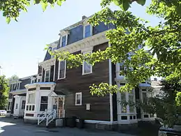 Sen. William P. Frye House |
October 8, 1976 (#76000189) |
453-461 Main St. 44°06′22″N 70°12′40″W |
Lewiston | |
| 33 | A. A. Garcelon House | 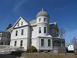 A. A. Garcelon House |
June 13, 1986 (#86001269) |
223 Main St. 44°05′38″N 70°13′36″W |
Auburn | |
| 34 | Gay-Munroe House | 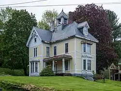 Gay-Munroe House |
December 31, 2001 (#01001422) |
64 Highland Ave. 44°06′00″N 70°14′04″W |
Auburn | |
| 35 | Grand Trunk Railroad Station | 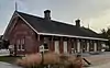 Grand Trunk Railroad Station |
June 4, 1979 (#79000127) |
Lincoln St. 44°05′37″N 70°13′12″W |
Lewiston | |
| 36 | Hathorn Hall, Bates College | 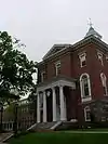 Hathorn Hall, Bates College |
August 25, 1970 (#70000071) |
Bates College campus 44°06′23″N 70°12′17″W |
Lewiston | |
| 37 | Healey Asylum | 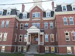 Healey Asylum |
October 1, 1979 (#79000128) |
81 Ash St. 44°05′50″N 70°12′49″W |
Lewiston | |
| 38 | Captain Holland House | 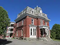 Captain Holland House |
March 21, 1985 (#85000609) |
142 College St. 44°06′08″N 70°12′38″W |
Lewiston | |
| 39 | Holland-Drew House | 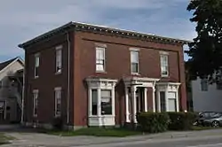 Holland-Drew House |
December 22, 1978 (#78000324) |
377 Main St. 44°06′12″N 70°12′44″W |
Lewiston | |
| 40 | Irish Site | November 14, 1992 (#92001517) |
Address Restricted |
East Auburn | ||
| 41 | Philip M. and Deborah N. Isaacson House |  Philip M. and Deborah N. Isaacson House |
November 18, 2011 (#11000816) |
2 Benson St. 44°06′30″N 70°12′25″W |
Lewiston | |
| 42 | Jordan School | 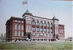 Jordan School |
March 22, 1984 (#84001355) |
35 Wood St. 44°06′03″N 70°12′36″W |
Lewiston | |
| 43 | Charles A. Jordan House | 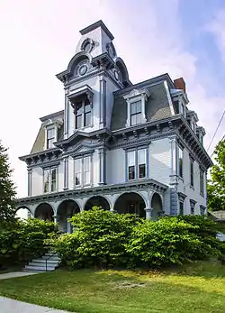 Charles A. Jordan House |
July 15, 1974 (#74000147) |
63 Academy St. 44°05′34″N 70°13′45″W |
Auburn | |
| 44 | F.M. Jordan House |  F.M. Jordan House |
December 29, 2014 (#14001088) |
18 Laurel Ave. 44°05′24″N 70°13′31″W |
Auburn | |
| 45 | Keystone Mineral Springs | 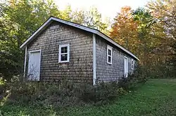 Keystone Mineral Springs |
October 19, 2005 (#05001175) |
Keystone Rd. 44°04′44″N 70°19′29″W |
Poland | |
| 46 | Kora Temple | 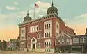 Kora Temple |
September 11, 1975 (#75000088) |
11 Sabattus St. 44°06′01″N 70°12′55″W |
Lewiston | |
| 47 | Lamb Block | 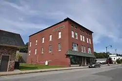 Lamb Block |
October 31, 2012 (#12000891) |
10 Depot St. 44°28′21″N 70°11′19″W |
Livermore Falls | |
| 48 | Lamoreau Site | July 13, 1989 (#89000837) |
Address Restricted |
Auburn | ||
| 49 | Lewiston City Hall | 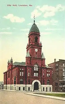 Lewiston City Hall |
October 21, 1976 (#76000085) |
Pine and Park Sts. 44°05′42″N 70°12′57″W |
Lewiston | |
| 50 | Lewiston Commercial Historic District | Lewiston Commercial Historic District |
October 4, 2018 (#100003009) |
1-393 Lisbon, 157-249 Main, 35 Ash & 103 Park Sts. 44°05′47″N 70°13′02″W |
Lewiston | |
| 51 | Lewiston Mills and Water Power System Historic District | Lewiston Mills and Water Power System Historic District |
July 14, 2015 (#15000415) |
Bounded by Androscoggin R., Lisbon, Locust & Bates Sts. 44°05′38″N 70°13′02″W |
Lewiston | |
| 52 | Lewiston Public Library | 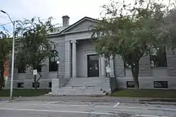 Lewiston Public Library |
January 31, 1978 (#78000157) |
Park and Pine Sts. 44°05′44″N 70°12′58″W |
Lewiston | |
| 53 | Lewiston Trust and Safe Deposit Company | 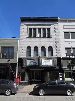 Lewiston Trust and Safe Deposit Company |
April 25, 1986 (#86002283) |
46 Lisbon St. 44°05′52″N 70°13′05″W |
Lewiston | |
| 54 | Lisbon Falls High School | 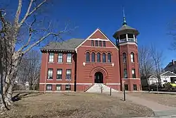 Lisbon Falls High School |
November 7, 2007 (#07001150) |
4 Campus Ave. 44°00′05″N 70°03′35″W |
Lisbon Falls | |
| 55 | Edward Little House | 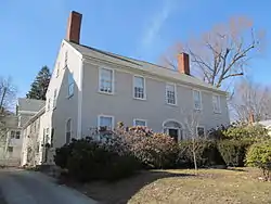 Edward Little House |
May 12, 1976 (#76000086) |
217 Main St. 44°05′38″N 70°13′35″W |
Auburn | |
| 56 | Lord Block | 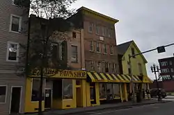 Lord Block |
April 25, 1986 (#86002284) |
379 Lisbon St. 44°05′32″N 70°12′55″W |
Lewiston | |
| 57 | James C. Lord House | 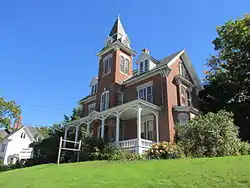 James C. Lord House |
July 21, 1978 (#78000158) |
497 Main St. 44°06′31″N 70°12′33″W |
Lewiston | |
| 58 | Lower Lisbon Street Historic District | 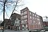 Lower Lisbon Street Historic District |
May 21, 1985 (#85001128) |
Lisbon St. between Cedar and Chestnut 44°05′36″N 70°12′58″W |
Lewiston | |
| 59 | Lyceum Hall |  Lyceum Hall |
April 25, 1986 (#86002285) |
49 Lisbon St. 44°05′51″N 70°13′06″W |
Lewiston | |
| 60 | Main Street Historic District | Main Street Historic District |
April 21, 1989 (#89000255) |
Roughly bounded by Drummond, Main, Elm, and High Sts. 44°05′38″N 70°13′37″W |
Auburn | |
| 61 | Main Street-Frye Street Historic District | 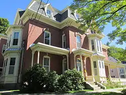 Main Street-Frye Street Historic District |
January 23, 2009 (#08001355) |
Frye St. and portions of Main St. and College St. 44°06′21″N 70°12′33″W |
Lewiston | |
| 62 | Maine State Building | 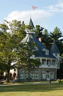 Maine State Building |
July 18, 1974 (#74000148) |
Poland Spring 44°01′38″N 70°21′44″W |
Poland | |
| 63 | Maine Supply Company Building | 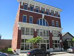 Maine Supply Company Building |
April 25, 1986 (#86002286) |
415-417 Lisbon St. 44°05′30″N 70°12′53″W |
Lewiston | |
| 64 | Manufacturer's National Bank | 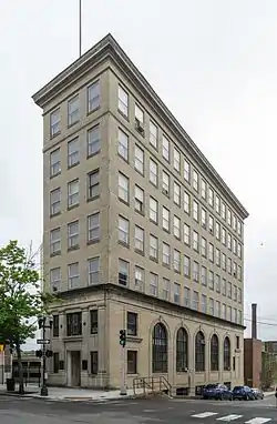 Manufacturer's National Bank |
April 25, 1986 (#86002287) |
145 Lisbon St. 44°05′46″N 70°13′04″W |
Lewiston | |
| 65 | Marcotte Nursing Home | 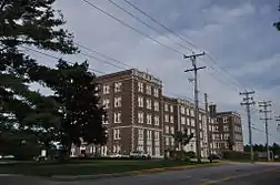 Marcotte Nursing Home |
December 26, 1985 (#85003128) |
100 Campus Ave. 44°06′09″N 70°11′59″W |
Lewiston | |
| 66 | Dr. Louis J. Martel House | 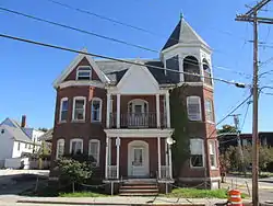 Dr. Louis J. Martel House |
January 4, 1983 (#83000445) |
122-124 Bartlett St. 44°05′46″N 70°12′39″W |
Lewiston | |
| 67 | Moyer Site | November 14, 1992 (#92001518) |
Address Restricted |
Keens Mills | ||
| 68 | Horace Munroe House | 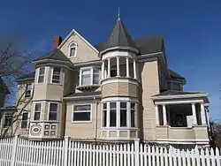 Horace Munroe House |
November 10, 1980 (#80000213) |
123 Pleasant St. 44°05′12″N 70°13′43″W |
Auburn | |
| 69 | Nelson Family Farm | December 17, 1992 (#92001707) |
End of Shackley Hill Rd., 0.8 miles (1.3 km) north of its junction with State Route 108 44°24′34″N 70°16′05″W |
Livermore | ||
| 70 | The Norlands | 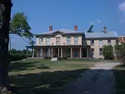 The Norlands |
December 30, 1969 (#69000004) |
295 Norlands Rd. 44°24′27″N 70°12′39″W |
Livermore | |
| 71 | Oak Street School | 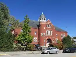 Oak Street School |
October 8, 1976 (#76000190) |
36 Oak St. 44°05′55″N 70°12′58″W |
Lewiston | |
| 72 | Odd Fellows Block | 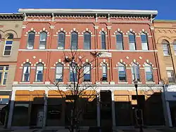 Odd Fellows Block |
April 25, 1986 (#86002288) |
182-190 Lisbon St. 44°05′44″N 70°13′01″W |
Lewiston | |
| 73 | Osgood Building | 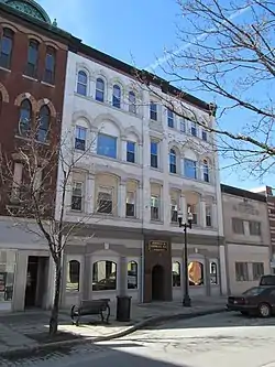 Osgood Building |
April 25, 1986 (#86002289) |
129 Lisbon St. 44°05′47″N 70°13′05″W |
Lewiston | |
| 74 | Nathaniel Osgood House | 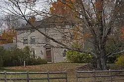 Nathaniel Osgood House |
March 21, 1985 (#85000608) |
State Route 136 43°55′09″N 70°07′06″W |
Durham | |
| 75 | Bradford Peck House | 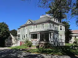 Bradford Peck House |
February 12, 2009 (#09000010) |
506 Main St. 44°06′33″N 70°12′34″W |
Lewiston | |
| 76 | Samuel Penney House | 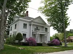 Samuel Penney House |
April 11, 2002 (#02000346) |
78 Maple St. 44°06′40″N 70°23′45″W |
Mechanic Falls | |
| 77 | Pilsbury Block | 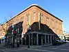 Pilsbury Block |
April 14, 1983 (#83000446) |
200-210 Lisbon St. 44°05′44″N 70°13′01″W |
Lewiston | |
| 78 | Poland Railroad Station |  Poland Railroad Station |
July 4, 1980 (#80004600) |
Harris Hill and Plain Rds. 44°03′42″N 70°23′18″W |
Poland | |
| 79 | Poland Spring Beach House, (Former) | 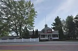 Poland Spring Beach House, (Former) |
September 24, 1999 (#99001191) |
State Route 26, 0.1 miles (0.16 km) east of its junction with Skellinger Rd. 44°02′17″N 70°22′30″W |
South Poland | |
| 80 | Poland Spring Bottling Plant and Spring House | 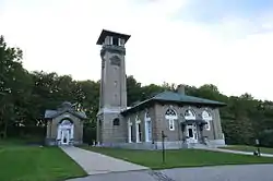 Poland Spring Bottling Plant and Spring House |
March 22, 1984 (#84001354) |
Ricker Rd. 44°01′44″N 70°21′35″W |
Poland | Now a museum. |
| 81 | Poland Springs Historic District | 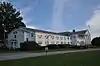 Poland Springs Historic District |
August 13, 2013 (#13000595) |
543 Maine St. 44°02′N 70°22′W |
Poland | |
| 82 | Quartz Scraper Site | November 14, 1992 (#92001508) |
Address Restricted |
Keens Mills | ||
| 83 | Judson Record House | March 17, 2015 (#15000086) |
22 Church St. 44°28′29″N 70°11′20″W |
Livermore Falls | Houses Maine's Paper Heritage Museum. | |
| 84 | Roak Block | 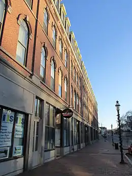 Roak Block |
January 28, 1982 (#82000738) |
144-170 Main St. 44°05′44″N 70°13′30″W |
Auburn | |
| 85 | William A. Robinson House | 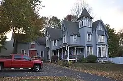 William A. Robinson House |
April 3, 1993 (#93000204) |
11 Forest Ave. 44°05′49″N 70°14′12″W |
Auburn | |
| 86 | St. Cyril and St. Methodius Church | 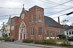 St. Cyril and St. Methodius Church |
May 26, 1977 (#77000061) |
Main and High Sts. 43°59′57″N 70°03′32″W |
Lisbon Falls | |
| 87 | St. Joseph's Catholic Church | 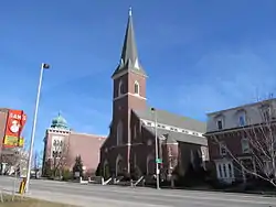 St. Joseph's Catholic Church |
July 13, 1989 (#89000845) |
253 Main St. 44°06′00″N 70°12′58″W |
Lewiston | |
| 88 | Saint Mary's General Hospital | 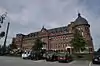 Saint Mary's General Hospital |
December 30, 1987 (#87002191) |
45 Golder St. 44°06′03″N 70°12′02″W |
Lewiston | |
| 89 | Sts. Peter and Paul Church | 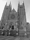 Sts. Peter and Paul Church |
July 14, 1983 (#83000447) |
27 Bartlett St. 44°05′55″N 70°12′47″W |
Lewiston | |
| 90 | Savings Bank Block |  Savings Bank Block |
January 20, 1978 (#78000323) |
215 Lisbon St. 44°05′43″N 70°12′56″W |
Lewiston | |
| 91 | George Seaverns House |  George Seaverns House |
September 12, 1985 (#85002180) |
8 High St. 44°06′37″N 70°23′21″W |
Mechanic Falls | |
| 92 | Second Callahan Block |  Second Callahan Block |
April 25, 1986 (#86002290) |
282 Lisbon St. 44°05′38″N 70°12′58″W |
Lewiston | |
| 93 | Shaker Village | .jpg.webp) Shaker Village |
September 13, 1974 (#74000318) |
State Route 26 43°59′22″N 70°21′59″W |
Sabbathday Lake | Extends into Cumberland County |
| 94 | Shiloh Temple |  Shiloh Temple |
May 12, 1975 (#75000203) |
South of Lisbon Falls on the southern bank of the Androscoggin River 43°58′49″N 70°02′50″W |
Durham | |
| 95 | Trinity Episcopal Church | 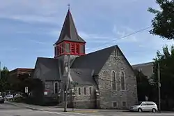 Trinity Episcopal Church |
March 30, 1978 (#78000159) |
Bates and Spruce Sts. 44°05′37″N 70°12′46″W |
Lewiston | |
| 96 | Turner Cattle Pound | 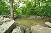 Turner Cattle Pound |
August 7, 2009 (#09000592) |
Southwestern corner of Gen. Turner Hill Rd. and the Kennebec Trail 44°16′19″N 70°15′11″W |
Turner | |
| 97 | Turner Town House | 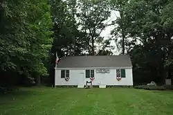 Turner Town House |
July 9, 1979 (#79000129) |
State Route 117 44°16′18″N 70°13′30″W |
Turner | |
| 98 | Union Block | 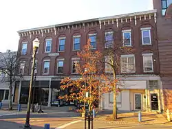 Union Block |
April 25, 1986 (#86002291) |
21-29 Lisbon St. 44°05′53″N 70°13′07″W |
Lewiston | |
| 99 | Union Church | 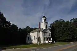 Union Church |
August 2, 2001 (#01000810) |
744 Royalsborough Rd. 43°58′54″N 70°07′45″W |
Durham | |
| 100 | US Post Office-Lewiston Main | 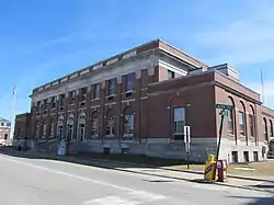 US Post Office-Lewiston Main |
May 2, 1986 (#86000879) |
49 Ash St. 44°05′47″N 70°12′57″W |
Lewiston | |
| 101 | Webster Grammar School | 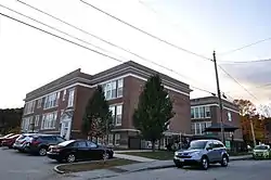 Webster Grammar School |
September 30, 2010 (#10000806) |
95 Hampshire St. 44°06′04″N 70°13′52″W |
Auburn | |
| 102 | Webster Rubber Company Plant | 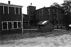 Webster Rubber Company Plant |
October 16, 1989 (#89001701) |
Greene St. 44°07′12″N 70°06′35″W |
Sabattus | Demolished in 2018. |
| 103 | Dr. Milton Wedgewood House | 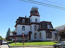 Dr. Milton Wedgewood House |
January 10, 1986 (#86000071) |
101 Pine St. 44°05′47″N 70°12′44″W |
Lewiston | |
| 104 | West Auburn School |  West Auburn School |
March 13, 2020 (#100005097) |
740 West Auburn Rd. 44°09′18″N 70°16′47″W |
Auburn | |
| 105 | West Durham Methodist Church | 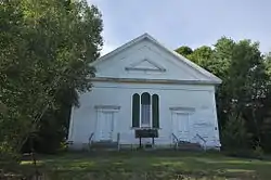 West Durham Methodist Church |
April 22, 2003 (#03000291) |
17 Runaround Pond Rd. 43°56′58″N 70°08′59″W |
West Durham | |
| 106 | Wilson I Site | November 14, 1992 (#92001512) |
Address Restricted |
East Auburn | ||
| 107 | Wood Island Site | November 14, 1992 (#92001516) |
Address Restricted |
Keens Mills |
Former and moved listings
| [3] | Name on the Register | Image | Date listed | Date removed | Location | City or town | Summary |
|---|---|---|---|---|---|---|---|
| 1 | Bergin Block | April 25, 1986 (#86002278) | November 6, 2015 | 330 Lisbon St. 44°05′36″N 70°13′05″W |
Lewiston | Demolished in 1999.[7] | |
| 2 | Bradford House | December 22, 1978 (#78000154) | July 14, 2015 | 54-56 Pine St. 44°05′47″N 70°12′52″W |
Lewiston | Damaged by fire in 2007 and later demolished. | |
| 3 | Cowan Mill |  Cowan Mill |
August 1, 1985 (#85001656) | November 2, 2011 | Island Mill St. 44°05′55″N 70°13′18″W |
Lewiston | |
| 4 | Cushman Tavern | 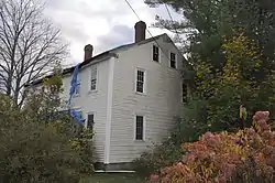 Cushman Tavern |
October 9, 1979 (#79000125) | November 25, 2020 | Northeast of Lisbon on State Route 9 44°03′36″N 70°05′11″W |
Lisbon | Demolished. |
| 5 | Gilead Railroad Station, Former | 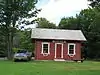 Gilead Railroad Station, Former |
March 26, 1992 (#92000272) | Moved to Gilead in January 2011[8] | Back St and Bridge St, just off Route 2, Gilead 44°23′40″N 70°58′21″W |
Auburn | |
| 6 | Deacon Elijah Livermore House | 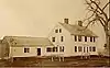 Deacon Elijah Livermore House |
February 24, 1975 (#75000089) | January 15, 2004 | 6 mi. S of Livermore Falls on Hillman's Ferry Road |
Livermore Falls | |
| 7 | C. Varney Site | November 14, 1992 (#92001514) | December 30, 1996 | Off State Route 117 above the Nezinscot River, southwest of Turner Center[9]:121 44°16′00″N 70°14′12″W |
Keens Mills | A Late Paleoindian site; almost completely excavated before site destruction in 1998[9]:119 | |
| 8 | High Street Congregational Church | June 5, 1975 (#75000087) | February 6, 1986 | High St. |
Auburn | ||
| 9 | Worumbo Mill | 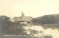 Worumbo Mill |
October 15, 1973 (#100001674) | October 5, 2017 | On the banks of the Androscoggin River 43°59′37″N 70°04′05″W |
Lisbon Falls |
See also
| Wikimedia Commons has media related to National Register of Historic Places in Androscoggin County, Maine. |
References
- The latitude and longitude information provided in this table was derived originally from the National Register Information System, which has been found to be fairly accurate for about 99% of listings. Some locations in this table may have been corrected to current GPS standards.
- "National Register of Historic Places: Weekly List Actions". National Park Service, United States Department of the Interior. Retrieved on February 5, 2021.
- Numbers represent an alphabetical ordering by significant words. Various colorings, defined here, differentiate National Historic Landmarks and historic districts from other NRHP buildings, structures, sites or objects.
- "National Register Information System". National Register of Historic Places. National Park Service. April 24, 2008.
- The eight-digit number below each date is the number assigned to each location in the National Register Information System database, which can be viewed by clicking the number.
- Coordinates given are those for Ram Island; the NRIS lists the site as "Address Restricted"
- "Appendix A: Zoning and Land Use Code - Significant Buildings and Districts (PDF page 17)". City of Lewiston. Retrieved 2014-10-15.
- http://www.gileadhistoricalsociety.blogspot.com/
- Petersen, James B., et al. "The Varney Farm Site and the Late Paleoindian Period in Northeastern North America". Archaeology of Eastern North America 28 (2000): 113-139.
| Topics | |
|---|---|
| Lists by state |
|
| Lists by insular areas | |
| Lists by associated state | |
| Other areas | |
| Related | |
| |
Municipalities and communities of Androscoggin County, Maine, United States | ||
|---|---|---|
| Cities | Androscoggin County map | |
| Towns | ||
| CDPs | ||
| Other villages | ||
| ||
This article is issued from Wikipedia. The text is licensed under Creative Commons - Attribution - Sharealike. Additional terms may apply for the media files.