National Register of Historic Places listings in Washington County, Maine
This is a list of the National Register of Historic Places listings in Washington County, Maine.

Location of Washington County in Maine
This is intended to be a complete list of the properties and districts on the National Register of Historic Places in Washington County, Maine, United States. Latitude and longitude coordinates are provided for many National Register properties and districts; these locations may be seen together in a map.[1]
There are 100 properties and districts listed on the National Register in the county. Another property was once listed but has been removed.
- This National Park Service list is complete through NPS recent listings posted February 5, 2021.[2]
| Androscoggin - Aroostook - Cumberland - Franklin - Hancock - Kennebec - Knox - Lincoln - Oxford - Penobscot - Piscataquis - Sagadahoc - Somerset - Waldo - Washington - York |
Current listings
| [3] | Name on the Register[4] | Image | Date listed[5] | Location | City or town | Description |
|---|---|---|---|---|---|---|
| 1 | "The Rim" and Site of Fort Foster |  "The Rim" and Site of Fort Foster |
July 23, 1973 (#73000155) |
South of East Machias off U.S. Route 1 44°43′01″N 67°23′45″W |
East Machias | |
| 2 | Archibald-Adams House | 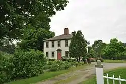 Archibald-Adams House |
March 13, 1987 (#87000429) |
State Route 193 44°36′21″N 67°55′38″W |
Cherryfield | |
| 3 | Atkinson-Koskinen Site 45.13 | November 23, 1984 (#84000282) |
Address Restricted |
Steuben | ||
| 4 | Charles Best House | 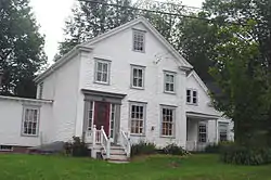 Charles Best House |
March 2, 1982 (#82000784) |
County Rd. 44°56′51″N 67°10′30″W |
West Pembroke | |
| 5 | Birch Point | December 9, 1997 (#97000913) |
Address Restricted |
Machiasport | ||
| 6 | Former Boynton High School | 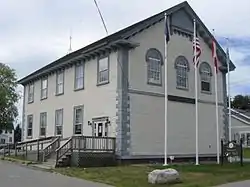 Former Boynton High School |
April 11, 2002 (#02000351) |
78 High St. 44°54′19″N 66°59′26″W |
Eastport | Now Eastport City Hall. |
| 7 | Boynton Street Historic District | 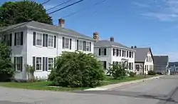 Boynton Street Historic District |
July 19, 1984 (#84001542) |
13-26 Boynton St. 44°54′18″N 66°59′13″W |
Eastport | |
| 8 | Henrietta Brewer House | 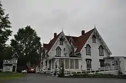 Henrietta Brewer House |
October 6, 1983 (#83003688) |
U.S. Route 1 45°05′04″N 67°06′41″W |
Robbinston | |
| 9 | John N.M. Brewer House | 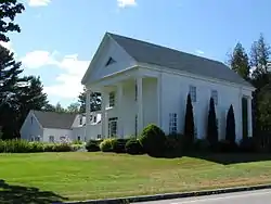 John N.M. Brewer House |
October 6, 1983 (#83003690) |
U.S. Route 1 45°04′55″N 67°06′40″W |
Robbinston | |
| 10 | Bucknam House | 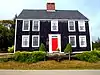 Bucknam House |
April 28, 1975 (#75000113) |
Main St. 44°39′15″N 67°43′33″W |
Columbia Falls | |
| 11 | Samuel Bucknam House | 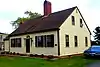 Samuel Bucknam House |
October 19, 1978 (#78000203) |
Main St. 44°39′09″N 67°43′46″W |
Columbia Falls | |
| 12 | Burnham Tavern | 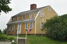 Burnham Tavern |
April 11, 1973 (#73000152) |
14 Colonial Way 44°42′50″N 67°27′36″W |
Machias | |
| 13 | Calais Free Library | 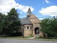 Calais Free Library |
April 12, 2001 (#01000370) |
Union St., 0.05 miles northwest of its junction with U.S. Route 1 45°11′21″N 67°16′38″W |
Calais | |
| 14 | Calais Historic District | 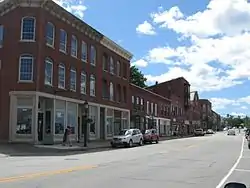 Calais Historic District |
December 20, 1978 (#78000204) |
Church, Main, and North Sts. 45°11′19″N 67°16′40″W |
Calais | |
| 15 | Calais Observatory | 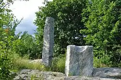 Calais Observatory |
December 19, 2012 (#12001069) |
Meridian Park, North St. 45°11′05″N 67°16′51″W |
Calais | Granite installation for performing 1857 longitude survey. |
| 16 | Calais Residential Historic District | 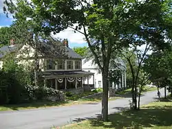 Calais Residential Historic District |
October 28, 1994 (#94001248) |
Roughly the area along Main St. and Calais Ave., and from Calais Ave. to Swan St. 45°11′11″N 67°16′25″W |
Calais | |
| 17 | Gen. Alexander Campbell House | 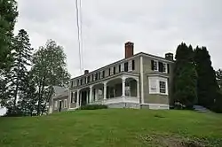 Gen. Alexander Campbell House |
April 13, 1977 (#77000088) |
Campbell Hill 44°35′53″N 67°55′18″W |
Cherryfield | |
| 18 | David W. Campbell House | 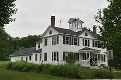 David W. Campbell House |
July 19, 1984 (#84001545) |
Main St. 44°36′02″N 67°55′19″W |
Cherryfield | |
| 19 | Frank Campbell House |  Frank Campbell House |
October 29, 1982 (#82000426) |
U.S. Route 1 44°35′52″N 67°55′23″W |
Cherryfield | |
| 20 | Col. Samuel Campbell House |  Col. Samuel Campbell House |
February 4, 1982 (#82000785) |
U.S. Route 1 44°35′54″N 67°55′18″W |
Cherryfield | |
| 21 | Central Congregational Church |  Central Congregational Church |
June 23, 1976 (#76000116) |
Middle St. 44°54′14″N 66°59′16″W |
Eastport | |
| 22 | Centre Street Congregational Church |  Centre Street Congregational Church |
May 12, 1975 (#75000114) |
Centre St. 44°42′54″N 67°27′37″W |
Machias | |
| 23 | Chaloner House | 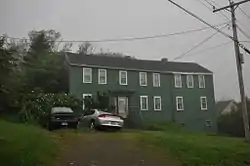 Chaloner House |
February 7, 2007 (#07000009) |
3 Pleasant St. 44°51′42″N 66°59′06″W |
Lubec | |
| 24 | Charlotte Pound | December 21, 2005 (#05001442) |
Charlotte Rd., 0.25 miles east of its junction with 214 45°00′25″N 67°16′16″W |
Charlotte | ||
| 25 | Cherryfield Academy | 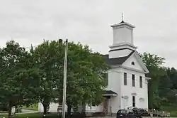 Cherryfield Academy |
February 19, 1982 (#82000786) |
Main St. 44°36′06″N 67°55′29″W |
Cherryfield | Now houses town offices |
| 26 | Cherryfield Historic District | 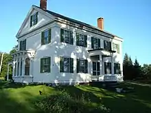 Cherryfield Historic District |
October 1, 1990 (#90001467) |
Roughly bounded by Church, Main, Park, New and High Sts., as well as River Rd. properties from U.S. Route 1 to Driscoll Island 44°35′54″N 67°55′32″W |
Cherryfield | |
| 27 | Columbia House |  Columbia House |
October 12, 2000 (#00001203) |
Main St. at its junction with Church Hill Circle 44°39′15″N 67°43′43″W |
Columbia Falls | |
| 28 | Columbia Union Church | June 20, 1997 (#97000607) |
Northern side of State Route 29-608 (Epping Road), 0.05 miles east of its junction with State Route 29-610 (Cemetery Road) 44°40′59″N 67°46′48″W |
Epping (Columbia, Maine) | ||
| 29 | Dennysville Historic District |  Dennysville Historic District |
October 29, 1982 (#82000427) |
The Lane, Main, and King Sts. 44°54′01″N 67°13′45″W |
Dennysville | |
| 30 | Devils Head Site | May 17, 2006 (#06000395) |
Address Restricted |
Calais | ||
| 31 | East Machias Historic District |  East Machias Historic District |
April 11, 1973 (#73000153) |
High, Water, and Bridge Sts. 44°44′11″N 67°23′21″W |
East Machias | |
| 32 | Eastport Historic District |  Eastport Historic District |
June 1, 1982 (#82000787) |
Water St.; 15 Sea St. 44°54′18″N 66°59′07″W |
Eastport | Sea Street address represents a boundary increase July 11, 2016. |
| 33 | Fort O'Brien |  Fort O'Brien |
October 1, 1969 (#69000024) |
South of Machiasport on a secondary road 44°41′22″N 67°23′48″W |
Machiasport | |
| 34 | Fort Sullivan | 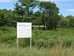 Fort Sullivan |
January 26, 1970 (#70000081) |
Moose Island; barracks, 74 Washington St. 44°54′27″N 66°59′19″W |
Eastport | |
| 35 | Jeremiah Fowler House | 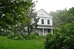 Jeremiah Fowler House |
December 29, 1983 (#83003693) |
35 School St. 44°51′37″N 66°59′14″W |
Lubec | |
| 36 | Gallison Memorial Library | 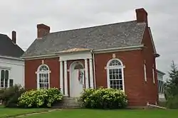 Gallison Memorial Library |
January 11, 2001 (#00001632) |
U.S. Route 1, 0.5 miles west of its junction with U.S. Route 1A 44°37′09″N 67°48′45″W |
Harrington | |
| 37 | Gates House | 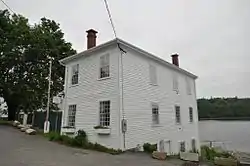 Gates House |
April 28, 1975 (#75000115) |
State Route 92 44°41′49″N 67°23′38″W |
Machiasport | |
| 38 | Gilmore House | 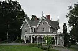 Gilmore House |
June 14, 1979 (#79000380) |
764 River Road 45°11′01″N 67°15′51″W |
Calais | Listed at 316 Main Street. |
| 39 | Governors Point | August 8, 2001 (#01000812) |
Address Restricted |
Grand Lake Stream | ||
| 40 | Grace Episcopal Church | 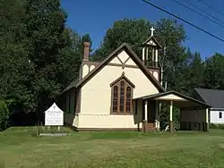 Grace Episcopal Church |
August 7, 2001 (#01000816) |
U.S. Route 1 0.5 miles northwest of its junction with 3rd Rd. 45°05′14″N 67°06′53″W |
Robbinston | |
| 41 | Grand Lake Stream Site | December 9, 1997 (#97000916) |
Address restricted |
Grand Lake Stream | ||
| 42 | Thomas Hamilton House | 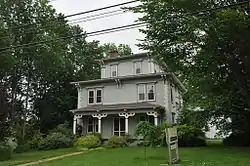 Thomas Hamilton House |
February 4, 1982 (#82000788) |
78 South St. 45°10′43″N 67°16′20″W |
Calais | |
| 43 | Hinckley Hill Historic District | 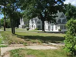 Hinckley Hill Historic District |
October 28, 1994 (#94001244) |
Roughly 305-326 Main St. 45°10′59″N 67°15′53″W |
Calais | |
| 44 | Hog Island-62.23 | December 9, 1997 (#97000911) |
Address restricted |
Machiasport | ||
| 45 | Hog Island-62.24 | September 5, 1997 (#97000917) |
Address restricted |
Machiasport | ||
| 46 | Hog Island-62.25 | December 9, 1997 (#97000918) |
Address restricted |
Machiasport | ||
| 47 | Hog Island-62.29 | September 5, 1997 (#97000912) |
Address restricted |
Machiasport | ||
| 48 | Holmes Cottage |  Holmes Cottage |
April 4, 1988 (#87001855) |
521 Main St. 45°11′15″N 67°16′28″W |
Calais | St. Croix Historical Society museum |
| 49 | Holmes Point | December 9, 1997 (#97000914) |
Address restricted |
Machiasport | ||
| 50 | Dr. Job Holmes House |  Dr. Job Holmes House |
April 5, 1990 (#90000579) |
527 Main St. 45°11′15″N 67°16′26″W |
Calais | St. Croix Historical Society museum |
| 51 | Indian River Baptist Church | June 23, 1988 (#88000893) |
State Route 187 at Indian River 44°34′22″N 67°38′36″W |
Addison | ||
| 52 | Theodore Jellison House |  Theodore Jellison House |
November 23, 1984 (#84000274) |
River Rd. 45°09′53″N 67°12′02″W |
Calais | |
| 53 | Jonesboro Grange No. 357 |  Jonesboro Grange No. 357 |
December 15, 2010 (#10001035) |
Harrington Road 44°39′44″N 67°34′21″W |
Jonesboro | |
| 54 | Jonesboro Union Church | 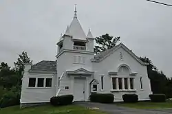 Jonesboro Union Church |
July 18, 2002 (#02000788) |
Looks Point Rd. at its junction with U.S. Route 1 44°39′35″N 67°34′32″W |
Jonesboro | |
| 55 | Libby Island Light Station | 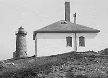 Libby Island Light Station |
June 18, 1976 (#76000117) |
South of Machiasport on Libby Island 44°34′16″N 67°21′54″W |
Machiasport | |
| 56 | Liberty Hall | 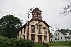 Liberty Hall |
November 23, 1977 (#77000089) |
State Route 92 44°41′51″N 67°23′40″W |
Machiasport | |
| 57 | Lincoln House | March 29, 1978 (#78000206) |
Maine State Route 86 44°54′23″N 67°13′44″W |
Dennysville | ||
| 58 | Little River Light Station | 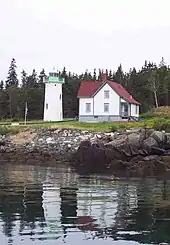 Little River Light Station |
March 14, 1988 (#88000156) |
Little River Island 44°39′02″N 67°11′39″W |
Cutler | |
| 59 | Lubec Channel Light Station | 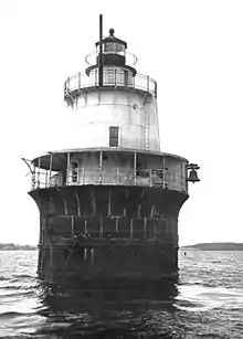 Lubec Channel Light Station |
March 14, 1988 (#88000152) |
Lubec Channel 44°50′31″N 66°58′38″W |
Lubec | |
| 60 | Machias Post Office and Customhouse |  Machias Post Office and Customhouse |
November 23, 1977 (#77000090) |
Main and Center Sts. 44°42′55″N 67°27′30″W |
Machias | |
| 61 | Machias Railroad Station | 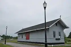 Machias Railroad Station |
October 2, 1992 (#92001293) |
27 E. Main St. 44°43′10″N 67°27′08″W |
Machias | |
| 62 | Machias Valley Grange, No. 360 (Former) | 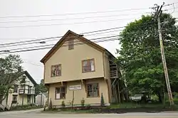 Machias Valley Grange, No. 360 (Former) |
May 8, 2007 (#07000410) |
3 Elm St. 44°42′47″N 67°27′27″W |
Machias | |
| 63 | Maine Archeological Survey site 62.46 | August 8, 2001 (#01000814) |
On an island in Machias Bay[6] |
Machiasport | A post-contact petroglyph site with carvings of European ships[6] | |
| 64 | The Mansion House | 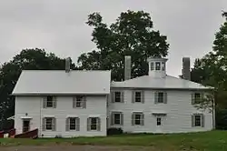 The Mansion House |
May 22, 1973 (#73000154) |
North of Robbinston on U.S. Route 1 45°05′10″N 67°06′44″W |
Robbinston | |
| 65 | Marsh Stream Farm | January 12, 2016 (#15000971) |
38 Marsh Stream Ln. 44°40′03″N 67°25′47″W |
Machiasport | ||
| 66 | McCurdy Smokehouse |  McCurdy Smokehouse |
July 15, 1993 (#93000638) |
Eastern side of Water St. at its junction with School St. 44°51′39″N 66°59′01″W |
Lubec | |
| 67 | McGlashan-Nickerson House |  McGlashan-Nickerson House |
June 14, 1990 (#90000920) |
St. Croix Dr. near Pettegrove Pt. 45°07′30″N 67°08′54″W |
Red Beach | |
| 68 | Henry D. Moore Parish House and Library |  Henry D. Moore Parish House and Library |
November 29, 2001 (#01001272) |
3 Rogers Point Rd. 44°30′39″N 67°57′43″W |
Steuben | |
| 69 | Narraguagus Light Station | 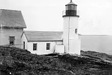 Narraguagus Light Station |
November 20, 1987 (#87002022) |
Eastern side of Pond Island 44°27′15″N 67°49′44″W |
Milbridge | |
| 70 | William M. Nash House | 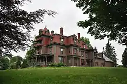 William M. Nash House |
January 4, 1983 (#83000477) |
River Rd. 44°36′02″N 67°55′42″W |
Cherryfield | |
| 71 | Ntolonapemk, Eastern Surplus Superfund Site | August 8, 2001 (#01000819) |
Roughly bounded by State Route 191, Stone Road, Meddybemps Lake, and the Dennys River[7] 45°02′18″N 67°21′31″W |
Meddybemps | ||
| 72 | Patten Building | 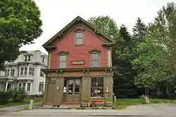 Patten Building |
December 22, 1978 (#78000207) |
Main St. 44°35′54″N 67°55′30″W |
Cherryfield | |
| 73 | Clark Perry House | 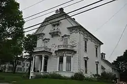 Clark Perry House |
October 9, 1979 (#79000169) |
Court St. 44°42′55″N 67°27′40″W |
Machias | |
| 74 | Petit Manan Light Station | 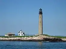 Petit Manan Light Station |
October 30, 1987 (#87001879) |
Petit Manan Island 44°22′03″N 67°51′53″W |
Milbridge | |
| 75 | Joshua Pettegrove House | 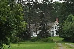 Joshua Pettegrove House |
March 17, 1994 (#94000179) |
Eastern side of U.S. Route 1, 0.25 miles north of its junction with Shattuck Rd. 45°07′32″N 67°08′47″W |
Red Beach | |
| 76 | Pike's Mile Markers | 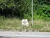 Pike's Mile Markers |
January 20, 1995 (#94001548) |
Twelve locations spaced 1 miles apart along the eastern side of U.S. Route 1 between Robbinston and Calais 45°10′04″N 67°14′01″W |
Calais | |
| 77 | Capt. John Plummer House | January 21, 2009 (#08001358) |
23 Pleasant St. 44°37′08″N 67°44′36″W |
Addison | ||
| 78 | Porter Memorial Library | 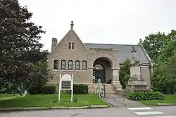 Porter Memorial Library |
January 20, 1978 (#78000208) |
Court St. 44°42′55″N 67°27′36″W |
Machias | |
| 79 | Reversing Falls Site | June 27, 1990 (#90000907) |
Address Restricted |
Pembroke | ||
| 80 | Ruggles House | 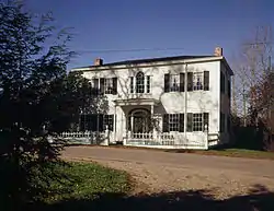 Ruggles House |
January 26, 1970 (#70000080) |
Main Street 44°39′08″N 67°43′49″W |
Columbia Falls | |
| 81 | St. Anne's Episcopal Church | 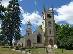 St. Anne's Episcopal Church |
July 8, 1982 (#82000789) |
Church St. 45°11′16″N 67°16′31″W |
Calais | |
| 82 | St. Croix Island International Historic Site |  St. Croix Island International Historic Site |
October 15, 1966 (#66000932) |
St. Croix Island, on the US side of the St. Croix River 45°07′42″N 67°08′02″W |
St. Croix Junction | |
| 83 | Sewall Memorial Congregational Church | 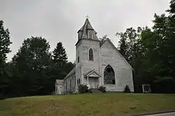 Sewall Memorial Congregational Church |
December 19, 2012 (#12001070) |
558 U.S. Route 1 45°05′04″N 67°06′42″W |
Robbinston | Misspelled "Sewell" in the National Register listing. |
| 84 | James R. Talbot House | 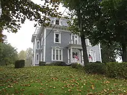 James R. Talbot House |
January 4, 1983 (#83000478) |
U.S. Route 1 44°44′18″N 67°23′28″W |
East Machias | |
| 85 | Todd House | 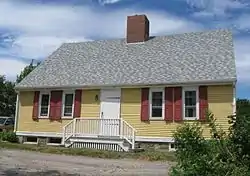 Todd House |
April 23, 1980 (#80000258) |
11 Capens Ave. 44°54′41″N 66°59′09″W |
Eastport | |
| 86 | Union Church, (former) | 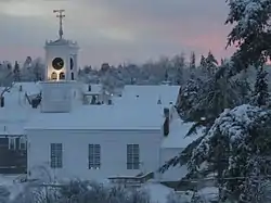 Union Church, (former) |
July 5, 2000 (#00000759) |
Main St., 0.1 miles northeast of its junction with Addison Rd. 44°39′12″N 67°43′46″W |
Columbia Falls | |
| 87 | Union Evangelical Church | June 7, 1996 (#96000654) |
Northern side of Addison Ridge Rd., 2 miles south of U.S. Route 1 44°36′59″N 67°45′20″W |
Addison | ||
| 88 | Union Hall | 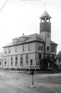 Union Hall |
June 25, 1987 (#87000938) |
Near the junction of U.S. Route 1 and State Route 169 45°39′29″N 67°52′02″W |
Danforth | |
| 89 | Union Meeting House | 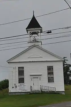 Union Meeting House |
April 11, 2014 (#14000139) |
153 US Route 1 44°47′27″N 67°10′32″W |
Whiting | |
| 90 | U.S. Inspection Station-Calais (Ferry Point), Maine | 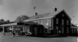 U.S. Inspection Station-Calais (Ferry Point), Maine |
September 10, 2014 (#14000559) |
1 Main St. 45°11′27″N 67°17′01″W |
Calais | |
| 91 | Everett Wallace House | 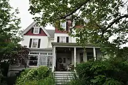 Everett Wallace House |
March 7, 1996 (#96000243) |
Western side of U.S. Route 1, 0.05 miles north of its junction with Wyman Rd. 44°31′57″N 67°52′59″W |
Milbridge | |
| 92 | George Washburn House | 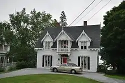 George Washburn House |
February 11, 1982 (#82000790) |
772 River Road 45°10′59″N 67°15′50″W |
Calais | Listed at 318 Main Street. |
| 93 | Washington County Courthouse | 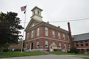 Washington County Courthouse |
November 7, 1976 (#76000119) |
Court St. 44°42′58″N 67°27′36″W |
Machias | |
| 94 | Washington County Jail | 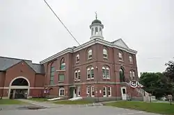 Washington County Jail |
April 7, 1988 (#88000393) |
Court St. 44°42′58″N 67°27′35″W |
Machias | |
| 95 | West Quoddy Head Light Station | 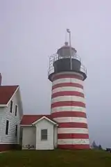 West Quoddy Head Light Station |
July 4, 1980 (#80004601) |
Southeast of Lubec on West Quoddy Head 44°48′54″N 66°57′00″W |
Lubec | |
| 96 | West Quoddy Lifesaving Station | 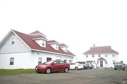 West Quoddy Lifesaving Station |
April 20, 1990 (#90000581) |
Northern side of W. Quoddy Head 44°49′04″N 66°57′59″W |
Lubec | |
| 97 | Whitlocks Mill Light Station | 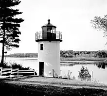 Whitlocks Mill Light Station |
January 21, 1988 (#87002276) |
Southern bank of the St. Croix River 45°09′46″N 67°13′41″W |
Calais | |
| 98 | Whitneyville Congregational Church | 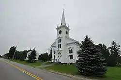 Whitneyville Congregational Church |
June 26, 1979 (#79000170) |
Main St. 44°43′19″N 67°31′24″W |
Whitneyville | |
| 99 | Windswept | May 8, 2007 (#07000411) |
421 Petit Manan Point Rd. 44°25′05″N 67°54′45″W |
Steuben | ||
| 100 | Daniel Young House | 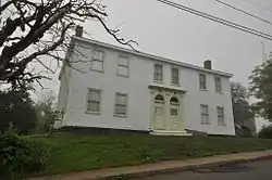 Daniel Young House |
March 22, 1984 (#84001547) |
34 Main St. 44°51′39″N 66°59′15″W |
Lubec |
Former and moved listings
| [3] | Name on the Register | Image | Date listed | Date removed | Location | City or town | Summary |
|---|---|---|---|---|---|---|---|
| 1 | First Congregational Church | December 20, 1978 (#78000205) | April 29, 2004 | Calais Avenue |
Lubec | ||
| 2 | The Lion (locomotive) | 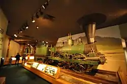 The Lion (locomotive) |
December 15, 1976 (#76000118) | moved in 1985 | Maine State Museum 44°42′30″N 67°27′21″W |
Augusta | Originally listed while on display at the University of Maine at Machias. |
See also
| Wikimedia Commons has media related to National Register of Historic Places in Washington County, Maine. |
References
- The latitude and longitude information provided in this table was derived originally from the National Register Information System, which has been found to be fairly accurate for about 99% of listings. Some locations in this table may have been corrected to current GPS standards.
- "National Register of Historic Places: Weekly List Actions". National Park Service, United States Department of the Interior. Retrieved on February 5, 2021.
- Numbers represent an alphabetical ordering by significant words. Various colorings, defined here, differentiate National Historic Landmarks and historic districts from other NRHP buildings, structures, sites or objects.
- "National Register Information System". National Register of Historic Places. National Park Service. April 24, 2008.
- The eight-digit number below each date is the number assigned to each location in the National Register Information System database, which can be viewed by clicking the number.
- Hedden, Mark. "Contact Period Petroglyphs in Machias Bay, Maine", Archaeology of Eastern North America 30 (2002): 1-20.
- Address derived from this Passamaquoddy tribal website; the NRIS lists it as "Address Restricted"
| Topics | |
|---|---|
| Lists by state |
|
| Lists by insular areas | |
| Lists by associated state | |
| Other areas | |
| Related | |
| |
Municipalities and communities of Washington County, Maine, United States | ||
|---|---|---|
| Cities | Washington County map | |
| Towns |
| |
| Plantations | ||
| Unorganized territories | ||
| CDPs | ||
| Other villages | ||
| Indian reservations | ||
| ||
This article is issued from Wikipedia. The text is licensed under Creative Commons - Attribution - Sharealike. Additional terms may apply for the media files.