National Register of Historic Places listings in Waldo County, Maine
This is a list of the National Register of Historic Places listings in Waldo County, Maine.
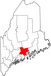
Location of Waldo County in Maine
This is intended to be a complete list of the properties and districts on the National Register of Historic Places in Waldo County, Maine, United States. Latitude and longitude coordinates are provided for many National Register properties and districts; these locations may be seen together in a map.[1]
There are 65 properties and districts listed on the National Register in the county, including 1 National Historic Landmark. Another property was once listed but has been removed.
- This National Park Service list is complete through NPS recent listings posted February 5, 2021.[2]
| Androscoggin - Aroostook - Cumberland - Franklin - Hancock - Kennebec - Knox - Lincoln - Oxford - Penobscot - Piscataquis - Sagadahoc - Somerset - Waldo - Washington - York |
Current listings
| [3] | Name on the Register[4] | Image | Date listed[5] | Location | City or town | Description |
|---|---|---|---|---|---|---|
| 1 | Archeological Site No. 29-64 | February 22, 1982 (#82000782) |
Address Restricted |
Islesboro | ||
| 2 | Archeological Site No. 39.1 | August 1, 1994 (#94000759) |
Address Restricted |
Searsmont | ||
| 3 | Bayside Historic District | December 30, 1996 (#96001477) |
Roughly bounded by Penobscot Bay, Clinton Ave., George St., and Bay View Park 44°22′48″N 68°58′09″W |
Bayside | ||
| 4 | Belfast Commercial Historic District | 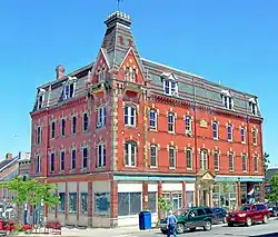 Belfast Commercial Historic District |
April 4, 1980 (#80000257) |
Main St. between Church and Cross Sts. 44°25′34″N 69°00′27″W |
Belfast | |
| 5 | Belfast Historic District |  Belfast Historic District |
August 21, 1986 (#86002733) |
Roughly bounded by High, Grove, Elm, Congress, Main, Market, and Imrose; also 59-63 Anderson St; also 121 High St. 44°25′25″N 69°00′23″W |
Belfast | Anderson St. addresses and High St. address each represent boundary increases April 02, 1993, and December 28, 1995 |
| 6 | Belfast National Bank | 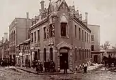 Belfast National Bank |
April 23, 1973 (#73000148) |
Main and Beaver Sts. 44°25′32″N 69°00′26″W |
Belfast | |
| 7 | Black Horse Tavern | 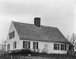 Black Horse Tavern |
February 11, 1982 (#82000783) |
Searsport Ave. 44°25′44″N 68°59′02″W |
Belfast | |
| 8 | Carver Memorial Library | 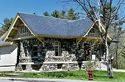 Carver Memorial Library |
October 14, 1993 (#93001113) |
Northeastern corner of the junction of Union and Mortland Sts. 44°27′38″N 68°55′23″W |
Searsport | |
| 9 | Hezekiah Chase House | January 31, 1978 (#78000202) |
U.S. Route 202 44°36′49″N 69°19′58″W |
Unity | ||
| 10 | Christ Church | March 26, 1992 (#92000276) |
Off the western side of Main Rd. south of Dark Harbor 44°15′26″N 68°54′45″W |
Dark Harbor | ||
| 11 | Church Street Historic District | 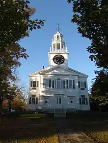 Church Street Historic District |
November 28, 1978 (#78000331) |
Irregular pattern along Church St. from High to Franklin Sts. 44°25′23″N 69°00′14″W |
Belfast | |
| 12 | Cobe Estate | Cobe Estate |
October 20, 1983 (#83003684) |
North of Northport on Bluff Rd. 44°22′27″N 68°58′07″W |
Northport | |
| 13 | College Club Inn | 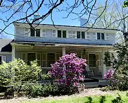 College Club Inn |
April 14, 2000 (#00000377) |
190 W. Main St. 44°26′40″N 68°56′07″W |
Searsport | |
| 14 | Dark Harbor Shop | September 28, 2017 (#100001677) |
515 Pendleton Point Rd. 44°15′41″N 68°54′49″W |
Islesboro | ||
| 15 | Drexel Estate | March 21, 1985 (#85000613) |
The Bluff 44°20′37″N 68°52′50″W |
Islesboro | ||
| 16 | East Main Street Historic District | 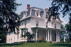 East Main Street Historic District |
December 13, 1991 (#91001815) |
U.S. Route 1 between Black Rd. and Navy St. 44°27′27″N 68°54′53″W |
Searsport | |
| 17 | Farwell Brothers Store | December 30, 2019 (#100004828) |
37 Gordon Hill Rd. 44°34′43″N 69°16′33″W |
Thorndike | ||
| 18 | First Church of Belfast | 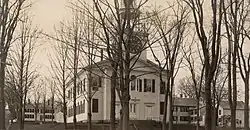 First Church of Belfast |
November 7, 1976 (#76000115) |
Church St. 44°25′28″N 69°00′27″W |
Belfast | |
| 19 | Fort Knox State Park | 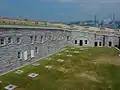 Fort Knox State Park |
October 1, 1969 (#69000023) |
U.S. Route 1 near Prospect 44°33′53″N 68°48′34″W |
Prospect | |
| 20 | Fort Point Light Station | 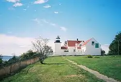 Fort Point Light Station |
March 23, 1988 (#87002269) |
Fort Point Rd. 44°28′01″N 68°48′45″W |
Stockton Springs | |
| 21 | Fort Pownall Memorial | 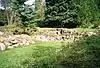 Fort Pownall Memorial |
October 28, 1969 (#69000028) |
Southeast of Stockton Springs on Fort Point 44°28′05″N 68°48′46″W |
Stockton Springs | |
| 22 | Frankfort Dam | 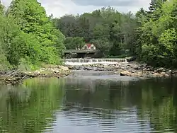 Frankfort Dam |
February 12, 2003 (#03000018) |
South of the junction of U.S. Route 1A and the north branch of Marsh Stream 44°36′33″N 68°52′24″W |
Frankfort | |
| 23 | Free Will Baptist Church and Cemetery | September 27, 1988 (#88000891) |
Church Rd. 44°21′11″N 68°53′41″W |
North Islesboro | ||
| 24 | Georges River Canal | March 5, 1970 (#70000048) |
Upper Falls on the Georges River in Warren to the Union town line, extending to Quantabacook Pond in Searsmont 44°15′N 69°15′W |
Searsmont | Also extends into Knox County | |
| 25 | Greer's Corner School | October 16, 1991 (#91001513) |
Southeastern corner of Back Belmont and Lincolnville Rd. 44°22′28″N 69°07′48″W |
Belmont Corner | ||
| 26 | Grindle Point Light Station | 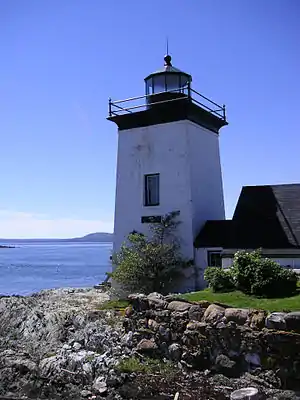 Grindle Point Light Station |
March 13, 1987 (#87000427) |
Ferry Rd. 44°16′53″N 68°56′36″W |
Islesboro | |
| 27 | Hardscrabble Farm | March 17, 1994 (#94000181) |
Eastern side of Maine State Route 131, 0.5 miles (0.80 km) south of its junction with State Route 173 44°21′13″N 69°11′56″W |
Searsmont | ||
| 28 | Hayford Block | 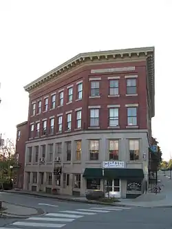 Hayford Block |
August 29, 1977 (#77000087) |
47 Church St. 44°25′31″N 69°00′27″W |
Belfast | |
| 29 | Nathan G. Hichborn House | 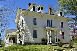 Nathan G. Hichborn House |
April 7, 1988 (#88000392) |
Church St. 44°29′25″N 68°51′29″W |
Stockton Springs | |
| 30 | Islesboro Free Library | January 5, 1989 (#88003018) |
Main Rd. 44°18′09″N 68°54′04″W |
Islesboro | ||
| 31 | Keen Hall | June 26, 2017 (#100001242) |
1 Main St. 44°31′43″N 69°17′48″W |
Freedom | ||
| 32 | Ebenezer Knowlton House | January 11, 2002 (#01001433) |
Choate Rd. 44°22′44″N 69°16′03″W |
Montville | ||
| 33 | Lincolnville Center Meeting House | July 21, 1983 (#83000475) |
State Route 173 44°17′55″N 69°06′33″W |
Lincolnville Center | ||
| 34 | (Former) Maine Central Railroad Depot | August 5, 2009 (#09000595) |
31 State Route 7 44°33′05″N 69°07′17″W |
Brooks | ||
| 35 | Marsh School | April 23, 2013 (#13000188) |
930 Bangor Rd. 44°33′04″N 68°51′53″W |
Prospect | ||
| 36 | Masonic Temple | Masonic Temple |
April 26, 1973 (#73000246) |
High St. (U.S. Route 1) 44°25′34″N 69°00′24″W |
Belfast | |
| 37 | Capt. John McGilvery House | 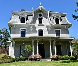 Capt. John McGilvery House |
December 29, 1983 (#83003685) |
E. Main St. 44°27′31″N 68°55′00″W |
Searsport | |
| 38 | Capt. William McGilvery House | Capt. William McGilvery House |
December 29, 1983 (#83003686) |
E. Main St. 44°27′33″N 68°54′52″W |
Searsport | |
| 39 | Mill at Freedom Falls | April 19, 2012 (#12000228) |
South side of Mill St., 125 feet (38 m) west of Pleasant St. 44°31′41″N 69°17′49″W |
Freedom | ||
| 40 | Moody Farm | October 31, 2002 (#02001269) |
Junction of State Route 173 and Lawry Rd. 44°21′33″N 69°08′56″W |
Searsmont | ||
| 41 | Montville Town House | April 24, 2012 (#12000227) |
418 Center Rd. 44°26′47″N 69°14′46″W |
Montville | ||
| 42 | Mortland Family Farm | October 24, 1991 (#91001510) |
Eastern side of Mortland Rd. north of Searsport 44°28′38″N 68°55′21″W |
Searsport | ||
| 43 | Mount Waldo Granite Works |  Mount Waldo Granite Works |
March 15, 1974 (#74000194) |
on the slopes of Mount Waldo 44°35′26″N 68°53′01″W |
Frankfort | |
| 44 | Capt. John P. Nichols House |  Capt. John P. Nichols House |
January 4, 1983 (#83000476) |
U.S. Route 1 44°27′28″N 68°54′56″W |
Searsport | |
| 45 | Old Post Office | June 19, 1973 (#73000149) |
Main St. (State Route 173) 44°23′31″N 69°18′26″W |
Liberty | ||
| 46 | James G. Pendleton House | 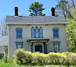 James G. Pendleton House |
March 10, 1995 (#95000218) |
81 W. Main St. 44°27′10″N 68°55′59″W |
Searsport | |
| 47 | Penobscot Marine Museum | 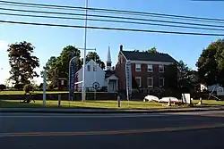 Penobscot Marine Museum |
July 1, 1970 (#70000088) |
Church St. 44°27′36″N 68°55′31″W |
Searsport | |
| 48 | Philler Cottage | April 11, 1985 (#85000726) |
Main Rd., Dark Harbor 44°15′31″N 68°54′45″W |
Islesboro | ||
| 49 | Primrose Hill Historic District | October 3, 1973 (#73000150) |
High and Anderson Sts. 44°25′16″N 69°00′44″W |
Belfast | ||
| 50 | Privateer Brigantine DEFENCE Shipwreck Site | March 18, 1975 (#75000205) |
Buried in Stockton Springs Harbor |
Stockton Springs | Ship wrecked during the 1779 Penobscot Expedition. | |
| 51 | Searsport Historic District | 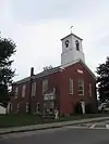 Searsport Historic District |
July 27, 1979 (#79000168) |
Main St. 44°27′30″N 68°55′33″W |
Searsport | |
| 52 | Seven Star Grange, No. 73 | November 18, 2011 (#11000817) |
696 Bangor Rd. 44°39′46″N 69°15′26″W |
Troy | ||
| 53 | Springdale Farm | April 24, 2000 (#00000374) |
Horseback Rd., 0.5 miles (0.80 km) south of Troy Rd. 44°40′59″N 69°21′57″W |
Burnham | ||
| 54 | Stockton Springs Community Church | 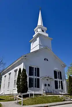 Stockton Springs Community Church |
June 20, 1985 (#85001266) |
20 Church St. 44°29′28″N 68°51′29″W |
Stockton Springs | |
| 55 | George S. Tiffany Cottage | October 16, 1989 (#89001700) |
Off Main Rd. 44°14′57″N 68°55′22″W |
Dark Harbor | ||
| 56 | Tranquility Grange No. 344 | April 11, 2002 (#02000350) |
1 mile (1.6 km) north of the junction of State Routes 52 and 173 44°18′21″N 69°05′52″W |
Lincolnville Center | ||
| 57 | Troy Meeting House | 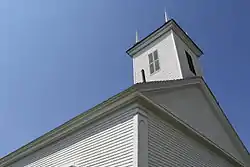 Troy Meeting House |
November 18, 2011 (#11000818) |
514 Bangor Rd. 44°39′54″N 69°14′23″W |
Troy | |
| 58 | George Ulmer House | October 4, 2006 (#06000922) |
3 S. Cobbtown Rd. 44°17′55″N 69°00′14″W |
Lincolnville | ||
| 59 | Union Hall | .jpg.webp) Union Hall |
March 20, 1986 (#86000478) |
3 Reservoir St. 44°27′34″N 68°55′28″W |
Searsport | |
| 60 | Union School | March 25, 1993 (#93000203) |
Eastern side of Mt. Ephraim Rd., 0.2 miles (0.32 km) north of its junction with U.S. Route 1 44°27′38″N 68°55′43″W |
Searsport | ||
| 61 | Village School | June 27, 2014 (#14000363) |
69 School Street 44°36′45″N 69°20′15″W |
Unity | ||
| 62 | James P. White House | 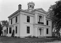 James P. White House |
April 24, 1973 (#73000245) |
1 Church St. 44°25′15″N 69°00′02″W |
Belfast | |
| 63 | Whitney Farm | 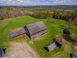 Whitney Farm |
March 17, 2015 (#15000087) |
215 Whitney Rd. 44°19′44″N 69°13′50″W |
Appleton | Extends into Searsmont; farmstead is in Appleton. |
| 64 | Winterport Congregational Church | April 24, 1973 (#73000151) |
Alternate U.S. Route 1 44°38′09″N 68°50′49″W |
Winterport | ||
| 65 | Winterport Historic District |  Winterport Historic District |
October 3, 1975 (#75000112) |
Irregular pattern along Main, Elm, Cushing, Lebanon, Commercial, Dean, and Water Sts. 44°38′10″N 68°50′53″W |
Winterport |
Former listing
| [3] | Name on the Register | Image | Date listed | Date removed | Location | City or town | Summary |
|---|---|---|---|---|---|---|---|
| 1 | Waldo-Hancock Bridge | 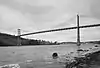 Waldo-Hancock Bridge |
June 20, 1985 (#85001267) | December 18, 2013 | U.S. Route 1 44°33′37″N 68°48′08″W |
Prospect | Demolished in 2013. Extended into Hancock County |
See also
| Wikimedia Commons has media related to National Register of Historic Places in Waldo County, Maine. |
References
- The latitude and longitude information provided in this table was derived originally from the National Register Information System, which has been found to be fairly accurate for about 99% of listings. Some locations in this table may have been corrected to current GPS standards.
- "National Register of Historic Places: Weekly List Actions". National Park Service, United States Department of the Interior. Retrieved on February 5, 2021.
- Numbers represent an alphabetical ordering by significant words. Various colorings, defined here, differentiate National Historic Landmarks and historic districts from other NRHP buildings, structures, sites or objects.
- "National Register Information System". National Register of Historic Places. National Park Service. April 24, 2008.
- The eight-digit number below each date is the number assigned to each location in the National Register Information System database, which can be viewed by clicking the number.
| Topics | |
|---|---|
| Lists by state |
|
| Lists by insular areas | |
| Lists by associated state | |
| Other areas | |
| Related | |
| |
Municipalities and communities of Waldo County, Maine, United States | ||
|---|---|---|
| City | Waldo County map | |
| Towns | ||
| CDPs | ||
| Other villages | ||
| ||
This article is issued from Wikipedia. The text is licensed under Creative Commons - Attribution - Sharealike. Additional terms may apply for the media files.