National Register of Historic Places listings in Franklin County, Maine
This is a list of the National Register of Historic Places listings in Franklin County, Maine.
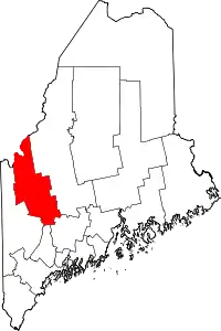
Location of Franklin County in Maine
This is intended to be a complete list of the properties and districts on the National Register of Historic Places in Franklin County, Maine, United States. Latitude and longitude coordinates are provided for many National Register properties and districts; these locations may be seen together in a map.[1]
There are 45 properties and districts listed on the National Register in the county. Two properties were once listed, but have been removed.
- This National Park Service list is complete through NPS recent listings posted February 5, 2021.[2]
| Androscoggin - Aroostook - Cumberland - Franklin - Hancock - Kennebec - Knox - Lincoln - Oxford - Penobscot - Piscataquis - Sagadahoc - Somerset - Waldo - Washington - York |
Current listings
| [3] | Name on the Register[4] | Image | Date listed[5] | Location | City or town | Description |
|---|---|---|---|---|---|---|
| 1 | Arnold Trail to Quebec |  Arnold Trail to Quebec |
October 1, 1969 (#69000018) |
Along the Kennebec River, through Wayman and Flagstaff lakes along the Dead River and Chain of Ponds to Quebec 44°40′49″N 69°59′18″W |
Coburn Gore | Extends through Franklin, Kennebec, Sagadahoc, and Somerset counties |
| 2 | Barn on Lot 8, Range G |  Barn on Lot 8, Range G |
August 24, 2011 (#11000581) |
816 Foster Hill Rd. 44°51′29″N 70°13′20″W |
Freeman Township | |
| 3 | Bass Boarding House |  Bass Boarding House |
April 7, 1988 (#88000396) |
Canal St. 44°35′12″N 70°13′58″W |
Wilton | Now the Wilton Farm and Home Museum. |
| 4 | Ora Blanchard House | 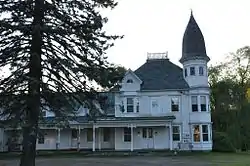 Ora Blanchard House |
January 15, 1980 (#80000215) |
Main St. 45°08′32″N 70°26′42″W |
Stratton | |
| 5 | John G. Coburn Farm | 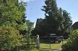 John G. Coburn Farm |
April 11, 2002 (#02000347) |
434 Carthage Road (Route 162), just north of the Webb River 44°37′36″N 70°28′36″W |
Carthage | Mis-listed as "John G. Coburn", on River Road. |
| 6 | Coplin Plantation Schoolhouse | 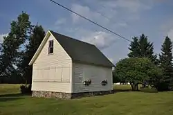 Coplin Plantation Schoolhouse |
September 11, 1997 (#97001132) |
State Route 16 approximately 4.5 miles southwest of its junction with State Route 27 45°05′32″N 70°29′55″W |
Coplin Plantation | |
| 7 | Cutler Memorial Library | 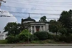 Cutler Memorial Library |
November 2, 1973 (#73000104) |
Academy and High Sts. 44°40′09″N 70°08′55″W |
Farmington | |
| 8 | Farmington Historic District | 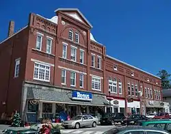 Farmington Historic District |
January 20, 1995 (#94001551) |
Roughly bounded by High, Academy, Anson, and Grove Sts. 44°40′14″N 70°08′58″W |
Farmington | Boundary decrease (listed 4/27/2010) |
| 9 | First Congregational Church, United Church of Christ | 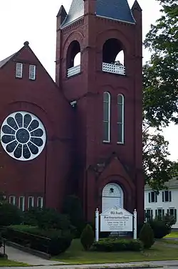 First Congregational Church, United Church of Christ |
July 25, 1974 (#74000149) |
235 Main St. 44°40′04″N 70°09′00″W |
Farmington | |
| 10 | Franklin County Courthouse | 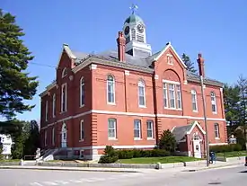 Franklin County Courthouse |
October 6, 1983 (#83003641) |
Main and Anson Sts. 44°40′17″N 70°09′08″W |
Farmington | |
| 11 | Free Will Baptist Meetinghouse | 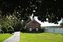 Free Will Baptist Meetinghouse |
August 28, 1973 (#73000264) |
219 Main St. 44°40′08″N 70°09′03″W |
Farmington | Now a garage. |
| 12 | Goodspeed Memorial Library | 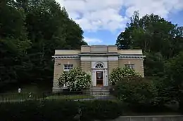 Goodspeed Memorial Library |
January 5, 1989 (#88003019) |
104 Main St. 44°35′16″N 70°13′51″W |
Wilton | |
| 13 | Greenacre | 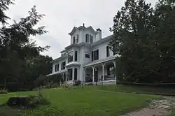 Greenacre |
October 29, 1982 (#82000422) |
17 Court St. 44°40′24″N 70°08′53″W |
Farmington | |
| 14 | Isabel and Chester Greenwood House | 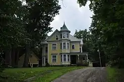 Isabel and Chester Greenwood House |
July 12, 1978 (#78000160) |
112 Hill Street 44°39′39″N 70°08′52″W |
Farmington | |
| 15 | The Herbert | 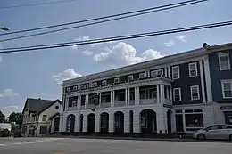 The Herbert |
March 26, 2018 (#100002226) |
246 Main St. 44°57′31″N 70°09′16″W |
Kingfield | |
| 16 | Holmes-Crafts Homestead | 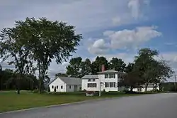 Holmes-Crafts Homestead |
April 26, 1973 (#73000105) |
Old N. Jay Rd. on State Route 4 44°31′08″N 70°13′28″W |
North Jay | Owned by the local historical society. |
| 17 | Frank Hutchins House | 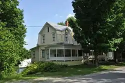 Frank Hutchins House |
December 29, 1986 (#86003532) |
High St. 44°57′27″N 70°09′17″W |
Kingfield | Home to the local historical society. |
| 18 | Jay-Niles Memorial Library | 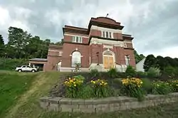 Jay-Niles Memorial Library |
March 13, 1987 (#87000414) |
State Route 4 44°32′53″N 70°14′17″W |
North Jay | |
| 19 | Little Red Schoolhouse | 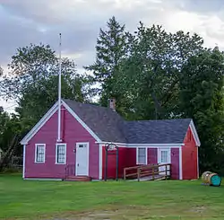 Little Red Schoolhouse |
February 23, 1972 (#72000070) |
Franklin Agricultural Society Fairgrounds[6] 44°39′46″N 70°08′23″W |
Farmington | Originally on Wilton Road; moved to fairgrounds in 2007. |
| 20 | Madrid Village Schoolhouse | 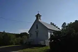 Madrid Village Schoolhouse |
December 14, 1995 (#95001460) |
Western side of Reeds Mills Rd., 0.05 miles north of its junction with State Route 4 44°51′53″N 70°27′45″W |
Madrid | |
| 21 | Maine Woods Office | 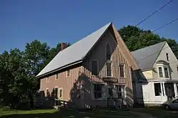 Maine Woods Office |
November 10, 1980 (#80000216) |
Main St. 44°49′27″N 70°20′55″W |
Phillips | Now the Phillips Community House. |
| 22 | McCleary Farm | McCleary Farm |
April 7, 1989 (#89000253) |
S. Strong Rd. 44°45′50″N 70°12′34″W |
Strong | |
| 23 | Merrill Hall | 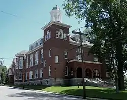 Merrill Hall |
January 23, 1980 (#80000217) |
Maine and Academy Sts. 44°40′09″N 70°08′58″W |
Farmington | |
| 24 | New Sharon Congregational Church | 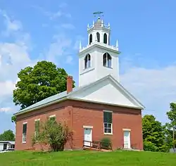 New Sharon Congregational Church |
June 20, 1985 (#85001261) |
State Route 134 44°38′10″N 70°00′50″W |
New Sharon | |
| 25 | Nordica Homestead | 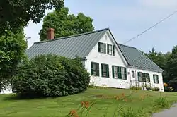 Nordica Homestead |
December 23, 1969 (#69000006) |
North of Farmington on Holly Rd. off State Route 27 44°41′42″N 70°08′43″W |
Farmington | Now a museum. |
| 26 | North Jay Grange Store | 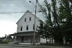 North Jay Grange Store |
October 23, 1974 (#74000150) |
State Route 17 44°33′15″N 70°14′09″W |
North Jay | |
| 27 | William F. Norton House | 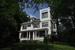 William F. Norton House |
July 8, 1982 (#82000741) |
1 Stanley Ave. 44°57′39″N 70°09′06″W |
Kingfield | |
| 28 | Old Union Meetinghouse | 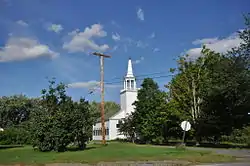 Old Union Meetinghouse |
October 30, 1973 (#73000106) |
U.S. Route 2 44°37′26″N 70°04′40″W |
Farmington | |
| 29 | Oquossoc Log Church | 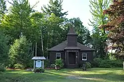 Oquossoc Log Church |
July 19, 1984 (#84001368) |
State Route 4 44°58′00″N 70°46′14″W |
Rangeley | |
| 30 | Orgone Energy Observatory |  Orgone Energy Observatory |
January 29, 1999 (#98001602) |
Western side of Dodge Pond Rd., 0.65 miles north of the junction of State Routes 4/16 44°58′54″N 70°43′05″W |
Rangeley | Now the William/Wilhelm Reich Museum. |
| 31 | Porter-Bell-Brackley Estate | 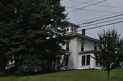 Porter-Bell-Brackley Estate |
November 10, 1980 (#80000218) |
Lower Main St. 44°48′16″N 70°13′14″W |
Strong | |
| 32 | Hiram Ramsdell House | 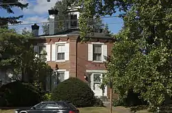 Hiram Ramsdell House |
December 4, 1973 (#73000107) |
High and Perham Sts. 44°40′17″N 70°08′59″W |
Farmington | |
| 33 | Rangeley Tavern |  Rangeley Tavern |
March 22, 2018 (#100002227) |
2443 Main St. 44°57′49″N 70°38′27″W |
Rangeley | |
| 34 | Rangeley Trust Company Building | 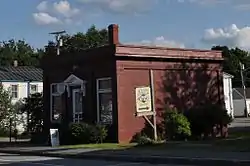 Rangeley Trust Company Building |
July 13, 1989 (#89000846) |
Main St. 44°57′50″N 70°38′32″W |
Rangeley | Now the local historical society museum. |
| 35 | Rangeley Public Library | 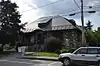 Rangeley Public Library |
July 12, 1978 (#78000161) |
Lake St. 44°57′53″N 70°38′38″W |
Rangeley | |
| 36 | Salem Town House (Former) | 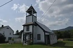 Salem Town House (Former) |
August 5, 2005 (#05000795) |
State Route 142 44°54′05″N 70°16′35″W |
Salem | |
| 37 | Temple Intervale School | 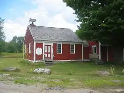 Temple Intervale School |
February 8, 1985 (#85000240) |
Temple Intervale 44°41′54″N 70°14′45″W |
Temple | |
| 38 | Thompson's Bridge | 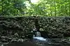 Thompson's Bridge |
March 22, 1991 (#91000321) |
Over Thompson's Creek off the northern side of State Route 43 at the Franklin-Somerset county line 44°43′36″N 70°00′25″W |
Allen's Mills | |
| 39 | Tufts House | 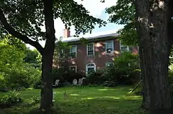 Tufts House |
May 8, 1979 (#79000130) |
Southeast of Farmington on U.S. Route 2 44°38′10″N 70°05′35″W |
Farmington | |
| 40 | Union Church | 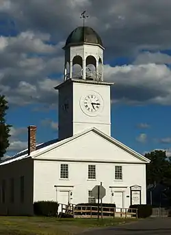 Union Church |
July 13, 1989 (#89000844) |
Main and Pleasant Sts. 44°49′24″N 70°20′23″W |
Phillips | |
| 41 | Upper Dallas School | 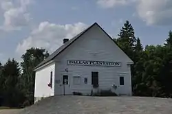 Upper Dallas School |
February 9, 1990 (#89002345) |
Saddleback Rd. 44°57′55″N 70°36′08″W |
Dallas Plantation | |
| 42 | U.S. Inspection Station-Coburn Gore, Maine | 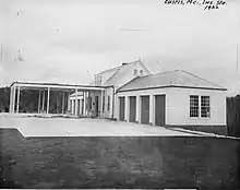 U.S. Inspection Station-Coburn Gore, Maine |
September 10, 2014 (#14000558) |
ME 27 45°22′43″N 70°48′25″W |
Coburn Gore | |
| 43 | Weld Town Hall | 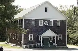 Weld Town Hall |
June 27, 2007 (#07000597) |
17 School St. 44°41′51″N 70°25′12″W |
Weld | |
| 44 | Capt. Joel Whitney House | 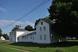 Capt. Joel Whitney House |
April 22, 2003 (#03000293) |
8 Pleasant St. 44°49′22″N 70°20′24″W |
Phillips | Home to the Phillips Historical Society. |
| 45 | Amos G. Winter House | 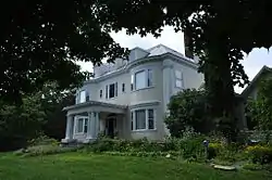 Amos G. Winter House |
May 3, 1976 (#76000191) |
Winter's Hill off State Route 27 44°57′33″N 70°09′37″W |
Kingfield |
Former listings
| [3] | Name on the Register | Image | Date listed | Date removed | Location | City or town | Summary |
|---|---|---|---|---|---|---|---|
| 1 | Jacob Abbott House | 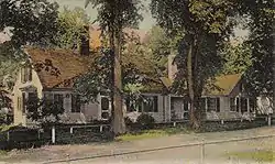 Jacob Abbott House |
November 26, 1973 (#73000103) | April 27, 2010 | State Route 27 44°39′56″N 70°08′52″W |
Farmington | |
| 2 | New Sharon Bridge | 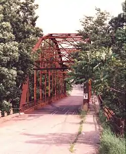 New Sharon Bridge |
September 24, 1999 (#99001189) | July 14, 2015 | South of U.S. Route 2 over the Sandy River 44°38′16″N 70°00′56″W |
New Sharon | Demolished. |
See also
| Wikimedia Commons has media related to National Register of Historic Places in Franklin County, Maine. |
References
- The latitude and longitude information provided in this table was derived originally from the National Register Information System, which has been found to be fairly accurate for about 99% of listings. Some locations in this table may have been corrected to current GPS standards.
- "National Register of Historic Places: Weekly List Actions". National Park Service, United States Department of the Interior. Retrieved on February 5, 2021.
- Numbers represent an alphabetical ordering by significant words. Various colorings, defined here, differentiate National Historic Landmarks and historic districts from other NRHP buildings, structures, sites or objects.
- "National Register Information System". National Register of Historic Places. National Park Service. April 24, 2008.
- The eight-digit number below each date is the number assigned to each location in the National Register Information System database, which can be viewed by clicking the number.
- http://farmington.mainememory.net/page/1073/display.html
| Topics | |
|---|---|
| Lists by state |
|
| Lists by insular areas | |
| Lists by associated state | |
| Other areas | |
| Related | |
| |
Municipalities and communities of Franklin County, Maine, United States | ||
|---|---|---|
| Towns | Franklin County map | |
| Plantations | ||
| Unorganized territories | ||
| CDPs | ||
| Other villages | ||
| Footnotes | ‡This populated place also has portions in an adjacent county | |
| ||
This article is issued from Wikipedia. The text is licensed under Creative Commons - Attribution - Sharealike. Additional terms may apply for the media files.