National Register of Historic Places listings in Oxford County, Maine
This is a list of the National Register of Historic Places listings in Oxford County, Maine.
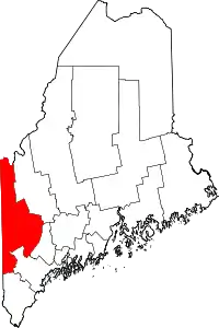
Location of Oxford County in Maine
This is intended to be a complete list of the properties and districts on the National Register of Historic Places in Oxford County, Maine, United States. Latitude and longitude coordinates are provided for many National Register properties and districts; these locations may be seen together in a map.[1]
There are 100 properties and districts listed on the National Register in the county. One property was once listed, but as since been delisted.
- This National Park Service list is complete through NPS recent listings posted January 29, 2021.[2]
| Androscoggin - Aroostook - Cumberland - Franklin - Hancock - Kennebec - Knox - Lincoln - Oxford - Penobscot - Piscataquis - Sagadahoc - Somerset - Waldo - Washington - York |
Current listings
| [3] | Name on the Register[4] | Image | Date listed[5] | Location | City or town | Description |
|---|---|---|---|---|---|---|
| 1 | Albany Town House | 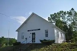 Albany Town House |
August 7, 2007 (#07000793) |
Junction of State Routes 5 and 35 44°19′27″N 70°46′10″W |
Albany Township | |
| 2 | Andover Hook and Ladder Company Building | 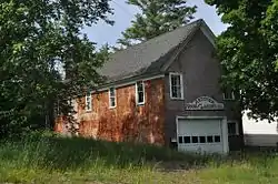 Andover Hook and Ladder Company Building |
January 11, 2001 (#00001631) |
39 Elm St. 44°38′10″N 70°44′59″W |
Andover | |
| 3 | Andover Public Library | 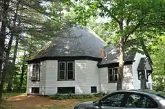 Andover Public Library |
January 27, 1981 (#81000103) |
Church St. 44°37′54″N 70°45′07″W |
Andover | |
| 4 | Barrows-Steadman Homestead | 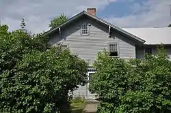 Barrows-Steadman Homestead |
April 12, 1982 (#82000771) |
NE corner of Main and Stuart St. 44°01′04″N 70°58′47″W |
Fryeburg | |
| 5 | Bell Hill Meetinghouse | 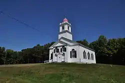 Bell Hill Meetinghouse |
July 10, 2003 (#03000620) |
191 Bell Hill Rd. 44°05′17″N 70°33′36″W |
Otisfield | |
| 6 | Bell Hill School | 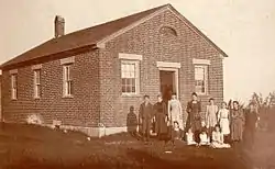 Bell Hill School |
July 10, 2003 (#03000619) |
185 Bell Hill Rd. 44°05′15″N 70°33′35″W |
Otisfield | |
| 7 | Bennett Bridge | 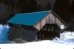 Bennett Bridge |
February 16, 1970 (#70000055) |
1.5 miles (2.4 km) south of Wilsons Mills off State Route 16, over the Magalloway River 44°55′04″N 71°02′21″W |
Wilsons Mills | |
| 8 | Nathaniel and Elizabeth Bennett House | 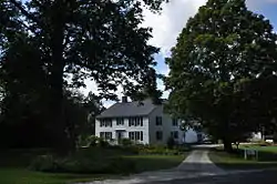 Nathaniel and Elizabeth Bennett House |
June 7, 1996 (#96000652) |
Western side of Crockett Ridge Rd., 1.4 miles (2.3 km) north of its junction with State Route 117 44°13′57″N 70°34′31″W |
Norway | |
| 9 | Brick School | 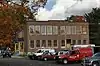 Brick School |
June 26, 2017 (#100001241) |
3 E. Main St. 44°13′23″N 70°30′42″W |
Paris | |
| 10 | Brickett Place | 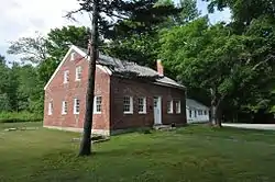 Brickett Place |
July 28, 1982 (#82000772) |
State Route 113 44°16′03″N 71°00′18″W |
Stow | |
| 11 | Broad Street Historic District | 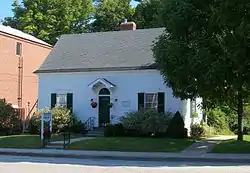 Broad Street Historic District |
December 28, 1977 (#77000078) |
Broad St. and the Common; also along Church and Park Sts. 44°24′07″N 70°47′23″W |
Bethel | Second set of addresses represents a boundary increase |
| 12 | Camp Cinnamon |  Camp Cinnamon |
September 30, 2019 (#100004470) |
37 Camp Cinnamon Rd. 44°13′28″N 70°39′37″W |
Norway | |
| 13 | Center Meeting House and Common |  Center Meeting House and Common |
June 20, 1997 (#97000606) |
476 Main St. 44°08′18″N 70°28′18″W |
Oxford | |
| 14 | Squire Chase House |  Squire Chase House |
May 7, 1979 (#79000158) |
Main St., SW of junction with Bridgton Rd. 44°01′15″N 70°58′34″W |
Fryeburg | |
| 15 | Church of the New Jerusalem |  Church of the New Jerusalem |
June 13, 1986 (#86001274) |
4 Oxford St. 44°00′56″N 70°58′51″W |
Fryeburg | |
| 16 | Churchill Bridge |  Churchill Bridge |
March 17, 1994 (#94000180) |
Mountain Rd. across Bicknell Brook, 1 mile (1.6 km) west of its junction with Sodom Rd. 44°14′44″N 70°23′10″W |
Buckfield | |
| 17 | Cole Block | 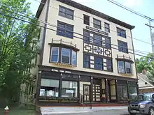 Cole Block |
April 1, 1998 (#98000310) |
19 Main St. 44°24′26″N 70°47′33″W |
Bethel | |
| 18 | Deacon Hutchins House | 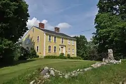 Deacon Hutchins House |
July 10, 1979 (#79000159) |
Northwest of Rumford on State Route 5 44°32′47″N 70°41′42″W |
Rumford | |
| 19 | Deering Memorial United Methodist Church | 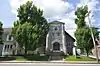 Deering Memorial United Methodist Church |
January 24, 2008 (#07001444) |
39 Main St. 44°13′23″N 70°30′55″W |
Paris | Sidney Badgley and William H. Nicklas, architects (1911). |
| 20 | District No. 1 Schoolhouse | 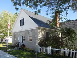 District No. 1 Schoolhouse |
July 19, 1984 (#84001466) |
515 Main St. 44°00′54″N 70°58′57″W |
Fryeburg | Now the library. |
| 21 | Dreamhome |  Dreamhome |
September 27, 1996 (#96001037) |
Western side of Lake Christopher, 0.45 miles (0.72 km) north of Hill Rd. 44°22′16″N 70°39′10″W |
Bryant Pond | |
| 22 | Eastman Hill Rural Historic District |  Eastman Hill Rural Historic District |
June 8, 1993 (#93000477) |
Eastman Hill Rd. east of Center Lovell 44°10′17″N 70°52′17″W |
Center Lovell | |
| 23 | First Universalist Society of West Sumner |  First Universalist Society of West Sumner |
August 9, 2002 (#02000850) |
1114 Main St. 44°21′58″N 70°27′40″W |
Sumner | |
| 24 | Fives Court |  Fives Court |
October 5, 2017 (#16000676) |
55 Fairburn Way, Westways 44°12′54″N 70°53′14″W |
Lovell | An early 20th-century fives court. |
| 25 | Forest Lodge | 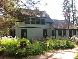 Forest Lodge |
December 30, 2008 (#08001257) |
Carry Rd., about 1.9 miles (3.1 km) west of Middle Dam 44°46′00″N 70°57′01″W |
Upton | |
| 26 | Foster Family Home |  Foster Family Home |
November 9, 1994 (#94001247) |
Western side of Sunday River Rd., 1.5 miles (2.4 km) northwest of its junction with Skiway Rd. 44°29′28″N 70°50′35″W |
Newry | |
| 27 | Fryeburg Registry of Deeds | 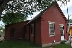 Fryeburg Registry of Deeds |
December 30, 1987 (#87002196) |
Main St., next to the library 44°00′53″N 70°58′59″W |
Fryeburg | |
| 28 | Fryeburg Town House, Former | 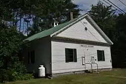 Fryeburg Town House, Former |
October 2, 1992 (#92001295) |
Eastern side of State Route 5, 0.1 miles (0.16 km) north of its junction with Woodlawn Ave. (now Corn Shop Rd.) 44°04′14″N 70°56′43″W |
Fryeburg Center | |
| 29 | Gehring Clinic | 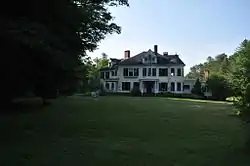 Gehring Clinic |
August 2, 1976 (#76000105) |
Off State Route 5 44°23′58″N 70°47′16″W |
Bethel | |
| 30 | Gilead Railroad Station, Former | 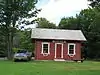 Gilead Railroad Station, Former |
March 26, 1992 (#92000272) |
Back St and Bridge St, just off Route 2, Gilead 44°23′40″N 70°58′21″W |
Gilead | Moved in Jan 2011 from Auburn back to Gilead[6] |
| 31 | Greenwood Cattle Pound | 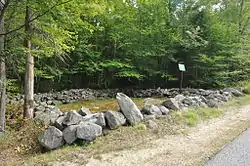 Greenwood Cattle Pound |
August 7, 2007 (#07000794) |
Greenwood Rd., 0.33 miles (0.53 km) north of State Route 219 44°19′21″N 70°39′18″W |
Greenwood | |
| 32 | Greenwood Town Hall, Former | 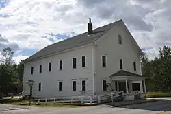 Greenwood Town Hall, Former |
January 11, 2001 (#00001634) |
270 Main St. 44°24′04″N 70°42′22″W |
Locke Mills | |
| 33 | Hall House | 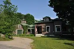 Hall House |
October 31, 2002 (#02001271) |
10 Kilborn St. 44°24′25″N 70°47′09″W |
Bethel | |
| 34 | Enoch Hall House | 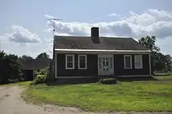 Enoch Hall House |
December 23, 1993 (#93001431) |
Western side of Bean Rd., 0.5 miles (0.80 km) southeast of its junction with State Route 117 44°16′57″N 70°20′38″W |
Buckfield | |
| 35 | Hemlock Bridge |  Hemlock Bridge |
February 16, 1970 (#70000056) |
Northeast of Fryeburg Center, over the Old Course Saco River 44°04′46″N 70°54′13″W |
Fryeburg Center | |
| 36 | Hershey Plow Company Building | 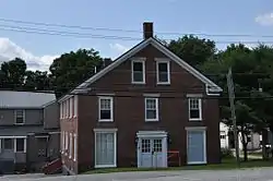 Hershey Plow Company Building |
June 14, 1990 (#90000922) |
Hill St. near Stony Brook 44°13′21″N 70°30′25″W |
South Paris | |
| 37 | Hubbard-Cotton Store | 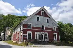 Hubbard-Cotton Store |
June 14, 1990 (#90000923) |
State Routes 5/113 across the Saco River from their junction with State Route 117 43°52′28″N 70°48′19″W |
Hiram | |
| 38 | Moses Hutchins House | 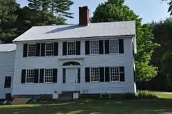 Moses Hutchins House |
April 22, 2003 (#03000290) |
Junction of State Route 6 and Old Stage Rd. 44°08′51″N 70°53′02″W |
Lovell | |
| 39 | J&O Irish Store | 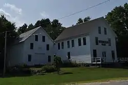 J&O Irish Store |
December 29, 1983 (#83003666) |
State Route 140 44°22′22″N 70°20′52″W |
Hartford | Now a local history museum. |
| 40 | Zadoc Long Free Library | 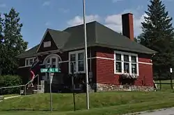 Zadoc Long Free Library |
June 24, 1994 (#94000636) |
Southern side of State Route 117 at its junction with State Route 140 44°17′22″N 70°21′55″W |
Buckfield | John Calvin Stevens, architect (1900-01). |
| 41 | Lovejoy Bridge | 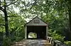 Lovejoy Bridge |
February 16, 1970 (#70000057) |
Over the Ellis River 44°35′37″N 70°44′02″W |
South Andover | |
| 42 | Lovell Meeting House | 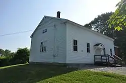 Lovell Meeting House |
June 27, 2014 (#14000360) |
1133 Main St. 44°11′03″N 70°53′25″W |
Lovell | |
| 43 | Lovell Village Church | 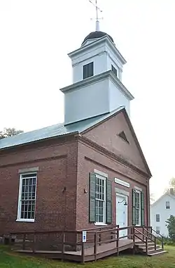 Lovell Village Church |
June 20, 1986 (#86001337) |
Church St. 44°07′40″N 70°53′36″W |
Lovell | Ammi Cutter, architect (1851). |
| 44 | Lower Meeting House and East Bethel Cemetery | 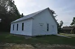 Lower Meeting House and East Bethel Cemetery |
June 25, 2013 (#13000440) |
1797 Intervale Road 44°27′53″N 70°43′17″W |
Bethel | |
| 45 | Lower Sunday River School | 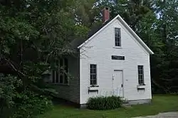 Lower Sunday River School |
May 23, 1978 (#78000189) |
Southwest of Newry on Sunday River Rd. 44°28′20″N 70°49′57″W |
Newry | |
| 46 | Main Street Historic District | 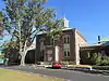 Main Street Historic District |
March 22, 1991 (#91000324) |
Main Street from Portland St. to about Swans Falls Rd. 44°01′15″N 70°58′35″W |
Fryeburg | |
| 47 | Maine Archaeological Survey site 21.26 | September 5, 1997 (#97000915) |
Address restricted |
Lovell | ||
| 48 | Arthur L. Mann Memorial Library | 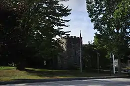 Arthur L. Mann Memorial Library |
January 5, 1989 (#88003016) |
Main St. 44°19′30″N 70°34′27″W |
West Paris | |
| 49 | Dr. Moses Mason House | 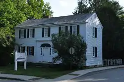 Dr. Moses Mason House |
October 17, 1972 (#72000110) |
Broad St. 44°24′18″N 70°47′32″W |
Bethel | Bethel Historical Society property. |
| 50 | McLaughlin House and Garden |  McLaughlin House and Garden |
October 27, 2000 (#00001202) |
97 Main St. 44°13′08″N 70°31′03″W |
South Paris | |
| 51 | McWain-Hall House | 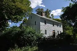 McWain-Hall House |
March 25, 1987 (#87000416) |
McWain Hill Rd. 44°11′14″N 70°40′10″W |
Waterford | |
| 52 | Mechanic Institute | 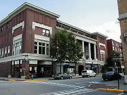 Mechanic Institute |
May 13, 1980 (#80000241) |
44-56 Congress St. 44°32′46″N 70°32′45″W |
Rumford | |
| 53 | Merrill-Poor House | 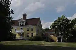 Merrill-Poor House |
May 17, 1976 (#76000106) |
Northeast of Andover on State Route 120 44°38′09″N 70°44′19″W |
Andover | |
| 54 | Middle Intervale Meeting House and Common | 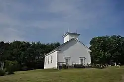 Middle Intervale Meeting House and Common |
June 26, 1998 (#98000721) |
757 Intervale Rd. 44°27′51″N 70°47′11″W |
Bethel | |
| 55 | Municipal Building |  Municipal Building |
May 13, 1980 (#80000242) |
Congress St. 44°32′48″N 70°32′47″W |
Rumford | |
| 56 | North Waterford Congregational Church | 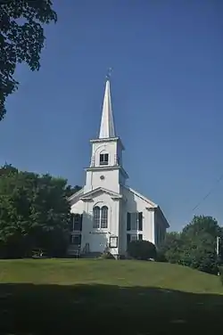 North Waterford Congregational Church |
June 13, 1986 (#86001275) |
Off State Route 35 44°16′57″N 70°46′24″W |
North Waterford | |
| 57 | Norway Historic District | 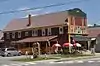 Norway Historic District |
July 21, 1988 (#88000391) |
Roughly bounded by Pearl St., Danforth St. and Greenleaf Ave., Pennesseewassee Stream, and Main and Whitman Sts. 44°12′49″N 70°32′31″W |
Norway | |
| 58 | The Nutting Homestead | 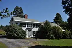 The Nutting Homestead |
December 3, 1974 (#74000163) |
South of Otisfield off State Route 121 44°04′14″N 70°32′37″W |
Otisfield | |
| 59 | Osgood Family House | 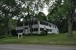 Osgood Family House |
April 5, 1990 (#90000576) |
Main St. 44°00′42″N 70°59′15″W |
Fryeburg | |
| 60 | Otisfield Town House (Former) | 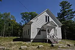 Otisfield Town House (Former) |
February 15, 2005 (#05000055) |
53 Bell Hill Rd. 44°04′54″N 70°33′14″W |
Otisfield | |
| 61 | Otisfield Town Pound | December 30, 2019 (#100004826) |
Near 322 Bell Hill Rd. 44°05′43″N 70°34′00″W |
Otisfield | ||
| 62 | Oxford Congregational Church and Cemetery | 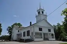 Oxford Congregational Church and Cemetery |
June 24, 1994 (#94000637) |
Eastern side of King St., 0.2 miles (0.32 km) north of its junction with State Route 121 44°08′02″N 70°29′30″W |
Oxford | |
| 63 | Paris Hill Historic District | 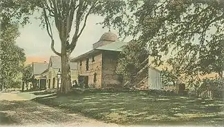 Paris Hill Historic District |
June 19, 1973 (#73000243) |
Main St. and Hannibal Hamlin Dr., east to Mt. Mica and Christian Ridge Rds. 44°15′44″N 70°30′07″W |
Paris Hill | |
| 64 | Paris Public Library | 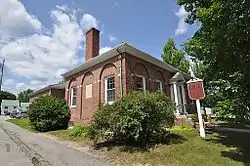 Paris Public Library |
January 5, 1989 (#88003015) |
3 Main St. 44°13′24″N 70°30′53″W |
South Paris | John Calvin Stevens, architect. |
| 65 | Marion Parsons House | 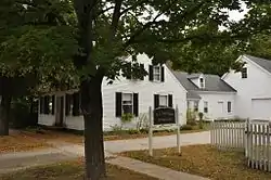 Marion Parsons House |
January 23, 1987 (#86002432) |
179 Main St. 44°00′51″N 70°59′01″W |
Fryeburg | |
| 66 | Peabody Tavern | 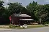 Peabody Tavern |
December 13, 1976 (#76000107) |
East of Gilead on U.S. Route 2 44°23′55″N 70°56′07″W |
Gilead | |
| 67 | John M. Philbrook House | 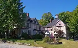 John M. Philbrook House |
December 14, 1995 (#95001465) |
32 Main St. 44°24′20″N 70°47′27″W |
Bethel | Now the Victoria Inn |
| 68 | Samuel D. Philbrook House | 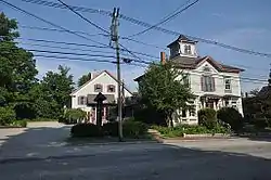 Samuel D. Philbrook House |
March 10, 1995 (#95000216) |
162 Main St. 44°24′35″N 70°47′21″W |
Bethel | |
| 69 | Porter Old Meetinghouse | 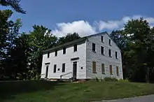 Porter Old Meetinghouse |
April 2, 1973 (#73000267) |
North of Porter off State Route 25 43°49′05″N 70°56′50″W |
Porter | |
| 70 | Porter-Parsonfield Bridge | 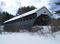 Porter-Parsonfield Bridge |
February 16, 1970 (#70000058) |
0.5 miles (0.80 km) south of Porter over the Ossipee River 43°47′30″N 70°56′18″W |
Porter | Extends into York County |
| 71 | E.C. and M.I. Record Homestead | 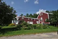 E.C. and M.I. Record Homestead |
August 24, 2011 (#11000582) |
8 Bean Rd. 44°17′11″N 70°20′49″W |
Buckfield | |
| 72 | Rivercroft Farm | 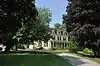 Rivercroft Farm |
July 16, 2008 (#08000668) |
55, 59, and 60 River St. 44°01′05″N 70°59′32″W |
Fryeburg | |
| 73 | Robinson-Parsons Farm |  Robinson-Parsons Farm |
February 4, 1982 (#82000773) |
Town Farm Brook Rd. 44°11′28″N 70°29′59″W |
Paris | |
| 74 | Rumford Commercial Historic District | 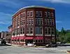 Rumford Commercial Historic District |
March 27, 2017 (#100000808) |
49-150 Congress, 65-91 Canal, 60-94 River & 23 Hartford Sts. 44°32′43″N 70°32′44″W |
Rumford | |
| 75 | Rumford Falls I-IV Site | November 14, 1992 (#92001513) |
Address Restricted |
South Rumford | ||
| 76 | Rumford Falls Power Company Building | 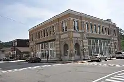 Rumford Falls Power Company Building |
May 13, 1980 (#80000243) |
59 Congress St. 44°32′41″N 70°32′47″W |
Rumford | |
| 77 | Rumford Falls V Site | November 14, 1992 (#92001509) |
Address Restricted |
South Rumford | ||
| 78 | Rumford Point Congregational Church | 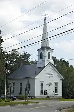 Rumford Point Congregational Church |
June 20, 1985 (#85001259) |
Junction of U.S. Route 2 and State Route 5 44°30′03″N 70°40′18″W |
Rumford | Jonathan Adams Bartlett, architect (1865). |
| 79 | Rumford Public Library | 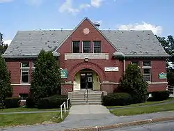 Rumford Public Library |
January 5, 1989 (#88003023) |
Rumford Ave. 44°32′49″N 70°32′58″W |
Rumford | John Calvin Stevens, architect (1903). |
| 80 | Ryefield Bridge | 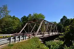 Ryefield Bridge |
September 24, 1999 (#99001193) |
West Andrew Hill Road over the Crooked River 44°08′34″N 70°35′43″W |
Otisfield | Extends into Harrison in Cumberland County |
| 81 | Levi Sargent House | 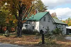 Levi Sargent House |
March 13, 1987 (#87000419) |
Otisfield Gore Rd. 44°08′58″N 70°33′52″W |
Otisfield | |
| 82 | Soldiers Memorial Library | 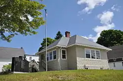 Soldiers Memorial Library |
October 16, 2008 (#08000992) |
85 Main St. 43°52′56″N 70°47′52″W |
Hiram | |
| 83 | Stearns Hill Farm | 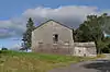 Stearns Hill Farm |
February 11, 2009 (#09000014) |
90 Stearns Hill Rd. 44°18′17″N 70°31′14″W |
West Paris | |
| 84 | Elisha F. Stone House | 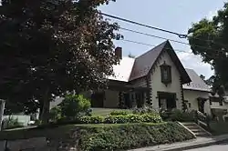 Elisha F. Stone House |
April 28, 1983 (#83000466) |
Gothic St. 44°13′29″N 70°30′54″W |
South Paris | |
| 85 | Strathglass Building | 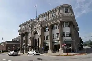 Strathglass Building |
May 13, 1980 (#80000244) |
33 Hartford St. 44°32′46″N 70°32′45″W |
Rumford | |
| 86 | Strathglass Park District | 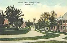 Strathglass Park District |
October 18, 1974 (#74000181) |
Bounded by Lincoln Ave., Hancock St., Maine Ave., and York St. 44°33′03″N 70°33′06″W |
Rumford | |
| 87 | Sturtevant Hall | 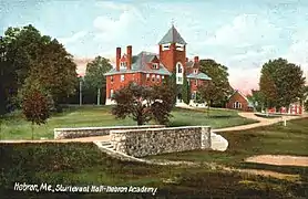 Sturtevant Hall |
September 19, 1977 (#77000079) |
State Route 119 44°12′02″N 70°24′34″W |
Hebron | John Calvin Stevens, architect (1891). |
| 88 | Sunday River Bridge | 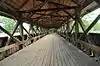 Sunday River Bridge |
February 16, 1970 (#70000059) |
West of Newry, over the Sunday River 44°29′31″N 70°50′36″W |
Newry | Also known locally as the Artist's Bridge. |
| 89 | Town of Rumford Site | November 14, 1992 (#92001507) |
Address Restricted |
Rumford | ||
| 90 | Union Church | 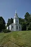 Union Church |
June 22, 1980 (#80000245) |
Off State Route 140 44°17′40″N 70°22′13″W |
Buckfield | |
| 91 | Union School | June 20, 2018 (#100002593) |
392 Church St. 44°23′25″N 70°18′44″W |
Hartford | ||
| 92 | Upton Grange No. 404 (Former) | 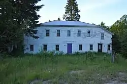 Upton Grange No. 404 (Former) |
October 12, 2000 (#00001206) |
Junction of State Route 26 and Mill Rd. 44°41′40″N 71°00′43″W |
Upton | |
| 93 | Vail Site | January 23, 1980 (#80000246) |
Address Restricted |
Parkertown Township | ||
| 94 | Wadsworth Hall | 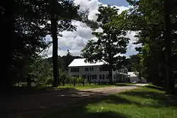 Wadsworth Hall |
January 21, 1974 (#74000182) |
South of Hiram 43°51′48″N 70°48′47″W |
Hiram | |
| 95 | David Warren House | 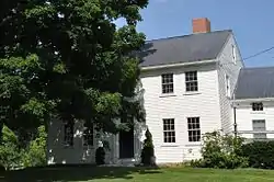 David Warren House |
April 28, 1983 (#83000467) |
Off State Route 140 44°19′26″N 70°21′04″W |
Hartford | |
| 96 | Waterford Historic District | 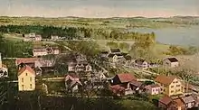 Waterford Historic District |
April 24, 1980 (#80000247) |
State Routes 35 and 37 Boundary increase (listed August 23, 2011, refnum 11000583): 30 Valley Rd 44°10′54″N 70°43′01″W |
Waterford | |
| 97 | John Watson House | 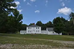 John Watson House |
December 31, 1974 (#74000183) |
1 mile (1.6 km) northwest of Hiram on Benny Babb Hill Road 43°53′51″N 70°48′53″W |
Hiram | |
| 98 | West Paris Lodge No. 15, I.O.O.F. | 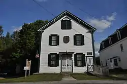 West Paris Lodge No. 15, I.O.O.F. |
January 27, 2012 (#11001058) |
221 Main St. 44°19′33″N 70°34′21″W |
West Paris | |
| 99 | Whitman Memorial Library |  Whitman Memorial Library |
January 12, 1995 (#94001549) |
1 mile (1.6 km) southwest of the junction of State Routes 26 and 232 44°22′46″N 70°38′39″W |
Bryant Pond | |
| 100 | Benjamin Wiley House |  Benjamin Wiley House |
November 10, 1980 (#80000248) |
Southeast of North Fryeburg on Fish St. 44°06′18″N 70°57′44″W |
North Fryeburg |
Former listing
| [3] | Name on the Register | Image | Date listed | Date removed | Location | City or town | Summary |
|---|---|---|---|---|---|---|---|
| 1 | Knight's Country Store | April 14, 1978 (#78000328) | August 5, 1987 | ME 5A |
Lovell vicinity |
See also
| Wikimedia Commons has media related to National Register of Historic Places in Oxford County, Maine. |
References
- The latitude and longitude information provided in this table was derived originally from the National Register Information System, which has been found to be fairly accurate for about 99% of listings. Some locations in this table may have been corrected to current GPS standards.
- "National Register of Historic Places: Weekly List Actions". National Park Service, United States Department of the Interior. Retrieved on January 29, 2021.
- Numbers represent an alphabetical ordering by significant words. Various colorings, defined here, differentiate National Historic Landmarks and historic districts from other NRHP buildings, structures, sites or objects.
- "National Register Information System". National Register of Historic Places. National Park Service. April 24, 2008.
- The eight-digit number below each date is the number assigned to each location in the National Register Information System database, which can be viewed by clicking the number.
- http://www.gileadhistoricalsociety.blogspot.com/
| Topics | |
|---|---|
| Lists by state |
|
| Lists by insular areas | |
| Lists by associated state | |
| Other areas | |
| Related | |
| |
Municipalities and communities of Oxford County, Maine, United States | ||
|---|---|---|
| Towns | Oxford County map | |
| Plantations | ||
| Unorganized territories | ||
| CDPs | ||
| Other villages | ||
| Footnotes | ‡This populated place also has portions in an adjacent county | |
| ||
This article is issued from Wikipedia. The text is licensed under Creative Commons - Attribution - Sharealike. Additional terms may apply for the media files.