National Register of Historic Places listings in Hancock County, Maine
This is a list of the National Register of Historic Places listings in Hancock County, Maine.

Location of Hancock County in Maine
This is intended to be a complete list of the properties and districts on the National Register of Historic Places in Hancock County, Maine, United States. Latitude and longitude coordinates are provided for many National Register properties and districts; these locations may be seen together in a map.[1]
There are 128 properties and districts listed on the National Register in the county, including two National Historic Landmarks. Another three properties were once listed but have been removed.
- This National Park Service list is complete through NPS recent listings posted February 5, 2021.[2]
| Androscoggin - Aroostook - Cumberland - Franklin - Hancock - Kennebec - Knox - Lincoln - Oxford - Penobscot - Piscataquis - Sagadahoc - Somerset - Waldo - Washington - York |
Current listings
| [3] | Name on the Register[4] | Image | Date listed[5] | Location | City or town | Description |
|---|---|---|---|---|---|---|
| 1 | Robert Abbe Museum of Stone Antiquities | 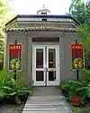 Robert Abbe Museum of Stone Antiquities |
January 19, 1983 (#83000451) |
South of Bar Harbor off State Route 3 44°21′40″N 68°12′30″W |
Bar Harbor | |
| 2 | Agassiz Bedrock Outcrop | 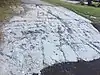 Agassiz Bedrock Outcrop |
February 13, 2003 (#03000014) |
406 State St. 44°33′40″N 68°26′19″W |
Ellsworth | |
| 3 | Baker Island Light Station | .jpg.webp) Baker Island Light Station |
March 14, 1988 (#88000046) |
Baker Island in Acadia National Park 44°14′28″N 68°11′56″W |
Islesford | First light station serving Mount Desert Island—established in 1828—with a surviving 1855 light tower and keeper's house.[6] |
| 4 | Barncastle | 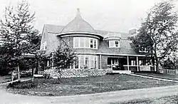 Barncastle |
November 10, 1980 (#80000219) |
South St. 44°23′51″N 68°35′18″W |
Blue Hill | |
| 5 | Bass Harbor Head Light Station | 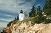 Bass Harbor Head Light Station |
January 21, 1988 (#87002273) |
Bass Harbor Head 44°13′19″N 68°20′16″W |
Bass Harbor | |
| 6 | Bass Harbor Memorial Library | 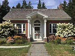 Bass Harbor Memorial Library |
August 5, 2009 (#09000593) |
89 Bernard Rd. 44°14′28″N 68°21′20″W |
Tremont | |
| 7 | Bear Island Light Station | 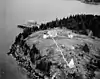 Bear Island Light Station |
March 14, 1988 (#88000043) |
Bear Island, Acadia National Park 44°17′00″N 68°16′14″W |
Northeast Harbor | Light station established in 1839 to serve Northeast Harbor, with a surviving 1889 light tower and keeper's house and 1905 outbuildings.[7] |
| 8 | Beth Eden Chapel | August 2, 2001 (#01000818) |
Naskeag Point Rd. at Stubbs Dr. 44°14′05″N 68°31′56″W |
Brooklin | ||
| 9 | Black Mansion |  Black Mansion |
December 23, 1969 (#69000026) |
W. Main St. (State Route 172) 44°32′12″N 68°26′21″W |
Ellsworth | |
| 10 | Blackwoods Campground | 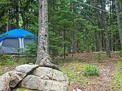 Blackwoods Campground |
June 29, 2007 (#07000612) |
State Route 233, Eagle Lake Rd. 44°18′38″N 68°12′15″W |
Bar Harbor | |
| 11 | Blue Hill Historic District | 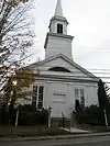 Blue Hill Historic District |
December 8, 1980 (#80000220) |
State Routes 15, 172, 176, and 177 44°24′49″N 68°35′22″W |
Blue Hill | |
| 12 | BOWDOIN (schooner) | 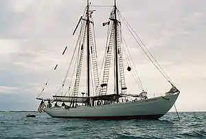 BOWDOIN (schooner) |
February 12, 1980 (#80000411) |
Maine Maritime Academy 44°23′12″N 68°47′48″W |
Castine | |
| 13 | Brick School House | April 23, 1980 (#80000221) |
School House Hill 44°50′51″N 68°19′43″W |
Aurora | ||
| 14 | Brooklin IOOF Hall | 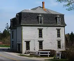 Brooklin IOOF Hall |
January 26, 1990 (#89002341) |
State Route 175 44°15′55″N 68°34′51″W |
Brooklin | |
| 15 | Brown-Pilsbury Double House | September 11, 1997 (#97001129) |
188-190 Franklin St. 44°34′26″N 68°47′49″W |
Bucksport | ||
| 16 | Buck Memorial Library | 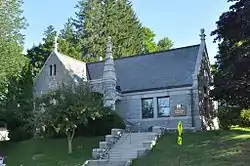 Buck Memorial Library |
December 30, 1987 (#87002193) |
Maine St. 44°34′17″N 68°47′32″W |
Bucksport | |
| 17 | Bucksport Railroad Station | 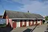 Bucksport Railroad Station |
April 28, 1975 (#75000091) |
Main St. 44°34′19″N 68°47′50″W |
Bucksport | |
| 18 | Burnt Coat Harbor Light Station | 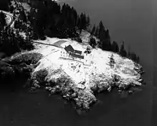 Burnt Coat Harbor Light Station |
January 21, 1988 (#87002272) |
Hockamock Head 44°08′03″N 68°26′52″W |
Swans Island | |
| 19 | Carriage Paths, Bridges and Gatehouses | 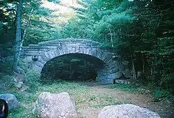 Carriage Paths, Bridges and Gatehouses |
November 14, 1979 (#79000131) |
Acadia National Park and vicinity 44°20′32″N 68°15′30″W |
Acadia National Park | Network of scenic carriage roads with 13 bridges and two gatehouse complexes, established 1919–1931 by John D. Rockefeller, Jr. for automobile-free recreation by high-society vacationers. Now open to non-motorized use by the public.[8] |
| 20 | Castine Historic District | 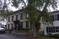 Castine Historic District |
February 23, 1973 (#73000240) |
Roughly bounded by the Bagaduce and Penobscot rivers, and by Wadsworth Cove Rd. 44°23′27″N 68°48′19″W |
Castine | |
| 21 | Cate House | 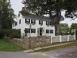 Cate House |
January 26, 1970 (#70000040) |
Corner of Court and Pleasant Sts. 44°23′18″N 68°48′01″W |
Castine | |
| 22 | Church of Our Father | July 1, 1999 (#99000770) |
State Route 3, 0.5 miles (0.80 km) north of Crooked Rd. 44°25′15″N 68°15′02″W |
Hulls Cove | ||
| 23 | Claremont Hotel | 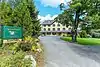 Claremont Hotel |
March 29, 1978 (#78000162) |
Claremont Rd. 44°16′44″N 68°18′46″W |
Southwest Harbor | |
| 24 | Cleftstone | September 24, 1999 (#99001192) |
92 Eden St. 44°23′36″N 68°13′19″W |
Bar Harbor | ||
| 25 | Cover Farm | December 14, 1995 (#95001464) |
Off the western side of State Route 3, 0.3 miles (0.48 km) northwest of its junction with Crooked Rd. 44°25′05″N 68°15′18″W |
Hulls Cove | ||
| 26 | Criterion Theatre | 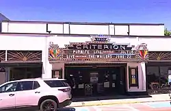 Criterion Theatre |
April 23, 1980 (#80000222) |
35 Cottage St. 44°23′24″N 68°12′23″W |
Bar Harbor | |
| 27 | Dix Family Stable | April 5, 1990 (#90000578) |
State Route 102A 44°14′33″N 68°20′41″W |
Bass Harbor | ||
| 28 | Duck Cove School | July 15, 1993 (#93000640) |
Eastern side of State Route 46 at its junction with Stubbs Brook Rd. 44°35′36″N 68°44′33″W |
Bucksport | ||
| 29 | East Blue Hill Library | April 5, 1990 (#90000577) |
Miliken Rd. 44°25′01″N 68°31′21″W |
East Blue Hill | ||
| 30 | East Blue Hill Post Office | February 12, 2003 (#03000016) |
13 Curtis Cove Rd. 44°25′01″N 68°31′20″W |
East Blue Hill | ||
| 31 | Eastbrook Baptist Church and Eastbrook Town House | December 18, 1978 (#78000163) |
State Route 200 44°40′42″N 68°16′00″W |
Eastbrook | ||
| 32 | Edgecliff | October 16, 2013 (#13000835) |
34 Norwood Ln. 44°17′04″N 68°19′02″W |
Southwest Harbor | ||
| 33 | Eegonos | 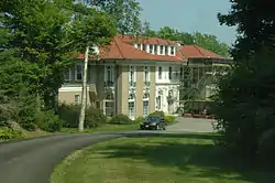 Eegonos |
January 15, 1980 (#80000223) |
145 Eden St. 44°24′15″N 68°13′58″W |
Bar Harbor | |
| 34 | Egg Rock Light Station | 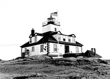 Egg Rock Light Station |
January 21, 1988 (#87002270) |
Egg Rock in Frenchman Bay 44°21′13″N 68°08′20″W |
Winter Harbor | |
| 35 | Ellsworth City Hall | 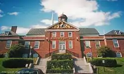 Ellsworth City Hall |
January 10, 1986 (#86000073) |
City Hall Plaza 44°32′33″N 68°25′27″W |
Ellsworth | |
| 36 | Ellsworth Congregational Church | 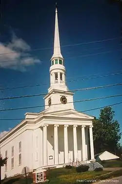 Ellsworth Congregational Church |
April 23, 1973 (#73000108) |
State St. 44°32′37″N 68°25′52″W |
Ellsworth | |
| 37 | Ellsworth Power House and Dam | .jpg.webp) Ellsworth Power House and Dam |
June 20, 1985 (#85001262) |
Union River 44°32′39″N 68°25′50″W |
Ellsworth | |
| 38 | Elm Street Congregational Church and Parish House | 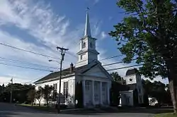 Elm Street Congregational Church and Parish House |
June 14, 1990 (#90000925) |
Junction of Elm and Franklin Sts. 44°34′24″N 68°47′41″W |
Bucksport | |
| 39 | James Emery House | August 13, 1974 (#74000151) |
Main St. 44°34′23″N 68°47′48″W |
Bucksport | ||
| 40 | The Farm House | November 7, 2007 (#07001152) |
15 Highbrook Rd. 44°23′18″N 68°13′09″W |
Bar Harbor | ||
| 41 | Fernald Point Prehistoric Site | July 21, 1978 (#78000164) |
Fernald Point[9] 44°17′53″N 68°18′35″W |
Southwest Harbor | ||
| 42 | First Baptist Church | 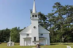 First Baptist Church |
August 2, 2001 (#01000817) |
362 Lamoine Beach Rd. 44°28′03″N 68°19′17″W |
East Lamoine | |
| 43 | First Baptist Church | April 24, 1973 (#73000109) |
Off State Route 172 44°18′16″N 68°36′52″W |
Sedgwick | ||
| 44 | Flye Point 2 | April 15, 1985 (#85000842) |
Address Restricted |
Brooklin | ||
| 45 | Fort George |  Fort George |
December 30, 1969 (#69000007) |
Wadsworth St. off Battle Ave. 44°23′27″N 68°48′22″W |
Castine | A British fort during the American Revolution and the site of the Penobscot Expedition |
| 46 | The Free Baptist Church of Great Pond | October 31, 2012 (#12000892) |
1231 Great Pond Rd. 44°56′14″N 68°16′50″W |
Great Pond | ||
| 47 | Garland Farm | October 19, 2005 (#05001174) |
1029 State Route 3 44°25′40″N 68°19′30″W |
Bar Harbor | ||
| 48 | Gavin Watson Site | March 18, 1987 (#87000415) |
Address Restricted |
Sullivan | ||
| 49 | Daniel Coit Gilman Summer Home | October 15, 1966 (#66000093) |
Off Huntington Rd. 44°17′30″N 68°16′56″W |
Northeast Harbor | ||
| 50 | Goddard Site | May 7, 1979 (#79000132) |
Address Restricted |
Brooklin | ||
| 51 | The Grand |  The Grand |
August 1, 2012 (#12000452) |
163, 165, 167, 169, & 173 Main St. 44°32′30″N 68°25′22″W |
Ellsworth | |
| 52 | Granite Store |  Granite Store |
December 16, 1974 (#74000152) |
U.S. Route 1 44°31′12″N 68°11′57″W |
Sullivan | |
| 53 | Great Duck Island Light Station | .jpg.webp) Great Duck Island Light Station |
March 14, 1988 (#88000159) |
Southern tip of Great Duck Island 44°08′32″N 68°14′46″W |
Frenchboro | |
| 54 | Edward J. Hammond Hall | January 14, 2004 (#03001405) |
Main St. 44°23′28″N 68°05′23″W |
Winter Harbor | ||
| 55 | Hancock County Jail | 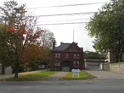 Hancock County Jail |
January 24, 2008 (#07001445) |
40 State St. 44°32′32″N 68°25′34″W |
Ellsworth | |
| 56 | Hancock Point School | April 23, 2013 (#13000187) |
644 Point Rd. 44°29′15″N 68°14′55″W |
Hancock | ||
| 57 | Harbor Lane-Eden Street Historic District | July 22, 2009 (#09000550) |
Portions of Harbor Ln. and Eden St. 44°23′22″N 68°13′02″W |
Bar Harbor | ||
| 58 | Squire Ignatius Haskell House | February 3, 1978 (#78000165) |
20 Main Street 44°13′26″N 68°40′49″W |
Deer Isle | Now Pilgrim's Inn. | |
| 59 | Haystack Mountain School of Crafts | December 23, 2005 (#05001469) |
89 Haystack School Dr. 44°11′19″N 68°35′05″W |
Deer Isle | ||
| 60 | Phineas Heywood House | 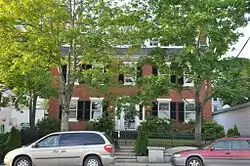 Phineas Heywood House |
January 7, 1988 (#87002194) |
343 Maine St. 44°34′19″N 68°47′42″W |
Bucksport | |
| 61 | Higgins Barn | January 28, 2004 (#03001502) |
256 Oak Hill Rd. 44°22′48″N 68°21′48″W |
Indian Point | ||
| 62 | Highseas | November 30, 1978 (#78000326) |
South of Bar Harbor on Schooner Head Rd. 44°21′21″N 68°11′01″W |
Bar Harbor | Highseas was built in 1912 as a private summer estate. It is now a residence hall owned by The Jackson Laboratory. | |
| 63 | Ward Hinckley House | December 16, 1974 (#74000153) |
Address Restricted |
Blue Hill | ||
| 64 | Hulls Cove High School | March 25, 1999 (#99000374) |
State Route 3, 0.4 miles (0.64 km) north of its junction with Crooked Rd. 44°25′11″N 68°15′03″W |
Hulls Cove | ||
| 65 | Islesford Historical Museum and Blue Ducks Ships Store | 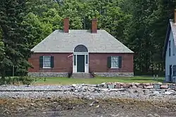 Islesford Historical Museum and Blue Ducks Ships Store |
September 30, 1980 (#80000224) |
Little Cranberry Island 44°15′42″N 68°14′25″W |
Islesford | |
| 66 | Col. Charles and Mary Ann Jarvis Homestead | January 15, 2004 (#03001403) |
10 Surry Rd. 44°32′18″N 68°25′46″W |
Ellsworth | ||
| 67 | Jesup Memorial Library | 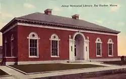 Jesup Memorial Library |
April 1, 1991 (#91000323) |
34 Mt. Desert St. 44°23′12″N 68°12′25″W |
Bar Harbor | |
| 68 | Jonathan Fisher Memorial | 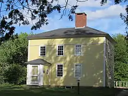 Jonathan Fisher Memorial |
December 30, 1969 (#69000031) |
Southwest of Blue Hill on State Route 15 (Outer Main St.) 44°24′18″N 68°35′51″W |
Blue Hill | |
| 69 | Col. Meltiah Jordan House | 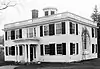 Col. Meltiah Jordan House |
August 13, 1974 (#74000154) |
20 State St. 44°32′32″N 68°25′32″W |
Ellsworth | Houses the Ellsworth Public Library; misspelled "Jordon" in the National Register. |
| 70 | John Innes Kane Cottage | 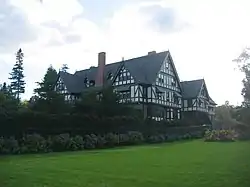 John Innes Kane Cottage |
March 26, 1992 (#92000275) |
Off the southeastern end of Hancock St. 44°23′09″N 68°11′53″W |
Bar Harbor | |
| 71 | Lucerne Inn | June 16, 1982 (#82000742) |
Bar Harbor Rd., U.S. Route 1A 44°42′10″N 68°35′59″W |
Dedham | ||
| 72 | Moore-Mayo House | September 22, 2004 (#04001050) |
Lighthouse Rd. 44°13′44″N 68°20′22″W |
Bass Harbor | ||
| 73 | Mount Desert Light Station | _Lighthouse_(1892_version)_Maine.JPG.webp) Mount Desert Light Station |
March 14, 1988 (#88000155) |
Mount Desert Rock 43°58′07″N 68°07′43″W |
Frenchboro | Mount Desert Light Station now operates as a research field station, and is owned by College of the Atlantic. |
| 74 | Nannau | November 8, 1984 (#84000322) |
Lower Main St. 44°22′31″N 68°11′45″W |
Bar Harbor | ||
| 75 | Nazi Spy Landing Site | February 13, 2003 (#03000015) |
Western shore of Crabtree Neck at Sunset Ledge Cove 44°28′25″N 68°14′41″W |
Hancock Point | Landing site of Erich Gimpel and William Colepaugh in late November 1944 | |
| 76 | Off-the-Neck Historic District | September 25, 1986 (#86002442) |
State Route 166 44°24′16″N 68°47′38″W |
Castine | ||
| 77 | Old Hancock County Buildings | November 23, 1977 (#77000161) |
Court St. 44°32′20″N 68°25′46″W |
Ellsworth | ||
| 78 | Old Red Store | December 30, 2019 (#100004825) |
129 Bernard Rd. 44°14′24″N 68°21′14″W |
Tremont | ||
| 79 | Frederick Law Olmsted Summer Home | November 7, 1976 (#76000089) |
Southwest of Sunset on Deer Isle 44°10′43″N 68°43′05″W |
Sunset | ||
| 80 | Parker House | 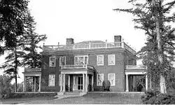 Parker House |
September 22, 2004 (#04001047) |
185 South St. 44°23′49″N 68°35′19″W |
Blue Hill | |
| 81 | Pentagoet Archeological District |  Pentagoet Archeological District |
April 12, 1993 (#93000603) |
Perkins Street at Pentagoet Lane 44°23′05″N 68°48′12″W |
Castine | |
| 82 | John Perkins House | 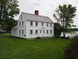 John Perkins House |
December 30, 1969 (#69000019) |
Perkins St. 44°23′02″N 68°48′22″W |
Castine | |
| 83 | John Peters House | October 6, 1983 (#83003642) |
Off State Route 176 44°24′41″N 68°34′28″W |
Blue Hill | ||
| 84 | Pond Island Archeological District | January 28, 1979 (#79000133) |
Pond Island[10] 44°17′36″N 68°48′29″W |
Deer Isle | Island now owned as conservation land by Maine Coast Heritage Trust. | |
| 85 | Peter Powers House | April 23, 1980 (#80000225) |
State Route 15 and Sunshine Rd. 44°13′00″N 68°40′27″W |
Deer Isle | ||
| 86 | Prospect Harbor Light Station | 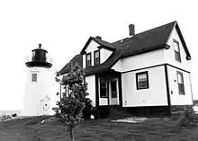 Prospect Harbor Light Station |
March 14, 1988 (#88000151) |
Prospect Harbor Pt. 44°24′11″N 68°00′48″W |
Prospect Harbor | |
| 87 | Jed Prouty Tavern and Inn | 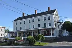 Jed Prouty Tavern and Inn |
January 10, 1986 (#86000074) |
52-54 Main St. 44°34′17″N 68°47′30″W |
Bucksport | |
| 88 | Pumpkin Island Light Station | 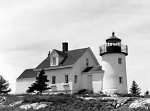 Pumpkin Island Light Station |
February 1, 1988 (#87002537) |
Pumpkin Island, Eggemoggin Reach 44°18′33″N 68°44′36″W |
Sargentville | |
| 89 | Raventhorp | January 7, 1988 (#87002195) |
Greening Island 44°16′58″N 68°18′12″W |
Southwest Harbor | ||
| 90 | Redwood | April 3, 1978 (#78000166) |
Barberry Lane 44°22′58″N 68°11′48″W |
Bar Harbor | ||
| 91 | Reverie Cove | 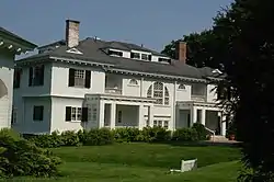 Reverie Cove |
February 19, 1982 (#82000743) |
Harbor Lane 44°23′25″N 68°12′56″W |
Bar Harbor | |
| 92 | Robertson Quarry Galamander |  Robertson Quarry Galamander |
October 2, 1992 (#92001292) |
Eastern side of State Route 182, northeast of its junction with Grist Mill Rd. 44°34′45″N 68°15′51″W |
West Franklin | A galamander is a specialized wagon for hauling stone; this is one of only two known to survive in Maine. |
| 93 | Rural Hall | September 22, 2004 (#04001049) |
Surry Rd., 1 mile (1.6 km) east of Contention Cove 44°29′42″N 68°26′46″W |
Surry | ||
| 94 | St. Edward's Convent, (Former) | 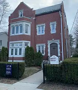 St. Edward's Convent, (Former) |
October 8, 1998 (#98001237) |
33 Ledgelawn Ave. 44°23′07″N 68°12′30″W |
Bar Harbor | |
| 95 | Saint Jude's Episcopal Church |  Saint Jude's Episcopal Church |
July 24, 1986 (#86001905) |
State Route 3 44°17′38″N 68°14′48″W |
Seal Harbor | |
| 96 | St. Mary's-By-The-Sea | 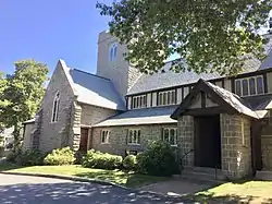 St. Mary's-By-The-Sea |
July 5, 2000 (#00000761) |
20 S. Shore Rd. 44°17′19″N 68°17′09″W |
Northeast Harbor | |
| 97 | Saint Saviour's Episcopal Church and Rectory |  Saint Saviour's Episcopal Church and Rectory |
June 20, 1995 (#95000729) |
41 Mt. Desert St. 44°23′14″N 68°12′23″W |
Bar Harbor | |
| 98 | Schoodic Peninsula Historic District | June 29, 2007 (#100001261) |
1.5 miles (2.4 km) south of State Route 186 44°22′30″N 68°03′50″W |
Winter Harbor | ||
| 99 | Sea Change | August 7, 2009 (#08000991) |
27 Corning Way 44°17′13″N 68°16′51″W |
Northeast Harbor | ||
| 100 | Seal Harbor Congregational Church | February 14, 1985 (#85000272) |
State Route 3 44°17′37″N 68°14′54″W |
Seal Harbor | ||
| 101 | Seawall Campground | 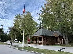 Seawall Campground |
June 29, 2007 (#07000613) |
State Route 102A, Seawall Rd. 44°14′26″N 68°18′16″W |
Southwest Harbor | |
| 102 | Sedgwick Historic District | January 20, 1995 (#94001550) |
Junction of State Route 172 and Old County Rd. 44°18′58″N 68°36′35″W |
Sedgwick | ||
| 103 | Salome Sellers House | January 27, 1983 (#83004189) |
South of Deer Isle on State Route 15A 44°11′56″N 68°42′20″W |
Deer Isle | Museum of the Deer Isle-Stonington Historical Society | |
| 104 | Shore Acres | April 14, 2000 (#00000373) |
791 Lamoine Beach Rd. 44°27′12″N 68°17′07″W |
Lamoine Beach | ||
| 105 | Eric E. Soderholtz Cottage | June 18, 1992 (#92000793) |
Off the eastern side of State Route 186, 0.5 miles (0.80 km) south of U.S. Route 1 44°27′51″N 68°05′39″W |
West Gouldsboro | ||
| 106 | Somesville Historic District | 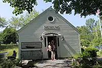 Somesville Historic District |
January 8, 1975 (#75000092) |
Somes Harbor and its environs 44°21′44″N 68°19′53″W |
Mount Desert | |
| 107 | Sorrento Library | June 20, 1995 (#95000724) |
Southern side of Waukeag Ave. 0.5 miles (0.80 km) west of its junction with State Route 185 44°28′22″N 68°11′18″W |
Sorrento | ||
| 108 | Sound Schoolhouse | September 30, 2019 (#100004469) |
373 Sound Drive 44°21′35″N 68°18′16″W |
Mount Desert | ||
| 109 | Sproul's Cafe | 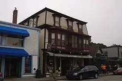 Sproul's Cafe |
February 4, 1982 (#82000744) |
128 Main St. 44°23′20″N 68°12′14″W |
Bar Harbor | |
| 110 | Stanwood Homestead | June 19, 1973 (#73000110) |
295 High St. (State Route 3) 44°31′42″N 68°24′18″W |
Ellsworth | Now Birdsacre Sanctuary | |
| 111 | Stone Barn Farm | 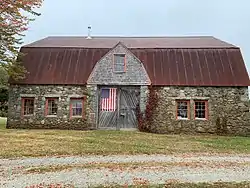 Stone Barn Farm |
November 29, 2001 (#01001271) |
Junction of Crooked Rd. and Norway Dr. 44°25′03″N 68°18′06″W |
Salsbury Cove | |
| 112 | Stonington Opera House | 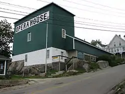 Stonington Opera House |
October 16, 1991 (#91001509) |
Northwestern corner of Main St. and School St. 44°09′21″N 68°40′01″W |
Stonington | |
| 113 | Surry Town Hall | 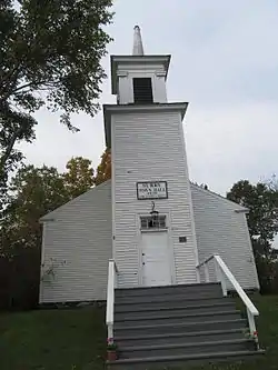 Surry Town Hall |
October 16, 2008 (#08000993) |
1217 Surry Rd. 44°29′50″N 68°29′29″W |
Surry | |
| 114 | Surry Village School | March 13, 2020 (#100005098) |
7 Toddy Pond Rd. 44°29′39″N 68°30′27″W |
Surry | ||
| 115 | Topside | August 13, 1975 (#75000229) |
Northern bank of Walker Pond off State Route 176 44°20′38″N 68°41′39″W |
Brooksville | ||
| 116 | The Turrets | December 24, 1974 (#74000155) |
Eden St. 44°23′41″N 68°13′13″W |
Bar Harbor | ||
| 117 | Union Church of Northeast Harbor | June 26, 1998 (#98000722) |
21 Summit Rd. 44°17′40″N 68°17′29″W |
Northeast Harbor | ||
| 118 | U.S. Naval Radio Station- Apartment Building and Power House | 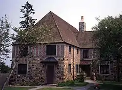 U.S. Naval Radio Station- Apartment Building and Power House |
July 3, 2013 (#13000533) |
Schoodic Peninsula unit, Acadia National Park 44°20′10″N 68°03′33″W |
Winter Harbor vicinity | |
| 119 | US Post Office-Bar Harbor Main | 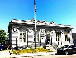 US Post Office-Bar Harbor Main |
May 2, 1986 (#86000880) |
55 Cottage St. 44°23′23″N 68°12′26″W |
Bar Harbor | |
| 120 | Von Mach Site (ME 151/02) | January 17, 1989 (#88000901) |
Address Restricted |
Brooksville | ||
| 121 | West Brooksville Congregational Church | June 20, 1995 (#95000727) |
Eastern side of State Route 176, 1 mile (1.6 km) northwest of its junction with Varnum Rd. 44°23′42″N 68°45′28″W |
West Brooksville | ||
| 122 | West Gouldsboro Union Church | 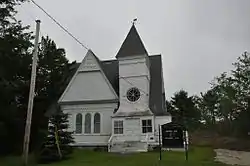 West Gouldsboro Union Church |
June 14, 1990 (#90000926) |
State Route 186 between Jones Cove and Jones Pond 44°27′55″N 68°05′41″W |
West Gouldsboro | |
| 123 | West Gouldsboro Village Library | 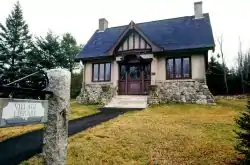 West Gouldsboro Village Library |
October 23, 1991 (#91001512) |
Eastern side of State Route 186 between Jones Cove and Jones Pond 44°27′56″N 68°05′41″W |
West Gouldsboro | |
| 124 | West Street Historic District | 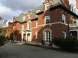 West Street Historic District |
May 6, 1980 (#80000226) |
West St. between Billings Ave. and Eden St. 44°23′28″N 68°12′41″W |
Bar Harbor | |
| 125 | E. B. White House | September 22, 1986 (#86002467) |
State Route 175 44°17′39″N 68°33′18″W |
Brooklin | ||
| 126 | Samuel Kidder Whiting House | July 14, 1983 (#83000453) |
214 Main St 44°32′34″N 68°25′15″W |
Ellsworth | ||
| 127 | Wilson Hall | 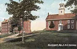 Wilson Hall |
April 27, 1983 (#83000452) |
Franklin St. 44°34′31″N 68°47′51″W |
Bucksport | |
| 128 | Winter Harbor Light Station | 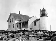 Winter Harbor Light Station |
February 1, 1988 (#87002538) |
Mark Island, Winter Harbor 44°21′42″N 68°05′18″W |
Winter Harbor |
Former listings
| [3] | Name on the Register | Image | Date listed | Date removed | Location | City or town | Summary |
|---|---|---|---|---|---|---|---|
| 1 | Atlantic Schoolhouse | January 19, 1996 (#95001547) | April 27, 2010 | Southern side of Town Rd. 44°10′16″N 68°25′17″W |
Swan's Island | ||
| 2 | Waldo-Hancock Bridge | 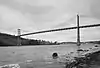 Waldo-Hancock Bridge |
June 20, 1985 (#85001267) | December 18, 2013 | U.S. Route 1 44°33′37″N 68°48′08″W |
Verona | Demolished in 2013. Extended into Waldo County |
| 3 | Wickyup |  Wickyup |
August 29, 1970 (#70000075) | March 5, 1986 | vicinity of East Sullivan 44°10′16″N 68°25′17″W |
Sullivan | Summer estate of explorer Richard E. Byrd, destroyed by fire in 1984.[11] |
See also
| Wikimedia Commons has media related to National Register of Historic Places in Hancock County, Maine. |
References
- The latitude and longitude information provided in this table was derived originally from the National Register Information System, which has been found to be fairly accurate for about 99% of listings. Some locations in this table may have been corrected to current GPS standards.
- "National Register of Historic Places: Weekly List Actions". National Park Service, United States Department of the Interior. Retrieved on February 5, 2021.
- Numbers represent an alphabetical ordering by significant words. Various colorings, defined here, differentiate National Historic Landmarks and historic districts from other NRHP buildings, structures, sites or objects.
- "National Register Information System". National Register of Historic Places. National Park Service. April 24, 2008.
- The eight-digit number below each date is the number assigned to each location in the National Register Information System database, which can be viewed by clicking the number.
- Mohney, Kirk F. (October 1987). "National Register of Historic Places Registration Form: Baker Island Light Station". National Park Service. Retrieved 2013-03-23. Cite journal requires
|journal=(help) - Mohney, Kirk F. (October 1987). "National Register of Historic Places Registration Form: Bear Island Light Station". National Park Service. Retrieved 2013-03-23. Cite journal requires
|journal=(help) - Krog, Bronwyn (1979-03-07). "National Register of Historic Places Registration Form: The Carriage Paths, Bridges and Gatehouses, Acadia National Park". National Park Service. Retrieved 2013-03-30. Cite journal requires
|journal=(help) - "An Island In Time" (PDF). The Abbe Museum. Retrieved 2015-02-10.
- "Maine Heritage - Spring 2013" (PDF). Maine Coast Heritage Trust. Retrieved 2015-02-10.
- "Dedesignation of Wickyup". National Park Service. Retrieved 2013-02-07.
External links
- "Historic properties list revised" - Mount Desert Islander, March 30, 2017
| Topics | |
|---|---|
| Lists by state |
|
| Lists by insular areas | |
| Lists by associated state | |
| Other areas | |
| Related | |
| |
Municipalities and communities of Hancock County, Maine, United States | ||
|---|---|---|
| City | Hancock County map | |
| Towns |
| |
| Unorganized territories | ||
| CDPs | ||
| Other villages | ||
| ||
This article is issued from Wikipedia. The text is licensed under Creative Commons - Attribution - Sharealike. Additional terms may apply for the media files.