National Register of Historic Places listings in Lincoln County, Maine
This is a list of the National Register of Historic Places listings in Lincoln County, Maine.
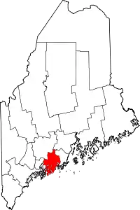
Location of Lincoln County in Maine
This is intended to be a complete list of the properties and districts on the National Register of Historic Places in Lincoln County, Maine, United States. Latitude and longitude coordinates are provided for many National Register properties and districts; these locations may be seen together in a map.[1]
There are 104 properties and districts listed on the National Register in the county, including 3 National Historic Landmarks. An additional three properties were once listed on the register, but have since been delisted.
- This National Park Service list is complete through NPS recent listings posted February 5, 2021.[2]
| Androscoggin - Aroostook - Cumberland - Franklin - Hancock - Kennebec - Knox - Lincoln - Oxford - Penobscot - Piscataquis - Sagadahoc - Somerset - Waldo - Washington - York |
Current listings
| [3] | Name on the Register[4] | Image | Date listed[5] | Location | City or town | Description |
|---|---|---|---|---|---|---|
| 1 | Alna Meetinghouse | 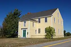 Alna Meetinghouse |
May 19, 1970 (#70000079) |
State Route 218, Alna Center 44°05′14″N 69°37′06″W |
Alna | |
| 2 | Alna School | 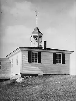 Alna School |
April 28, 1975 (#75000101) |
State Route 218, Alna Center 44°04′56″N 69°37′08″W |
Alna | |
| 3 | Arch Bridge | 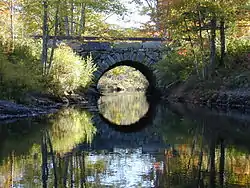 Arch Bridge |
July 7, 2003 (#03000618) |
Over the Pemaquid River on Benner Rd. 43°57′44″N 69°30′35″W |
Bristol | |
| 4 | Archeological Site 16.8 | June 29, 1984 (#84001433) |
Address Restricted |
Boothbay | ||
| 5 | Archeological Site 16.20 | June 29, 1984 (#84001456) |
Address Restricted |
Boothbay | ||
| 6 | Archeological Site 16.21 | June 29, 1984 (#84001452) |
Address Restricted |
Boothbay | ||
| 7 | Archeological Site 16.37 Area I and II | June 29, 1984 (#84001428) |
Address Restricted |
Boothbay | ||
| 8 | Archeological Site 16.38 | June 29, 1984 (#84001448) |
Address Restricted |
Boothbay | ||
| 9 | Archeological Site 16.47 | June 29, 1984 (#84001445) |
Address Restricted |
Boothbay | ||
| 10 | Archeological Site 16.68 | June 29, 1984 (#84001436) |
Address Restricted |
Boothbay | ||
| 11 | Archeological Site 16.73 | May 29, 1984 (#84001431) |
Address Restricted |
Boothbay | ||
| 12 | Archeological Site 26.27 | June 29, 1984 (#84001430) |
Address Restricted |
Boothbay | ||
| 13 | Archeological Site 16.175 | June 29, 1984 (#84001462) |
Address Restricted |
Boothbay | ||
| 14 | Archeological Site 16.198 | June 29, 1984 (#84001460) |
Address Restricted |
Boothbay | ||
| 15 | Auld-McCobb House | 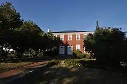 Auld-McCobb House |
June 28, 1988 (#88000883) |
Oak St. 43°51′08″N 69°37′42″W |
Boothbay Harbor | |
| 16 | Boothbay Harbor Memorial Library |  Boothbay Harbor Memorial Library |
April 18, 1977 (#77000077) |
State Route 27 43°51′13″N 69°37′41″W |
Boothbay Harbor | |
| 17 | Bowman-Carney House | 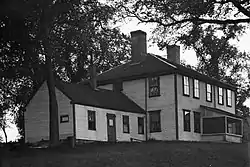 Bowman-Carney House |
April 7, 1971 (#71000071) |
Bowman Ln., off State Route 128 44°05′45″N 69°46′23″W |
Dresden | |
| 18 | Bremen Town Hall, Former | 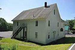 Bremen Town Hall, Former |
April 14, 2000 (#00000372) |
State Route 32, 0.2 miles north of Medomak Rd. 44°00′47″N 69°25′18″W |
Medomak | |
| 19 | Brick House Historic District | 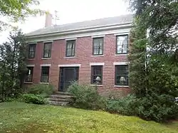 Brick House Historic District |
February 13, 2009 (#09000013) |
478 River Road 44°00′19″N 69°33′27″W |
Newcastle | Pre-20th century historic and archaeological listing of the Perkins Homestead. |
| 20 | Bridge Academy | 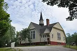 Bridge Academy |
January 9, 1987 (#86003540) |
44 Middle Rd. 44°06′17″N 69°43′35″W |
Dresden | Now houses the local public library. |
| 21 | Burnt Island Light Station | 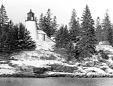 Burnt Island Light Station |
November 23, 1977 (#77000139) |
South of Boothbay Harbor on Burnt Island 43°49′30″N 69°38′25″W |
Boothbay Harbor | |
| 22 | Moses Carleton House | 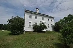 Moses Carleton House |
July 18, 2002 (#02000783) |
Hollywood Boulevard 0.2 miles northeast of its junction with State Route 94 44°06′47″N 69°36′40″W |
Alna | |
| 23 | Chapman-Hall House | 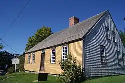 Chapman-Hall House |
May 19, 1970 (#70000077) |
Main and Vine Sts. 44°01′57″N 69°31′47″W |
Damariscotta | |
| 24 | Chimney Farm |  Chimney Farm |
February 7, 2007 (#07000012) |
617 East Neck Rd. 44°06′57″N 69°28′31″W |
Nobleboro | |
| 25 | Clary Mill |  Clary Mill |
December 2, 2004 (#04001283) |
104 Mills Rd. 44°13′42″N 69°35′03″W |
Whitefield | |
| 26 | Stephen Coffin House |  Stephen Coffin House |
April 15, 1987 (#86003519) |
Main St. 44°01′57″N 69°31′53″W |
Damariscotta | |
| 27 | Congregational Church of Edgecomb |  Congregational Church of Edgecomb |
June 12, 1987 (#87000923) |
Cross Point Rd. 43°59′07″N 69°38′47″W |
North Edgecomb | |
| 28 | CORA F. CRESSEY |  CORA F. CRESSEY |
April 18, 1990 (#90000586) |
Keene Narrows 43°59′04″N 69°24′54″W |
Bremen | |
| 29 | Cottage on King's Row | 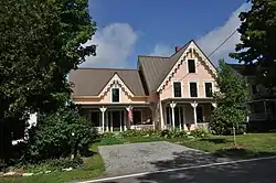 Cottage on King's Row |
January 12, 2016 (#15000970) |
1400 ME 32 43°56′42″N 69°27′46″W |
Bristol | |
| 30 | Matthew Cottrill House | 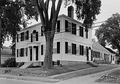 Matthew Cottrill House |
May 2, 1974 (#74000177) |
Main St. (U.S. Route 1) 44°01′50″N 69°32′06″W |
Damariscotta | |
| 31 | Cuckolds Light Station | 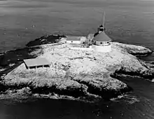 Cuckolds Light Station |
December 2, 2002 (#02001413) |
The Cuckolds 43°46′46″N 69°39′03″W |
Southport | |
| 32 | Damariscotta Baptist Church | 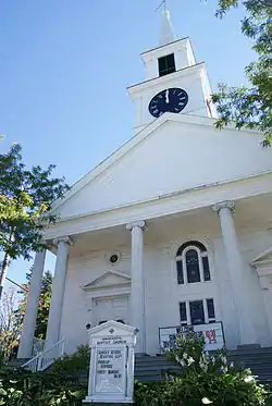 Damariscotta Baptist Church |
June 20, 1985 (#85001265) |
King's Square 44°01′53″N 69°31′47″W |
Damariscotta | |
| 33 | Damariscotta Oyster Shell Heaps |  Damariscotta Oyster Shell Heaps |
December 30, 1969 (#69000027) |
East and west banks of the Damariscotta River 44°02′31″N 69°30′47″W |
Damariscotta | Includes the Whaleback Shell Midden (now a state historic site) and the Glidden Shell Midden. |
| 34 | Damariscotta Shell Midden Historic District |  Damariscotta Shell Midden Historic District |
October 8, 1998 (#98001238) |
Along the Damariscotta River 44°02′34″N 69°30′54″W |
Damariscotta | Includes 10 shell middens (including Whaleback and Glidden), and one non-midden prehistoric archaeological site. |
| 35 | Damariscove Island Archeological Site | May 22, 1978 (#78000186) |
Damariscove Island 43°45′55″N 69°36′45″W |
Boothbay | Most of the island is archaeologically sensitive. | |
| 36 | Damariscove Lifesaving Station | June 25, 1987 (#87000924) |
Damariscove Island 43°45′17″N 69°36′58″W |
Boothbay | ||
| 37 | Dodge Point Site | March 22, 1991 (#91000319) |
Address Restricted |
Newcastle | ||
| 38 | Dresden Brick School House | 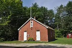 Dresden Brick School House |
June 13, 1986 (#86001273) |
State Route 128 44°05′07″N 69°46′26″W |
Dresden | |
| 39 | Dresden Town House | 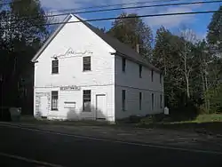 Dresden Town House |
October 12, 2000 (#00001204) |
391 Middle Rd. 44°05′08″N 69°44′37″W |
Dresden Mills | |
| 40 | Fisherman's Island | December 29, 2014 (#14001091) |
Address Restricted 43°47′54″N 69°36′11″W |
Boothbay | ||
| 41 | Fort Edgecomb | 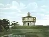 Fort Edgecomb |
October 1, 1969 (#69000020) |
On Davis Island in the Sheepscot River 43°59′37″N 69°39′26″W |
Edgecomb | Boundary increase December 22, 1991. |
| 42 | Fort William Henry | 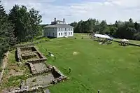 Fort William Henry |
December 1, 1969 (#69000021) |
Northwest of Pemaquid Beach 43°52′39″N 69°31′29″W |
Pemaquid Beach | |
| 43 | German Church and Cemetery | 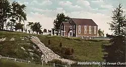 German Church and Cemetery |
May 19, 1970 (#70000050) |
1 mile south of Waldoboro Village on State Route 32 44°05′24″N 69°23′19″W |
Waldoboro | |
| 44 | Glidden-Austin Block | 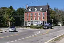 Glidden-Austin Block |
April 28, 1975 (#75000102) |
Junction of U.S. Route 1 and State Route 215 44°02′07″N 69°32′15″W |
Newcastle | |
| 45 | Old Gray House | May 8, 2007 (#07000408) |
60 Tavenner Rd. 43°52′27″N 69°40′51″W |
Boothbay | ||
| 46 | Harrington Meetinghouse | 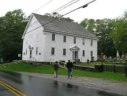 Harrington Meetinghouse |
May 19, 1970 (#70000051) |
Northwest of Pemaquid on Old Harrington Rd. 43°54′53″N 69°31′43″W |
Pemaquid | 1772 meeting house originally stood in Bristol Mills, frame taken down and reerected, building moved to present location and altered into a reverse plan and then mostly restored in 1960-1970. One of three meeting houses built at the same time in Bristol. |
| 47 | Head Tide Historic District |  Head Tide Historic District |
November 19, 1974 (#74000320) |
Both sides of the Sheepscot River 44°06′53″N 69°37′28″W |
Alna | |
| 48 | Hendricks Head Light Station | 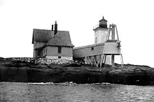 Hendricks Head Light Station |
November 20, 1987 (#87002024) |
Hendricks Head on Southport Island 43°49′21″N 69°41′25″W |
West Southport | |
| 49 | Anne Hilton Site | July 13, 1989 (#89000838) |
Address Restricted |
Newcastle | ||
| 50 | Huston House | 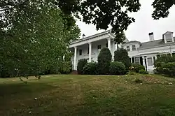 Huston House |
February 8, 1985 (#85000241) |
Bristol Rd. 44°01′04″N 69°31′49″W |
Damariscotta | |
| 51 | Hutchins House | 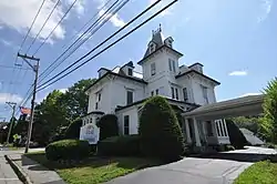 Hutchins House |
February 19, 1982 (#82000769) |
77 Main St. 44°05′46″N 69°22′26″W |
Waldoboro | |
| 52 | The Influence | 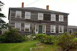 The Influence |
December 29, 1983 (#83003655) |
Main Street, Monhegan Island 43°45′49″N 69°19′17″W |
Monhegan | |
| 53 | Dr. F.W. Jackson House | 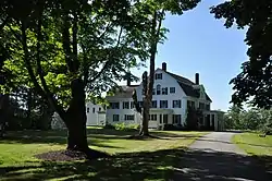 Dr. F.W. Jackson House |
November 10, 1980 (#80000236) |
State Route 32 44°12′09″N 69°27′50″W |
Jefferson | |
| 54 | Jefferson Cattle Pound | 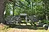 Jefferson Cattle Pound |
July 28, 2004 (#04000742) |
0.75 miles west of the junction of Gardiner Rd. and State Route 213 44°12′01″N 69°29′48″W |
Jefferson | |
| 55 | Jefferson Town House | 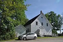 Jefferson Town House |
July 12, 1999 (#99000771) |
Junction of State Routes 126 and 213 44°12′02″N 69°29′06″W |
Jefferson | |
| 56 | Gov. Edward Kavanaugh House | Gov. Edward Kavanaugh House |
May 3, 1974 (#74000178) |
State Route 215 (Damariscotta Mills) 44°03′39″N 69°31′51″W |
Newcastle | |
| 57 | Rockwell Kent Cottage and Studio | April 8, 1992 (#92000278) |
Off the northern side of Horn Hill Rd. on Monhegan Island 43°45′47″N 69°19′08″W |
Monhegan | ||
| 58 | Knight-Corey House | 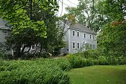 Knight-Corey House |
March 13, 1980 (#80000237) |
Corey Lane 43°52′35″N 69°38′09″W |
Boothbay | |
| 59 | Lithgow House | 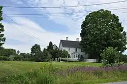 Lithgow House |
December 26, 1985 (#85003156) |
Blinn Hill Rd. 44°06′36″N 69°43′05″W |
Dresden | |
| 60 | Loudville Church | December 14, 1995 (#95001457) |
Center of Louds Island 43°55′49″N 69°26′07″W |
Loudville | ||
| 61 | Godfrey Ludwig House | 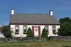 Godfrey Ludwig House |
September 22, 1980 (#80000238) |
State Route 32 44°09′33″N 69°25′00″W |
Waldoboro | |
| 62 | Main Street Historic District | 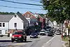 Main Street Historic District |
August 10, 1979 (#79000154) |
Main St.; also 170-270 Main St. and 4-5 Bristol Rd. 44°01′58″N 69°31′56″W |
Damariscotta | Second set of addresses represents a boundary increase |
| 63 | Manana Island Fog Signal Station | 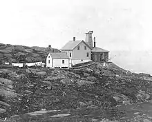 Manana Island Fog Signal Station |
December 2, 2002 (#02001412) |
Manana Island 43°45′54″N 69°19′37″W |
Monhegan | |
| 64 | Emily Means House | February 8, 1985 (#85000242) |
Birch Island 43°50′58″N 69°32′57″W |
South Bristol | ||
| 65 | Monhegan Island Lighthouse and Quarters | 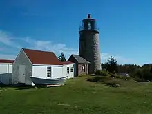 Monhegan Island Lighthouse and Quarters |
May 7, 1980 (#80000239) |
Monhegan Island 43°45′54″N 69°19′00″W |
Monhegan | |
| 66 | John Moore House |  John Moore House |
July 10, 1979 (#79000155) |
Southwest of Edgecomb on Cross Point Rd. 43°58′35″N 69°38′55″W |
Edgecomb | |
| 67 | Nahanada Village Site | July 22, 1980 (#80000240) |
Address Restricted |
Bristol | ||
| 68 | Nickels-Sortwell House |  Nickels-Sortwell House |
December 30, 1970 (#70000078) |
Northeastern corner of Main and Federal Sts. 44°00′15″N 69°40′03″W |
Wiscasset | |
| 69 | Parson's Bend |  Parson's Bend |
December 21, 2005 (#05001439) |
100 Nelson Rd. 44°05′55″N 69°36′00″W |
Alna | |
| 70 | Josiah K. Parsons Homestead | February 4, 1982 (#82000770) |
Greenleaf Cove Rd. 43°55′12″N 69°41′35″W |
Westport | Listed as being in the Wiscasset vicinity | |
| 71 | Stephen Parsons House |  Stephen Parsons House |
October 6, 1983 (#83003648) |
Southwest of Edgecomb on Parsons Creek 43°56′55″N 69°38′38″W |
Edgecomb | |
| 72 | Pemaquid Point Light | 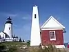 Pemaquid Point Light |
April 16, 1985 (#85000843) |
Pemaquid Point 43°50′13″N 69°30′23″W |
Bristol | |
| 73 | Pemaquid Restoration and Museum |  Pemaquid Restoration and Museum |
December 2, 1969 (#69000022) |
North of Pemaquid Beach at Pemaquid Point 43°52′41″N 69°31′17″W |
Pemaquid Beach | |
| 74 | Perkins Homestead | Perkins Homestead |
August 25, 2014 (#14000919) |
478 River Rd. 44°00′19″N 69°33′27″W |
Newcastle | Homestead associated with Frances Perkins, the first female United States Cabinet member; also listed as the "Brick House Historic District" for earlier significance. |
| 75 | Pownalborough Courthouse | 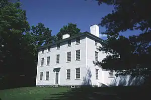 Pownalborough Courthouse |
January 12, 1970 (#70000052) |
Cedar Grove Rd. 44°06′19″N 69°45′59″W |
Dresden | |
| 76 | Pythian Opera House | 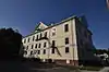 Pythian Opera House |
December 30, 2008 (#08001256) |
86 Townsend Ave. 43°51′16″N 69°37′35″W |
Boothbay Harbor | |
| 77 | Ram Island Light Station | 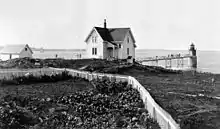 Ram Island Light Station |
January 21, 1988 (#87002280) |
Ram Island, Boothbay Harbor 43°48′14″N 69°36′00″W |
Boothbay Harbor | |
| 78 | Red Brick School | 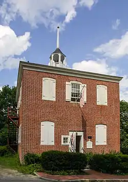 Red Brick School |
October 6, 1970 (#70000089) |
Warren St. 44°00′19″N 69°40′00″W |
Wiscasset | |
| 79 | Capt. George Scott House | 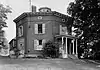 Capt. George Scott House |
February 23, 1972 (#72000104) |
Federal St. 44°00′26″N 69°39′49″W |
Wiscasset | |
| 80 | Second Congregational Church | 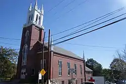 Second Congregational Church |
May 7, 1979 (#79000156) |
River St. 44°02′04″N 69°32′15″W |
Newcastle | |
| 81 | Sheepscot Historic District | 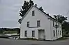 Sheepscot Historic District |
June 23, 1978 (#78000424) |
Sheepscot Rd. and Kings Hwy. 44°03′00″N 69°36′35″W |
Newcastle and Alna | |
| 82 | Sproul Homestead |  Sproul Homestead |
March 21, 1978 (#78000188) |
North of South Bristol on State Route 129 43°54′30″N 69°33′11″W |
South Bristol | |
| 83 | Sprucewold Lodge |  Sprucewold Lodge |
October 8, 2014 (#14000837) |
4-9 Nahanada Road 43°50′27″N 69°37′12″W |
Boothbay Harbor | |
| 84 | Squire Tarbox House | April 11, 1985 (#85000725) |
State Route 144 43°54′05″N 69°42′30″W |
Westport | ||
| 85 | St. Andrew's Church |  St. Andrew's Church |
October 8, 1976 (#76000101) |
Glidden St. 44°02′03″N 69°32′04″W |
Newcastle | |
| 86 | St. Denis Catholic Church | 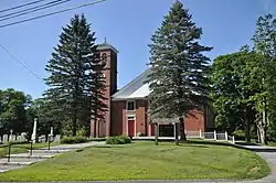 St. Denis Catholic Church |
October 29, 1976 (#76000102) |
298 State Route 126 44°13′43″N 69°36′52″W |
North Whitefield | |
| 87 | St. John's Anglican Church and Parsonage Site | 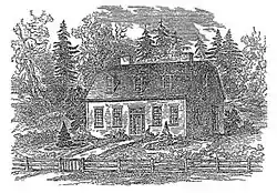 St. John's Anglican Church and Parsonage Site |
November 21, 1978 (#78000187) |
Address Restricted |
Dresden | |
| 88 | St. John's Episcopal Church | 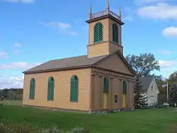 St. John's Episcopal Church |
June 14, 1991 (#91000769) |
Southern side of State Route 27 at its junction with Blinn Hill Rd. 44°06′24″N 69°43′25″W |
Dresden Mills | |
| 89 | St. Patrick's Catholic Church | 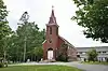 St. Patrick's Catholic Church |
April 23, 1973 (#73000133) |
Academy Rd. 44°03′25″N 69°32′07″W |
Newcastle | |
| 90 | Taylor Site 16.65 | June 29, 1984 (#84001441) |
Address Restricted |
Boothbay | ||
| 91 | Thompson Icehouse |  Thompson Icehouse |
December 31, 1974 (#74000179) |
State Route 129 43°52′44″N 69°33′38″W |
South Bristol | |
| 92 | U.S. Customhouse (Old Customhouse) and Post Office | 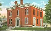 U.S. Customhouse (Old Customhouse) and Post Office |
August 25, 1970 (#70000053) |
Water St. 44°00′03″N 69°39′58″W |
Wiscasset | |
| 93 | U.S. Customhouse and Post Office | 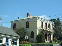 U.S. Customhouse and Post Office |
January 18, 1974 (#74000180) |
Main St. 44°05′44″N 69°22′33″W |
Waldoboro | |
| 94 | Union Church | 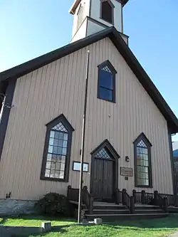 Union Church |
June 26, 1998 (#98000723) |
Eastern side of State Route 32, 0.05 miles south of its junction with Back Shore Rd. 43°56′49″N 69°27′40″W |
Round Pond | |
| 95 | Union Meeting House, (Former) | July 15, 2002 (#02000786) |
Main Rd., State Route 144 43°53′55″N 69°42′34″W |
Westport | ||
| 96 | Waldo Theatre | 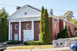 Waldo Theatre |
September 11, 1986 (#86002434) |
Main St. 44°05′45″N 69°22′30″W |
Waldoboro | |
| 97 | Waldoborough Town Pound | 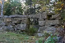 Waldoborough Town Pound |
May 28, 1976 (#76000103) |
Main St. 44°06′05″N 69°22′12″W |
Waldoboro | |
| 98 | Walpole Meetinghouse | 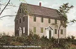 Walpole Meetinghouse |
November 7, 1976 (#76000104) |
North of Walpole on Meeting House Rd. 43°59′09″N 69°32′28″W |
Walpole | |
| 99 | Daniel Weston Homestead |  Daniel Weston Homestead |
October 1, 1979 (#79000157) |
West of Medomak on State Route 32 44°00′06″N 69°25′43″W |
Medomak | |
| 100 | Westport Community Church | July 15, 2002 (#02000784) |
Main Rd., State Route 144 43°53′57″N 69°42′34″W |
Westport | ||
| 101 | Wetherill Site | December 17, 1992 (#92001709) |
Address Restricted |
Waldoboro | ||
| 102 | Whitefield Union Hall | 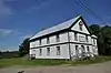 Whitefield Union Hall |
February 7, 2007 (#07000014) |
901 Townhouse Rd. 44°10′15″N 69°37′41″W |
Whitefield | |
| 103 | Wiscasset Historic District |  Wiscasset Historic District |
January 12, 1973 (#73000242) |
Roughly Parker, Dresden, Bradford, Main, and Federal Sts. 44°00′20″N 69°40′04″W |
Wiscasset | |
| 104 | Wiscasset Jail and Museum | 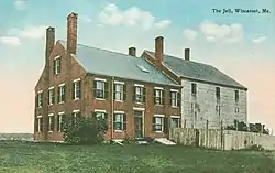 Wiscasset Jail and Museum |
January 26, 1970 (#70000054) |
State Route 218 44°00′38″N 69°39′44″W |
Wiscasset |
Former listings
| [3] | Name on the Register | Image | Date listed | Date removed | Location | City or town | Summary |
|---|---|---|---|---|---|---|---|
| 1 | HESPER and LUTHER LITTLE | April 18, 1990 (#90000589) | April 29, 2004 | Wiscasset waterfront off Water Street |
Wiscasset | ||
| 2 | Col. Isaac G. Reed House | August 5, 2005 (#100001676) | October 5, 2017 | 60 Glidden St. 44°05′49″N 69°22′38″W |
Waldoboro | Destroyed by fire April 2, 2017. | |
| 3 | Ada Smith Homestead | August 11, 1983 (#83000465) | January 15, 2004 | ME 218 |
Alna |
See also
| Wikimedia Commons has media related to National Register of Historic Places in Lincoln County, Maine. |
References
- The latitude and longitude information provided in this table was derived originally from the National Register Information System, which has been found to be fairly accurate for about 99% of listings. Some locations in this table may have been corrected to current GPS standards.
- "National Register of Historic Places: Weekly List Actions". National Park Service, United States Department of the Interior. Retrieved on February 5, 2021.
- Numbers represent an alphabetical ordering by significant words. Various colorings, defined here, differentiate National Historic Landmarks and historic districts from other NRHP buildings, structures, sites or objects.
- "National Register Information System". National Register of Historic Places. National Park Service. April 24, 2008.
- The eight-digit number below each date is the number assigned to each location in the National Register Information System database, which can be viewed by clicking the number.
| Topics | |
|---|---|
| Lists by state |
|
| Lists by insular areas | |
| Lists by associated state | |
| Other areas | |
| Related | |
| |
Municipalities and communities of Lincoln County, Maine, United States | ||
|---|---|---|
| Towns | Lincoln County map | |
| Plantation | ||
| Unorganized territories | ||
| CDPs | ||
| Other villages | ||
| ||
This article is issued from Wikipedia. The text is licensed under Creative Commons - Attribution - Sharealike. Additional terms may apply for the media files.