National Register of Historic Places listings in Bennington County, Vermont
This is a list of the National Register of Historic Places listings in Bennington County, Vermont.
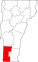
Location of Bennington County in Vermont
This is intended to be a complete list of the properties and districts on the National Register of Historic Places in Bennington County, Vermont, United States. Latitude and longitude coordinates are provided for many National Register properties and districts; these locations may be seen together in a map.[1]
There are 49 properties and districts listed on the National Register in the county.
- This National Park Service list is complete through NPS recent listings posted January 29, 2021.[2]
| Addison - Bennington - Caledonia - Chittenden - Essex - Franklin - Grand Isle - Lamoille - Orange - Orleans - Rutland - Washington - Windham - Windsor |
Current listings
| [3] | Name on the Register[4] | Image | Date listed[5] | Location | City or town | Description |
|---|---|---|---|---|---|---|
| 1 | Arlington Green Covered Bridge | 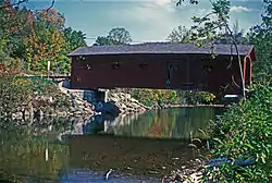 Arlington Green Covered Bridge |
August 28, 1973 (#73000184) |
Off VT 313 west of Arlington 43°06′16″N 73°13′14″W |
Arlington | |
| 2 | Arlington Village Historic District |  Arlington Village Historic District |
November 2, 1989 (#89001936) |
Roughly Main St., School St., E. Arlington Rd., and Battenkill Dr. 43°04′22″N 73°09′23″W |
Arlington | |
| 3 | Bennington Battle Monument | 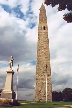 Bennington Battle Monument |
March 31, 1971 (#71000054) |
Monument Circle 42°53′20″N 73°13′00″W |
Bennington | |
| 4 | Bennington Falls Covered Bridge | 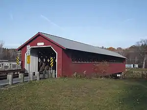 Bennington Falls Covered Bridge |
August 28, 1973 (#73000185) |
Northwest of Bennington off VT 67A 42°54′46″N 73°14′03″W |
Bennington | Also known as the Paper Mill Bridge |
| 5 | Bennington Fish Hatchery |  Bennington Fish Hatchery |
April 21, 1994 (#94000376) |
South Stream Rd. 42°51′09″N 73°10′20″W |
Bennington | |
| 6 | Bennington High School | 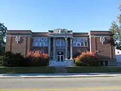 Bennington High School |
August 26, 2005 (#05000948) |
650 Main St. 42°52′43″N 73°11′24″W |
Bennington | Bennington's 1913 high school building |
| 7 | Bennington Post Office | 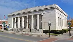 Bennington Post Office |
December 12, 1976 (#76000137) |
118 South St. 42°52′39″N 73°11′49″W |
Bennington | Former post office, now houses the police department |
| 8 | Bennington Railroad Station |  Bennington Railroad Station |
November 9, 1988 (#88001301) |
Depot and River Sts. 42°52′54″N 73°11′58″W |
Bennington | |
| 9 | W. H. Bradford Hook and Ladder Fire House | 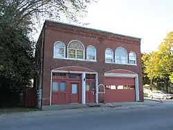 W. H. Bradford Hook and Ladder Fire House |
October 28, 1999 (#99001295) |
212 Safford St. 42°52′52″N 73°11′19″W |
Bennington | |
| 10 | Carrigan Lane Historic District | 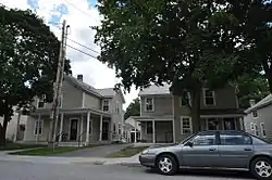 Carrigan Lane Historic District |
September 3, 1998 (#98001152) |
Roughly along Carrigan Ln., from Division St. to Safford St. 42°52′59″N 73°11′19″W |
Bennington | |
| 11 | Center Shaftsbury Historic District | 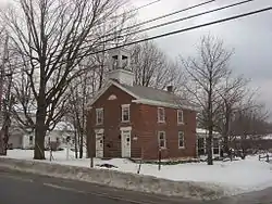 Center Shaftsbury Historic District |
November 9, 1988 (#88002052) |
VT 7A 42°59′05″N 73°12′42″W |
Shaftsbury | |
| 12 | Dorset Village Historic District | 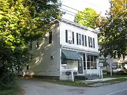 Dorset Village Historic District |
April 18, 1985 (#85000868) |
Roughly bounded by Main and Church Sts. and Dorset Hollow Rd.; also the junction of Church St. and West Rd. 43°15′26″N 73°06′15″W |
Dorset | Second set of boundaries represents a boundary increase |
| 13 | Downtown Bennington Historic District | 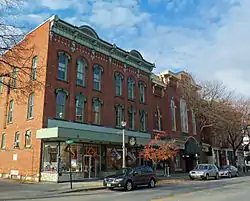 Downtown Bennington Historic District |
April 1, 1980 (#80000327) |
U.S. Route 7 and VT 9; also North, Main, and Silver Sts. 42°52′43″N 73°11′51″W |
Bennington | Second set of boundaries represents a boundary increase |
| 14 | East Arlington Village Historic District | 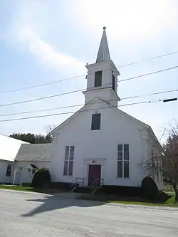 East Arlington Village Historic District |
July 5, 1996 (#96000689) |
Roughly bounded by Old Mill, Ice Pond, E. Arlington, and Warm Brook Rds., Maple and Pleasnt Sts., and the Lane 43°03′42″N 73°08′40″W |
Arlington | |
| 15 | Equinox House Historic District | 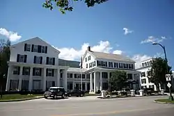 Equinox House Historic District |
November 21, 1972 (#72000107) |
Main and Union Sts. 43°09′43″N 73°04′25″W |
Manchester | Boundary increased June 3, 1980 |
| 16 | First Congregational Church of Bennington | 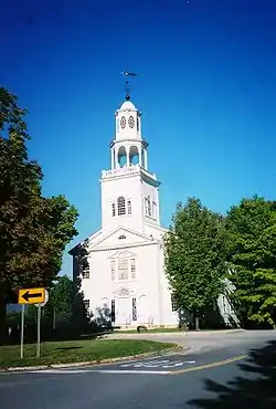 First Congregational Church of Bennington |
April 24, 1973 (#73000186) |
Monument Ave. 42°53′00″N 73°12′48″W |
Bennington | |
| 17 | Robert Frost Farm | 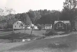 Robert Frost Farm |
May 23, 1968 (#68000047) |
0.25 mi (0.40 km) west of U.S. Route 7 on Buck Hill Rd. 42°56′28″N 73°11′42″W |
South Shaftsbury | Residence of poet Robert Frost between 1929 and 1938. Designated a National Historic Landmark in 1968, the Park Service withdrew the landmark designation in 1986.[6] |
| 18 | Furnace Grove Historic District |  Furnace Grove Historic District |
June 27, 1997 (#97000646) |
VT 9, 1 mi (1.6 km) east of the junction of VT 9 and Burgess Rd. 42°53′06″N 73°09′24″W |
Bennington | |
| 19 | Gov. Jonas Galusha Homestead | 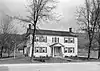 Gov. Jonas Galusha Homestead |
November 30, 1979 (#79000217) |
3817 Vermont Route 7A 42°59′17″N 73°12′24″W |
Center Shaftsbury | |
| 20 | Zera Hard House |  Zera Hard House |
November 9, 1988 (#88002230) |
River Rd. 43°07′49″N 73°04′56″W |
Manchester | |
| 21 | Henry Covered Bridge | Henry Covered Bridge |
August 28, 1973 (#73000187) |
Northwest of Bennington off VT 67A 42°54′45″N 73°15′18″W |
Bennington | |
| 22 | William Henry House | 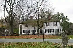 William Henry House |
November 9, 1988 (#88001302) |
River Rd. 42°54′30″N 73°15′20″W |
Bennington | |
| 23 | Hildene | 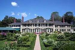 Hildene |
October 28, 1977 (#77000095) |
820 Hildene Rd. 43°08′13″N 73°04′25″W |
Manchester | |
| 24 | Holden-Leonard Mill Complex | 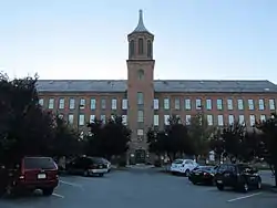 Holden-Leonard Mill Complex |
November 14, 1988 (#88002085) |
160 Benmont Ave. 42°53′06″N 73°12′13″W |
Bennington | |
| 25 | Holden-Leonard Workers Housing Historic District | 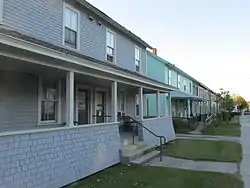 Holden-Leonard Workers Housing Historic District |
May 19, 2011 (#11000296) |
121-139, 124-150 Benmont Ave. & 105-115, 117-123 Holden St. 42°53′00″N 73°12′07″W |
Bennington | |
| 26 | Jenks Tavern | 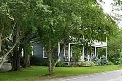 Jenks Tavern |
March 17, 1994 (#94000191) |
Junction of Dorset West Rd. and VT 315 43°16′20″N 73°07′35″W |
Rupert | |
| 27 | Johnny Seesaw's Historic District | 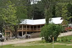 Johnny Seesaw's Historic District |
July 18, 2008 (#08000686) |
3574 VT 11 43°12′58″N 72°55′28″W |
Peru | |
| 28 | Kent Neighborhood Historic District |  Kent Neighborhood Historic District |
July 14, 1978 (#78003203) |
South of Dorset at Dorset West and Nichols Hill Rds. 43°14′22″N 73°05′54″W |
Dorset | |
| 29 | Amos Lawrence House | 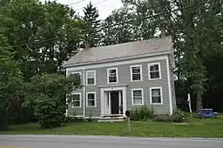 Amos Lawrence House |
May 21, 1985 (#85001245) |
Richville Rd. 43°09′55″N 73°03′11″W |
Manchester | |
| 30 | Manchester Village Historic District | 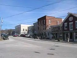 Manchester Village Historic District |
January 26, 1984 (#84003438) |
U.S. Route 7A, Union St., and Taconic Ave. 43°09′38″N 73°04′22″W |
Manchester | |
| 31 | Manley-Lefevre House |  Manley-Lefevre House |
January 26, 1990 (#89002324) |
Dorset West Rd., Town Highway 1 43°13′36″N 73°05′13″W |
Dorset | |
| 32 | David Mathews House | 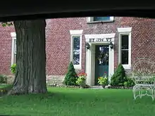 David Mathews House |
September 10, 1979 (#79000274) |
VT 67 42°56′27″N 73°16′28″W |
Shaftsbury | Extends into Rensselaer County, New York; also known as the State Line House. |
| 33 | Munro-Hawkins House | 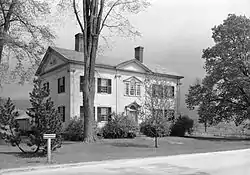 Munro-Hawkins House |
May 17, 1973 (#73000188) |
0.5 mi (0.80 km) south of Shaftsbury Center on Vermont Route 7A 42°57′24″N 73°12′31″W |
Shaftsbury Center | |
| 34 | North Bennington Depot | 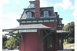 North Bennington Depot |
April 11, 1973 (#73000189) |
Buckley Rd. and Depot St. at the Vermont Railway tracks 42°55′56″N 73°14′32″W |
North Bennington | |
| 35 | North Bennington Historic District | 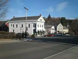 North Bennington Historic District |
August 29, 1980 (#80000328) |
VT 67 and VT 67A 42°55′48″N 73°14′35″W |
North Bennington | |
| 36 | Old Bennington Historic District | 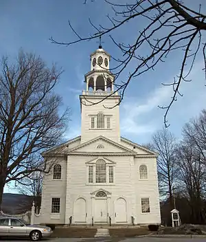 Old Bennington Historic District |
October 4, 1984 (#84000030) |
Roughly bounded by the former Rutland Railway line, Monument Ave. and Circle, West Rd., Seminary Lane, and Elm and Fairview Sts. 42°53′01″N 73°12′45″W |
Bennington | |
| 37 | The Orchards |  The Orchards |
April 24, 2000 (#00000384) |
982 Mansion Dr. 42°52′08″N 73°13′13″W |
Bennington | Now the campus of Southern Vermont College |
| 38 | Park-McCullough House | 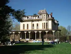 Park-McCullough House |
October 26, 1972 (#72000090) |
Southwestern corner of West and Park Sts. 42°55′42″N 73°14′49″W |
North Bennington | |
| 39 | Pratt-McDaniels-LaFlamme House | 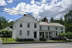 Pratt-McDaniels-LaFlamme House |
July 11, 2002 (#02000777) |
501-507 South St. 42°52′21″N 73°11′50″W |
Bennington | |
| 40 | Ritchie Block | 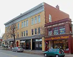 Ritchie Block |
November 6, 1986 (#86003060) |
465-473 Main St. 42°52′39″N 73°11′44″W |
Bennington | |
| 41 | School Street Duplexes | 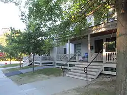 School Street Duplexes |
March 13, 2007 (#07000162) |
343-345 and 347-349 School St. 42°53′09″N 73°11′40″W |
Bennington | |
| 42 | Silk Covered Bridge | 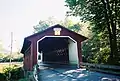 Silk Covered Bridge |
August 28, 1973 (#73000190) |
Northwest of Bennington off VT 67A 42°54′34″N 73°13′33″W |
Bennington | |
| 43 | Frederick Squire House | 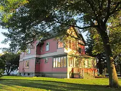 Frederick Squire House |
July 30, 1992 (#92000964) |
185 North St. 42°52′53″N 73°11′48″W |
Bennington | |
| 44 | Tudor House | 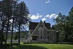 Tudor House |
September 10, 1979 (#79000218) |
VT 8 42°45′05″N 73°04′11″W |
Stamford | |
| 45 | Wait Block | Wait Block |
November 7, 1996 (#96001327) |
Near the junction of Main and Bonnet Sts. in Manchester Center 43°10′36″N 73°03′24″W |
Manchester | |
| 46 | H.C. White Company Mill Complex | 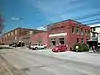 H.C. White Company Mill Complex |
January 11, 2017 (#100000515) |
940 Water St. 42°54′56″N 73°14′48″W |
North Bennington | |
| 47 | Cora B. Whitney School | 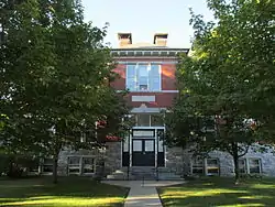 Cora B. Whitney School |
November 19, 2001 (#01001237) |
814 Gage St. 42°52′53″N 73°10′59″W |
Bennington | |
| 48 | Wilson House | 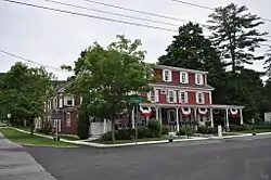 Wilson House |
December 13, 1995 (#95001427) |
Junction of Village St. and Mad Tom Rd. 43°14′22″N 73°00′33″W |
East Dorset | |
| 49 | Yester House |  Yester House |
November 10, 1988 (#88002051) |
West Rd. 43°10′39″N 73°04′39″W |
Manchester | Now the Southern Vermont Arts Center |
See also
| Wikimedia Commons has media related to National Register of Historic Places in Bennington County, Vermont. |
References
- The latitude and longitude information provided in this table was derived originally from the National Register Information System, which has been found to be fairly accurate for about 99% of listings. Some locations in this table may have been corrected to current GPS standards.
- "National Register of Historic Places: Weekly List Actions". National Park Service, United States Department of the Interior. Retrieved on January 29, 2021.
- Numbers represent an alphabetical ordering by significant words. Various colorings, defined here, differentiate National Historic Landmarks and historic districts from other NRHP buildings, structures, sites or objects.
- "National Register Information System". National Register of Historic Places. National Park Service. April 24, 2008.
- The eight-digit number below each date is the number assigned to each location in the National Register Information System database, which can be viewed by clicking the number.
- "Withdrawal of National Historic Landmark Designation: Robert Frost Farm". National Park Service. Retrieved 2012-03-12.
| Topics | |
|---|---|
| Lists by state |
|
| Lists by insular areas | |
| Lists by associated state | |
| Other areas | |
| Related | |
| |
Municipalities and communities of Bennington County, Vermont, United States | ||
|---|---|---|
| Towns | Map of Vermont highlighting Bennington County | |
| Villages | ||
| CDPs | ||
| Other communities | ||
| Footnotes | ‡ Disincorporated | |
| ||
This article is issued from Wikipedia. The text is licensed under Creative Commons - Attribution - Sharealike. Additional terms may apply for the media files.