National Register of Historic Places listings in Rutland County, Vermont
This is a list of the National Register of Historic Places listings in Rutland County, Vermont.
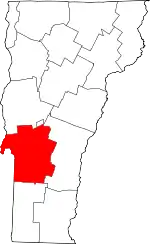
Location of Rutland County in Vermont
This is intended to be a complete list of the properties and districts on the National Register of Historic Places in Rutland County, Vermont, United States. Latitude and longitude coordinates are provided for many National Register properties and districts; these locations may be seen together in a map.[1]
There are 75 properties and districts listed on the National Register in the county, one of which is also a National Historic Landmark.
- This National Park Service list is complete through NPS recent listings posted January 29, 2021.[2]
| Addison - Bennington - Caledonia - Chittenden - Essex - Franklin - Grand Isle - Lamoille - Orange - Orleans - Rutland - Washington - Windham - Windsor |
Current listings
| [3] | Name on the Register[4] | Image | Date listed[5] | Location | City or town | Description |
|---|---|---|---|---|---|---|
| 1 | Nathan Allen House | 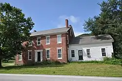 Nathan Allen House |
October 27, 1988 (#88002069) |
VT 30 43°21′45″N 73°11′07″W |
Pawlet | |
| 2 | H. H. Baxter Memorial Library | 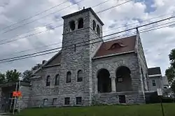 H. H. Baxter Memorial Library |
August 24, 1978 (#78000239) |
96 Grove St. 43°36′44″N 72°58′53″W |
Rutland | Now the Rutland Jewish Community Center |
| 3 | Benson Village | 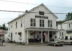 Benson Village |
November 17, 1978 (#78000240) |
Stage Rd. between Lake and Hulett Hill Rds. 43°42′33″N 73°18′38″W |
Benson | |
| 4 | Braintree School | 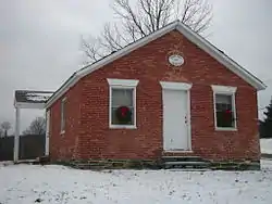 Braintree School |
May 3, 2010 (#09000917) |
9 Warren Switch Rd. 43°22′09″N 73°14′06″W |
Pawlet | |
| 5 | Brandon State School | 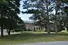 Brandon State School |
November 12, 1999 (#99001346) |
Off U.S. Route 7 43°48′42″N 73°06′30″W |
Brandon | |
| 6 | Brandon Village Historic District | 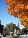 Brandon Village Historic District |
December 22, 1976 (#76000145) |
U.S. Route 7 43°47′52″N 73°05′18″W |
Brandon | |
| 7 | Bridge 4 | 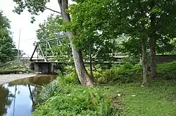 Bridge 4 |
November 5, 2009 (#09000892) |
Vermont Route 31 43°30′47″N 73°14′00″W |
Poultney | |
| 8 | Brown Covered Bridge | 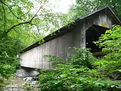 Brown Covered Bridge |
January 21, 1974 (#74000250) |
2.9 mi (4.7 km) east of North Clarendon across the Cold River 43°33′58″N 72°55′10″W |
Shrewsbury | 1880 bridge is one of the best remaining examples of a Town lattice truss. |
| 9 | Castleton Medical College Building | 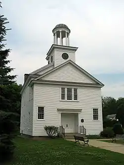 Castleton Medical College Building |
March 11, 1971 (#71000058) |
South St. 43°36′36″N 73°10′43″W |
Castleton | |
| 10 | Castleton Village Historic District | .jpg.webp) Castleton Village Historic District |
April 26, 1979 (#79000225) |
Irregular pattern along Main and South Sts. 43°36′39″N 73°10′47″W |
Castleton | |
| 11 | Chaffee-Moloney Houses | 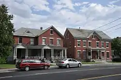 Chaffee-Moloney Houses |
November 19, 2001 (#01001240) |
194 and 196-98 Columbian Ave. 43°36′28″N 72°59′28″W |
Rutland | |
| 12 | Clarendon Congregational Church | 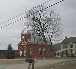 Clarendon Congregational Church |
July 12, 1984 (#84003471) |
Middle Rd. 43°31′06″N 72°58′16″W |
Clarendon | |
| 13 | Clarendon House | Clarendon House |
May 17, 1976 (#76000146) |
Off VT 133 43°32′55″N 73°01′18″W |
Clarendon Springs | |
| 14 | Clementwood |  Clementwood |
September 27, 1980 (#80000338) |
Clement Rd. 43°35′59″N 73°00′25″W |
Rutland | |
| 15 | Colburn Bridge |  Colburn Bridge |
October 11, 1990 (#90001493) |
U.S. Route 7 over Sugar Hollow Brook 43°42′25″N 73°01′17″W |
Pittsford | |
| 16 | Cold River Bridge | 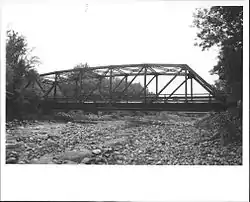 Cold River Bridge |
November 14, 1991 (#91001608) |
VT 7B over the Cold River 43°34′12″N 72°57′59″W |
Clarendon | Demolished in 2006 |
| 17 | Cooley Covered Bridge | 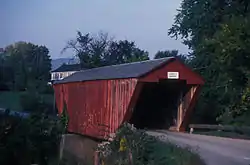 Cooley Covered Bridge |
January 24, 1974 (#74000251) |
1.2 mi (1.9 km) south of Pittsford across Furnace Brook 43°41′24″N 73°01′45″W |
Pittsford | |
| 18 | Crowley Cheese Factory |  Crowley Cheese Factory |
October 11, 1979 (#79000226) |
Southwest of Healdville on Healdville Rd. 43°25′26″N 72°47′13″W |
Healdville | |
| 19 | Danby Village Historic District | 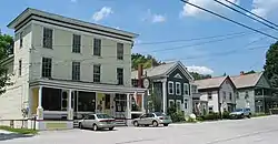 Danby Village Historic District |
February 10, 1983 (#83003219) |
Main St., Mt. Tabor Ave., Depot St., and Borough Hill Rd. 43°20′50″N 72°59′47″W |
Danby | |
| 20 | Dean Covered Bridge | 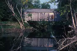 Dean Covered Bridge |
September 10, 1974 (#74000252) |
South of Brandon, over Otter Creek 43°46′43″N 73°05′51″W |
Brandon | |
| 21 | Depot Covered Bridge | 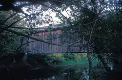 Depot Covered Bridge |
January 21, 1974 (#74000253) |
.8 mi (1.3 km) west of Pittsford across Otter Creek 43°42′34″N 73°02′36″W |
Pittsford | |
| 22 | East Clarendon Railroad Station | East Clarendon Railroad Station |
March 8, 1999 (#99000262) |
VT 103 and East Rd. 43°31′34″N 72°56′00″W |
Clarendon | |
| 23 | East Poultney Historic District | 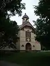 East Poultney Historic District |
January 31, 1978 (#78000241) |
Village green and environs 43°31′31″N 73°12′24″W |
East Poultney | |
| 24 | Fair Haven Green Historic District | 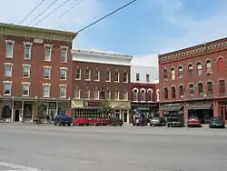 Fair Haven Green Historic District |
November 24, 1980 (#80000339) |
Park Pl., Adams and Main Sts. 43°35′35″N 73°15′57″W |
Fair Haven | |
| 25 | Forest Dale Iron Furnace | 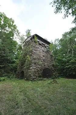 Forest Dale Iron Furnace |
June 13, 1974 (#74000254) |
VT 73 and Furnace Rd. 43°49′55″N 73°02′54″W |
Brandon | |
| 26 | Fort Vengeance Monument Site | 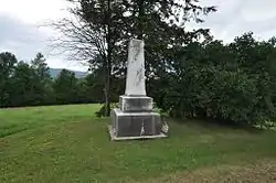 Fort Vengeance Monument Site |
March 15, 2006 (#06000139) |
U.S. Route 7, .57 mi (0.92 km) south of the town line with Brandon 43°44′51″N 73°02′53″W |
Pittsford | |
| 27 | Fox-Cook Farm | 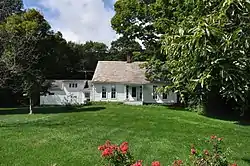 Fox-Cook Farm |
November 26, 1986 (#86003228) |
Off U.S. Route 7 on Cook Rd. 43°27′23″N 72°59′28″W |
Wallingford | |
| 28 | Gifford Woods State Park | 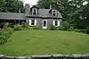 Gifford Woods State Park |
April 23, 2002 (#02000414) |
VT 100 43°40′29″N 72°48′44″W |
Killington | |
| 29 | Gorham Covered Bridge | 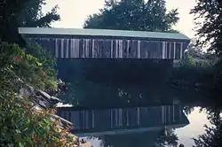 Gorham Covered Bridge |
February 12, 1974 (#74000255) |
North of Proctor across Otter Creek off VT 3 43°40′48″N 73°02′17″W |
Proctor | |
| 30 | Hager Farm | 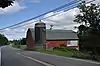 Hager Farm |
November 26, 1986 (#86003224) |
U.S. Route 7 43°26′10″N 72°59′26″W |
Wallingford | |
| 31 | Gen. Robinson Hall House | 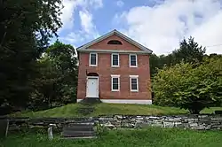 Gen. Robinson Hall House |
November 26, 1986 (#86003221) |
U.S. Route 7 43°25′47″N 72°59′24″W |
Wallingford | |
| 32 | Hammond Covered Bridge | 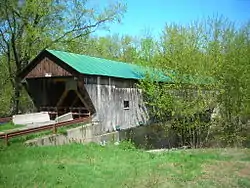 Hammond Covered Bridge |
January 21, 1974 (#74000256) |
Northwest of Pittsford across Otter Creek 43°43′14″N 73°03′14″W |
Pittsford | |
| 33 | Hosford-Sherman Farm | 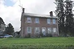 Hosford-Sherman Farm |
May 12, 1995 (#95000572) |
VT 30 43°34′04″N 73°13′25″W |
Poultney | |
| 34 | Hubbardton Battlefield | 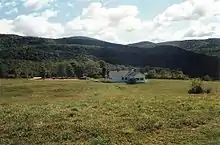 Hubbardton Battlefield |
March 11, 1971 (#71000059) |
Intersection of St. John and Monument Hill Roads 43°41′43″N 73°08′18″W |
Hubbardton | Boundary adjustments approved October 10, 2018. |
| 35 | Hulett Farm | 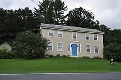 Hulett Farm |
November 26, 1986 (#86003220) |
U.S. Route 7 43°26′01″N 72°59′28″W |
Wallingford | |
| 36 | Hyde's Hotel | 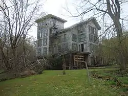 Hyde's Hotel |
April 11, 1980 (#80000340) |
South of Sudbury on VT 30 43°47′06″N 73°12′15″W |
Sudbury | |
| 37 | Hydeville School | 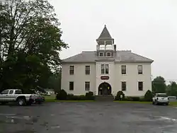 Hydeville School |
November 21, 1978 (#78000242) |
West of Castleton on VT 4A 43°36′19″N 73°13′48″W |
Castleton | |
| 38 | Immaculate Heart of Mary School | October 22, 2020 (#100005704) |
10 Lincoln Ave. 43°36′32″N 72°58′32″W |
Rutland | ||
| 39 | Kazon Building | 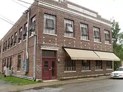 Kazon Building |
July 28, 2004 (#04000769) |
50 Marble St. 43°35′46″N 73°02′55″W |
West Rutland | |
| 40 | Asahel Kidder House | 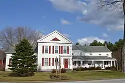 Asahel Kidder House |
February 7, 1997 (#97000024) |
VT 22A, south of its junction with Bolger Rd. 43°34′26″N 73°15′50″W |
Fair Haven | |
| 41 | Kingsley Covered Bridge | 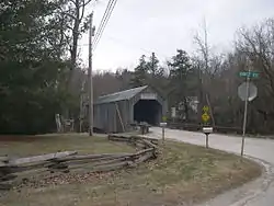 Kingsley Covered Bridge |
February 12, 1974 (#74000257) |
Southwest of East Clarendon across the Mill River 43°31′25″N 72°56′30″W |
East Clarendon | |
| 42 | Kingsley Grist Mill Historic District | 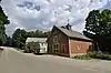 Kingsley Grist Mill Historic District |
November 8, 2007 (#07001170) |
East St. and Gorge Rd. 43°31′27″N 72°56′26″W |
Clarendon | |
| 43 | Laurel Glen Mausoleum-Laurel Hall | 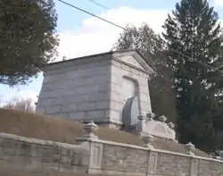 Laurel Glen Mausoleum-Laurel Hall |
November 23, 1998 (#98001429) |
VT 103, .5 mi (0.80 km) southeast of Cuttingsville 43°29′05″N 72°52′49″W |
Shrewsbury | |
| 44 | Linden Terrace | 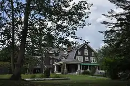 Linden Terrace |
August 23, 2007 (#07000844) |
191 Grove St. 43°37′07″N 72°59′06″W |
Rutland | |
| 45 | Longfellow School | 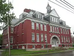 Longfellow School |
December 12, 1976 (#76000147) |
6 Church St. 43°36′31″N 72°58′42″W |
Rutland | |
| 46 | Marble Bridge | 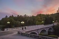 Marble Bridge |
November 14, 1991 (#91001609) |
Main St. over Otter Creek 43°39′40″N 73°02′02″W |
Proctor | |
| 47 | Marble Street Historic District | 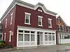 Marble Street Historic District |
March 1, 1990 (#90000338) |
87-132 Marble St. and 10 Smith Ave. 43°35′51″N 73°02′40″W |
West Rutland | |
| 48 | Middletown Springs Historic District | 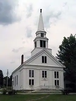 Middletown Springs Historic District |
October 17, 1985 (#85003239) |
East, North, South, and West Sts., Montvert Ave., and Schoolhouse Rd. 43°29′03″N 73°07′07″W |
Middletown Springs | |
| 49 | Mission of the Church of Our Savior |  Mission of the Church of Our Savior |
October 29, 1992 (#92001479) |
Mission Farm Rd. 43°37′09″N 72°45′25″W |
Killington | |
| 50 | Mountain View Stock Farm |  Mountain View Stock Farm |
October 30, 1989 (#89001817) |
VT 22A, north of Lake Rd. 43°42′30″N 73°17′50″W |
Benson | |
| 51 | Thomas H. Palmer House |  Thomas H. Palmer House |
December 29, 1978 (#78000243) |
2636 U.S. Route 7 43°42′01″N 73°00′28″W |
Pittsford | Currently the Inn at Logan's Run |
| 52 | Pawlet Town Hall |  Pawlet Town Hall |
December 13, 1995 (#95001449) |
School St. 43°20′45″N 73°10′47″W |
Pawlet | |
| 53 | Arthur Perkins House | 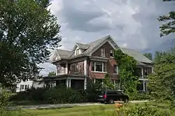 Arthur Perkins House |
September 27, 1988 (#88001579) |
242 S. Main St. 43°35′30″N 72°58′08″W |
Rutland | |
| 54 | Pittsford Green Historic District | 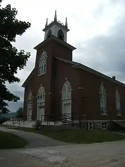 Pittsford Green Historic District |
May 13, 1982 (#82001704) |
Main St. 43°42′26″N 73°01′44″W |
Pittsford | |
| 55 | Poultney Central School | 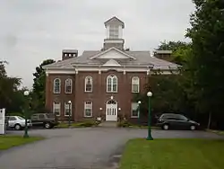 Poultney Central School |
March 25, 1977 (#77000100) |
Main St. 43°31′04″N 73°14′06″W |
Poultney | |
| 56 | Poultney Main Street Historic District | 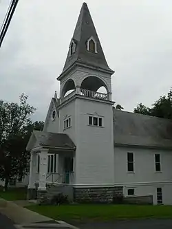 Poultney Main Street Historic District |
June 2, 1988 (#88000649) |
Roughly Main St., E. Main St., Depot St., Knapp Ave., Beaman St., Grove St., Maple Ave., and College Ave. 43°31′02″N 73°14′05″W |
Poultney | |
| 57 | Proctor-Clement House | 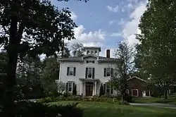 Proctor-Clement House |
June 17, 1982 (#82001705) |
85 Field Ave. 43°37′36″N 72°59′11″W |
Rutland | Now the Antique Mansion Bed and Breakfast. |
| 58 | Rural Otter Creek Valley Historic District | 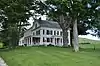 Rural Otter Creek Valley Historic District |
March 31, 1987 (#86003212) |
Roughly U.S. Route 7 west of Otter Creek 43°27′03″N 72°59′13″W |
Wallingford | |
| 59 | Rutland Courthouse Historic District | 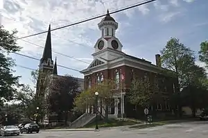 Rutland Courthouse Historic District |
September 8, 1976 (#76000148) |
U.S. Route 7 43°36′25″N 72°58′29″W |
Rutland | |
| 60 | Rutland Downtown Historic District | 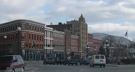 Rutland Downtown Historic District |
August 22, 1980 (#80000387) |
Roughly bounded by Strongs Ave., State, Wales, Washington, Pine, and Cottage Sts. 43°36′05″N 72°58′52″W |
Rutland | |
| 61 | St. Stanislaus Kostka School and Convent House | 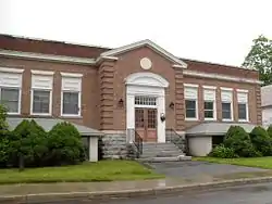 St. Stanislaus Kostka School and Convent House |
June 18, 2010 (#10000349) |
95 & 113 Barnes St. 43°35′53″N 73°03′07″W |
West Rutland | |
| 62 | Sanderson Covered Bridge | 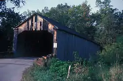 Sanderson Covered Bridge |
June 13, 1974 (#74000258) |
W of Brandon over Otter Creek 43°47′22″N 73°06′45″W |
Brandon | |
| 63 | Anthony Scoville House | 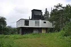 Anthony Scoville House |
August 24, 2007 (#07000845) |
905 Dawley Rd. 43°28′25″N 72°50′02″W |
Mount Holly | |
| 64 | Simeon Smith House | 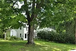 Simeon Smith House |
March 3, 1983 (#83003220) |
W. Haven Rd. 43°38′11″N 73°18′00″W |
West Haven | |
| 65 | Simeon Smith Mansion |  Simeon Smith Mansion |
November 21, 1991 (#91001675) |
Smith Rd. west of junction with VT 22A 43°37′57″N 73°18′15″W |
West Haven | |
| 66 | St. Peter's Church and Mount St. Joseph Convent Complex |  St. Peter's Church and Mount St. Joseph Convent Complex |
October 3, 1980 (#80000388) |
Convent Ave., Meadow and River Sts. 43°36′08″N 72°59′10″W |
Rutland | |
| 67 | Sudbury Congregational Church |  Sudbury Congregational Church |
October 28, 1977 (#77000101) |
VT 30 43°47′58″N 73°12′15″W |
Sudbury | |
| 68 | Sudbury School No. 3 |  Sudbury School No. 3 |
November 2, 1978 (#78000244) |
Junction of VT 30 and VT 73 43°47′47″N 73°12′22″W |
Sudbury | |
| 69 | Tinmouth Historic District | 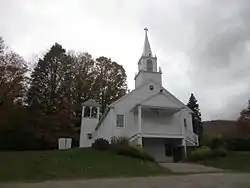 Tinmouth Historic District |
June 25, 1980 (#80000425) |
VT 140 and VT 2 43°26′55″N 73°03′06″W |
Tinmouth | |
| 70 | Homer Waldo Farm | 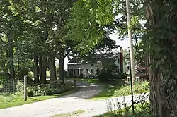 Homer Waldo Farm |
November 26, 1986 (#86003215) |
Waldo Ln. 43°27′53″N 72°58′57″W |
Wallingford | |
| 71 | Wallingford Main Street Historic District |  Wallingford Main Street Historic District |
November 1, 1984 (#84000424) |
Main and School Sts. 43°28′17″N 72°58′38″W |
Wallingford | |
| 72 | Watkins School | 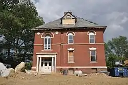 Watkins School |
April 7, 2014 (#14000133) |
26 Watkins Ave. 43°36′26″N 72°59′45″W |
Rutland | |
| 73 | Wells Village School | 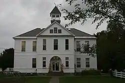 Wells Village School |
October 7, 1993 (#93001004) |
Northern side of Main St. (VT 30) 43°25′05″N 73°12′25″W |
Wells | |
| 74 | West Haven Baptist Church | 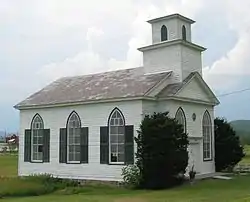 West Haven Baptist Church |
March 13, 2007 (#07000161) |
48 Book Rd. 43°39′02″N 73°20′53″W |
West Haven | |
| 75 | West Rutland Town Hall | 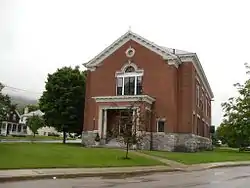 West Rutland Town Hall |
July 28, 1983 (#83003221) |
Main and Marble Sts. 43°35′42″N 73°02′56″W |
West Rutland |
See also
| Wikimedia Commons has media related to National Register of Historic Places in Rutland County, Vermont. |
References
- The latitude and longitude information provided in this table was derived originally from the National Register Information System, which has been found to be fairly accurate for about 99% of listings. Some locations in this table may have been corrected to current GPS standards.
- "National Register of Historic Places: Weekly List Actions". National Park Service, United States Department of the Interior. Retrieved on January 29, 2021.
- Numbers represent an alphabetical ordering by significant words. Various colorings, defined here, differentiate National Historic Landmarks and historic districts from other NRHP buildings, structures, sites or objects.
- "National Register Information System". National Register of Historic Places. National Park Service. April 24, 2008.
- The eight-digit number below each date is the number assigned to each location in the National Register Information System database, which can be viewed by clicking the number.
| Topics | |
|---|---|
| Lists by state |
|
| Lists by insular areas | |
| Lists by associated state | |
| Other areas | |
| Related | |
| |
Municipalities and communities of Rutland County, Vermont, United States | ||
|---|---|---|
| City | Map of Vermont highlighting Rutland County | |
| Towns | ||
| Village | ||
| CDPs | ||
| Other communities | ||
| ||
This article is issued from Wikipedia. The text is licensed under Creative Commons - Attribution - Sharealike. Additional terms may apply for the media files.