National Register of Historic Places listings in Windham County, Vermont
This is a list of the National Register of Historic Places listings in Windham County, Vermont.
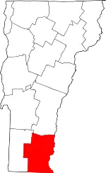
Location of Windham County in Vermont
This is intended to be a complete list of the properties and districts on the National Register of Historic Places in Windham County, Vermont, United States. Latitude and longitude coordinates are provided for many National Register properties and districts; these locations may be seen together in a map.[1]
There are 97 properties and districts listed on the National Register in the county, including 2 National Historic Landmarks.
- This National Park Service list is complete through NPS recent listings posted January 29, 2021.[2]
| Addison - Bennington - Caledonia - Chittenden - Essex - Franklin - Grand Isle - Lamoille - Orange - Orleans - Rutland - Washington - Windham - Windsor |
Current listings
| [3] | Name on the Register[4] | Image | Date listed[5] | Location | City or town | Description |
|---|---|---|---|---|---|---|
| 1 | Adams Gristmill Warehouse | Adams Gristmill Warehouse |
January 22, 1990 (#88002162) |
Bridge St. 43°08′07″N 72°26′30″W |
Bellows Falls | |
| 2 | Bartonsville Covered Bridge | 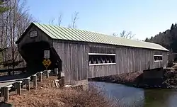 Bartonsville Covered Bridge |
July 2, 1973 (#73000201) |
Across the Williams River at the southern end of Bartonsville 43°13′27″N 72°32′12″W |
Rockingham | Destroyed in 2011 by flash flooding caused by Hurricane Irene,[6] and rebuilt in 2012. |
| 3 | Bellows Falls Co-operative Creamery Complex | Bellows Falls Co-operative Creamery Complex |
January 22, 1990 (#88002164) |
Bridge St. 43°08′10″N 72°26′32″W |
Bellows Falls | |
| 4 | Bellows Falls Downtown Historic District | 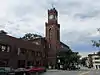 Bellows Falls Downtown Historic District |
August 16, 1982 (#82001706) |
Depot, Canal, Rockingham, Bridge, Mill, and Westminster Sts. 43°08′04″N 72°26′42″W |
Bellows Falls | |
| 5 | Bellows Falls Neighborhood Historic District | 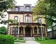 Bellows Falls Neighborhood Historic District |
January 17, 2002 (#01001477) |
Atkinson, Westminster, School, and Hapgood Sts., Hapgood Pl., and Burt St., Henry St., South St., Hadley St., and Temple Pl.; also Center, Front, Old Terrace, and Pine Sts. 43°07′53″N 72°26′57″W |
Bellows Falls | Second set of streets represents a boundary increase |
| 6 | Bellows Falls Petroglyph Site (VT-WD-8) | 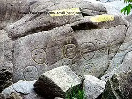 Bellows Falls Petroglyph Site (VT-WD-8) |
January 22, 1990 (#88002166) |
Address Restricted |
Bellows Falls | |
| 7 | Bellows Falls Times Building | 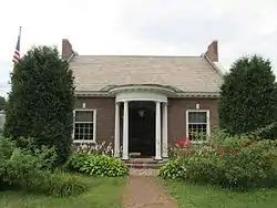 Bellows Falls Times Building |
January 22, 1990 (#88002160) |
Bridge and Island Sts. 43°08′05″N 72°26′34″W |
Bellows Falls | |
| 8 | Brattleboro Downtown Historic District | 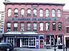 Brattleboro Downtown Historic District |
February 17, 1983 (#83003225) |
Main St. from Vernon to Walnut, Flat, Elliot, High, and Grove Sts.; also Plaza Park, Main St. at its junction with Canal St., Vermont Routes 119 and 142, and 1 Holstein Place 42°51′13″N 72°33′35″W |
Brattleboro | Second set of streets represents a boundary increase dating to September 15, 2004 |
| 9 | Brattleboro Retreat | 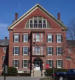 Brattleboro Retreat |
April 12, 1984 (#84003478) |
Linden St. and Upper Dummerston Rd. 42°51′52″N 72°34′17″W |
Brattleboro | |
| 10 | Bridge 19 | 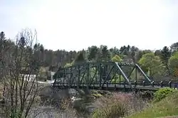 Bridge 19 |
September 28, 2007 (#07001025) |
Grassy Brook Rd. 42°59′44″N 72°38′16″W |
Brookline and Newfane | aka the Brookline-Newfane Bridge |
| 11 | Broad Brook House | 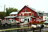 Broad Brook House |
August 4, 2011 (#11000517) |
475 Coolidge Hwy. 42°49′04″N 72°34′31″W |
Guilford | |
| 12 | Brooks House | 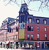 Brooks House |
February 1, 1980 (#80000343) |
4 High St. and 128 Main St. 42°51′12″N 72°33′31″W |
Brattleboro | |
| 13 | Butterfield House | 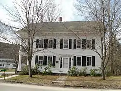 Butterfield House |
August 6, 2005 (#05000806) |
204 Main St. 43°10′18″N 72°36′25″W |
Grafton | Now the Grafton Public Library |
| 14 | Canal Street Schoolhouse | 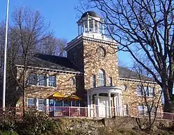 Canal Street Schoolhouse |
August 19, 1977 (#77000103) |
Canal St. at Clark St. 42°50′52″N 72°33′40″W |
Brattleboro | |
| 15 | Canal Street-Clark Street Neighborhood Historic District | 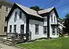 Canal Street-Clark Street Neighborhood Historic District |
July 8, 1993 (#93000593) |
Roughly bounded by Canal, S. Main, Lawrence and Clark Sts. 42°50′56″N 72°33′35″W |
Brattleboro | |
| 16 | Christ Church | 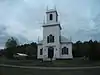 Christ Church |
May 13, 1982 (#82001707) |
Melendy Rd. and U.S. Route 5 42°48′58″N 72°34′30″W |
Guilford | |
| 17 | Corse-Shippee House | 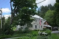 Corse-Shippee House |
May 7, 2008 (#08000386) |
11 Dorr Fitch Rd. 42°56′08″N 72°50′52″W |
Dover | |
| 18 | Theophilus Crawford House | 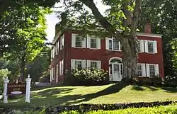 Theophilus Crawford House |
March 9, 1995 (#95000175) |
Southwestern side of Hickory Ridge Rd., about 2 mi (3.2 km) north of Putney 42°59′55″N 72°32′14″W |
Putney | |
| 19 | Creamery Covered Bridge | 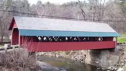 Creamery Covered Bridge |
August 28, 1973 (#73000202) |
West of Brattleboro off Vermont Route 9 42°50′58″N 72°35′12″W |
Brattleboro | |
| 20 | Crows Nest | 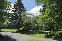 Crows Nest |
May 18, 1998 (#98000431) |
36 Sturgis Dr. 42°54′43″N 72°53′01″W |
Wilmington | |
| 21 | Dickinson Estate Historic District | 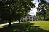 Dickinson Estate Historic District |
November 9, 2005 (#05001237) |
Dickinson and Kipling Rds. 42°53′37″N 72°33′55″W |
Brattleboro | |
| 22 | District No. 1 Schoolhouse | 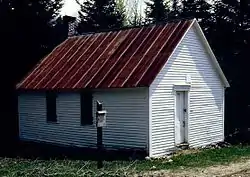 District No. 1 Schoolhouse |
April 20, 1992 (#92000337) |
Somerset Rd. 42°57′40″N 72°59′02″W |
Somerset | |
| 23 | Dover Town Hall | 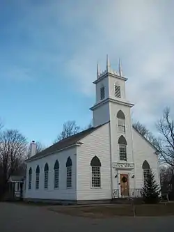 Dover Town Hall |
September 1, 1988 (#88001466) |
School House Rd. 42°56′38″N 72°48′08″W |
Dover | |
| 24 | East Putney Brook Stone Arch Bridge | 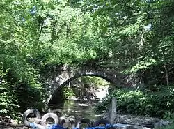 East Putney Brook Stone Arch Bridge |
December 12, 1976 (#76000149) |
Spans East Putney Brook off River Rd. 42°59′09″N 72°28′09″W |
East Putney | |
| 25 | Estey Organ Company Factory |  Estey Organ Company Factory |
April 17, 1980 (#80000344) |
Birge St.; also 68 Birge St. 42°50′51″N 72°34′04″W |
Brattleboro | 68 Birge represents a boundary increase |
| 26 | First Congregational Church and Meetinghouse | 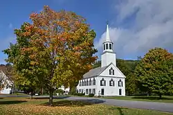 First Congregational Church and Meetinghouse |
November 15, 2002 (#02001344) |
Near the junction of Vermont Routes 30 and 35 43°02′49″N 72°40′10″W |
Townshend | |
| 27 | Follett Stone Arch Bridge Historic District | 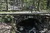 Follett Stone Arch Bridge Historic District |
December 12, 1976 (#76000150) |
West of Townshend off Vermont Route 30 43°02′48″N 72°41′59″W |
Townshend | |
| 28 | Gas Station at Bridge and Island Streets | 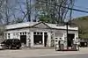 Gas Station at Bridge and Island Streets |
January 22, 1990 (#88002161) |
Bridge and Island Sts. 43°08′06″N 72°26′32″W |
Bellows Falls | |
| 29 | George-Pine-Henry Street Historic District | 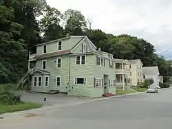 George-Pine-Henry Street Historic District |
July 13, 2010 (#09000918) |
5-22 George St.; 1-17 Pine St.; 32-44 Henry St. 43°07′52″N 72°27′02″W |
Rockingham | |
| 30 | Grafton Congregational Church and Chapel | 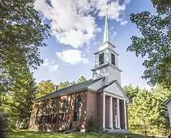 Grafton Congregational Church and Chapel |
December 10, 1979 (#79000230) |
Main St. 43°10′24″N 72°36′42″W |
Grafton | |
| 31 | Grafton District Schoolhouse No. 2 | 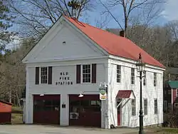 Grafton District Schoolhouse No. 2 |
August 11, 2005 (#05000868) |
217 Main St. 43°10′19″N 72°36′24″W |
Grafton | Also served as a fire station 1922-92. |
| 32 | Grafton Post Office | 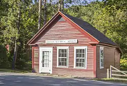 Grafton Post Office |
August 6, 2005 (#05000807) |
205 Main St. 43°10′19″N 72°36′25″W |
Grafton | |
| 33 | Grafton Village Historic District | 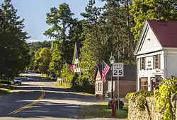 Grafton Village Historic District |
April 7, 2010 (#10000171) |
Main St., Vermont Route 121 E., Townshend Rd., Chester Hill Rd., Hidder Hill Rd., Pleasant St., School St., Middletown Rd., and Hinck 43°10′18″N 72°36′24″W |
Grafton | |
| 34 | Green River Covered Bridge | 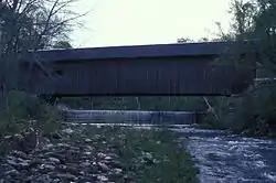 Green River Covered Bridge |
August 28, 1973 (#73000203) |
Across the Green River 42°46′31″N 72°40′04″W |
Green River | |
| 35 | Green River Crib Dam | _Guilford%252C_Vt..jpg.webp) Green River Crib Dam |
April 7, 1995 (#95000374) |
Green River Rd. (Town Highway 5) 42°46′32″N 72°40′04″W |
Guilford | |
| 36 | Lewis Grout House | 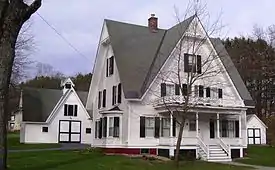 Lewis Grout House |
November 7, 1996 (#96001328) |
960? Western Ave. (at Bonnyvale Rd.) 42°51′13″N 72°36′06″W |
Brattleboro | |
| 37 | Guilford Center Meeting House | 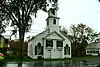 Guilford Center Meeting House |
May 13, 1982 (#82001708) |
4042 Guilford Center Rd. 42°47′31″N 72°37′32″W |
Guilford | |
| 38 | Hall Covered Bridge | 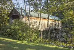 Hall Covered Bridge |
August 28, 1973 (#73000204) |
West of Bellows Falls across the Saxtons River, off Vermont Route 121 43°08′12″N 72°29′16″W |
Bellows Falls | Bridge collapsed in 1980 and was rebuilt as a replica of the old bridge in 1982. |
| 39 | William A. Hall House | 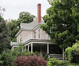 William A. Hall House |
May 5, 1999 (#99000537) |
1 Hapgood St. 43°07′48″N 72°26′44″W |
Bellows Falls | |
| 40 | William Harris House | 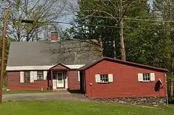 William Harris House |
December 18, 1978 (#78000250) |
Western Ave. 42°51′01″N 72°35′20″W |
Brattleboro | |
| 41 | Deacon John Holbrook House | 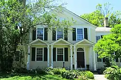 Deacon John Holbrook House |
March 19, 1982 (#82001709) |
80 Linden Street 42°51′24″N 72°33′43″W |
Brattleboro | |
| 42 | Homestead-Horton Neighborhood Historic District | 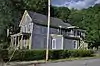 Homestead-Horton Neighborhood Historic District |
April 3, 2009 (#09000160) |
Homestead Pl., Horton Pl., and Canal St. 42°50′49″N 72°33′42″W |
Brattleboro | |
| 43 | Houghtonville Historic District | 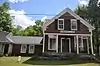 Houghtonville Historic District |
September 8, 2015 (#15000583) |
Houghtonville, Stagecoach & Cabell Rds. 43°11′52″N 72°38′51″W |
Grafton | |
| 44 | Howard Hardware Storehouse | 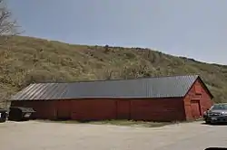 Howard Hardware Storehouse |
January 22, 1990 (#88002163) |
Bridge St. 43°08′09″N 72°26′27″W |
Bellows Falls | |
| 45 | Kidder Covered Bridge | 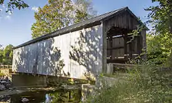 Kidder Covered Bridge |
July 2, 1973 (#73000205) |
Southeast of Grafton 43°10′08″N 72°36′21″W |
Grafton | |
| 46 | Londonderry Town House | 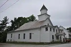 Londonderry Town House |
July 14, 1983 (#83003227) |
Middletown Rd. 43°11′41″N 72°48′54″W |
South Londonderry | |
| 47 | Mechanicsville Historic District |  Mechanicsville Historic District |
September 16, 2010 (#10000766) |
Route 121 E. 43°10′13″N 72°35′57″W |
Grafton | |
| 48 | Medburyville Bridge | 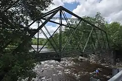 Medburyville Bridge |
November 8, 1990 (#90001746) |
Town Highway 31 over the Deerfield River 42°52′16″N 72°55′12″W |
Wilmington | |
| 49 | Middletown Rural Historic District |  Middletown Rural Historic District |
March 21, 2011 (#11000101) |
Middletown Rd., Avery Park Dr., Middletown Cemetery Rd., Woodchuck Hill Rd., Vermont Route 121 43°11′18″N 72°37′25″W |
Grafton | |
| 50 | Milldean and Alexander-Davis House |  Milldean and Alexander-Davis House |
May 24, 1990 (#90000815) |
Main St. near town center 43°10′19″N 72°36′28″W |
Grafton | |
| 51 | Miss Bellows Falls Diner |  Miss Bellows Falls Diner |
February 15, 1983 (#83003226) |
90 Rockingham St. 43°08′06″N 72°26′51″W |
Bellows Falls | |
| 52 | Moore and Thompson Paper Mill Complex |  Moore and Thompson Paper Mill Complex |
March 16, 1984 (#84003475) |
Bridge St. 43°08′01″N 72°26′29″W |
Bellows Falls | |
| 53 | Naulakha |  Naulakha |
April 11, 1979 (#79000231) |
Off U.S. Route 5 42°53′55″N 72°33′51″W |
Dummerston | Home where Rudyard Kipling wrote The Jungle Book |
| 54 | Newfane Village Historic District |  Newfane Village Historic District |
July 21, 1983 (#83003228) |
Main, West, Church, Court, Depot, and Cross Sts. 42°59′16″N 72°39′26″W |
Newfane | |
| 55 | Oak Hill Cemetery Chapel | 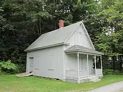 Oak Hill Cemetery Chapel |
November 14, 1991 (#91001613) |
Off Pleasant St. 43°07′32″N 72°27′10″W |
Bellows Falls | |
| 56 | Old Brick Church | 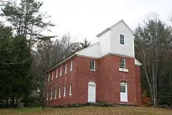 Old Brick Church |
November 30, 1979 (#79000340) |
Off Vermont Route 35 43°07′23″N 72°34′42″W |
Athens | |
| 57 | Park Farm | 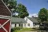 Park Farm |
August 4, 2003 (#03000737) |
26 Woodchuck Hill Rd. 43°11′26″N 72°37′31″W |
Grafton | |
| 58 | Parker Hill Rural Historic District | 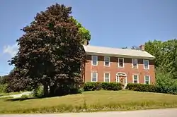 Parker Hill Rural Historic District |
May 20, 1993 (#93000431) |
Parker Hill and Lower Parker Hill Rds. 43°13′25″N 72°28′46″W |
Rockingham | |
| 59 | Pond Road Chapel | 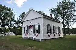 Pond Road Chapel |
May 9, 1985 (#85000959) |
Pond Rd., Town Highway 2 42°44′49″N 72°30′43″W |
Vernon | |
| 60 | Putney Village Historic District | 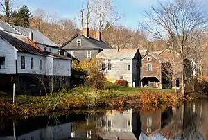 Putney Village Historic District |
February 20, 1986 (#86000324) |
Westminster W Rd., U.S. Route 5, Christian Sq., Old U.S. Route 5, and Depot Rd. 42°58′30″N 72°31′27″W |
Putney | |
| 61 | Rice Farm Road Bridge | 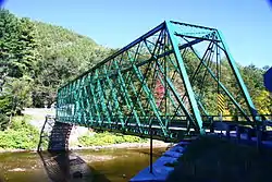 Rice Farm Road Bridge |
November 7, 1995 (#95001259) |
Town Highway 62, off Vermont Route 30 42°54′58″N 72°36′48″W |
Dummerston | |
| 62 | Robertson Paper Company Complex | 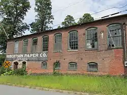 Robertson Paper Company Complex |
January 22, 1990 (#88002165) |
Island St. 43°08′09″N 72°26′36″W |
Bellows Falls | Demolished in 2018-19 |
| 63 | Rockingham Meetinghouse | 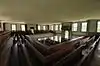 Rockingham Meetinghouse |
September 10, 1979 (#79000232) |
Meeting House Rd. 43°11′16″N 72°29′13″W |
Rockingham | A rare 18th-century New England meetinghouse of the "second period" type. |
| 64 | Rockingham Village Historic District |  Rockingham Village Historic District |
January 4, 2008 (#07001346) |
Meeting House Rd., Rockingham Hill Rd. 43°11′17″N 72°29′20″W |
Rockingham | |
| 65 | Round Schoolhouse |  Round Schoolhouse |
November 23, 1977 (#77000104) |
South of Brookline 43°01′17″N 72°36′17″W |
Brookline | |
| 66 | Sabin-Wheat Farm |  Sabin-Wheat Farm |
July 28, 2004 (#04000771) |
346 Westminster Rd. 42°59′58″N 72°31′55″W |
Putney | |
| 67 | Sacketts Brook Stone Arch Bridge | 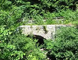 Sacketts Brook Stone Arch Bridge |
December 12, 1976 (#76000151) |
Off U.S. Route 5 on Mill Rd. 42°58′29″N 72°31′05″W |
Putney | |
| 68 | Saxtons River Village Historic District |  Saxtons River Village Historic District |
September 29, 1988 (#88001851) |
Roughly bounded by Burk Hill and Belleview Rds., Oak St., the Saxtons River, and Westminster West Rd. 43°08′19″N 72°30′34″W |
Saxtons River | |
| 69 | Scott Covered Bridge | 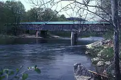 Scott Covered Bridge |
August 28, 1973 (#73000206) |
West of Townshend off Vermont Route 30 43°02′53″N 72°41′50″W |
Townshend | |
| 70 | Scott Farm Historic District | 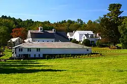 Scott Farm Historic District |
November 19, 2001 (#01001241) |
707 Kipling Rd. 42°54′34″N 72°34′14″W |
Dummerston | |
| 71 | Simpsonville Stone Arch Bridge | 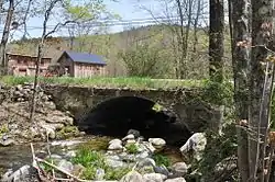 Simpsonville Stone Arch Bridge |
April 11, 1977 (#77000105) |
North of Townshend on Vermont Route 35 43°04′13″N 72°39′19″W |
Townshend | |
| 72 | Samuel Gilbert Smith Farmstead | 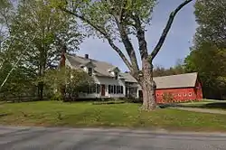 Samuel Gilbert Smith Farmstead |
July 20, 2000 (#00000830) |
375 Orchard St. 42°51′38″N 72°35′19″W |
Brattleboro | |
| 73 | South Londonderry Village Historic District | 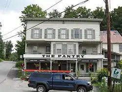 South Londonderry Village Historic District |
July 24, 1986 (#86001943) |
Church, Main, River, School, and Farnum Sts., and Melendy Hill Rd. 43°11′18″N 72°48′43″W |
South Londonderry | |
| 74 | South Newfane Bridge | 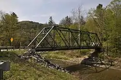 South Newfane Bridge |
September 8, 1992 (#92001174) |
Town Highway 26 (Parish Hill Rd.) over the Rock River 42°56′16″N 72°42′18″W |
Newfane | |
| 75 | South Windham Village Historic District |  South Windham Village Historic District |
October 27, 1988 (#88002061) |
Town Highways 1 and 26 43°07′42″N 72°42′47″W |
Windham | |
| 76 | Stratton Mountain Lookout Tower | 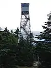 Stratton Mountain Lookout Tower |
June 17, 1992 (#92000687) |
Summit of Stratton Mountain in the Green Mountain National Forest 43°05′09″N 72°55′30″W |
Stratton | |
| 77 | Tontine Building |  Tontine Building |
May 2, 2008 (#08000158) |
500 Coolidge Highway 42°49′03″N 72°34′31″W |
Guilford | |
| 78 | Townshend State Park | 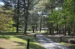 Townshend State Park |
February 14, 2002 (#02000030) |
2755 State Forest Rd. 43°02′13″N 72°42′15″W |
Townshend | |
| 79 | Union Station | 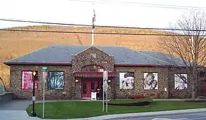 Union Station |
June 7, 1974 (#74000268) |
Junction of Bridge St. and Boston and Maine railroad tracks 42°51′05″N 72°33′25″W |
Brattleboro | |
| 80 | Vermont Academy Campus Historic District | 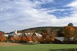 Vermont Academy Campus Historic District |
July 14, 2015 (#15000423) |
10 Long Walk 43°08′31″N 72°30′32″W |
Rockingham | |
| 81 | Vernon District Schoolhouse No. 4 |  Vernon District Schoolhouse No. 4 |
November 9, 2005 (#05001236) |
4201 Fort Bridgman Rd. 42°44′14″N 72°28′11″W |
Vernon | |
| 82 | West Brattleboro Green Historic District |  West Brattleboro Green Historic District |
June 24, 2002 (#02000675) |
870-950 Western Ave., 19-35 South St., and town common. 42°51′09″N 72°36′00″W |
Brattleboro | |
| 83 | West Dover Village Historic District | 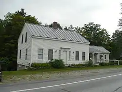 West Dover Village Historic District |
October 24, 1985 (#85003381) |
Vermont Route 100, Valley View, Cross Town, Parsonage, Dorr Fitch, and Bogle Rds. 42°56′14″N 72°51′03″W |
Dover | |
| 84 | West Dummerston Covered Bridge | 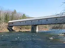 West Dummerston Covered Bridge |
May 8, 1973 (#73000207) |
Dummerston Center Rd. and Vermont Route 30, over the West River 42°56′12″N 72°36′49″W |
Dummerston | |
| 85 | West Townshend Stone Arch Bridge | 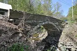 West Townshend Stone Arch Bridge |
April 18, 1977 (#77000106) |
Spans Tannery Brook 43°05′03″N 72°42′36″W |
West Townshend | |
| 86 | West Townshend Village Historic District |  West Townshend Village Historic District |
September 11, 1986 (#86001502) |
Roughly Main St. from Old Vermont Route 30 to Vermont Route 30 and Town Roads 7, 23, 47, 49, and 50 43°04′55″N 72°42′38″W |
West Townshend | |
| 87 | Westminster Terrace Historic District |  Westminster Terrace Historic District |
July 13, 2010 (#09000265) |
Along Westminster Terrace 43°07′36″N 72°26′34″W |
Rockingham and Westminster | |
| 88 | Westminster Village Historic District |  Westminster Village Historic District |
July 14, 1988 (#88001058) |
Main and School Sts., and Grout Ave. 43°04′03″N 72°27′42″W |
Westminster | |
| 89 | Wheelock House |  Wheelock House |
May 8, 1986 (#86001033) |
Vermont Route 30 43°02′01″N 72°39′49″W |
Townshend | |
| 90 | Whitingham Village Historic District |  Whitingham Village Historic District |
March 15, 2006 (#06000140) |
Vermont Route 100, School St., Brook St., and Stimpson Hill Rd. 42°47′25″N 72°52′49″W |
Whitingham | |
| 91 | Williams River Route 5 Bridge | 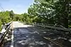 Williams River Route 5 Bridge |
November 14, 1991 (#91001603) |
U.S. Route 5 over the Williams River 43°10′57″N 72°27′36″W |
Rockingham | |
| 92 | Williams Street Extension Historic District | 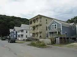 Williams Street Extension Historic District |
July 13, 2010 (#09000893) |
51-58, 61-68, 70 Williams St. 43°08′08″N 72°27′09″W |
Rockingham | |
| 93 | Williamsville Covered Bridge | 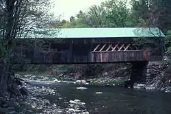 Williamsville Covered Bridge |
August 14, 1973 (#73000208) |
Southwest of Newfane at Williamsville 42°56′34″N 72°41′17″W |
Newfane | |
| 94 | Wilmington Village Historic District | 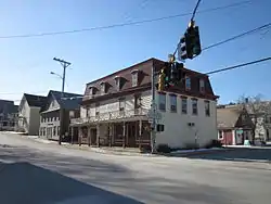 Wilmington Village Historic District |
August 11, 1980 (#80000389) |
Vermont Routes 9 and 100 42°52′09″N 72°52′30″W |
Wilmington | |
| 95 | Windham Village Historic District | 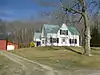 Windham Village Historic District |
November 1, 1984 (#84000428) |
Town Hill Rd. 43°10′37″N 72°43′38″W |
Windham | |
| 96 | Worrall Covered Bridge | 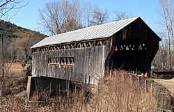 Worrall Covered Bridge |
July 16, 1973 (#73000209) |
North of Rockingham across the Williams River 43°12′42″N 72°32′09″W |
Rockingham | |
| 97 | Arthur D. and Emma J. Wyatt House |  Arthur D. and Emma J. Wyatt House |
May 10, 2005 (#05000420) |
125 Putney Rd. 42°51′32″N 72°33′30″W |
Brattleboro |
See also
| Wikimedia Commons has media related to National Register of Historic Places in Windham County, Vermont. |
References
- The latitude and longitude information provided in this table was derived originally from the National Register Information System, which has been found to be fairly accurate for about 99% of listings. Some locations in this table may have been corrected to current GPS standards.
- "National Register of Historic Places: Weekly List Actions". National Park Service, United States Department of the Interior. Retrieved on January 29, 2021.
- Numbers represent an alphabetical ordering by significant words. Various colorings, defined here, differentiate National Historic Landmarks and historic districts from other NRHP buildings, structures, sites or objects.
- "National Register Information System". National Register of Historic Places. National Park Service. April 24, 2008.
- The eight-digit number below each date is the number assigned to each location in the National Register Information System database, which can be viewed by clicking the number.
- Flooding takes toll on historic bridges Archived 2012-03-24 at the Wayback Machine, WCAX.com
| Topics | |
|---|---|
| Lists by state |
|
| Lists by insular areas | |
| Lists by associated state | |
| Other areas | |
| Related | |
| |
Municipalities and communities of Windham County, Vermont, United States | ||
|---|---|---|
| Towns | Map of Vermont highlighting Windham County | |
| Villages | ||
| CDPs | ||
| Other communities | ||
| Footnotes | ‡ Disincorporated | |
| ||
This article is issued from Wikipedia. The text is licensed under Creative Commons - Attribution - Sharealike. Additional terms may apply for the media files.