National Register of Historic Places listings in Orange County, Vermont
This is a list of the National Register of Historic Places listings in Orange County, Vermont.
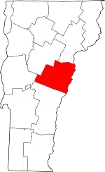
Location of Orange County in Vermont
This is intended to be a complete list of the properties and districts on the National Register of Historic Places in Orange County, Vermont, United States. Latitude and longitude coordinates are provided for many National Register properties and districts; these locations may be seen together in a map.[1]
There are 63 properties and districts listed on the National Register in the county, including 1 National Historic Landmark.
- This National Park Service list is complete through NPS recent listings posted January 29, 2021.[2]
| Addison - Bennington - Caledonia - Chittenden - Essex - Franklin - Grand Isle - Lamoille - Orange - Orleans - Rutland - Washington - Windham - Windsor |
Current listings
| [3] | Name on the Register[4] | Image | Date listed[5] | Location | City or town | Description |
|---|---|---|---|---|---|---|
| 1 | Allis State Park | 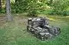 Allis State Park |
March 29, 2002 (#02000280) |
VT 65 44°02′41″N 72°38′12″W |
Brookfield | |
| 2 | Aloha Camp | 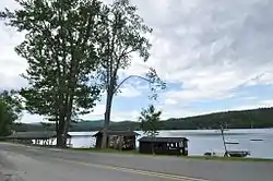 Aloha Camp |
September 5, 2003 (#03000892) |
2039 Lake Morey Rd. 43°55′41″N 72°09′18″W |
Fairlee | |
| 3 | Aloha Hive Camp | 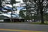 Aloha Hive Camp |
September 5, 2003 (#03000893) |
846 VT 244 43°53′32″N 72°13′08″W |
West Fairlee | |
| 4 | Bayley Historic District |  Bayley Historic District |
July 28, 1983 (#83003211) |
US 5 and Oxbow St. 44°05′11″N 72°03′09″W |
Newbury | |
| 5 | Bedell Covered Bridge | 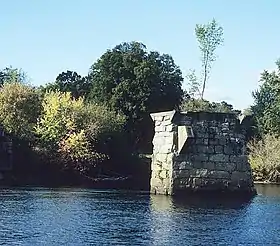 Bedell Covered Bridge |
May 28, 1975 (#75002171) |
Crossed the Connecticut River between Haverhill, New Hampshire and Newbury, Vermont 44°02′53″N 72°04′20″W |
Newbury | Blown away by high winds in 1979. |
| 6 | Bradford Village Historic District |  Bradford Village Historic District |
May 28, 1975 (#75000142) |
Residential area along Main, Depot, Pleasant, High, and Mill Sts., Wrights Ave., Goshen Rd., and U.S. Route 5 43°59′52″N 72°07′29″W |
Bradford | |
| 7 | Braley Covered Bridge | 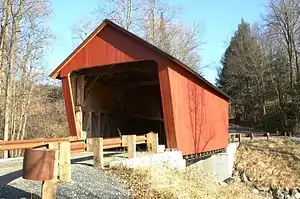 Braley Covered Bridge |
June 13, 1974 (#74000236) |
East of Randolph off VT 14, over the Second Branch of the White River 43°55′42″N 72°33′26″W |
Randolph | |
| 8 | Bridge 22 | 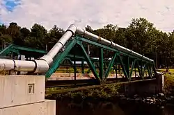 Bridge 22 |
November 3, 2010 (#10000878) |
Town Highway 27 (Creamery Rd) 43°59′17″N 72°07′48″W |
Bradford | Metal Truss, Masonry, and Concrete Bridges in Vermont MPS |
| 9 | Brock Hill Schoolhouse | 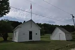 Brock Hill Schoolhouse |
August 4, 2003 (#03000738) |
North Rd. 44°05′59″N 72°08′30″W |
Newbury | |
| 10 | Brookfield Village Historic District | 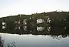 Brookfield Village Historic District |
March 28, 1974 (#74000237) |
Sunset Lake area 44°02′35″N 72°36′07″W |
Brookfield | |
| 11 | Camp Billings | 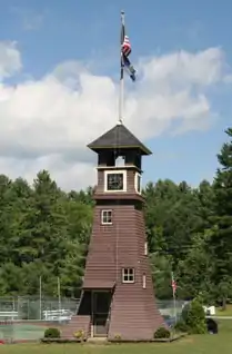 Camp Billings |
January 11, 2006 (#05001524) |
1452 VT 244 43°53′25″N 72°13′58″W |
Thetford | |
| 12 | Camp Wyoda | 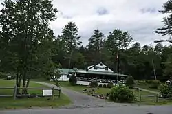 Camp Wyoda |
September 5, 2003 (#03000895) |
43 Middlebrook Rd. 43°53′28″N 72°13′51″W |
West Fairlee | Now known as Aloha Horizons Camp |
| 13 | Chandler Music Hall and Bethany Parish House |  Chandler Music Hall and Bethany Parish House |
July 16, 1973 (#73000196) |
71 Main St. 43°55′32″N 72°39′57″W |
Randolph | |
| 14 | Elwin Chase House | 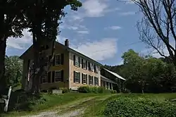 Elwin Chase House |
November 2, 1977 (#77000099) |
366 Topsham-Corinth Rd. 44°07′12″N 72°14′21″W |
Topsham | |
| 15 | Chelsea Village Historic District | 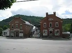 Chelsea Village Historic District |
September 29, 1983 (#83003212) |
N. and S. Main, Jail, School, Court, and Church Sts., and Maple and Highland Aves. 43°59′23″N 72°26′51″W |
Chelsea | |
| 16 | Cilley Covered Bridge | 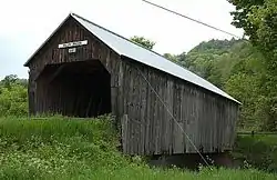 Cilley Covered Bridge |
September 10, 1974 (#74000238) |
Southwest of Tunbridge over the First Branch of the White River 43°52′59″N 72°30′17″W |
Tunbridge | |
| 17 | Congregational Church of Chelsea | 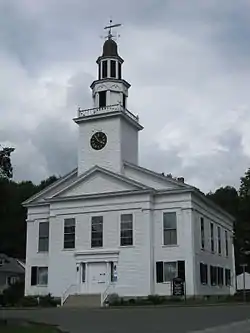 Congregational Church of Chelsea |
September 3, 1976 (#76000140) |
Chelsea Green 43°59′19″N 72°26′48″W |
Chelsea | |
| 18 | Depot Square Historic District |  Depot Square Historic District |
May 29, 1975 (#75000143) |
Both sides of Main, Pleasant and Salisbury Sts., and both sides of the Central Vermont Railway tracks 43°55′23″N 72°39′58″W |
Randolph | |
| 19 | Ely Boston & Maine Railroad Depot |  Ely Boston & Maine Railroad Depot |
December 9, 1994 (#94001448) |
U.S. Route 5 south of its junction with VT 244 43°52′24″N 72°10′40″W |
Fairlee | |
| 20 | Fairlee Railroad Depot |  Fairlee Railroad Depot |
July 23, 1998 (#98000906) |
Between U.S. Route 5 and the Boston and Maine Railroad tracks 43°54′23″N 72°08′40″W |
Fairlee | |
| 21 | Fairlee Town Hall | 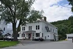 Fairlee Town Hall |
February 25, 2014 (#14000044) |
75 Town Common Rd. 43°54′30″N 72°08′32″W |
Fairlee | |
| 22 | Flint Covered Bridge | .jpg.webp) Flint Covered Bridge |
September 10, 1974 (#74000239) |
Northeast of Tunbridge off VT 110, over the First Branch of the White River 43°56′56″N 72°27′31″W |
Tunbridge | |
| 23 | Foundry Bridge | 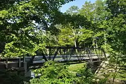 Foundry Bridge |
July 11, 2007 (#07000692) |
Foundry Rd. 43°54′52″N 72°28′37″W |
Tunbridge | |
| 24 | Gifford Covered Bridge | 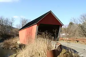 Gifford Covered Bridge |
July 30, 1974 (#74000240) |
South of Randolph off VT 14 over the Second Branch of the White River 43°55′00″N 72°33′25″W |
East Randolph | |
| 25 | Goshen Church |  Goshen Church |
September 3, 1976 (#76000141) |
North of Bradford on Goshen Rd. 44°02′52″N 72°08′54″W |
Bradford | |
| 26 | Hayward and Kibby Mill | 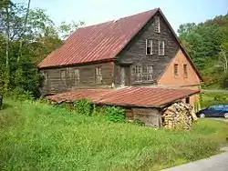 Hayward and Kibby Mill |
March 12, 1992 (#92000094) |
Spring Rd. at the First Branch of the White River 43°53′29″N 72°29′31″W |
Tunbridge | |
| 27 | Howe Covered Bridge | 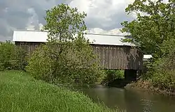 Howe Covered Bridge |
September 10, 1974 (#74000241) |
South of Tunbridge off VT 110, over the First Branch of the White River 43°51′53″N 72°29′58″W |
Tunbridge | |
| 28 | Kimball Public Library |  Kimball Public Library |
March 14, 1985 (#85000568) |
67 Main St. 43°55′31″N 72°39′58″W |
Randolph | |
| 29 | Kingsbury Covered Bridge |  Kingsbury Covered Bridge |
July 30, 1974 (#74000242) |
South of East Randolph off VT 14 over the Second Branch of the White River 43°52′52″N 72°34′56″W |
East Randolph | |
| 30 | Lanakila Camp |  Lanakila Camp |
September 5, 2003 (#03000894) |
2899 Lake Morey Rd. 43°56′12″N 72°08′30″W |
Fairlee | |
| 31 | Larkin Covered Bridge | 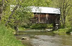 Larkin Covered Bridge |
July 30, 1974 (#74000327) |
Northeast of North Tunbridge off VT 110 over the First Branch of the White River 43°55′22″N 72°27′56″W |
Tunbridge | |
| 32 | Lyme–East Thetford Bridge | .jpg.webp) Lyme–East Thetford Bridge |
March 27, 2020 (#100005159) |
VT 113 / East Thetford Rd. over the Connecticut R. 43°48′44″N 72°10′59″W |
Thetford | Extends into Grafton County, New Hampshire |
| 33 | Mari-Castle | 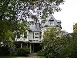 Mari-Castle |
May 24, 1990 (#90000796) |
41 S. Main St. 43°55′03″N 72°40′06″W |
Randolph | |
| 34 | Asa May House |  Asa May House |
April 7, 1993 (#93000240) |
Town Highway 4 (Blood Brook Rd.) southeast of West Fairlee Center 43°55′33″N 72°12′32″W |
West Fairlee | |
| 35 | Mill Covered Bridge | 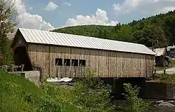 Mill Covered Bridge |
July 30, 1974 (#74000243) |
West of VT 110, over the First Branch of the White River 43°53′29″N 72°29′31″W |
Tunbridge | |
| 36 | The Samuel Morey Memorial Bridge | 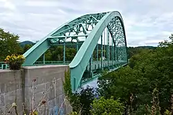 The Samuel Morey Memorial Bridge |
December 8, 1997 (#97001523) |
NH 25A over the Connecticut River 43°54′25″N 72°08′23″W |
Fairlee | Extends into Grafton County, New Hampshire |
| 37 | Justin Smith Morrill Homestead | 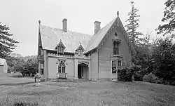 Justin Smith Morrill Homestead |
October 15, 1966 (#66000795) |
South of the Common 43°51′46″N 72°22′33″W |
Strafford | Gothic Revival home of Justin Smith Morrill, Vermont Representative and Senator known for the 1862 and 1890 Morrill Land-Grant Colleges Acts. |
| 38 | Moxley Covered Bridge | 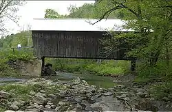 Moxley Covered Bridge |
September 10, 1974 (#74000244) |
South of Chelsea over the First Branch of the White River 43°57′25″N 72°27′49″W |
Chelsea | |
| 39 | Newbury Town House | 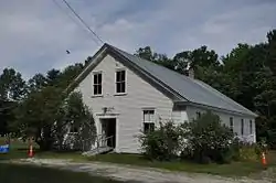 Newbury Town House |
July 28, 1983 (#83003213) |
Scotch Hollow Rd. 44°06′22″N 72°07′34″W |
Newbury | |
| 40 | Newbury Village Historic District | 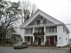 Newbury Village Historic District |
August 4, 1983 (#83003214) |
Main, Pulaski, Cross, and Pine Sts., Chapel Rd. and Romance Lane 44°04′40″N 72°03′29″W |
Newbury | |
| 41 | Marvin Newton House | 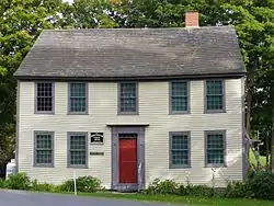 Marvin Newton House |
June 11, 1980 (#80000337) |
Ridge Rd. 44°01′27″N 72°36′07″W |
Brookfield | |
| 42 | Oxbow Historic District | 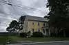 Oxbow Historic District |
July 28, 1983 (#83003215) |
US 5 44°05′42″N 72°02′50″W |
Newbury | |
| 43 | Peabody Library | 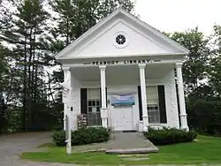 Peabody Library |
September 27, 1984 (#84003466) |
7299 VT 113 43°53′07″N 72°15′40″W |
Thetford | |
| 44 | Piermont Bridge |  Piermont Bridge |
June 6, 2001 (#01000630) |
NH 25 over the Connecticut River 43°58′40″N 72°06′45″W |
Bradford | Extends into Grafton County, New Hampshire |
| 45 | Post Mills Church | 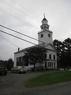 Post Mills Church |
October 29, 1992 (#92001489) |
VT 244 east of its junction with VT 113 43°53′14″N 72°15′08″W |
Thetford | |
| 46 | Randolph Center Historic District | 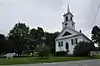 Randolph Center Historic District |
November 21, 1974 (#74000245) |
West and Main Sts. 43°56′18″N 72°36′46″W |
Randolph | |
| 47 | South Newbury Village Historic District |  South Newbury Village Historic District |
July 28, 1983 (#83003216) |
U.S. Route 5 and Doe Hill Rd. 44°02′44″N 72°05′11″W |
Newbury | |
| 48 | South Tunbridge Methodist Episcopal Church |  South Tunbridge Methodist Episcopal Church |
March 2, 2001 (#01000215) |
VT 110 1/3 mile north of the Royalton town line 43°51′24″N 72°30′07″W |
Tunbridge | |
| 49 | Strafford Village Historic District |  Strafford Village Historic District |
June 20, 1974 (#74000246) |
Roughly both sides of the Morrill Highway and Sharon Brook Rd. 43°51′54″N 72°22′44″W |
Strafford | |
| 50 | Stratton's Inn |  Stratton's Inn |
July 29, 1982 (#82001703) |
East of Brookfield on East St. 44°03′00″N 72°35′00″W |
Brookfield | |
| 51 | Thetford Center Covered Bridge | 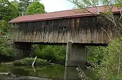 Thetford Center Covered Bridge |
September 17, 1974 (#74000247) |
Over the Ompompanoosuc River 43°49′55″N 72°15′12″W |
Thetford | |
| 52 | Thetford Center Historic District | 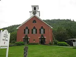 Thetford Center Historic District |
March 5, 1998 (#98000220) |
Roughly along VT 113, Tucker Hill Rd., and Buzzell Bridge Rd. 43°49′46″N 72°15′02″W |
Thetford | |
| 53 | Thetford Hill Historic District | 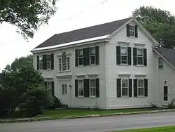 Thetford Hill Historic District |
October 27, 1988 (#88002134) |
Roughly VT 113 and Academy Rd. 43°49′01″N 72°13′44″W |
Thetford | |
| 54 | Thetford Hill State Park |  Thetford Hill State Park |
February 14, 2002 (#02000029) |
622 Academy Rd. 43°48′43″N 72°14′24″W |
Thetford | |
| 55 | Tunbridge Village Historic District | 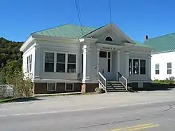 Tunbridge Village Historic District |
June 24, 1994 (#94000635) |
Roughly, along VT 110 and adjacent roads including Town Road 45 and Spring and Stafford Rds. 43°53′15″N 72°29′42″W |
Tunbridge | |
| 56 | Union Village Covered Bridge | 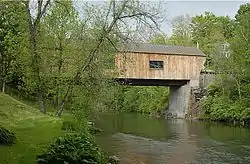 Union Village Covered Bridge |
September 17, 1974 (#74000248) |
Over the Ompompanoosuc River 43°47′19″N 72°15′17″W |
Thetford | |
| 57 | Waits River Schoolhouse | 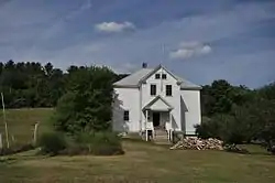 Waits River Schoolhouse |
September 27, 1988 (#88002656) |
VT 25 north of Waits River 44°05′29″N 72°17′09″W |
Waits River | |
| 58 | Wells River Graded School | 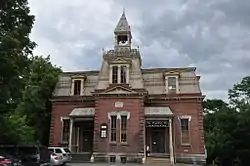 Wells River Graded School |
September 3, 1976 (#76000142) |
Main St. 44°09′06″N 72°02′44″W |
Wells River | |
| 59 | Wells River Village Historic District |  Wells River Village Historic District |
July 28, 1983 (#83003217) |
Main, Center, Grove, Cross, and Water Sts. 44°09′08″N 72°02′53″W |
Wells River | |
| 60 | West Fairlee Center Church | 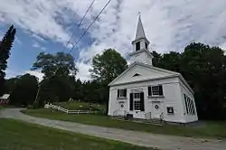 West Fairlee Center Church |
June 21, 2002 (#02000662) |
3870 Middlebrook Rd. 43°56′34″N 72°13′31″W |
West Fairlee | |
| 61 | West Newbury Village Historic District |  West Newbury Village Historic District |
September 15, 1983 (#83003218) |
Snake and Tucker Mtn. Rds. 44°03′44″N 72°07′29″W |
Newbury | |
| 62 | Harlie Whitcomb Farm |  Harlie Whitcomb Farm |
September 11, 1979 (#79000224) |
George Street past the cemetery 44°09′23″N 72°24′03″W |
Orange | Listed in Barre vicinity |
| 63 | Wildwood Hall |  Wildwood Hall |
October 2, 1978 (#78000237) |
Moore's Hill Rd. 44°03′54″N 72°04′24″W |
Newbury |
See also
| Wikimedia Commons has media related to National Register of Historic Places in Orange County, Vermont. |
References
- The latitude and longitude information provided in this table was derived originally from the National Register Information System, which has been found to be fairly accurate for about 99% of listings. Some locations in this table may have been corrected to current GPS standards.
- "National Register of Historic Places: Weekly List Actions". National Park Service, United States Department of the Interior. Retrieved on January 29, 2021.
- Numbers represent an alphabetical ordering by significant words. Various colorings, defined here, differentiate National Historic Landmarks and historic districts from other NRHP buildings, structures, sites or objects.
- "National Register Information System". National Register of Historic Places. National Park Service. April 24, 2008.
- The eight-digit number below each date is the number assigned to each location in the National Register Information System database, which can be viewed by clicking the number.
| Topics | |
|---|---|
| Lists by state |
|
| Lists by insular areas | |
| Lists by associated state | |
| Other areas | |
| Related | |
| |
Municipalities and communities of Orange County, Vermont, United States | ||
|---|---|---|
| Towns | Map of Vermont highlighting Orange County | |
| Villages | ||
| CDPs | ||
| Other communities | ||
| ||
This article is issued from Wikipedia. The text is licensed under Creative Commons - Attribution - Sharealike. Additional terms may apply for the media files.