National Register of Historic Places listings in Addison County, Vermont
This is a list of the National Register of Historic Places listings in Addison County, Vermont.
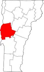
Location of Addison County in Vermont
This is intended to be a complete list of the properties and districts on the National Register of Historic Places in Addison County, Vermont, United States. Latitude and longitude coordinates are provided for many National Register properties and districts; these locations may be seen together in a map.[1]
There are 70 properties and districts listed on the National Register in the county, including 4 National Historic Landmarks. Two properties were once listed, but have been removed.
- This National Park Service list is complete through NPS recent listings posted February 5, 2021.[2]
| Addison - Bennington - Caledonia - Chittenden - Essex - Franklin - Grand Isle - Lamoille - Orange - Orleans - Rutland - Washington - Windham - Windsor |
Current listings
| [3] | Name on the Register[4] | Image | Date listed[5] | Location | City or town | Description |
|---|---|---|---|---|---|---|
| 1 | Addison Baptist Church | 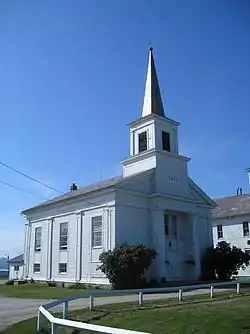 Addison Baptist Church |
November 2, 1978 (#78003202) |
Junction of VT 22A and VT 17 44°05′19″N 73°18′10″W |
Addison | |
| 2 | Bottum Farm | 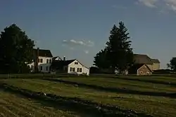 Bottum Farm |
March 7, 2008 (#08000157) |
1423 North St. 44°08′41″N 73°09′29″W |
New Haven | |
| 3 | Bridge 26 | 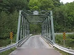 Bridge 26 |
June 7, 2006 (#06000488) |
Town Highway 11, Morgan Horse Farm Rd., over Otter Creek 44°04′23″N 73°11′39″W |
Weybridge | |
| 4 | Bristol Downtown Historic District |  Bristol Downtown Historic District |
February 3, 1983 (#83003203) |
Main St. 44°07′57″N 73°04′40″W |
Bristol | |
| 5 | Camp Marbury Historic District | December 6, 2018 (#100003222) |
243, 245 & 293 Mile Point Rd. 44°11′59″N 73°21′26″W |
Ferrisburgh | ||
| 6 | Cedar Swamp Covered Bridge | 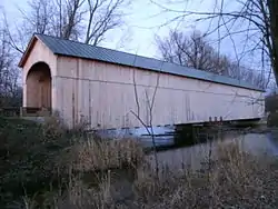 Cedar Swamp Covered Bridge |
September 10, 1974 (#74000386) |
West of West Salisbury over Otter Creek 43°55′06″N 73°10′28″W |
West Salisbury | |
| 7 | Chimney Point Tavern |  Chimney Point Tavern |
March 31, 1971 (#71000073) |
VT 125 44°02′04″N 73°25′18″W |
Addison | |
| 8 | Chipman's Point |  Chipman's Point |
December 26, 1996 (#96001519) |
Chipman Point Rd. 43°47′59″N 73°22′32″W |
Orwell | |
| 9 | Cornwall General Store |  Cornwall General Store |
August 6, 2005 (#05000804) |
2635 VT 30, Seth Warner Highway 43°57′40″N 73°12′34″W |
Cornwall | Demolished c. 2013. |
| 10 | Cornwall Town Hall | 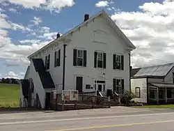 Cornwall Town Hall |
May 8, 1986 (#86001035) |
VT 30 43°57′41″N 73°12′52″W |
Cornwall | |
| 11 | Cotton Free Library | 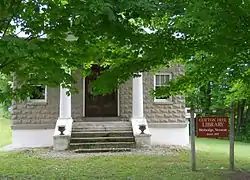 Cotton Free Library |
April 4, 1996 (#96000388) |
Quaker Village Rd., near the junction of Baker Ct. and Quaker Village Rd. 44°03′54″N 73°12′57″W |
Weybridge | |
| 12 | Capts. Louis and Philomene Daniels House |  Capts. Louis and Philomene Daniels House |
July 11, 2001 (#01000733) |
50 Macdonough Dr. 44°10′12″N 73°15′28″W |
Vergennes | |
| 13 | District School No. 1 | 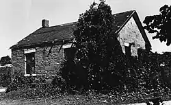 District School No. 1 |
April 17, 1980 (#80000323) |
Lake Rd. 44°07′37″N 73°21′53″W |
Panton | |
| 14 | District Six Schoolhouse |  District Six Schoolhouse |
August 18, 1977 (#77000093) |
Elmendorf Road 43°55′52″N 73°17′48″W |
Shoreham | |
| 15 | Colonel Ephraim and Sarah Doolittle Farm |  Colonel Ephraim and Sarah Doolittle Farm |
January 6, 1995 (#94001523) |
1 mi (1.6 km) east of VT 22A on Doolittle Rd. 43°56′19″N 73°18′16″W |
Shoreham | |
| 16 | East Shoreham Covered Railroad Bridge |  East Shoreham Covered Railroad Bridge |
June 13, 1974 (#74000198) |
Southeast of Shoreham over the Lemon Fair River 43°51′33″N 73°15′22″W |
Shoreham | |
| 17 | Fenn Farm | January 6, 1995 (#94001518) |
Western side of VT 116 (Case St.) 43°58′46″N 73°06′16″W |
Middlebury | ||
| 18 | Field Farm |  Field Farm |
March 10, 1995 (#95000214) |
Fuller Mountain Rd. 44°13′34″N 73°11′56″W |
Ferrisburgh | |
| 19 | First Congregational Church | 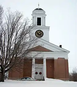 First Congregational Church |
March 2, 2001 (#01000210) |
464 Main St. 43°48′15″N 73°18′03″W |
Orwell | |
| 20 | First Congregational Church of Cornwall Parsonage | 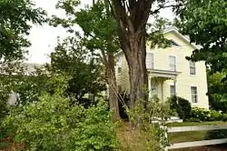 First Congregational Church of Cornwall Parsonage |
June 29, 2015 (#15000376) |
18 VT 74 43°57′39″N 73°12′36″W |
Cornwall | |
| 21 | Paris and Anna Fletcher House | .jpg.webp) Paris and Anna Fletcher House |
February 12, 1999 (#99000218) |
VT 22A, north of its junction with Middle Rd. 43°59′07″N 73°18′48″W |
Bridport | |
| 22 | Robert Frost Farm | Robert Frost Farm |
May 23, 1968 (#68000046) |
1 mi (1.6 km) north of VT 125, 3 mi (4.8 km) east of Ripton 43°58′08″N 72°59′49″W |
Ripton | Homestead of author Robert Frost; now owned by Middlebury College. |
| 23 | Glen Dale | 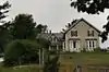 Glen Dale |
July 11, 2002 (#02000776) |
1455 Cider Mill Rd. 44°00′10″N 73°12′34″W |
Cornwall | |
| 24 | Halpin Covered Bridge | 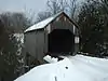 Halpin Covered Bridge |
September 10, 1974 (#74000199) |
Northeast of Middlebury 44°03′00″N 73°08′28″W |
Middlebury | |
| 25 | John Hamilton Farmstead | 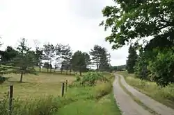 John Hamilton Farmstead |
June 17, 1993 (#93000531) |
VT 125 west of the Lemon Fair River 43°59′18″N 73°16′33″W |
Bridport | |
| 26 | Hand's Cove | 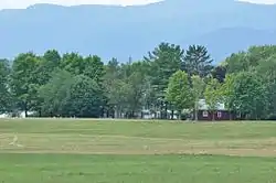 Hand's Cove |
May 22, 1980 (#80000324) |
Southwest of Shoreham on Hands Cove Rd. 43°52′02″N 73°21′56″W |
Shoreham | |
| 27 | Hawley's Ferry House |  Hawley's Ferry House |
November 2, 1978 (#78000224) |
Northwest of Ferrisburg on Kingsland Bay 44°14′26″N 73°17′52″W |
Ferrisburg | |
| 28 | The Heights | 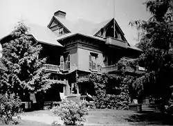 The Heights |
December 29, 1988 (#88003082) |
South St./VT 30 44°00′18″N 73°10′54″W |
Middlebury | Also known as Thaddeus Chapman House |
| 29 | Hoag Gristmill and Knight House Complex |  Hoag Gristmill and Knight House Complex |
April 22, 1980 (#80000325) |
Northwest of Starksboro on State Prison Hollow Rd. 44°14′37″N 73°04′08″W |
Starksboro | |
| 30 | House at 215 School Street | 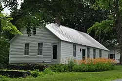 House at 215 School Street |
December 16, 2005 (#05001423) |
215 School St. 43°53′33″N 73°18′55″W |
Shoreham | |
| 31 | Lampson School | .jpg.webp) Lampson School |
December 21, 2001 (#01001363) |
44 Sumner Rd. 44°05′30″N 73°06′34″W |
New Haven | |
| 32 | Larrabee's Point Complex | 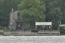 Larrabee's Point Complex |
May 1, 1980 (#80000423) |
Southwest of Shoreham 43°51′20″N 73°22′36″W |
Shoreham | |
| 33 | Leicester Meeting House | 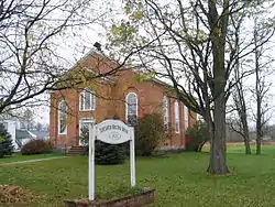 Leicester Meeting House |
July 28, 1988 (#88001043) |
U.S. Route 7 and Town Highway 1 43°51′58″N 73°06′32″W |
Leicester | |
| 34 | Middlebury Gorge Concrete Arch Bridge |  Middlebury Gorge Concrete Arch Bridge |
November 14, 1991 (#91001604) |
Vermont 125 over the Middlebury River 43°58′12″N 73°05′11″W |
East Middlebury | |
| 35 | Middlebury Village Historic District | 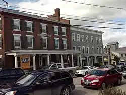 Middlebury Village Historic District |
November 13, 1976 (#76000223) |
U.S. Route 7; also VT 30 and VT 125 44°00′51″N 73°10′04″W |
Middlebury | Vermont highway addresses represent a boundary increases |
| 36 | Monkton Borough Baptist Church | 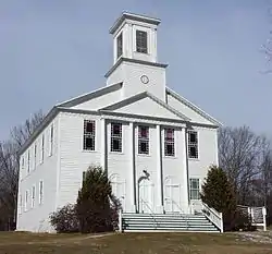 Monkton Borough Baptist Church |
January 5, 1989 (#88003121) |
Town Highway 1 (Monkton Rd.) 44°14′18″N 73°08′42″W |
Monkton | Now used as a Grange hall. |
| 37 | Monkton Town Hall |  Monkton Town Hall |
January 3, 1978 (#78000225) |
North of Monkton on Monkton Ridge Rd. 44°15′13″N 73°07′30″W |
Monkton | |
| 38 | Mount Independence |  Mount Independence |
September 3, 1971 (#71000079) |
On Lake Champlain opposite Fort Ticonderoga, northwest of Orwell 43°49′33″N 73°23′02″W |
Orwell | Site of Fort Independence, an American Revolutionary War fortification built opposite Fort Ticonderoga. |
| 39 | New Haven Junction Depot | 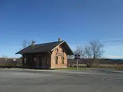 New Haven Junction Depot |
October 19, 1978 (#78000226) |
Junction of U.S. Route 7 and VT 17 44°07′24″N 73°11′00″W |
New Haven | |
| 40 | Old Stone Blacksmith Shop | 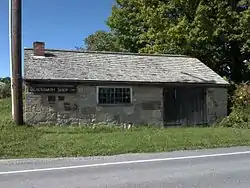 Old Stone Blacksmith Shop |
April 21, 1975 (#75000136) |
North of Cornwall on VT 30 43°58′39″N 73°12′21″W |
Cornwall | |
| 41 | Orwell Site |  Orwell Site |
April 11, 1977 (#77000094) |
Address Restricted |
Orwell | |
| 42 | Pulp Mill Covered Bridge | 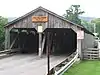 Pulp Mill Covered Bridge |
September 10, 1974 (#74000200) |
Northwest of Middlebury off VT 23 44°01′29″N 73°10′41″W |
Middlebury | |
| 43 | Ripton Community House | 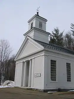 Ripton Community House |
July 3, 1973 (#73000180) |
On VT 125 43°58′30″N 73°02′14″W |
Ripton | |
| 44 | Rokeby | 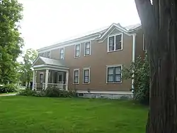 Rokeby |
June 20, 1974 (#74000201) |
North of Ferrisburg off U.S. Route 7 44°13′21″N 73°14′17″W |
Ferrisburg | Robinson family farmstead significant for its role in the Underground Railroad |
| 45 | Salisbury Congregational Church | 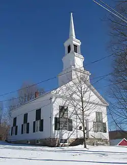 Salisbury Congregational Church |
March 2, 2001 (#01000212) |
West Salisbury Rd. 43°53′49″N 73°06′10″W |
Salisbury | |
| 46 | Salisbury Fish Hatchery | 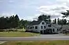 Salisbury Fish Hatchery |
March 24, 1994 (#94000176) |
VT 53, southeast of its junction with Smead Rd. 43°55′29″N 73°05′47″W |
Salisbury | |
| 47 | Salisbury Town Hall | 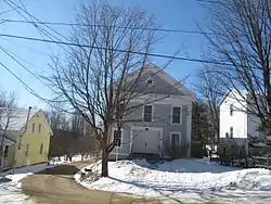 Salisbury Town Hall |
November 7, 1995 (#95001262) |
West of the junction of Maple and Prospect Sts. 43°53′46″N 73°06′08″W |
Salisbury | |
| 48 | Salisbury Village Blacksmith Shop | December 9, 2020 (#100005912) |
925 Maple St. 43°53′47″N 73°06′05″W |
Salisbury | ||
| 49 | School House and Town Hall | 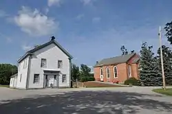 School House and Town Hall |
June 14, 1988 (#88001045) |
U.S. Route 7 and Town Highway 1 43°51′58″N 73°06′33″W |
Leicester | |
| 50 | Shard Villa | 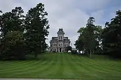 Shard Villa |
October 30, 1989 (#89001789) |
Junction of Shard Villa and Columbus Smith Rds. 43°56′22″N 73°09′13″W |
Salisbury | |
| 51 | Shoreham Congregational Church | 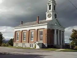 Shoreham Congregational Church |
March 2, 2001 (#01000211) |
School St. 43°53′36″N 73°18′59″W |
Shoreham | |
| 52 | South Starksboro Friends Meeting House and Cemetery | 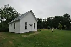 South Starksboro Friends Meeting House and Cemetery |
November 7, 1985 (#85002769) |
Dan Sargent Rd. 44°10′02″N 73°00′53″W |
Starksboro | |
| 53 | Stagecoach Inn | 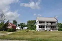 Stagecoach Inn |
November 15, 1984 (#84000674) |
U.S. Route 7 43°51′57″N 73°06′27″W |
Leicester | |
| 54 | Starksboro Village Meeting House | 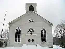 Starksboro Village Meeting House |
November 7, 1985 (#85002768) |
VT 116 44°13′32″N 73°03′28″W |
Starksboro Village | |
| 55 | Ruth Stone House |  Ruth Stone House |
November 22, 2016 (#16000791) |
788 Hathaway Rd. 43°51′12″N 72°59′55″W |
Goshen | |
| 56 | Stone Mill | 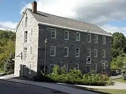 Stone Mill |
April 11, 1973 (#73000181) |
Mill St. 44°01′05″N 73°10′15″W |
Middlebury | |
| 57 | Old Stone Row | 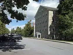 Old Stone Row |
September 18, 1997 (#97001162) |
Junction of S. Main St. and Old Chapel Rd. 44°00′32″N 73°10′34″W |
Middlebury | |
| 58 | Gen. Samuel Strong House |  Gen. Samuel Strong House |
April 11, 1973 (#73000182) |
64 W. Main St. 44°09′50″N 73°15′30″W |
Vergennes | |
| 59 | John Strong House | 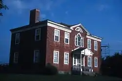 John Strong House |
May 15, 1980 (#80000326) |
6656 VT 17 44°03′17″N 73°24′43″W |
Addison | Surrounded by D.A.R. State Park; itself a historic house museum. |
| 60 | Samuel Paddock Strong House | 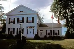 Samuel Paddock Strong House |
August 15, 1979 (#79000216) |
82 W. Main St. 44°09′41″N 73°15′41″W |
Vergennes | |
| 61 | Union Church | 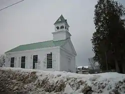 Union Church |
July 20, 2000 (#00000829) |
Junction of River Rd. and East St. 44°05′33″N 73°06′34″W |
New Haven | |
| 62 | Union Meetinghouse | 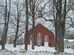 Union Meetinghouse |
February 23, 1978 (#78000227) |
U.S. Route 7 44°12′22″N 73°14′45″W |
Ferrisburg | |
| 63 | University of Vermont Morgan Horse Farm | 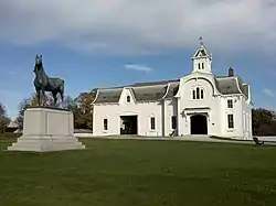 University of Vermont Morgan Horse Farm |
April 11, 1973 (#73000183) |
Mogan Horse Farm Rd., off U.S. Route 7 44°02′40″N 73°11′10″W |
Weybridge | |
| 64 | Vergennes Historic District | 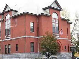 Vergennes Historic District |
September 3, 1976 (#76000136) |
U.S. Route 7 (at time of listing, now Vermont Route 22A) 44°10′07″N 73°15′15″W |
Vergennes | |
| 65 | Vergennes Residential Historic District |  Vergennes Residential Historic District |
May 8, 2003 (#03000395) |
S. Water St., Green St., S. Maple St., all south of Main St. 44°09′57″N 73°15′09″W |
Vergennes | |
| 66 | Waybury Inn | 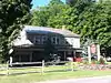 Waybury Inn |
July 14, 1983 (#83003204) |
VT 125 43°58′19″N 73°05′35″W |
East Middlebury | |
| 67 | Wesleyan Methodist Church |  Wesleyan Methodist Church |
April 12, 1996 (#96000387) |
Quaker Village Rd., near the junction of Baker Ct. and Quaker Village Rd. 44°03′53″N 73°12′57″W |
Weybridge | |
| 68 | Wilcox-Cutts House | 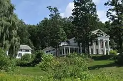 Wilcox-Cutts House |
December 2, 1974 (#74000202) |
2 mi (3.2 km) south of Orwell on VT 22A 43°47′05″N 73°18′29″W |
Orwell | |
| 69 | Emma Willard House | 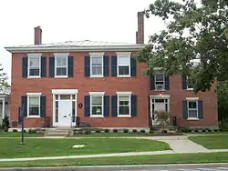 Emma Willard House |
October 15, 1966 (#66000798) |
Middlebury College campus 44°00′27″N 73°10′29″W |
Middlebury | Home of Emma Willard, pioneer in women's education in the United States |
| 70 | Witherell Farm |  Witherell Farm |
April 1, 1993 (#93000241) |
Town Highway 74 (Witherell Rd.) west of Lakeview and St. Genevieve cemeteries 43°53′02″N 73°20′23″W |
Shoreham |
Former listings
| [3] | Name on the Register | Image | Date listed | Date removed | Location | City or town | Summary |
|---|---|---|---|---|---|---|---|
| 1 | Brooksville Advent Church |  Brooksville Advent Church |
November 21, 2002 (#02001380) | March 22, 2016 | 1338 Dog Team Tavern Rd. 44°03′53″N 73°10′23″W |
New Haven | |
| 2 | Dog Team Tavern | November 21, 2002 (#02001381) | March 22, 2016 | 1338 Dog Team Tavern Rd. 44°03′51″N 73°10′24″W |
New Haven | Destroyed by fire in 2006 when the final owner set the building on fire and committed suicide there.[6] |
See also
| Wikimedia Commons has media related to National Register of Historic Places in Addison County, Vermont. |
References
- The latitude and longitude information provided in this table was derived originally from the National Register Information System, which has been found to be fairly accurate for about 99% of listings. Some locations in this table may have been corrected to current GPS standards.
- "National Register of Historic Places: Weekly List Actions". National Park Service, United States Department of the Interior. Retrieved on February 5, 2021.
- Numbers represent an alphabetical ordering by significant words. Various colorings, defined here, differentiate National Historic Landmarks and historic districts from other NRHP buildings, structures, sites or objects.
- "National Register Information System". National Register of Historic Places. National Park Service. April 24, 2008.
- The eight-digit number below each date is the number assigned to each location in the National Register Information System database, which can be viewed by clicking the number.
- Alice Levitt, , Seven Days (October 31, 2012).
| Topics | |
|---|---|
| Lists by state |
|
| Lists by insular areas | |
| Lists by associated state | |
| Other areas | |
| Related | |
| |
Municipalities and communities of Addison County, Vermont, United States | ||
|---|---|---|
| City | Map of Vermont highlighting Addison County | |
| Towns | ||
| CDPs | ||
| Other communities | ||
| ||
This article is issued from Wikipedia. The text is licensed under Creative Commons - Attribution - Sharealike. Additional terms may apply for the media files.