National Register of Historic Places listings in Orleans County, Vermont
This is a list of the National Register of Historic Places listings in Orleans County, Vermont.
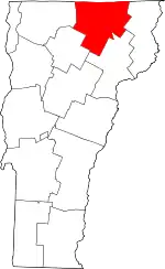
Location of Orleans County in Vermont
This is intended to be a complete list of the properties and districts on the National Register of Historic Places in Orleans County, Vermont, United States. Latitude and longitude coordinates are provided for many National Register properties and districts; these locations may be seen together in a map.[1]
There are 27 properties and districts listed on the National Register in the county.
- This National Park Service list is complete through NPS recent listings posted January 29, 2021.[2]
| Addison - Bennington - Caledonia - Chittenden - Essex - Franklin - Grand Isle - Lamoille - Orange - Orleans - Rutland - Washington - Windham - Windsor |
Current listings
| [3] | Name on the Register[4] | Image | Date listed[5] | Location | City or town | Description |
|---|---|---|---|---|---|---|
| 1 | Brownington Village Historic District | 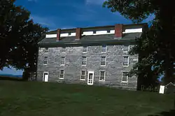 Brownington Village Historic District |
May 9, 1973 (#73000197) |
Hinman and Brownington Centers Rd. 44°50′19″N 72°10′10″W |
Brownington | |
| 2 | Crystal Lake Falls Historic District | 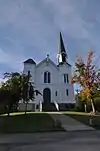 Crystal Lake Falls Historic District |
July 7, 1994 (#94000699) |
Roughly, Water St. from Church St. to Main St., Main from Water to Duck Pond Rd. and West St. from Cemetery Rd. to Main 44°44′47″N 72°10′38″W |
Barton | |
| 3 | Crystal Lake State Park | 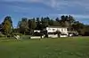 Crystal Lake State Park |
August 30, 2005 (#05000949) |
96 Bellwater Ave. 44°44′59″N 72°10′10″W |
Barton | |
| 4 | Derby House Hotel | September 3, 1998 (#98001150) |
Junction of VT 105 (Main St.) and West St. 44°56′52″N 72°08′04″W |
Derby | ||
| 5 | Jerry E. Dickerman House | July 11, 2001 (#01000732) |
36 Field Ave. 44°56′10″N 72°12′38″W |
Newport | ||
| 6 | District Number Four School | 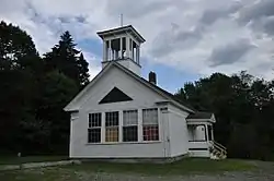 District Number Four School |
August 2, 2001 (#01000825) |
116 N. Craftsbury Rd. 44°38′16″N 72°22′31″W |
Craftsbury | |
| 7 | Fox Hall | 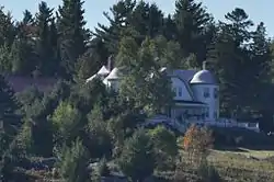 Fox Hall |
September 27, 1984 (#84003468) |
Fox Hall Ln., off Peene Hill Rd. 44°46′24″N 72°04′24″W |
Westmore | |
| 8 | Goodrich Memorial Library | 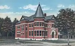 Goodrich Memorial Library |
November 23, 1983 (#83004228) |
Main and Field St. 44°56′09″N 72°12′37″W |
Newport | |
| 9 | Greensboro Depot | 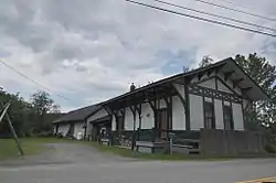 Greensboro Depot |
April 21, 1975 (#75000144) |
Western side of Main St. at railroad crossing 44°32′47″N 72°15′53″W |
Greensboro Bend | |
| 10 | Haskell Free Library and Opera House | 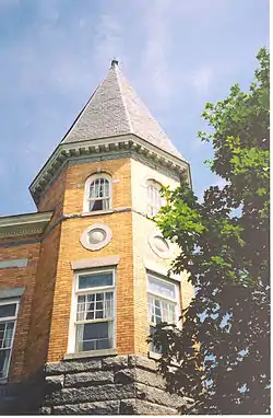 Haskell Free Library and Opera House |
September 8, 1976 (#76000143) |
Caswell Ave. 45°00′22″N 72°05′55″W |
Derby Line | |
| 11 | William Hayden House | January 31, 1978 (#78000238) |
South of Albany on VT 14 44°42′36″N 72°23′26″W |
Albany | ||
| 12 | Holland Congregational Church | December 4, 1986 (#86003411) |
W. Holland Rd. 44°58′09″N 72°02′14″W |
Holland | ||
| 13 | House at 68 Highland Avenue | July 20, 2000 (#00000831) |
68 Highland Ave. 44°55′57″N 72°13′18″W |
Newport | ||
| 14 | Irasburg Town Hall | November 21, 1994 (#94001334) |
Junction of VT 14 and VT 58, east of Creek Rd. 44°48′09″N 72°16′43″W |
Irasburg | ||
| 15 | L. P. Jenne Block | 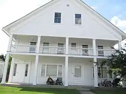 L. P. Jenne Block |
September 3, 1998 (#98001151) |
Junction of VT 105 (Main St.) and West St. 44°56′50″N 72°08′04″W |
Derby | |
| 16 | King Block | 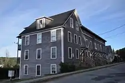 King Block |
June 20, 2002 (#02000663) |
117 High St. 44°44′58″N 72°10′37″W |
Barton | |
| 17 | Lakeview Inn | 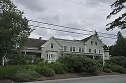 Lakeview Inn |
February 4, 2000 (#00000062) |
295 Breezy Ave. 44°34′18″N 72°17′55″W |
Greensboro | |
| 18 | Newport Downtown Historic District | 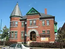 Newport Downtown Historic District |
September 28, 2006 (#06000898) |
Main, Coventry, Central, 2nd, Summer, 3rd, School, Bayview, Eastern, Field, Seymour, and Fyfe 44°56′15″N 72°12′35″W |
Newport | |
| 19 | Orleans County Courthouse and Jail Complex | 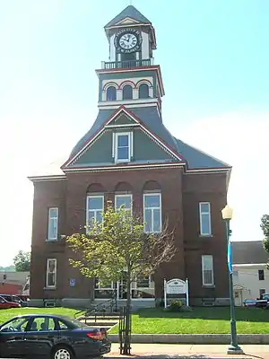 Orleans County Courthouse and Jail Complex |
November 23, 1984 (#84000336) |
Main St. 44°56′06″N 72°12′39″W |
Newport | |
| 20 | Orne Covered Bridge | 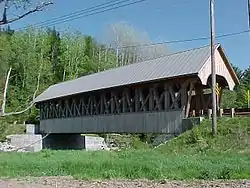 Orne Covered Bridge |
November 20, 1974 (#74000328) |
Back Coventry Rd., over the Black River 44°51′38″N 72°16′28″W |
Irasburg | |
| 21 | River Road Covered Bridge | 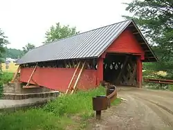 River Road Covered Bridge |
November 19, 1974 (#74000249) |
South of North Troy off VT 101, over the Missisquoi River 44°57′21″N 72°23′39″W |
North Troy | |
| 22 | J. S. Sweeney Store, Barn, Livery and Hall | 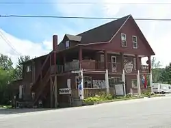 J. S. Sweeney Store, Barn, Livery and Hall |
August 18, 1992 (#92000993) |
Junction of VT 105 and Town Highway 3 (Main St.) 44°50′16″N 71°59′24″W |
Charleston | |
| 23 | U.S. Courthouse, Post Office and Customs House | 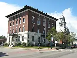 U.S. Courthouse, Post Office and Customs House |
December 12, 1976 (#76000144) |
217 Main St. 44°56′07″N 72°12′37″W |
Newport | |
| 24 | U.S. Inspection Station-Beebe Plain, Vermont | 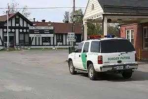 U.S. Inspection Station-Beebe Plain, Vermont |
September 10, 2014 (#14000608) |
3136 Beebe Rd. 45°00′20″N 72°08′30″W |
Derby | |
| 25 | U.S. Inspection Station-Derby Line, Vermont |  U.S. Inspection Station-Derby Line, Vermont |
September 10, 2014 (#14000609) |
84 Main St. 45°00′17″N 72°06′01″W |
Derby | |
| 26 | U.S. Inspection Station-North Troy, Vermont | 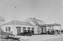 U.S. Inspection Station-North Troy, Vermont |
September 10, 2014 (#14000610) |
743 VT 243 45°00′21″N 72°24′54″W |
Troy | |
| 27 | Ai J. White Duplex | August 4, 2011 (#11000516) |
343 Main St. 44°56′04″N 72°12′46″W |
Newport |
See also
| Wikimedia Commons has media related to National Register of Historic Places in Orleans County, Vermont. |
References
- The latitude and longitude information provided in this table was derived originally from the National Register Information System, which has been found to be fairly accurate for about 99% of listings. Some locations in this table may have been corrected to current GPS standards.
- "National Register of Historic Places: Weekly List Actions". National Park Service, United States Department of the Interior. Retrieved on January 29, 2021.
- Numbers represent an alphabetical ordering by significant words. Various colorings, defined here, differentiate National Historic Landmarks and historic districts from other NRHP buildings, structures, sites or objects.
- "National Register Information System". National Register of Historic Places. National Park Service. April 24, 2008.
- The eight-digit number below each date is the number assigned to each location in the National Register Information System database, which can be viewed by clicking the number.
| Topics | |
|---|---|
| Lists by state |
|
| Lists by insular areas | |
| Lists by associated state | |
| Other areas | |
| Related | |
| |
Municipalities and communities of Orleans County, Vermont, United States | ||
|---|---|---|
| City | Map of Vermont highlighting Orleans County | |
| Towns | ||
| Villages | ||
| CDPs | ||
| Unincorporated communities | ||
| ||
This article is issued from Wikipedia. The text is licensed under Creative Commons - Attribution - Sharealike. Additional terms may apply for the media files.