National Register of Historic Places listings in Washington County, Vermont
This is a list of the National Register of Historic Places listings in Washington County, Vermont.
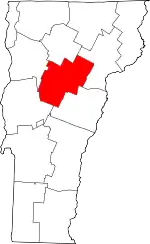
Location of Washington County in Vermont
This is intended to be a complete list of the properties and districts on the National Register of Historic Places in Washington County, Vermont, United States. Latitude and longitude coordinates are provided for many National Register properties and districts; these locations may be seen together in a map.[1]
There are 70 properties and districts listed on the National Register in the county, including 2 National Historic Landmarks.
- This National Park Service list is complete through NPS recent listings posted January 29, 2021.[2]
| Addison - Bennington - Caledonia - Chittenden - Essex - Franklin - Grand Isle - Lamoille - Orange - Orleans - Rutland - Washington - Windham - Windsor |
Current listings
| [3] | Name on the Register[4] | Image | Date listed[5] | Location | City or town | Description |
|---|---|---|---|---|---|---|
| 1 | Aldrich Public Library |  Aldrich Public Library |
January 5, 2015 (#15000961) |
6 Washington St. 44°11′51″N 72°30′04″W |
Barre | |
| 2 | Allenwood Farm |  Allenwood Farm |
December 22, 1983 (#83004229) |
U.S. Route 2 44°16′42″N 72°26′02″W |
Plainfield | |
| 3 | Athenwood and Thomas W. Wood Studio |  Athenwood and Thomas W. Wood Studio |
June 13, 1974 (#74000259) |
41 and 39 Northfield St. 44°15′21″N 72°34′47″W |
Montpelier | |
| 4 | Barre City Hall and Opera House | 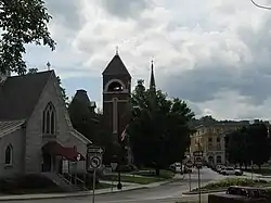 Barre City Hall and Opera House |
January 18, 1973 (#73000198) |
12 N. Main St. 44°11′48″N 72°30′10″W |
Barre City | |
| 5 | Barre Downtown Historic District | 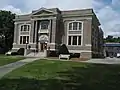 Barre Downtown Historic District |
September 4, 1979 (#79000227) |
United States Route 302 44°11′50″N 72°30′09″W |
Barre City | |
| 6 | Beck and Beck Granite Shed | 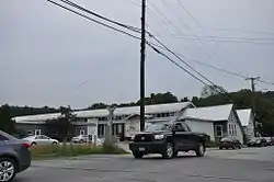 Beck and Beck Granite Shed |
September 29, 2011 (#11000714) |
30 Granite St. 44°11′58″N 72°30′23″W |
Barre City | |
| 7 | Bridge 31 | 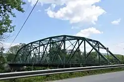 Bridge 31 |
August 9, 2006 (#06000703) |
Winooski St. 44°20′21″N 72°45′51″W |
Waterbury | |
| 8 | Bridge No. 27 | 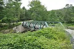 Bridge No. 27 |
January 11, 2006 (#05001523) |
Town Highway 61, Lover's Ln. 44°11′15″N 72°38′27″W |
Berlin | |
| 9 | Center Road Culvert | March 2, 2020 (#100005024) |
Center Rd. 44°17′10″N 72°31′18″W |
East Montpelier | ||
| 10 | Central Vermont Railway Depot | 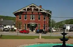 Central Vermont Railway Depot |
April 1, 1975 (#75000145) |
Western end of Depot Sq. 44°08′55″N 72°39′30″W |
Northfield | |
| 11 | Coburn Covered Bridge |  Coburn Covered Bridge |
October 9, 1974 (#74000260) |
Northeast of East Montpelier between Vermont Route 14 and U.S. Route 2, over the Winooski River 44°16′51″N 72°27′18″W |
East Montpelier | |
| 12 | Colby Mansion |  Colby Mansion |
September 10, 1979 (#79000228) |
VT 100 44°20′59″N 72°44′35″W |
Waterbury | |
| 13 | College Hall | 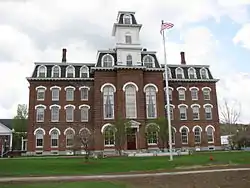 College Hall |
April 23, 1975 (#75000146) |
Vermont College campus, Ridge St. 44°15′19″N 72°34′04″W |
Montpelier | |
| 14 | Currier Park Historic District | 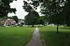 Currier Park Historic District |
September 27, 1990 (#90001454) |
Properties bordering Currier Park on Park, North, East and Academy Sts. and adjacent properties on Averill and Cliff Sts 44°11′50″N 72°29′52″W |
Barre City | |
| 15 | Parley Davis House |  Parley Davis House |
September 18, 1989 (#89000242) |
Center Road 44°17′01″N 72°31′47″W |
East Montpelier | |
| 16 | East Calais Historic District |  East Calais Historic District |
September 24, 2020 (#100005618) |
VT 14, Marshfield Rd., Batten Rd., Back St., and Moscow Woods Rd. 44°21′56″N 72°25′51″W |
Calais | |
| 17 | East Village Meetinghouse | 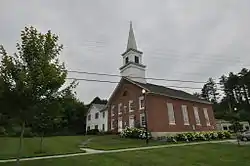 East Village Meetinghouse |
June 30, 1980 (#80000341) |
US 2 and VT 14 44°16′18″N 72°29′12″W |
East Montpelier | |
| 18 | Gale-Bancroft House | 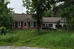 Gale-Bancroft House |
November 15, 1984 (#84000741) |
Brook Rd. 44°16′31″N 72°25′23″W |
Plainfield | |
| 19 | Goddard College Greatwood Campus |  Goddard College Greatwood Campus |
March 7, 1996 (#96000253) |
Junction of U.S. Route 2 and Vermont Route 214 44°16′43″N 72°26′04″W |
Plainfield | |
| 20 | Great Eddy Covered Bridge | 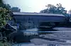 Great Eddy Covered Bridge |
September 6, 1974 (#74000261) |
Bridge St., east of Vermont Route 100 over Mad River 44°11′22″N 72°49′26″W |
Waitsfield | Also known as the Waitsfield Village Covered Bridge. |
| 21 | Green Mountain Seminary | 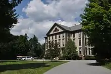 Green Mountain Seminary |
January 30, 1978 (#78000245) |
Hollow Rd. 44°22′39″N 72°43′05″W |
Waterbury Center | |
| 22 | Italian Baptist Church | 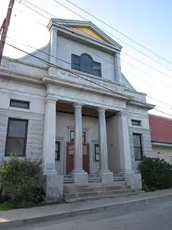 Italian Baptist Church |
April 23, 1975 (#75000147) |
10 N. Brook St. 44°12′13″N 72°30′30″W |
Barre City | |
| 23 | Jones Brothers Granite Shed | 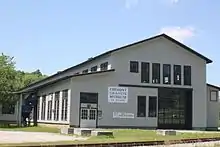 Jones Brothers Granite Shed |
April 26, 2002 (#02000413) |
7 Jones Bros. Way 44°12′42″N 72°31′15″W |
Barre City | Now the Vermont Granite Museum. |
| 24 | Jones-Pestle Farmstead |  Jones-Pestle Farmstead |
September 8, 2015 (#15000582) |
339 Bridge St. 44°11′11″N 72°49′11″W |
Waitsfield | |
| 25 | Joslin Farm |  Joslin Farm |
October 27, 1988 (#88002058) |
E. Warren Rd., 1.5 mi (2.4 km) east of junction with Bridge St. 44°10′07″N 72°48′36″W |
Waitsfield | |
| 26 | Kents Corner Historic District |  Kents Corner Historic District |
May 8, 1973 (#73000199) |
Kent's Corner; also Kent Hill, Old West Church, Robinson Cemetery, Fowler, and Bliss Pond Roads 44°21′54″N 72°29′18″W |
Calais | Second set of addresses represents a boundary increase June 30, 2006 |
| 27 | Lareau Farmstead |  Lareau Farmstead |
December 27, 2016 (#16000919) |
48 Lareau Rd. 44°10′21″N 72°50′03″W |
Waitsfield | |
| 28 | Chauncey B. Leonard House |  Chauncey B. Leonard House |
March 9, 1995 (#95000176) |
Northern side of Shed Rd., about 0.2 mi (0.32 km) west of Scott Hill Rd. 44°12′39″N 72°34′46″W |
Berlin | |
| 29 | Mad River Glen Ski Area Historic District | 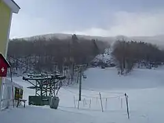 Mad River Glen Ski Area Historic District |
July 5, 2012 (#12000409) |
VT 17 (McCullough Turnpike) 44°12′07″N 72°55′02″W |
Fayston | Extends into Buels Gore in Chittenden County |
| 30 | Lower Cox Brook Covered Bridge |  Lower Cox Brook Covered Bridge |
October 15, 1974 (#74000262) |
Off Vermont Route 12 44°10′21″N 72°39′12″W |
Northfield Falls | |
| 31 | Mad River Valley Rural Historic District |  Mad River Valley Rural Historic District |
August 5, 1994 (#94000836) |
Roughly along Vermont Routes 100 and 100B from Waitsfield to Moretown and parts of North and River Rds. 44°13′16″N 72°47′29″W |
Moretown and Waitsfield | |
| 32 | Martin Covered Bridge | 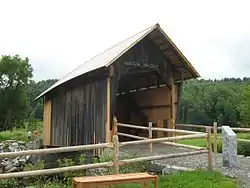 Martin Covered Bridge |
October 9, 1974 (#74000358) |
Northeast of Plainfield, over the Winooski River off US 2 44°17′07″N 72°24′48″W |
Marshfield | |
| 33 | Mayo Building | 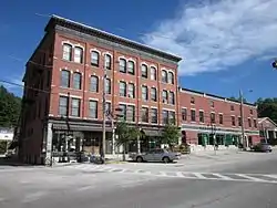 Mayo Building |
July 14, 1983 (#83003222) |
Main and East Sts. 44°08′54″N 72°39′22″W |
Northfield | |
| 34 | McLaughlin Farm | 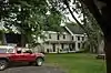 McLaughlin Farm |
January 22, 1996 (#95001556) |
Town Highway 17 (Bragg Hill Rd.) 44°11′37″N 72°50′45″W |
Fayston | Now known as Knoll Farm. |
| 35 | Middlesex-Winooski River Bridge | 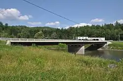 Middlesex-Winooski River Bridge |
November 14, 1991 (#91001610) |
U.S. Route 2 over the Winooski River 44°18′22″N 72°41′48″W |
Middlesex and Moretown | Historic bridge replaced in 2010. |
| 36 | Mill Village Historic District | 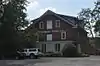 Mill Village Historic District |
June 12, 1979 (#79000229) |
Roughly bounded by Vermont Route 100, Interstate 89, and Stowe St. 44°20′35″N 72°44′52″W |
Waterbury | |
| 37 | Montpelier Historic District | 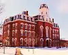 Montpelier Historic District |
November 3, 1978 (#78000246) |
U.S. Route 2 and Vermont Route 12; also 70–101 E. State St. and 1 West St.; also Monsignor Crosby Ave., Peck Place, Tower Loop Rd., Cross, Downing, Franklin & Wilder Sts. 44°15′41″N 72°34′37″W |
Montpelier | Second and third sets of addresses represents boundary increases approved April 17, 1989 and February 20, 2018. |
| 38 | National Clothespin Factory | 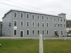 National Clothespin Factory |
December 16, 2005 (#05001422) |
One Granite St. 44°15′08″N 72°34′16″W |
Montpelier | Was the last manufacturer of wooden clothespins in the US; building now houses martial arts studios and other businesses; see also Grave of Jack Crowell |
| 39 | Nichols House |  Nichols House |
January 31, 1978 (#78000247) |
Southwest of East Barre off Vermont Route 110 44°08′59″N 72°27′31″W |
East Barre | |
| 40 | North Calais Village Historic District |  North Calais Village Historic District |
September 24, 2010 (#10000772) |
N. Calais Rd., Foster Hill Rd., Upper Rd., Moscow Hills Rd., G.A.R. Rd. 44°23′27″N 72°26′37″W |
Calais | |
| 41 | Northfield Falls Covered Bridge | 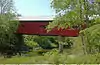 Northfield Falls Covered Bridge |
August 13, 1974 (#74000263) |
North of Northfield off Vermont Route 12, over Dog River 44°10′20″N 72°39′18″W |
Northfield | |
| 42 | Old Red Mill | 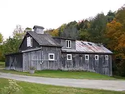 Old Red Mill |
October 20, 1977 (#77000102) |
Vermont Route 12 44°07′07″N 72°39′27″W |
South Northfield | |
| 43 | Old West Church | 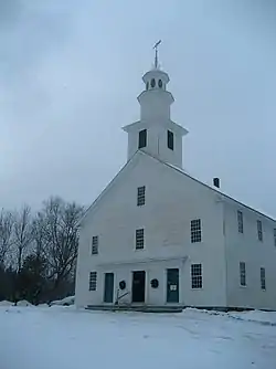 Old West Church |
May 8, 1973 (#73000200) |
0.8 mi (1.3 km) south of Kent's Corner 44°21′31″N 72°29′37″W |
Calais | |
| 44 | Pine Brook Covered Bridge | .jpg.webp) Pine Brook Covered Bridge |
June 13, 1974 (#74000264) |
Northeast of Waitsfield over Pine Brook 44°12′21″N 72°47′32″W |
Waitsfield | |
| 45 | Plainfield Village Historic District | 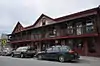 Plainfield Village Historic District |
February 3, 1983 (#83003223) |
High, School, Main and Water Sts., and Brook Rd. 44°16′43″N 72°25′32″W |
Plainfield and Marshfield | |
| 46 | Reynolds House | August 5, 2020 (#100005433) |
102 South Main St. 44°11′29″N 72°29′57″W |
Barre | ||
| 47 | Roxbury Fish Hatchery | 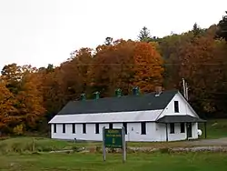 Roxbury Fish Hatchery |
March 24, 1994 (#94000177) |
Western side of Vermont Route 12A, about 1 mile (1.6 km) south of Roxbury 44°03′46″N 72°44′38″W |
Roxbury | Vermont Fish and Wildlife Department's Roxbury Fish Culture Station, the first fish culture station in Vermont, built in 1891 |
| 48 | Scampini Block | 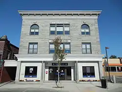 Scampini Block |
March 13, 2007 (#07000160) |
289 N. Main St. 44°12′07″N 72°30′16″W |
Barre City | |
| 49 | Slaughter House Covered Bridge | 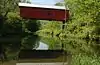 Slaughter House Covered Bridge |
June 13, 1974 (#74000265) |
North of Northfield off Vermont Route 12 over Dog River 44°10′07″N 72°39′17″W |
Northfield | |
| 50 | E. L. Smith Roundhouse Granite Shed |  E. L. Smith Roundhouse Granite Shed |
September 26, 2011 (#11000704) |
23 Burnham Meadows 44°11′51″N 72°30′19″W |
Barre City | |
| 51 | Socialist Labor Party Hall |  Socialist Labor Party Hall |
October 22, 1998 (#98001267) |
46 Granite St. 44°11′54″N 72°30′27″W |
Barre City | |
| 52 | Stony Brook Covered Bridge |  Stony Brook Covered Bridge |
November 20, 1974 (#74000266) |
Southwest of Northfield off Vermont Route 12A, over Stony Brook 44°07′16″N 72°41′25″W |
Northfield | |
| 53 | Joshua Twing Gristmill |  Joshua Twing Gristmill |
December 29, 1978 (#78000248) |
450 N. Main St. 44°12′18″N 72°30′41″W |
Barre City | |
| 54 | Union Co-operative Store Bakery |  Union Co-operative Store Bakery |
November 13, 2003 (#03001166) |
46½ Granite St. 44°11′55″N 72°30′24″W |
Barre City | |
| 55 | Union Meetinghouse | 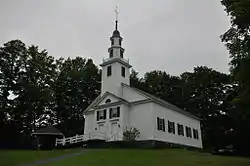 Union Meetinghouse |
June 30, 1980 (#80000342) |
Center Rd. 44°17′00″N 72°31′39″W |
East Montpelier | |
| 56 | Upper Cox Brook Covered Bridge | 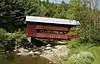 Upper Cox Brook Covered Bridge |
October 1, 1974 (#74000267) |
North of Northfield off Vermont Route 12 over Cox Brook 44°10′25″N 72°39′20″W |
Northfield | |
| 57 | Vermont State Hospital Historic District | 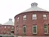 Vermont State Hospital Historic District |
November 8, 2016 (#16000765) |
Horseshoe & State Drs., Park Row 44°19′55″N 72°45′14″W |
Waterbury | |
| 58 | Vermont Statehouse | 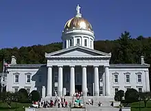 Vermont Statehouse |
December 30, 1970 (#70000739) |
State St. 44°15′44″N 72°34′51″W |
Montpelier | |
| 59 | Waitsfield Common Historic District |  Waitsfield Common Historic District |
November 8, 2001 (#01001227) |
Joslin Hill Rd., North Rd., East Rd., and Common Rd. 44°11′16″N 72°47′47″W |
Waitsfield | |
| 60 | Waitsfield Village Historic District | 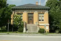 Waitsfield Village Historic District |
August 11, 1983 (#83003224) |
Vermont Route 100 and Bridge St. 44°11′26″N 72°49′22″W |
Waitsfield | |
| 61 | Warren Covered Bridge | 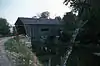 Warren Covered Bridge |
August 7, 1974 (#74000269) |
Off Vermont Route 100, over the Mad River 44°06′40″N 72°51′26″W |
Warren | |
| 62 | Warren Village Historic District | 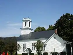 Warren Village Historic District |
November 20, 1992 (#92001532) |
Along Town Highways 1, 4, 16 and 17 44°06′49″N 72°51′24″W |
Warren | |
| 63 | Waterbury Center Methodist Church | 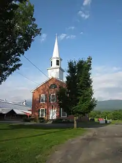 Waterbury Center Methodist Church |
January 9, 1978 (#78000251) |
Vermont Route 100 44°22′51″N 72°43′13″W |
Waterbury Center | |
| 64 | Waterbury Village Historic District | 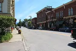 Waterbury Village Historic District |
August 24, 1978 (#78000249) |
U.S. Route 2 44°20′06″N 72°45′17″W |
Waterbury | |
| 65 | Wheelock Law Office | 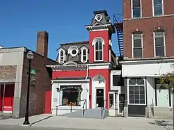 Wheelock Law Office |
June 18, 1975 (#75000148) |
135 N. Main St. 44°11′53″N 72°30′13″W |
Barre City | |
| 66 | Theodore Wood House | 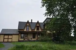 Theodore Wood House |
February 10, 2005 (#05000037) |
1420 Hollister Hill Rd. 44°18′07″N 72°24′51″W |
Marshfield | |
| 67 | Woodbury Graded School | 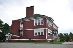 Woodbury Graded School |
September 30, 1993 (#93001008) |
Junction of Town Highway 22 and Vermont Route 14 44°26′24″N 72°24′59″W |
Woodbury | |
| 68 | Woodbury Town Hall |  Woodbury Town Hall |
March 31, 1995 (#95000296) |
Vermont Route 14 44°26′26″N 72°24′57″W |
Woodbury | |
| 69 | Worcester Town Hall | 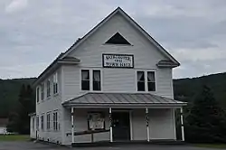 Worcester Town Hall |
November 9, 2005 (#05001234) |
12 Worcester Village Rd. 44°22′22″N 72°33′00″W |
Worcester | |
| 70 | Worcester Village School | 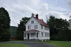 Worcester Village School |
November 9, 2005 (#05001235) |
17 Calais Rd. 44°22′21″N 72°32′55″W |
Worcester |
See also
| Wikimedia Commons has media related to National Register of Historic Places in Washington County, Vermont. |
References
- The latitude and longitude information provided in this table was derived originally from the National Register Information System, which has been found to be fairly accurate for about 99% of listings. Some locations in this table may have been corrected to current GPS standards.
- "National Register of Historic Places: Weekly List Actions". National Park Service, United States Department of the Interior. Retrieved on January 29, 2021.
- Numbers represent an alphabetical ordering by significant words. Various colorings, defined here, differentiate National Historic Landmarks and historic districts from other NRHP buildings, structures, sites or objects.
- "National Register Information System". National Register of Historic Places. National Park Service. April 24, 2008.
- The eight-digit number below each date is the number assigned to each location in the National Register Information System database, which can be viewed by clicking the number.
| Topics | |
|---|---|
| Lists by state |
|
| Lists by insular areas | |
| Lists by associated state | |
| Other areas | |
| Related | |
| |
Municipalities and communities of Washington County, Vermont, United States | ||
|---|---|---|
| Cities | Map of Vermont highlighting Washington County | |
| Towns | ||
| Villages | ||
| CDPs | ||
| Other communities | ||
| ||
This article is issued from Wikipedia. The text is licensed under Creative Commons - Attribution - Sharealike. Additional terms may apply for the media files.