National Register of Historic Places listings in Caledonia County, Vermont
This is a list of the National Register of Historic Places listings in Caledonia County, Vermont.
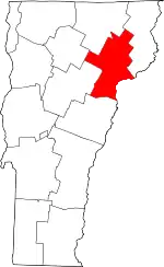
Location of Caledonia County in Vermont
This is intended to be a complete list of the properties and districts on the National Register of Historic Places in Caledonia County, Vermont, United States. Latitude and longitude coordinates are provided for many National Register properties and districts; these locations may be seen together in a map.[1]
There are 57 properties and districts listed on the National Register in the county, including 1 National Historic Landmark.
- This National Park Service list is complete through NPS recent listings posted January 29, 2021.[2]
| Addison - Bennington - Caledonia - Chittenden - Essex - Franklin - Grand Isle - Lamoille - Orange - Orleans - Rutland - Washington - Windham - Windsor |
Current listings
| [3] | Name on the Register[4] | Image | Date listed[5] | Location | City or town | Description |
|---|---|---|---|---|---|---|
| 1 | Barnet Center Historic District | .jpg.webp) Barnet Center Historic District |
July 12, 1984 (#84003440) |
Barnet Center Rd. at Ferguson Rd. 44°18′44″N 72°05′09″W |
Barnet | |
| 2 | Benoit Apartment House-74 Pearl Street | 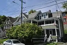 Benoit Apartment House-74 Pearl Street |
May 6, 1994 (#94000378) |
439 Pearl St. 44°25′11″N 72°01′02″W |
St. Johnsbury | |
| 3 | Benoit Apartment House-76 Pearl Street | 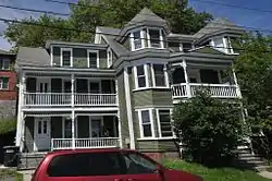 Benoit Apartment House-76 Pearl Street |
May 6, 1994 (#94000379) |
447 Pearl St. 44°25′09″N 72°01′02″W |
St. Johnsbury | |
| 4 | Bradley Covered Bridge | 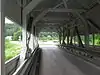 Bradley Covered Bridge |
June 13, 1977 (#77000096) |
North of Lyndon on Center St. over Miller Run 44°32′31″N 72°00′38″W |
Lyndon | |
| 5 | Building at 143 Highland Avenue | 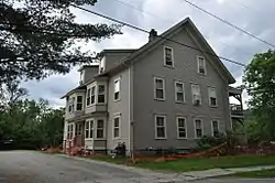 Building at 143 Highland Avenue |
April 6, 2000 (#00000358) |
143 Highland Ave. 44°30′22″N 72°22′07″W |
Hardwick | |
| 6 | Burklyn Hall | 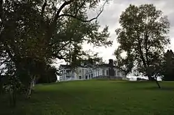 Burklyn Hall |
May 7, 1973 (#73000191) |
Bemis Hill Rd. 44°35′04″N 71°57′49″W |
East Burke | |
| 7 | Burrington Covered Bridge | 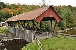 Burrington Covered Bridge |
June 13, 1974 (#74000203) |
Northeast of Lyndon off VT 114 over the East Branch of the Passumpsic River 44°33′13″N 71°58′12″W |
Lyndon | |
| 8 | Caledonia No. 9 Grange Hall | December 26, 2017 (#100001937) |
88 Church St. 44°31′21″N 72°18′27″W |
East Hardwick | ||
| 9 | Centre Covered Bridge | 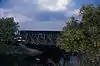 Centre Covered Bridge |
June 20, 1974 (#74000204) |
Northeast of Lyndon off U.S. Route 5, over the Passumpsic River 44°32′36″N 72°00′06″W |
Lyndon | |
| 10 | Chamberlin Mill Covered Bridge | 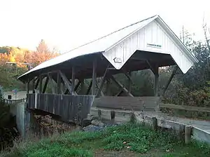 Chamberlin Mill Covered Bridge |
July 30, 1974 (#74000205) |
West of VT 114 over the South Wheelock Branch of Passumpsic River 44°30′59″N 72°01′00″W |
Lyndon | |
| 11 | Christian Union Society Meetinghouse | 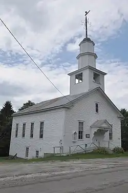 Christian Union Society Meetinghouse |
May 23, 1980 (#80000385) |
Bayley-Hazen Military Rd. 44°28′43″N 72°17′30″W |
South Walden | |
| 12 | Cobb School | 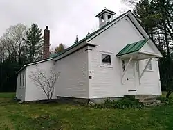 Cobb School |
September 30, 1993 (#93001007) |
Junction of Hardwick Town Highway 10 (Cobb School Rd.) and Sanborn Cemetery Rd. 44°33′23″N 72°20′32″W |
Hardwick | |
| 13 | Cote Apartment House | 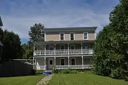 Cote Apartment House |
May 6, 1994 (#94000377) |
16 Elm St. 44°25′18″N 72°00′40″W |
St. Johnsbury | |
| 14 | Darling Estate Historic District | 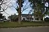 Darling Estate Historic District |
August 23, 2011 (#10000911) |
Darling Hill Rd. in Burke and Lyndon; Pinkham Rd. in Burke[6] 44°35′24″N 71°57′37″W |
Burke and Lyndon | |
| 15 | Darling Inn | 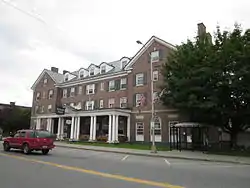 Darling Inn |
November 24, 1980 (#80000386) |
Depot St. 44°32′03″N 72°00′16″W |
Lyndonville | |
| 16 | J. R. Darling Store | 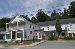 J. R. Darling Store |
May 12, 2004 (#04000442) |
1334 Scott Highway 44°12′44″N 72°11′41″W |
Groton | |
| 17 | District 6 School House | 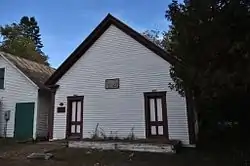 District 6 School House |
February 1, 2006 (#05001588) |
73 Cemetery Circle 44°32′20″N 72°00′46″W |
Lyndon | |
| 18 | Downtown Hardwick Village Historic District | 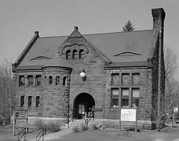 Downtown Hardwick Village Historic District |
September 30, 1982 (#82001698) |
Main, Church, Maple, and Mill Sts.; also Brush St. 44°30′19″N 72°21′50″W |
Hardwick | Brush St. represents a boundary increase |
| 19 | Elkins Tavern | 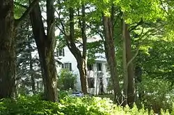 Elkins Tavern |
December 18, 1978 (#78000228) |
Bayley-Hazen Rd. 44°19′22″N 72°09′58″W |
Peacham | |
| 20 | Fairbanks Museum | 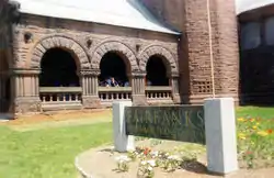 Fairbanks Museum |
January 2, 2008 (#07001344) |
1302 Main St. 44°25′12″N 72°01′13″W |
St. Johnsbury | |
| 21 | Franklin Fairbanks House | 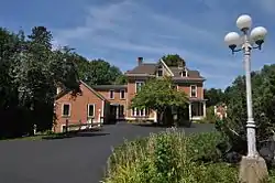 Franklin Fairbanks House |
September 27, 1980 (#80000329) |
357 Western Ave. 44°25′02″N 72°01′39″W |
St. Johnsbury | |
| 22 | William and Agnes Gilkerson Farm | 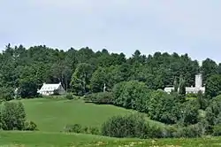 William and Agnes Gilkerson Farm |
October 29, 1992 (#92001504) |
Town Highway 5 (Kitchel Hill Rd.) west of its junction with U.S. Route 5 44°21′44″N 72°03′41″W |
Barnet | Also known as Kitchel Hill Farm. |
| 23 | Alice Lord Goodine House | 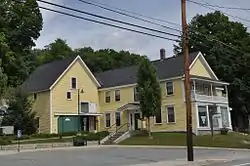 Alice Lord Goodine House |
May 12, 2004 (#04000441) |
1304 Scott Highway 44°12′37″N 72°11′40″W |
Groton | Houses the local library. |
| 24 | Greenbanks Hollow Covered Bridge | 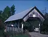 Greenbanks Hollow Covered Bridge |
June 13, 1974 (#74000206) |
South of Danville, Greenbanks Hollow Rd. over Joes Brook 44°22′38″N 72°07′20″W |
Danville | |
| 25 | Grouselands | December 22, 1983 (#83004224) |
Town Highway 26 44°29′38″N 72°07′14″W |
Danville | ||
| 26 | Hardwick Street Historic District | 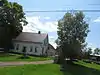 Hardwick Street Historic District |
June 22, 1979 (#79000321) |
Northeast of Hardwick 44°33′00″N 72°17′58″W |
Hardwick | |
| 27 | Lee Farm | 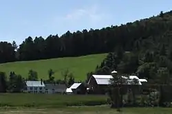 Lee Farm |
May 26, 1983 (#83003205) |
VT 18 44°25′20″N 71°57′03″W |
Waterford | |
| 28 | Lind Houses | 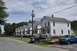 Lind Houses |
September 27, 1988 (#88001589) |
Pleasant St. 44°11′07″N 72°08′19″W |
South Ryegate | |
| 29 | Lower Waterford Congregational Church | July 8, 2019 (#100004181) |
63 Lower Waterford Rd. 44°21′17″N 71°54′27″W |
Waterford | ||
| 30 | Maple Street-Clarks Avenue Historic District | 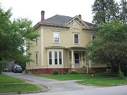 Maple Street-Clarks Avenue Historic District |
May 5, 1994 (#94000381) |
17-49 Maple St., 4-34 Clarks Ave., 95½-101 Main St., 4 and 6 Frost Ave., and 3 and 5 Idlewood Terr. 44°25′18″N 72°01′04″W |
St. Johnsbury | |
| 31 | Caleb H. Marshall House |  Caleb H. Marshall House |
August 16, 1994 (#94000868) |
426 Summer St. 44°25′17″N 72°01′18″W |
St. Johnsbury | |
| 32 | Mathewson Block | 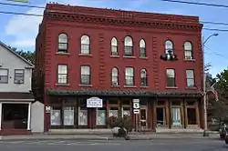 Mathewson Block |
May 20, 1999 (#99000623) |
Junction of Main St. and Maple St. 44°32′07″N 72°00′21″W |
Lyndon | |
| 33 | McIndoes Academy | 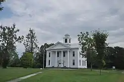 McIndoes Academy |
May 6, 1975 (#75000137) |
Main St. 44°15′51″N 72°03′52″W |
McIndoe Falls | |
| 34 | Methodist-Episcopal Church | 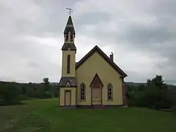 Methodist-Episcopal Church |
January 5, 1978 (#78000229) |
Off VT 16 44°32′33″N 72°12′48″W |
Stannard | |
| 35 | Morency Paint Shop and Apartment Building | 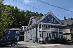 Morency Paint Shop and Apartment Building |
May 5, 1994 (#94000380) |
73-77 Portland St. 44°25′13″N 72°00′30″W |
St. Johnsbury | |
| 36 | New Discovery State Park |  New Discovery State Park |
January 17, 2002 (#01001475) |
4239 VT 232 44°18′36″N 72°15′08″W |
Peacham | |
| 37 | Old Schoolhouse Bridge | 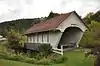 Old Schoolhouse Bridge |
March 31, 1971 (#71000055) |
S. Wheelock Rd. over Cold Hill Brook 44°30′57″N 72°00′38″W |
Lyndon | |
| 38 | Peacham Corner Historic District | 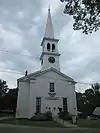 Peacham Corner Historic District |
December 18, 2003 (#03001308) |
Bayley Hazen Rd., Main St., Church St., Academy Hill, Old Cemetery Rd., Macks Mountain Rd. 44°19′39″N 72°10′21″W |
Peacham | |
| 39 | Railroad Street Historic District | 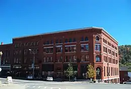 Railroad Street Historic District |
June 25, 1974 (#74000354) |
Roughly bounded north and south by Railroad St. and the Canadian Pacific railroad tracks 44°25′01″N 72°01′00″W |
St. Johnsbury | |
| 40 | Ricker Pond State Park | 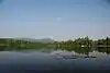 Ricker Pond State Park |
March 29, 2002 (#02000277) |
526 State Forest Rd. 44°14′41″N 72°14′54″W |
Groton | |
| 41 | Riverside | 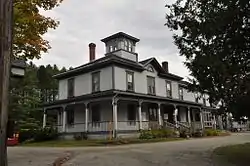 Riverside |
June 17, 1993 (#93000532) |
Lily Pond Rd. south of Lyndonville 44°30′47″N 71°59′40″W |
Lyndonville | |
| 42 | Shearer and Corser Double House | 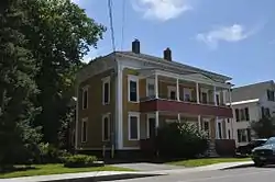 Shearer and Corser Double House |
August 16, 1994 (#94000861) |
592 Summer St. 44°25′26″N 72°01′12″W |
St. Johnsbury | |
| 43 | Josiah and Lydia Shedd Farmstead | 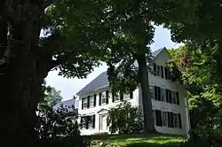 Josiah and Lydia Shedd Farmstead |
March 17, 2005 (#05000188) |
1721 Bayley-Hazen Rd. 44°20′37″N 72°10′36″W |
Peacham | |
| 44 | St. Johnsbury Athenaeum | 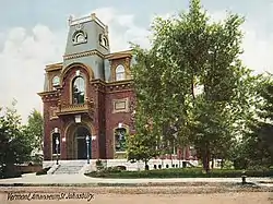 St. Johnsbury Athenaeum |
June 18, 1996 (#96000970) |
30 Main St. 44°25′04″N 72°01′19″W |
St. Johnsbury | Significant due to its construction, its American paintings and books from its original role as a public library and free art gallery, and its funding by Horace Fairbanks, manufacturer of the world’s first platform scale. |
| 45 | St. Johnsbury Federal Fish Culture Station |  St. Johnsbury Federal Fish Culture Station |
March 18, 2005 (#05000189) |
374 Emerson Falls Rd. 44°25′59″N 72°02′15″W |
St. Johnsbury | Now houses offices. |
| 46 | St. Johnsbury Historic District |  St. Johnsbury Historic District |
April 17, 1980 (#80000424) |
U.S. Routes 2 and 5 44°25′06″N 72°01′02″W |
St. Johnsbury | |
| 47 | St. Johnsbury Main Street Historic District | 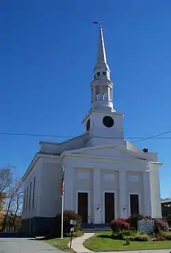 St. Johnsbury Main Street Historic District |
May 28, 1975 (#75000238) |
Area along Main St. including intersecting streets 44°25′06″N 72°01′14″W |
St. Johnsbury | |
| 48 | Stannard Schoolhouse | 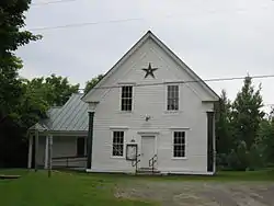 Stannard Schoolhouse |
December 12, 1977 (#77000097) |
Off VT 16 44°32′34″N 72°12′52″W |
Stannard | Now the town hall. |
| 49 | Stillwater State Park |  Stillwater State Park |
March 29, 2002 (#02000278) |
126 Boulder Beach Rd. 44°16′46″N 72°16′23″W |
Groton | |
| 50 | Thresher Mill |  Thresher Mill |
April 4, 1996 (#96000386) |
W. Barnet Rd., approximately 1.5 mi (2.4 km) west of Barnet 44°18′37″N 72°05′51″W |
Barnet | |
| 51 | Phineas Thurston House |  Phineas Thurston House |
October 30, 1989 (#89001788) |
Barnet Town Highway 12 44°21′56″N 72°01′29″W |
Barnet | |
| 52 | Toll House |  Toll House |
August 9, 2006 (#06000704) |
2028 Mountain Rd. 44°35′38″N 71°54′12″W |
Burke | |
| 53 | Union Meeting House | 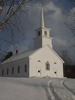 Union Meeting House |
January 4, 2008 (#07001345) |
2614 Burke Hollow Rd. 44°37′20″N 71°56′55″W |
Burke | |
| 54 | West View Farm | 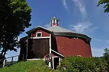 West View Farm |
January 6, 1995 (#94001522) |
Along Waterford Highway 34 44°24′08″N 71°59′33″W |
Waterford | |
| 55 | Wheelock Common Historic District |  Wheelock Common Historic District |
August 30, 2007 (#07000894) |
VT 122 and Town Highway 17 44°35′16″N 72°04′59″W |
Wheelock | |
| 56 | Whitehill House | 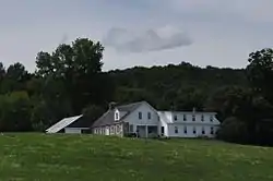 Whitehill House |
May 30, 1975 (#75000138) |
North of Ryegate on Groton-Peacham Rd. 44°15′55″N 72°10′27″W |
Ryegate | |
| 57 | Whittier House |  Whittier House |
August 23, 1984 (#84003456) |
Greenbanks Hollow Rd. 44°22′43″N 72°07′22″W |
Danville |
See also
| Wikimedia Commons has media related to National Register of Historic Places in Caledonia County, Vermont. |
References
- The latitude and longitude information provided in this table was derived originally from the National Register Information System, which has been found to be fairly accurate for about 99% of listings. Some locations in this table may have been corrected to current GPS standards.
- "National Register of Historic Places: Weekly List Actions". National Park Service, United States Department of the Interior. Retrieved on January 29, 2021.
- Numbers represent an alphabetical ordering by significant words. Various colorings, defined here, differentiate National Historic Landmarks and historic districts from other NRHP buildings, structures, sites or objects.
- "National Register Information System". National Register of Historic Places. National Park Service. April 24, 2008.
- The eight-digit number below each date is the number assigned to each location in the National Register Information System database, which can be viewed by clicking the number.
- Geocode coordinates derived from NRHP nomination information at HistoricVermont.org.
| Topics | |
|---|---|
| Lists by state |
|
| Lists by insular areas | |
| Lists by associated state | |
| Other areas | |
| Related | |
| |
Municipalities and communities of Caledonia County, Vermont, United States | ||
|---|---|---|
| Towns | Map of Vermont highlighting Caledonia County | |
| Incorporated villages | ||
| Non-village CDPs | ||
| Unincorporated communities | ||
| ||
This article is issued from Wikipedia. The text is licensed under Creative Commons - Attribution - Sharealike. Additional terms may apply for the media files.