National Register of Historic Places listings in Caribou County, Idaho
This is a list of the National Register of Historic Places listings in Caribou County, Idaho.
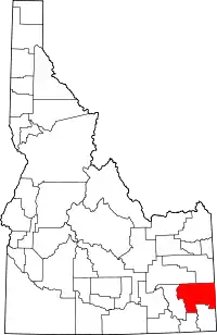
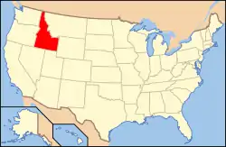
Location of Caribou County in Idaho
This is intended to be a complete list of the properties and districts on the National Register of Historic Places in Caribou County, Idaho, United States. Latitude and longitude coordinates are provided for many National Register properties and districts; these locations may be seen together in a map.[1]
There are 8 properties and districts listed on the National Register in the county. More may be added; properties and districts nationwide are added to the Register weekly.[2]
- This National Park Service list is complete through NPS recent listings posted February 5, 2021.[3]
Current listings
| [4] | Name on the Register[5] | Image | Date listed[6] | Location | City or town | Description |
|---|---|---|---|---|---|---|
| 1 | Caribou County Courthouse | 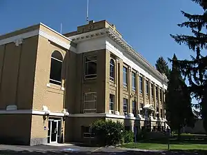 Caribou County Courthouse |
September 22, 1987 (#87001582) |
159 S. Main 42°39′21″N 111°36′08″W |
Soda Springs | |
| 2 | Chesterfield Historic District | 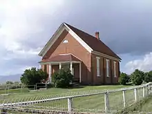 Chesterfield Historic District |
December 4, 1980 (#80001297) |
Town of Chesterfield 42°52′01″N 111°54′22″W |
Chesterfield | |
| 3 | Enders Hotel | 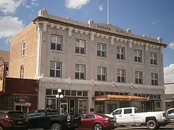 Enders Hotel |
May 14, 1993 (#93000384) |
76 S. Main St. 42°39′27″N 111°36′12″W |
Soda Springs | |
| 4 | Grace Pegram Truss Railroad Bridge |  Grace Pegram Truss Railroad Bridge |
July 25, 1997 (#97000758) |
Over the Bear River 0.5 miles (0.80 km) north-northwest of the junction of State Highway 34 and Turner Rd. 42°35′06″N 111°44′05″W |
Grace | |
| 5 | William Hopkins House | 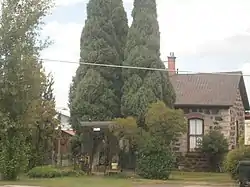 William Hopkins House |
January 8, 1979 (#79000787) |
351 E. Hooper Ave. 42°39′33″N 111°35′33″W |
Soda Springs | |
| 6 | Lander Road | April 24, 1975 (#75000627) |
Northeast of Soda Springs in the Caribou National Forest, south of State Highway 34 42°52′55″N 111°11′07″W |
Soda Springs | ||
| 7 | Edgar Walter Largilliere Sr. House | 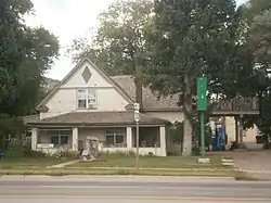 Edgar Walter Largilliere Sr. House |
December 23, 1991 (#91001870) |
30 W. 2nd, S. St. 42°39′18″N 111°36′13″W |
Soda Springs | |
| 8 | Soda Springs City Hall | 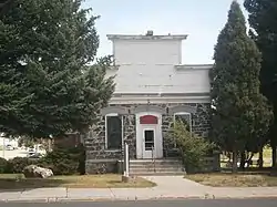 Soda Springs City Hall |
May 14, 1993 (#93000385) |
109 S. Main St. 42°39′24″N 111°36′08″W |
Soda Springs |
See also
| Wikimedia Commons has media related to National Register of Historic Places in Caribou County, Idaho. |
References
- The latitude and longitude information provided in this table was derived originally from the National Register Information System, which has been found to be fairly accurate for about 99% of listings. Some locations in this table may have been corrected to current GPS standards.
- "National Register of Historic Places: Weekly List Actions". National Park Service. Retrieved March 29, 2009.
- "National Register of Historic Places: Weekly List Actions". National Park Service, United States Department of the Interior. Retrieved on February 5, 2021.
- Numbers represent an alphabetical ordering by significant words. Various colorings, defined here, differentiate National Historic Landmarks and historic districts from other NRHP buildings, structures, sites or objects.
- "National Register Information System". National Register of Historic Places. National Park Service. April 24, 2008.
- The eight-digit number below each date is the number assigned to each location in the National Register Information System database, which can be viewed by clicking the number.
| Topics | |
|---|---|
| Lists by state |
|
| Lists by insular areas | |
| Lists by associated state | |
| Other areas | |
| Related | |
| |
Municipalities and communities of Caribou County, Idaho, United States | ||
|---|---|---|
| Cities | Map of Idaho highlighting Caribou County | |
| Unincorporated communities | ||
| Indian reservation | ||
| Ghost town | ||
| Footnotes | ‡ This populated place also extends into Wyoming, ‡‡ This populated place also has portions in an adjacent county or counties | |
| ||
This article is issued from Wikipedia. The text is licensed under Creative Commons - Attribution - Sharealike. Additional terms may apply for the media files.