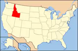
National Register of Historic Places listings in Bingham County, Idaho
This is a list of the National Register of Historic Places listings in Bingham County, Idaho.
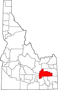
Location of Bingham County in Idaho
This is intended to be a complete list of the properties and districts on the National Register of Historic Places in Bingham County, Idaho, United States. Latitude and longitude coordinates are provided for many National Register properties and districts; these locations may be seen together in a map.[1]
There are 18 properties and districts listed on the National Register in the county. More may be added; properties and districts nationwide are added to the Register weekly.[2]
- This National Park Service list is complete through NPS recent listings posted February 5, 2021.[3]
Current listings
| [4] | Name on the Register[5] | Image | Date listed[6] | Location | City or town | Description |
|---|---|---|---|---|---|---|
| 1 | Aviator's Cave |  Aviator's Cave |
July 22, 2010 (#09001224) |
Grounds of Idaho National Laboratory[7] Address Restricted |
Arco | |
| 2 | Blackfoot I.O.O.F. Hall |  Blackfoot I.O.O.F. Hall |
May 15, 1979 (#79000775) |
57 Bridge St. 43°11′22″N 112°20′41″W |
Blackfoot | |
| 3 | Blackfoot LDS Tabernacle |  Blackfoot LDS Tabernacle |
September 19, 1977 (#77000456) |
120 S. Shilling St. 43°11′12″N 112°20′34″W |
Blackfoot | |
| 4 | Blackfoot Railway Depot |  Blackfoot Railway Depot |
November 20, 1974 (#74000731) |
130 NW Main St. 43°11′22″N 112°20′35″W |
Blackfoot | Now houses the Idaho Potato Museum |
| 5 | Eastern Idaho District Fair Historic District |  Eastern Idaho District Fair Historic District |
August 10, 2001 (#01000864) |
97 Park Dr. 43°11′45″N 112°20′23″W |
Blackfoot | |
| 6 | Fort Hall Site | 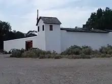 Fort Hall Site |
November 21, 1974 (#74000732) |
16 miles north of Fort Hall 43°08′55″N 112°10′58″W |
Fort Hall | Site of the second Fort Hall (1870-1883). |
| 7 | Idaho Republican Building | 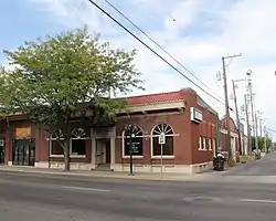 Idaho Republican Building |
October 16, 1979 (#79000776) |
167 W. Bridge St. 43°11′24″N 112°20′44″W |
Blackfoot | |
| 8 | J.W. Jones Building |  J.W. Jones Building |
November 17, 1982 (#82000319) |
104 Main St., NE. 43°11′23″N 112°20′38″W |
Blackfoot | |
| 9 | Nels and Emma Just House | July 17, 2020 (#100005363) |
995 Reid Rd. 43°15′51″N 112°06′08″W |
Firth | ||
| 10 | Lincoln Creek Day School | April 9, 2010 (#10000174) |
Rich Lane, eight miles southeast of Idaho State Highway 91 43°11′19″N 112°12′14″W |
Blackfoot | ||
| 11 | North Shilling Historic District |  North Shilling Historic District |
August 29, 1979 (#79000777) |
N. Shilling Ave. 43°11′19″N 112°20′28″W |
Blackfoot | |
| 12 | Nuart Theater |  Nuart Theater |
October 19, 1978 (#78001049) |
195 N. Broadway 43°11′27″N 112°20′38″W |
Blackfoot | |
| 13 | Ross Fork Episcopal Church | 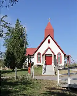 Ross Fork Episcopal Church |
January 3, 1983 (#83000277) |
Mission Rd. 43°11′23″N 112°20′38″W |
Fort Hall | |
| 14 | Ross Fork Oregon Short Lines Railroad Depot |  Ross Fork Oregon Short Lines Railroad Depot |
September 7, 1984 (#84001019) |
Agency Rd. 43°01′47″N 112°25′51″W |
Fort Hall | |
| 15 | St. Paul's Episcopal Church | 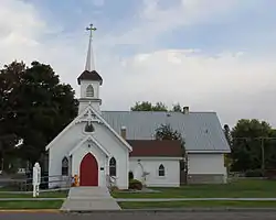 St. Paul's Episcopal Church |
May 15, 1979 (#79000778) |
72 N. Shilling Ave. 43°11′17″N 112°20′29″W |
Blackfoot | |
| 16 | Shilling Avenue Historic District |  Shilling Avenue Historic District |
August 18, 1983 (#83000278) |
Shilling Ave. between E. Idaho and Bingham Sts. and Bridge and Judicial Sts. to Stout Ave. 43°11′13″N 112°20′32″W |
Blackfoot | |
| 17 | Standrod Bank |  Standrod Bank |
August 30, 1979 (#79000779) |
59 and 75 Main St., W. 43°11′22″N 112°20′40″W |
Blackfoot | |
| 18 | US Post Office-Blackfoot Main | 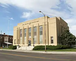 US Post Office-Blackfoot Main |
March 16, 1989 (#89000128) |
165 W. Pacific 43°11′27″N 112°20′42″W |
Blackfoot |
Proposed or formerly listed
- Dubois Historic District, roughly bounded by E. Main, Court, S. Shilling, and Bingham Sts., Blackfoot, Idaho. Status changed October 4, 1982, reference number 82005189.[5] Incorporated into Shilling Avenue Historic District, 1983.
See also
| Wikimedia Commons has media related to National Register of Historic Places in Bingham County, Idaho. |
References
- The latitude and longitude information provided in this table was derived originally from the National Register Information System, which has been found to be fairly accurate for about 99% of listings. Some locations in this table may have been corrected to current GPS standards.
- "National Register of Historic Places: Weekly List Actions". National Park Service. Retrieved March 29, 2009.
- "National Register of Historic Places: Weekly List Actions". National Park Service, United States Department of the Interior. Retrieved on February 5, 2021.
- Numbers represent an alphabetical ordering by significant words. Various colorings, defined here, differentiate National Historic Landmarks and historic districts from other NRHP buildings, structures, sites or objects.
- "National Register Information System". National Register of Historic Places. National Park Service. April 24, 2008.
- The eight-digit number below each date is the number assigned to each location in the National Register Information System database, which can be viewed by clicking the number.
- Stacy, Susan M. Proving the Principle: A History of the Idaho National Engineering and Environmental Laboratory, 1949-1999. Idaho Falls: USDOE, 2000, 4.
This article is issued from Wikipedia. The text is licensed under Creative Commons - Attribution - Sharealike. Additional terms may apply for the media files.

