National Register of Historic Places listings in Lincoln County, Idaho
This is a list of the National Register of Historic Places listings in Lincoln County, Idaho.
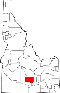
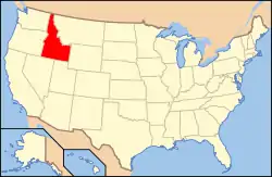
Location of Lincoln County in Idaho
This is intended to be a complete list of the properties and districts on the National Register of Historic Places in Lincoln County, Idaho, United States. Latitude and longitude coordinates are provided for many National Register properties and districts; these locations may be seen together in a map.[1]
There are 41 properties and districts listed on the National Register in the county. More may be added; properties and districts nationwide are added to the Register weekly.[2]
- This National Park Service list is complete through NPS recent listings posted February 5, 2021.[3]
Current listings
| [4] | Name on the Register[5] | Image | Date listed[6] | Location | City or town | Description |
|---|---|---|---|---|---|---|
| 1 | American Legion Hall | 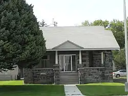 American Legion Hall |
September 8, 1983 (#83002355) |
107 W. A St. 42°56′04″N 114°24′25″W |
Shoshone | |
| 2 | Jose and Gertrude Anasola House | 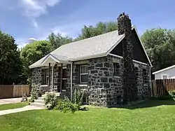 Jose and Gertrude Anasola House |
September 8, 1983 (#83002356) |
120 N. Alta St. 42°56′13″N 114°24′11″W |
Shoshone | |
| 3 | Galo Arambarri Boarding House | 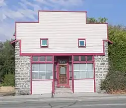 Galo Arambarri Boarding House |
September 8, 1983 (#83002357) |
109 N. Greenwood St. 42°56′15″N 114°24′17″W |
Shoshone | |
| 4 | S.A. Bate Barn and Chicken House | 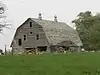 S.A. Bate Barn and Chicken House |
September 8, 1983 (#83002358) |
Southeast of Dietrich 42°53′05″N 114°15′14″W |
Dietrich | |
| 5 | W. H. Baugh House | September 8, 1983 (#83002359) |
East of Shoshone 42°57′38″N 114°18′36″W |
Shoshone | ||
| 6 | Ignacio Berriochoa Farm | September 8, 1983 (#83002360) |
Northwest of Dietrich 42°55′10″N 114°18′03″W |
Dietrich | ||
| 7 | Birdie Boussuet Farm | September 8, 1983 (#83002361) |
West of Richfield 43°01′54″N 114°11′24″W |
Richfield | ||
| 8 | Tom Byrne House | September 8, 1983 (#83002362) |
Northeast of Shoshone 43°07′45″N 114°15′54″W |
Shoshone | ||
| 9 | Custer Slaughter House | 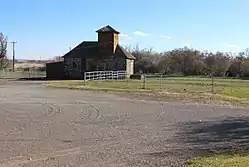 Custer Slaughter House |
September 8, 1983 (#83002363) |
West of Shoshone 42°56′41″N 114°24′41″W |
Shoshone | |
| 10 | Darrah House and Water Tank House | September 8, 1983 (#83002365) |
Northeast of Shoshone 42°58′55″N 114°21′32″W |
Shoshone | ||
| 11 | Ben Darrah Water Tank and Well House | 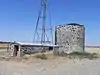 Ben Darrah Water Tank and Well House |
September 8, 1983 (#83002364) |
North of Shoshone 43°01′34″N 114°24′58″W |
Shoshone | |
| 12 | Charles W. Dill House | 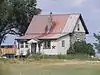 Charles W. Dill House |
September 8, 1983 (#83002366) |
East of Shoshone 42°55′08″N 114°21′45″W |
Shoshone | |
| 13 | Alvin Eskelton Barn | September 8, 1983 (#83002367) |
Northwest of Richfield 43°05′34″N 114°10′25″W |
Richfield | ||
| 14 | George H. Gaches Cellar and Ice House | September 8, 1983 (#83002368) |
Northwest of Shoshone 43°01′07″N 114°26′43″W |
Shoshone | ||
| 15 | Thomas Gooding Water Tank House | September 8, 1983 (#83002369) |
Northwest of Shoshone 43°01′32″N 114°30′55″W |
Shoshone | ||
| 16 | Gehrig Gottfried Cabin | September 8, 1983 (#83002370) |
Northwest of Shoshone 43°02′45″N 114°19′33″W |
Shoshone | ||
| 17 | Daniel A. Hunt House | 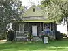 Daniel A. Hunt House |
September 8, 1983 (#83002371) |
Southwest of Dietrich 42°52′06″N 114°17′41″W |
Dietrich | |
| 18 | J.C. Penney Company Building | 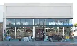 J.C. Penney Company Building |
September 8, 1983 (#83002372) |
104 S. Rail St. 42°56′06″N 114°24′21″W |
Shoshone | |
| 19 | Louis Johnson Barn | September 8, 1983 (#83002373) |
Southwest of Richfield 43°01′36″N 114°13′45″W |
Richfield | ||
| 20 | Louis Johnson Water Tank House | September 8, 1983 (#83002374) |
West of Richfield 43°01′30″N 114°14′37″W |
Richfield | ||
| 21 | Quet Johnson Farm | September 8, 1983 (#83002375) |
Northwest of Richfield 43°05′55″N 114°10′10″W |
Richfield | ||
| 22 | W.S. Kohl Barn | September 8, 1983 (#83002376) |
Northeast of Richfield 43°04′25″N 114°07′54″W |
Richfield | ||
| 23 | James H. Lane Barn | 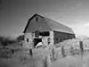 James H. Lane Barn |
September 8, 1983 (#83002377) |
South of Richfield 43°02′33″N 114°09′07″W |
Richfield | |
| 24 | Lemmon Hardware Store | September 8, 1983 (#83002378) |
Main St. and Nez Perce Ave. 43°02′58″N 114°09′08″W |
Richfield | ||
| 25 | W.H. Murphy House | 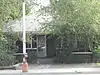 W.H. Murphy House |
September 8, 1983 (#83002379) |
607 S. Greenwood St. 42°55′53″N 114°24′30″W |
Shoshone | |
| 26 | Myers School | September 8, 1983 (#83002380) |
West of Shoshone 42°57′28″N 114°29′20″W |
Shoshone | ||
| 27 | A.G. Newman House | 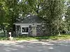 A.G. Newman House |
September 8, 1983 (#83002381) |
309 E. C St. 42°55′55″N 114°24′16″W |
Shoshone | |
| 28 | Thomas Olley House | 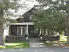 Thomas Olley House |
September 8, 1983 (#83002382) |
522 N. Apple St. 42°56′28″N 114°24′20″W |
Shoshone | |
| 29 | Jack Oughton House | 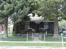 Jack Oughton House |
September 8, 1983 (#83002383) |
123 N. Beverly St. 42°56′13″N 114°24′08″W |
Shoshone | |
| 30 | Denton J. Paul Water Tank | 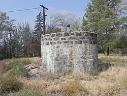 Denton J. Paul Water Tank |
September 8, 1983 (#83002384) |
East of Dietrich 42°54′31″N 114°14′28″W |
Dietrich | |
| 31 | Kenneth G. Phelphs Barn | September 8, 1983 (#83002385) |
West of Richfield 43°02′58″N 114°10′25″W |
Richfield | ||
| 32 | Purdum Livery Stable | September 15, 1983 (#83002393) |
113 N. Rail St., E. 42°56′09″N 114°24′16″W |
Shoshone | ||
| 33 | Richfield Pump House | September 8, 1983 (#83002386) |
Southeast of Richfield 43°02′30″N 114°09′01″W |
Richfield | ||
| 34 | William M. Ritter House | September 8, 1983 (#83002387) |
Northeast of Shoshone 43°01′10″N 114°21′13″W |
Shoshone | ||
| 35 | Shoshone Historic District | June 27, 1975 (#75000636) |
Irregular pattern, including the northern bank of the Little Wood River and W. D St.; also 115 N. Greenwood St. 42°56′02″N 114°24′28″W |
Shoshone | Greenwood St. address represents a boundary increase | |
| 36 | Arthur D. Silva Flume | September 8, 1983 (#83002388) |
Northwest of Shoshone 42°59′26″N 114°26′59″W |
Shoshone | ||
| 37 | Arthur D. Silva Ranch | September 8, 1983 (#83002389) |
Northwest of Shoshone 42°59′37″N 114°27′14″W |
Shoshone | ||
| 38 | Arthur D. Silva Water Tank | September 8, 1983 (#83002390) |
Northwest of Shoshone 42°59′43″N 114°27′14″W |
Shoshone | ||
| 39 | Manuel Silva Barn | Manuel Silva Barn |
September 8, 1983 (#83002391) |
East of Shoshone 42°55′34″N 114°21′35″W |
Shoshone | |
| 40 | John G. Turner House | September 8, 1983 (#83002392) |
West of Richfield 43°00′20″N 114°14′23″W |
Richfield | ||
| 41 | Wood River Center Grange No. 87 | 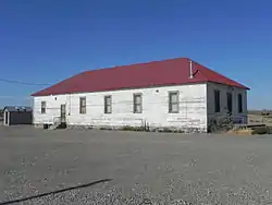 Wood River Center Grange No. 87 |
July 3, 2003 (#03000586) |
375 W. 4 Mile Rd. 43°00′12″N 114°28′43″W |
Shoshone |
See also
| Wikimedia Commons has media related to National Register of Historic Places in Lincoln County, Idaho. |
References
- The latitude and longitude information provided in this table was derived originally from the National Register Information System, which has been found to be fairly accurate for about 99% of listings. Some locations in this table may have been corrected to current GPS standards.
- "National Register of Historic Places: Weekly List Actions". National Park Service. Retrieved March 29, 2009.
- "National Register of Historic Places: Weekly List Actions". National Park Service, United States Department of the Interior. Retrieved on February 5, 2021.
- Numbers represent an alphabetical ordering by significant words. Various colorings, defined here, differentiate National Historic Landmarks and historic districts from other NRHP buildings, structures, sites or objects.
- "National Register Information System". National Register of Historic Places. National Park Service. April 24, 2008.
- The eight-digit number below each date is the number assigned to each location in the National Register Information System database, which can be viewed by clicking the number.
| Topics | |
|---|---|
| Lists by state |
|
| Lists by insular areas | |
| Lists by associated state | |
| Other areas | |
| Related | |
| |
Municipalities and communities of Lincoln County, Idaho, United States | ||
|---|---|---|
| Cities | Map of Idaho highlighting Lincoln County | |
| Unincorporated community | ||
| ||
This article is issued from Wikipedia. The text is licensed under Creative Commons - Attribution - Sharealike. Additional terms may apply for the media files.