National Register of Historic Places listings in Bonneville County, Idaho
This is a list of the National Register of Historic Places listings in Bonneville County, Idaho.
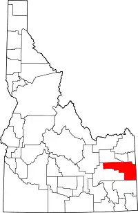
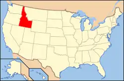
Location of Bonneville County in Idaho
This is intended to be a complete list of the properties and districts on the National Register of Historic Places in Bonneville County, Idaho, United States. Latitude and longitude coordinates are provided for many National Register properties and districts; these locations may be seen together in a map.[1]
There are 32 properties and districts listed on the National Register in the county. More may be added; properties and districts nationwide are added to the Register weekly.[2]
- This National Park Service list is complete through NPS recent listings posted February 5, 2021.[3]
Current listings
| [4] | Name on the Register[5] | Image | Date listed[6] | Location | City or town | Description |
|---|---|---|---|---|---|---|
| 1 | Andrew and Johanna M. Beckman Farm | November 6, 1992 (#92001414) |
U.S. Route 20, 0.5 miles west of its junction with New Sweden Rd. 43°29′37″N 112°08′12″W |
Idaho Falls | ||
| 2 | Oscar and Christina Beckman Farmstead | November 19, 1991 (#91001713) |
Southwestern corner of the junction of New Sweden-Shelley Rd. and U.S. Route 20 43°29′38″N 112°07′28″W |
Idaho Falls | ||
| 3 | Bonneville County Courthouse | 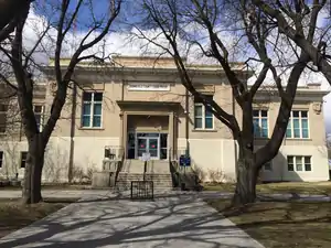 Bonneville County Courthouse |
July 10, 1979 (#79000781) |
605 N. Capital Ave. 43°29′42″N 112°02′25″W |
Idaho Falls | |
| 4 | Bonneville Hotel |  Bonneville Hotel |
August 30, 1984 (#84001032) |
400 block of W. C St. 43°29′41″N 112°02′19″W |
Idaho Falls | |
| 5 | Douglas-Farr Building | August 30, 1984 (#84001035) |
493 N. Capital Ave. 43°29′38″N 112°02′25″W |
Idaho Falls | ||
| 6 | Eagle Rock Ferry | June 7, 1974 (#74000734) |
North of Idaho Falls on the Snake River 43°36′15″N 112°03′23″W |
Idaho Falls | ||
| 7 | Eleventh Street Historic District | August 8, 1997 (#97000863) |
Roughly bounded by S. Boulevard, 13th, 10th, and 9th Sts., S. Emerson and S. Lee Aves. 43°29′18″N 112°01′47″W |
Idaho Falls | ||
| 8 | Farmers and Merchants Bank Building | August 30, 1984 (#84001037) |
383 W. A St. 43°29′31″N 112°02′24″W |
Idaho Falls | ||
| 9 | First Presbyterian Church | 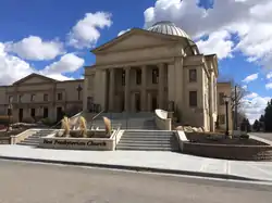 First Presbyterian Church |
March 29, 1978 (#78001052) |
325 Elm St. 43°29′22″N 112°02′06″W |
Idaho Falls | |
| 10 | Hasbrouck Building | 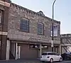 Hasbrouck Building |
August 30, 1984 (#84001039) |
362 Park Ave. 43°29′33″N 112°02′24″W |
Idaho Falls | |
| 11 | Holy Rosary Church | 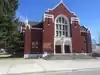 Holy Rosary Church |
July 17, 2002 (#02000802) |
288 E. 9th St. 43°29′22″N 112°01′47″W |
Idaho Falls | |
| 12 | Hotel Idaho | 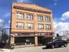 Hotel Idaho |
August 30, 1984 (#84001042) |
482 W. C St. 43°29′42″N 112°02′22″W |
Idaho Falls | |
| 13 | I.O.O.F. Building | 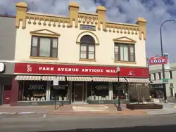 I.O.O.F. Building |
August 30, 1984 (#84001090) |
393 N. Park Ave. 43°29′34″N 112°02′28″W |
Idaho Falls | |
| 14 | Idaho Falls Airport Historic District | September 10, 1997 (#97001126) |
2381 Foote Dr. 43°31′02″N 112°03′30″W |
Idaho Falls | ||
| 15 | Idaho Falls City Building | 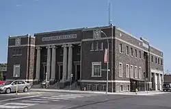 Idaho Falls City Building |
August 30, 1984 (#84001092) |
303 W. C St. 43°29′39″N 112°02′15″W |
Idaho Falls | |
| 16 | Idaho Falls Public Library | 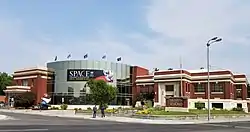 Idaho Falls Public Library |
August 30, 1984 (#84001093) |
200 N. Eastern Dr. 43°29′25″N 112°02′14″W |
Idaho Falls | |
| 17 | Iona Meetinghouse | 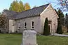 Iona Meetinghouse |
May 7, 1973 (#73000681) |
Southeast corner of Main St. and Rockwood Ave. 43°31′41″N 111°55′42″W |
Iona | Built in 1887, now the Stanger Memorial Art Gallery |
| 18 | Kress Building | 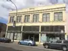 Kress Building |
August 30, 1984 (#84001095) |
451 N. Park Ave. 43°29′36″N 112°02′24″W |
Idaho Falls | |
| 19 | Montgomery Ward Building | 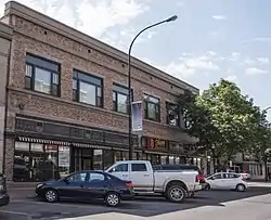 Montgomery Ward Building |
August 30, 1984 (#84001096) |
504–520 Shoup Ave. 43°29′35″N 112°02′16″W |
Idaho Falls | |
| 20 | New Sweden School | November 19, 1991 (#91001714) |
Southwestern corner of the junction of New Sweden School Rd. and Mill Rd. 43°28′56″N 112°06′07″W |
Idaho Falls | ||
| 21 | Palisades Dam and Powerplant Historic District | 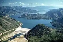 Palisades Dam and Powerplant Historic District |
August 6, 2018 (#100002771) |
US 26, .81 mi. S of jct. with Forest Road 260 43°20′02″N 111°12′16″W |
Palisades vicinity | |
| 22 | Ridge Avenue Historic District | May 20, 1993 (#93000388) |
Roughly bounded by N. Eastern Ave., Birch St., S. Boulevard, Ash St., W. Placer Ave., and Pine St. 43°29′24″N 112°02′07″W |
Idaho Falls | ||
| 23 | Rocky Mountain Bell Telephone Company Building | August 30, 1984 (#84001099) |
246 W. Broadway Ave. 43°29′29″N 112°02′20″W |
Idaho Falls | ||
| 24 | Salt River Hydroelectric Powerplant | December 2, 1993 (#93000889) |
End of County Road 12-104, 0.7 miles west of U.S. Route 89 43°06′14″N 111°02′20″W |
Wayan | Extends into Lincoln County, Wyoming | |
| 25 | Carl S. and Lizzie Sealander Farmstead | May 5, 1992 (#92000414) |
Western end of St. John Rd. 43°26′30″N 112°09′57″W |
Idaho Falls | ||
| 26 | Shane Building | 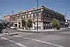 Shane Building |
August 30, 1984 (#84001101) |
381 N. Shoup Ave. 43°29′32″N 112°02′21″W |
Idaho Falls | |
| 27 | Shelton L.D.S. Ward Chapel | 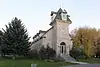 Shelton L.D.S. Ward Chapel |
August 30, 1979 (#79000783) |
Southwest of Ririe on Shelton Rd 43°37′07″N 111°49′23″W |
Ririe | |
| 28 | Trinity Methodist Church | 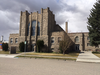 Trinity Methodist Church |
December 16, 1977 (#77000458) |
237 N. Water Ave. 43°29′25″N 112°02′13″W |
Idaho Falls | |
| 29 | Art Troutner Houses Historic District | September 10, 2008 (#08000868) |
3950, 4012, and 4032 S. 5th, W. 43°31′34″N 112°01′25″W |
Idaho Falls | ||
| 30 | U.S. Post Office | 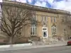 U.S. Post Office |
May 31, 1979 (#79000782) |
581 Park Ave. 43°29′40″N 112°02′20″W |
Idaho Falls | |
| 31 | Underwood Hotel | 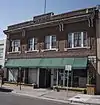 Underwood Hotel |
August 30, 1984 (#84001102) |
343-349 W. C St. 43°29′38″N 112°02′17″W |
Idaho Falls | |
| 32 | Wasden Site (Owl Cave) |  Wasden Site (Owl Cave) |
May 24, 1976 (#76000669) |
Address Restricted[7] |
Idaho Falls |
Former listings
| [4] | Name on the Register | Image | Date listed | Date removed | Location | City or town | Summary |
|---|---|---|---|---|---|---|---|
| 1 | Eagle Rock Street Historic District | 1973 (#73002267) | Unknown | 353, 357, 361, and 375 Eagle Rock St. |
Idaho Falls | ||
| 2 | Snake River Ranger Station | Snake River Ranger Station |
1983 (#83000297) | July 16, 1993 | US Highway 26 |
Swan Valley |
See also
| Wikimedia Commons has media related to National Register of Historic Places in Bonneville County, Idaho. |
References
- The latitude and longitude information provided in this table was derived originally from the National Register Information System, which has been found to be fairly accurate for about 99% of listings. Some locations in this table may have been corrected to current GPS standards.
- "National Register of Historic Places: Weekly List Actions". National Park Service. Retrieved March 29, 2009.
- "National Register of Historic Places: Weekly List Actions". National Park Service, United States Department of the Interior. Retrieved on February 5, 2021.
- Numbers represent an alphabetical ordering by significant words. Various colorings, defined here, differentiate National Historic Landmarks and historic districts from other NRHP buildings, structures, sites or objects.
- "National Register Information System". National Register of Historic Places. National Park Service. April 24, 2008.
- The eight-digit number below each date is the number assigned to each location in the National Register Information System database, which can be viewed by clicking the number.
- Some listings on the NRHP are highly sensitive sites and may be subject to looting or vandalism. The NRHP lists this site as "Address Restricted."
| Topics | |
|---|---|
| Lists by state |
|
| Lists by insular areas | |
| Lists by associated state | |
| Other areas | |
| Related | |
| |
Municipalities and communities of Bonneville County, Idaho, United States | ||
|---|---|---|
| Cities | Map of Idaho highlighting Bonneville County | |
| CDP | ||
| Unincorporated communities | ||
| Footnotes | ‡This populated place also has portions in an adjacent county or counties | |
| ||
This article is issued from Wikipedia. The text is licensed under Creative Commons - Attribution - Sharealike. Additional terms may apply for the media files.