Merrick County, Nebraska
Merrick County is a county in the U.S. state of Nebraska. As of the 2010 United States Census, the population was 7,845.[1] Its county seat is Central City.[2]
Merrick County | |
|---|---|
| County of Merrick | |
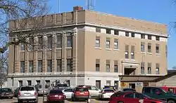 Merrick County Courthouse in Central City | |
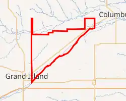
Interactive map of Merrick County | |
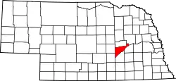 Location within the U.S. state of Nebraska | |
| Country | |
| State | |
| Established | November 4, 1858 |
| Organized | April 18, 1864 |
| Named for | Elvira Merrick |
| County seat | Central City |
| Largest city | Central City |
| Area | |
| • Total | 494 sq mi (1,280 km2) |
| • Land | 485 sq mi (1,260 km2) |
| • Water | 9.6 sq mi (25 km2) 1.9% |
| Highest elevation | 1,880 ft (570 m) |
| Lowest elevation | 1,345 ft (410 m) |
| Population | |
| • Estimate (2018) | 7,733 |
| • Density | 16.3/sq mi (6.3/km2) |
| Time zone | UTC−6 (Central) |
| • Summer (DST) | UTC−5 (CDT) |
| Area code | 308 |
| FIPS code | 31121 |
| GNIS feature ID | 835882 |
| Website | merrickcounty.ne.gov |
Merrick County is part of the Grand Island, NE Metropolitan Statistical Area.
In the Nebraska license plate system, Merrick County is represented by the prefix 46 (it had the 46th-largest number of vehicles registered in the state when the license plate system was established in 1922).
History
Merrick County was formed in 1858, and was organized in 1864.[3][4][5] It was named for Elvira Merrick, the maiden name of the wife of territorial legislator Henry W. DePuy, who introduced the bill that created the county.[6]
When first formed, the county was bounded on the south by the Platte River, and by straight lines on the north, east, and west; enclosing 180 square miles (470 km2) of the Pawnee Reservation, which had been established in 1857. In 1873, the state legislature removed these reservation lands from the county, leaving it with a jagged northern border from which narrow panhandles extended northward from the northeast and northwest corners. In 1897, the Pawnee Reservation became Nance County.[7]
Geography
The terrain of Merrick County is low rolling plains, sloping to the east and northeast. Most of the area is under cultivation. The Platte River flows northeastward along the southeast border line of the county. A smaller drainage, Prairie Creek, parallels the river, flowing northeastward through the center of the county before discharging into the Platte River northeast of Merrick County.[8] The county has an area of 494 square miles (1,280 km2), of which 485 square miles (1,260 km2) is land and 9.6 square miles (25 km2) (1.9%) is water.[9]
Major highways
Adjacent counties
- Platte County – northeast
- Polk County – east
- Hamilton County – south
- Hall County – southwest
- Howard County – west
- Nance County – north
Demographics
| Historical population | |||
|---|---|---|---|
| Census | Pop. | %± | |
| 1860 | 109 | — | |
| 1870 | 557 | 411.0% | |
| 1880 | 5,341 | 858.9% | |
| 1890 | 8,758 | 64.0% | |
| 1900 | 9,255 | 5.7% | |
| 1910 | 10,379 | 12.1% | |
| 1920 | 10,763 | 3.7% | |
| 1930 | 10,619 | −1.3% | |
| 1940 | 9,354 | −11.9% | |
| 1950 | 8,812 | −5.8% | |
| 1960 | 8,363 | −5.1% | |
| 1970 | 8,751 | 4.6% | |
| 1980 | 8,945 | 2.2% | |
| 1990 | 8,049 | −10.0% | |
| 2000 | 8,204 | 1.9% | |
| 2010 | 7,845 | −4.4% | |
| 2018 (est.) | 7,733 | [10] | −1.4% |
| US Decennial Census[11] 1790-1960[12] 1900-1990[13] 1990-2000[14] 2010-2013[1] | |||
As of the 2000 United States Census,[15] there were 8,204 people, 3,209 households, and 2,307 families in the county. The population density was 17 people per square mile (7/km2). There were 3,649 housing units at an average density of 8 per square mile (3/km2). The racial makeup of the county was 98.32% White, 0.22% Black or African American, 0.10% Native American, 0.21% Asian, 0.01% Pacific Islander, 0.67% from other races, and 0.48% from two or more races. 2.05% of the population were Hispanic or Latino of any race.
There were 3,209 households, out of which 33.30% had children under the age of 18 living with them, 61.10% were married couples living together, 6.50% had a female householder with no husband present, and 28.10% were non-families. 25.00% of all households were made up of individuals, and 13.10% had someone living alone who was 65 years of age or older. The average household size was 2.51 and the average family size was 2.99.
The county population contained 27.50% under the age of 18, 6.40% from 18 to 24, 24.70% from 25 to 44, 23.80% from 45 to 64, and 17.50% who were 65 years of age or older. The median age was 39 years. For every 100 females, there were 95.90 males. For every 100 females age 18 and over, there were 94.90 males.
The median income for a household in the county was $34,961, and the median income for a family was $39,729. Males had a median income of $26,998 versus $19,828 for females. The per capita income for the county was $15,958. About 7.00% of families and 8.90% of the population were below the poverty line, including 9.70% of those under age 18 and 9.20% of those age 65 or over.
Politics
Merrick County voters have been strongly Republican for decades. In no national election since 1936 has the county selected the Democratic Party candidate (as of 2016).
| Year | Republican | Democratic | Third Parties |
|---|---|---|---|
| 2020 | 79.8% 3,419 | 17.4% 743 | 2.8% 120 |
| 2016 | 77.2% 2,926 | 15.9% 602 | 6.9% 260 |
| 2012 | 71.4% 2,490 | 26.5% 925 | 2.1% 74 |
| 2008 | 69.2% 2,375 | 28.7% 986 | 2.0% 70 |
| 2004 | 75.8% 2,771 | 22.8% 833 | 1.5% 53 |
| 2000 | 71.3% 2,380 | 25.4% 848 | 3.4% 112 |
| 1996 | 58.7% 2,084 | 28.1% 997 | 13.3% 471 |
| 1992 | 48.7% 1,854 | 22.7% 864 | 28.7% 1,093 |
| 1988 | 66.2% 2,376 | 33.2% 1,192 | 0.7% 24 |
| 1984 | 76.1% 2,700 | 23.1% 818 | 0.8% 28 |
| 1980 | 73.4% 2,710 | 19.3% 712 | 7.4% 272 |
| 1976 | 60.2% 2,229 | 36.7% 1,360 | 3.1% 113 |
| 1972 | 73.2% 2,418 | 26.8% 887 | |
| 1968 | 65.9% 2,031 | 27.3% 840 | 6.9% 212 |
| 1964 | 50.8% 1,798 | 49.2% 1,741 | |
| 1960 | 69.0% 2,744 | 31.0% 1,234 | |
| 1956 | 71.7% 2,857 | 28.3% 1,126 | |
| 1952 | 77.3% 3,288 | 22.7% 965 | |
| 1948 | 62.1% 2,074 | 37.9% 1,267 | |
| 1944 | 65.9% 2,691 | 34.1% 1,390 | |
| 1940 | 66.3% 2,886 | 33.7% 1,466 | |
| 1936 | 48.4% 2,367 | 49.1% 2,401 | 2.4% 119 |
| 1932 | 36.2% 1,698 | 61.4% 2,881 | 2.5% 117 |
| 1928 | 69.6% 3,269 | 29.9% 1,403 | 0.6% 27 |
| 1924 | 54.3% 2,324 | 26.6% 1,137 | 19.1% 816 |
| 1920 | 65.1% 2,385 | 29.4% 1,075 | 5.5% 203 |
| 1916 | 44.8% 1,178 | 51.3% 1,349 | 3.8% 101 |
| 1912 | 22.7% 526 | 40.9% 950 | 36.4% 845 |
| 1908 | 46.9% 1,133 | 44.8% 1,081 | 8.3% 201 |
| 1904 | 61.1% 1,275 | 19.2% 400 | 19.7% 412 |
| 1900 | 52.3% 1,212 | 43.0% 996 | 4.8% 110 |
References
- "State & County QuickFacts". US Census Bureau. Archived from the original on June 7, 2011. Retrieved September 21, 2013.
- "Find a County". National Association of Counties. Retrieved 7 June 2011.
- Fitzpatrick, Lilian Linder (1925). Nebraska Place-Names. Lincoln: University of Nebraska Studies in Language, Literature, and Criticism. p. 102. Retrieved December 19, 2014.
- "Nebraska Historic Buildings Survey Reconnaissance Survey Final Report of Merrick County, Nebraska" (PDF). Nebraska State Historical Society. August 1, 1992. Retrieved December 19, 2014.
- Andreas, A. T. (1882). "Andreas' History of the State of Nebraska". The Kansas Collection. Archived from the original on 2003-05-08. Retrieved December 19, 2014.
- "Nebraska Place Names (1925)". NEGenWeb Project. Retrieved 8 January 2015.
- "Merrick County's 100th Year: 1858-1958". NEGenWeb Project. Retrieved 28 December 2009.
- Merrick County NE Google Maps (accessed 23 January 2019)
- "2010 Census Gazetteer Files". US Census Bureau. August 22, 2012. Archived from the original on November 13, 2013. Retrieved December 9, 2014.
- "Population and Housing Unit Estimates". Retrieved December 30, 2019.
- "US Decennial Census". US Census Bureau. Retrieved December 9, 2014.
- "Historical Census Browser". University of Virginia Library. Retrieved December 9, 2014.
- "Population of Counties by Decennial Census: 1900 to 1990". US Census Bureau. Retrieved December 9, 2014.
- "Census 2000 PHC-T-4. Ranking Tables for Counties: 1990 and 2000" (PDF). US Census Bureau. Retrieved December 9, 2014.
- "U.S. Census website". US Census Bureau. Retrieved 31 January 2008.
- Election Results
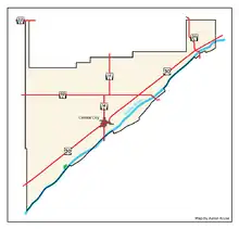
Places adjacent to Merrick County, Nebraska | ||||||||||
|---|---|---|---|---|---|---|---|---|---|---|
| ||||||||||
| Wikimedia Commons has media related to Merrick County, Nebraska. |
Municipalities and communities of Merrick County, Nebraska, United States | ||
|---|---|---|
| City | Map of Nebraska highlighting Merrick County | |
| Villages | ||
| Townships | ||
| CDP | ||
| Unincorporated communities | ||
| ||

| Authority control |
|---|