Comanche County, Texas
Comanche County is a county located on the Edwards Plateau in Central Texas. As of the 2010 census, its population was 13,974.[1] The county seat is Comanche.[2] The county was founded in 1856 and is named for the Comanche Native American tribe.
Comanche County | |
|---|---|
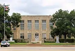 The Comanche County Courthouse in Comanche | |
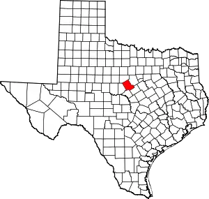 Location within the U.S. state of Texas | |
 Texas's location within the U.S. | |
| Coordinates: 31°57′N 98°34′W | |
| Country | |
| State | |
| Founded | 1856 |
| Named for | Comanche tribe |
| Seat | Comanche |
| Largest city | Comanche |
| Area | |
| • Total | 948 sq mi (2,460 km2) |
| • Land | 938 sq mi (2,430 km2) |
| • Water | 9.9 sq mi (26 km2) 1.0%% |
| Population (2010) | |
| • Total | 13,974 |
| • Density | 15/sq mi (6/km2) |
| Time zone | UTC−6 (Central) |
| • Summer (DST) | UTC−5 (CDT) |
| Congressional district | 11th |
History
Among the first inhabitants of present-day Comanche County were the Comanche Indian tribe.[3]
In 1854, Jesse M. Mercer and others organized a colony near the future settlement of Newburg.[4] in Comanche County on lands earlier granted by Mexico to Stephen F. Austin and Samuel May Williams.[5] Frank M. Collier built the first log house in the county.[6]
In 1856, the Texas legislature formed Comanche County from Coryell and Bosque counties. Cora community, named after Cora Beeman of Bell County, was designated as the county seat.[7] Comanche became the county seat in 1859.[8] As of 1860, the county population was 709 persons, including 61 slaves.[3]
The Comanche Chief[9] began publication in 1873. Editor Joe Hill's brother, Robert T. Hill, worked on the newspaper while developing his esteemed career as a geologist.[10]
In 1874, John Wesley Hardin and his gang celebrated his 21st birthday in Brown and Comanche counties. Deputy Charles Webb drew his gun, provoking a gunfight that ended Webb's life. A lynch mob was formed, but Hardin and his family were put into protective custody. The mob broke into the jail and hanged his brother Joe and two cousins. Hardin fled.[11] He was arrested in 1877 by Texas Rangers and a local authority on a train in Pensacola, Florida, while traveling under the alias James W. Swain.[12] He was tried in Comanche for the murder of Deputy Sheriff Charles Webb, and sentenced to 25 years in Huntsville Prison.[13]
Known for its fertile soil, Comanche County was a hotbed of political populism in the latter years of the 19th century.[14] In 1886, white residents drove African Americans out of the county with death threats and adopted a sundown town policy that prohibited African Americans from entering the county after dark.[15][16]
The Texas Central Railroad[17] began service in Comanche County in 1885 and began carrying cattle and cotton to market.[3] By 1890, cotton had become king in the county, but by the start of the 20th century, the boll weevil had devastated the county cotton industry for three decades. In 1907, farmers in the county began to experiment with peanut farming.[3]
Oil was discovered at Desdemona in 1910.[18][19] The peak year for the Comanche County oil boom was 1920.[3]
In the early 20th century, the Comanche region raised hogs, poultry, peanuts, watermelons, cantaloupes, and engaged in dairying. More than 70,000 fruit trees were grown in the county.[3] The area normally receives twenty inches of precipitation per year, but in the Dust Bowl of the Great Depression, drought conditions persisted. Farm products lost some 75 percent of their value during the depression, which the area state representative, Oscar Callaway, blamed primarily on the Federal Reserve System. Nearly 200 county families were on public relief, and area churches formed a private community chest for charity. Some sought employment as day laborers. Rabbits raided the peanut crop. Home canning saved many from total ruin. The county sought federal loans for water resources, civic buildings, and parks. At the time, none of the public schools in Comanche County even had a gymnasium. Ben Barnes, a lobbyist who was reared in Comanche County and formerly the former Speaker of the Texas House of Representatives and lieutenant governor, recalled how the Rural Electrification Administration in particular eased the plight of county residents. Despite the hardships, in 1934 all downtown buildings in the county seat were in use, and a few additional businesses opened even as the depression continued. Like much of the rest of the nation, Comanche County nevertheless persevered through the hard times.[14]
In 1951–1952, a desperate, drought-stricken county experimented with rain making.[3] Proctor Lake was impounded in 1963 to provide flood control and drinking water.[20]
From 1968 to 1974, Comanche County native Jim Reese served as the mayor of Odessa, Texas. He launched unsuccessful congressional campaigns in the 1976 general election against the Democrat George H. Mahon and in the 1978 Republican primary against George W. Bush. During the 1970s, the oil industrialist Bill Noël of Odessa purchased orchards in Comanche County.[21]
As of 1982, Comanche produced more than 45,546,000 pounds (20,659,000 kg) of peanuts, ranking second in Texas.[3]
Geography
According to the U.S. Census Bureau, the county has a total area of 948 square miles (2,460 km2), of which 938 square miles (2,430 km2) is land and 9.9 square miles (26 km2) (1.0%) is water.[22] The county is located some sixty miles north of the geographic center of Texas.
The county is home to Proctor Lake.
Adjacent counties
- Erath County (northeast)
- Hamilton County (southeast)
- Mills County (south)
- Brown County (southwest)
- Eastland County (northwest)
Demographics
| Historical population | |||
|---|---|---|---|
| Census | Pop. | %± | |
| 1860 | 709 | — | |
| 1870 | 1,001 | 41.2% | |
| 1880 | 8,608 | 759.9% | |
| 1890 | 15,608 | 81.3% | |
| 1900 | 23,009 | 47.4% | |
| 1910 | 27,186 | 18.2% | |
| 1920 | 25,748 | −5.3% | |
| 1930 | 18,430 | −28.4% | |
| 1940 | 19,245 | 4.4% | |
| 1950 | 15,516 | −19.4% | |
| 1960 | 11,865 | −23.5% | |
| 1970 | 11,898 | 0.3% | |
| 1980 | 12,617 | 6.0% | |
| 1990 | 13,381 | 6.1% | |
| 2000 | 14,026 | 4.8% | |
| 2010 | 13,974 | −0.4% | |
| 2019 (est.) | 13,635 | [23] | −2.4% |
| U.S. Decennial Census[24] 1850–2010[25] 2010–2014[1] | |||
As of the census[26] of 2000, there were 14,026 people, 5,522 households, and 3,926 families residing in the county. The population density was 15 people per square mile (6/km2). There were 7,105 housing units at an average density of 8 per square mile (3/km2). The racial makeup of the county was 87.30% White, 0.44% Black or African American, 0.61% Native American, 0.13% Asian, 0.01% Pacific Islander, 9.70% from other races, and 1.82% from two or more races. About 21% of the population were Hispanic or Latino of any race.
There were 5,522 households, of which 29.80% had children under the age of 18 living with them, 59.20% were married couples living together, 8.10% had a female householder with no husband present, and 28.90% were not families. About 26% of all households were made up of individuals, and 15.20% had someone living alone who was 65 years of age or older. The average household size was 2.48 and the average family size was 2.98.
In the county, the population was spread out, with 25.30% under the age of 18, 7.10% from 18 to 24, 23.30% from 25 to 44, 24.00% from 45 to 64, and 20.30% who were 65 years of age or older. The median age was 40 years. For every 100 females, there were 95.80 males. For every 100 females age 18 and over, there were 94.40 males.
The median income for a household in the county was $28,422, and the median income for a family was $34,810. Males had a median income of $26,094 versus $18,912 for females. The per capita income for the county was $14,677. About 14% of families and 17.30% of the population were below the poverty line, including 22.60% of those under age 18 and 16.00% of those age 65 or over.
Transportation
Major highways

 U.S. Highway 67/U.S. Highway 377
 State Highway 16
 State Highway 36
Airport
The Comanche County-City Airport is located two nautical miles (2.3 mi, 3.7 km) northeast of the City of Comanche's central business district.[27]
Media
Comanche County is currently listed as part of the Dallas-Fort Worth DMA. Local media outlets include KDFW-TV, KXAS-TV, WFAA-TV, KTVT-TV, KERA-TV, KTXA-TV, KDFI-TV, KDAF-TV, and KFWD-TV. Other nearby stations that provide coverage for Comanche County include KCEN-TV, KWTX-TV, and KAKW-DT from the Waco/Temple/Killeen DMA, and KTXS-TV, KTAB-TV, and KRBC-TV from the Abilene/Sweetwater/Brownwood DMA.
Two local newspapers serve Comanche County: the Comanche Chief and the De Leon Free Press.
Communities
Town
Unincorporated communities
Ghost towns
- Cora
- Mercer's Gap
- Suez
- Democrat
Politics
| Year | Republican | Democratic | Third parties |
|---|---|---|---|
| 2016 | 82.7% 4,333 | 15.1% 789 | 2.2% 115 |
| 2012 | 80.4% 3,944 | 18.1% 890 | 1.5% 72 |
| 2008 | 73.1% 3,813 | 25.6% 1,334 | 1.3% 70 |
| 2004 | 72.4% 3,813 | 27.2% 1,431 | 0.5% 24 |
| 2000 | 66.4% 3,334 | 32.6% 1,636 | 1.0% 52 |
| 1996 | 44.4% 2,123 | 44.7% 2,138 | 10.8% 518 |
| 1992 | 31.8% 1,666 | 43.8% 2,296 | 24.5% 1,286 |
| 1988 | 44.5% 2,120 | 55.1% 2,622 | 0.4% 19 |
| 1984 | 54.1% 2,678 | 45.4% 2,248 | 0.4% 22 |
| 1980 | 43.1% 1,977 | 55.6% 2,550 | 1.3% 61 |
| 1976 | 27.4% 1,297 | 72.2% 3,414 | 0.4% 20 |
| 1972 | 68.3% 2,608 | 30.8% 1,176 | 0.9% 34 |
| 1968 | 34.8% 1,436 | 48.0% 1,980 | 17.2% 709 |
| 1964 | 25.2% 962 | 74.7% 2,851 | 0.2% 6 |
| 1960 | 47.7% 1,828 | 51.7% 1,979 | 0.6% 23 |
| 1956 | 49.0% 1,900 | 50.6% 1,962 | 0.4% 16 |
| 1952 | 52.5% 2,411 | 47.5% 2,181 | 0.1% 4 |
| 1948 | 11.6% 408 | 83.2% 2,915 | 5.2% 182 |
| 1944 | 9.4% 356 | 77.7% 2,941 | 12.9% 490 |
| 1940 | 15.9% 610 | 84.1% 3,226 | 0.0% 1 |
| 1936 | 11.8% 355 | 86.1% 2,587 | 2.1% 63 |
| 1932 | 5.8% 192 | 93.9% 3,134 | 0.4% 13 |
| 1928 | 53.1% 1,483 | 46.9% 1,311 | |
| 1924 | 53.9% 456 | 32.6% 276 | 13.5% 114 |
| 1920 | 32.5% 930 | 57.1% 1,633 | 10.4% 297 |
| 1916 | 7.6% 148 | 76.4% 1,494 | 16.1% 314 |
| 1912 | 3.5% 68 | 85.8% 1,659 | 10.7% 206 |
See also
References
- "State & County QuickFacts". United States Census Bureau. Archived from the original on January 19, 2016. Retrieved December 9, 2013.
- "Find a County". National Association of Counties. Archived from the original on May 31, 2011. Retrieved 2011-06-07.
- Leffler, John. "Comanche County, Texas". Handbook of Texas Online. Texas State Historical Association. Retrieved December 1, 2010.
- Baker, T Lindsay (2005). More Ghost Towns of Texas. University of Oklahoma Press. pp. 106–107. ISBN 978-0-8061-3724-7.
- Henson, Margaret Swett. "Samuel May Williams". Handbook of Texas Online. Texas State Historical Association. Retrieved December 1, 2010.
- "1860 Comanche County, Texas Census, Index". TxGenWeb Project. Retrieved December 1, 2010.
- "Cora, Texas". Texas Escapes. Texas Escapes – Blueprints For Travel, LLC. Retrieved December 1, 2010.
- "Comanche, Texas". Texas Escapes. Texas Escapes – Blueprints For Travel, LLC. Retrieved December 1, 2010.
- Massey, Sara R (2006). Texas Women on the Cattle Trails. TAMU Press. p. 129. ISBN 978-1-58544-543-1.
- Alexander, Nancy S. "Robert Thomas Hill". Handbook of Texas Online. Texas State Historical Association. Retrieved December 1, 2010.
- Metz, Leon Claire (1998). "Charlie Webb Goes Down". John Wesley Hardin: Dark Angel of Texas. University of Oklahoma Press. pp. 133–138. ISBN 978-0-8061-2995-2.
- Smallwood, James (2008). The Feud That Wasn't: The Taylor Ring, Bill Sutton, John Wesley Hardin, and Violence in Texas. TAMU Press. p. 171. ISBN 978-1-60344-017-2.
- "A Guide to the John Wesley Hardin Collection, 1874–1931". Biographical Note. Texas State University-San Marcos. Missing or empty
|url=(help) - Don Holdridge, University of Texas of the Permian Basin in Odessa, Texas, "Surviving the Great Depression in Comanche County, Texas", West Texas Historical Association, annual meeting in Fort Worth, February 27, 2010
- Belmont Chronicle. St. Clairsville, Ohio. August 5, 1886. p. 1 https://www.newspapers.com/clip/29070659/ – via Newspapers.com.
Notices have been posted in various towns of Comanche county, Texas, warning all 'niggers' to leave under penalty of death, and it is fairly declared by the whites that no colored people will be allowed to live in that section, and yet Texas is said to be the most progressive and liberal of all the states in the South. Comanche county, by the way, cast 1826 votes for Cleveland and 90 for Blaine.
Missing or empty|title=(help) - "Tabooed: Texas County Where Negroes Are Unknown". The Courier-Journal. Louisville, Kentucky. August 19, 1901. p. 4 – via Newspapers.com.
- Young, Nancy Beck. "Texas Centrail Railroad". Handbook of Texas Online. Texas State Historical Association. Retrieved December 1, 2010.
- Grant, Joseph M (1996). The Great Texas Banking Crash: An Insider's Account. University of Texas Press. p. 6. ISBN 978-0-292-72791-5.
- "Desdemona, Texas". Texas Escapes. Texas Escapes – Blueprints For Travel, LLC. Retrieved December 1, 2010.
- "Proctor Lake History". US Army Corps of Engineers. Archived from the original on December 18, 2010. Retrieved December 1, 2010.
- "William Douglas Noël". Handbook of Texas Online. Texas State Historical Association. June 15, 2010. Retrieved June 27, 2011.
- "2010 Census Gazetteer Files". United States Census Bureau. August 22, 2012. Retrieved April 21, 2015.
- "Population and Housing Unit Estimates". United States Census Bureau. May 24, 2020. Retrieved May 27, 2020.
- "U.S. Decennial Census". United States Census Bureau. Retrieved April 21, 2015.
- "Texas Almanac: Population History of Counties from 1850–2010" (PDF). Texas Almanac. Retrieved April 21, 2015.
- "U.S. Census website". United States Census Bureau. Retrieved 2011-05-14.
- FAA Airport Form 5010 for MKN PDF. Federal Aviation Administration. Effective June 30, 2011.
- Leip, David. "Dave Leip's Atlas of U.S. Presidential Elections". uselectionatlas.org. Retrieved July 20, 2018.
External links
- Comanche County from the Handbook of Texas Online
- Comanche County Telephone [Comanche County Telephone]
- The Comanche Chief Newspaper
- The De Leon Free-Press Newspaper
Places adjacent to Comanche County, Texas | ||||||||||
|---|---|---|---|---|---|---|---|---|---|---|
| ||||||||||
Municipalities and communities of Comanche County, Texas, United States | ||
|---|---|---|
| Cities | Comanche County map | |
| Town | ||
| Unincorporated communities | ||
| ||

| Authority control |
|---|