McLennan County, Texas
McLennan County is a county located on the Edwards Plateau in Central Texas. As of the 2010 census, its population was 234,906.[1] Its county seat and largest city is Waco.[2] The U.S. census 2019 county population estimate is 256,623.[3] The county is named for Neil McLennan,[4] an early settler.
McLennan County | |
|---|---|
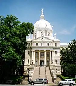 The McLennan County courthouse in Waco | |
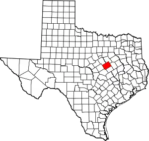 Location within the U.S. state of Texas | |
 Texas's location within the U.S. | |
| Coordinates: 31°33′N 97°12′W | |
| Country | |
| State | |
| Named for | Neil McLennan |
| Seat | Waco |
| Largest city | Waco |
| Area | |
| • Total | 1,060 sq mi (2,700 km2) |
| • Land | 1,037 sq mi (2,690 km2) |
| • Water | 23 sq mi (60 km2) 2.2%% |
| Population | |
| • Estimate (2019) | 256,623 |
| • Density | 227/sq mi (88/km2) |
| Time zone | UTC−6 (Central) |
| • Summer (DST) | UTC−5 (CDT) |
| Congressional district | 17th |
| Website | www |
McLennan County is included in the Waco Metropolitan Statistical Area.
History
McLennan County was created by the Texas Legislature in 1850 out of Milam County. The county seat, Waco, had been founded as an outpost of the Texas Rangers. It was laid out by George B. Erath, and was known by 1850 as Waco Village.
Popular carbonated beverage Dr Pepper was developed in Waco by pharmacist Charles Alderton in the 1880s. Dr Pepper was headquartered in Waco, until moved to Dallas, Texas. Waco is also home to the Dr Pepper Museum, housed in the 1906 building that was the first stand-alone facility used to bottle Dr Pepper.
According to local lore, the first sustained flight did not occur in Kitty Hawk, North Carolina, but just outside Tokio (a small community in McLennan County) by a man flying a gyrocopter. During World War I, McLennan County was home to at least one military airfield, Rich Field. In the aftermath of World War I, when social tensions were high as veterans returned, white racial violence broke out against blacks.
McLennan County's contributions to World War II include the reopening of Rich Field for use by the Air Force, and the opening of James Connally Air Force Base, now the home of TSTC Waco Airport and Texas State Technical College. Doris Miller from the county was awarded the Navy Cross for his heroism at Pearl Harbor; he was the first African American to earn such distinction. Local man James Connally became known as a World War II fighter pilot.
County Courthouse
The current County Courthouse is located in the county seat, Waco, Texas, and is the county's fourth courthouse. Completed in 1902 in the Beaux Arts Style, it is the next-to-last example of Architect James Riely Gordon's Texas courthouses. Of the eighteen he designed, thirteen remain standing. The first county courthouse was completed in 1851 for $500, and was a two story log cabin that was 30' x 30'. McLennan's second courthouse was a two story brick building completed in 1857 for $11,000. The third courthouse was styled after Second Empire by Architect W.C._Dodson, and completed in 1877 at a cost of $24,894.50. [5]
Institutions of higher education
In 1886, Baylor University relocated from Independence, Texas, to Waco and absorbed Waco University. During the early 20th century, McLennan County was home to as many as five colleges; in addition to Baylor, the other colleges included the predecessor to what is now known as Texas Christian University (now in Fort Worth), Paul Quinn College (relocated since to Dallas), and two other short-lived colleges.
In the 1960s, the Texas Legislature authorized McLennan Community College, the first community college to use those words in the name. Around the same time, what is now the flagship institution of Texas State Technical College was founded as James Connally Technical Institute, as a member of the Texas A&M University System. Today, Baylor, McLennan Community College, and Texas State Technical College continue to operate in McLennan County. They educate a large portion of the college-bound high-school graduates from the county and the surrounding areas. McLennan Community College has also partnered Tarleton State University, Texas Tech University, University of Texas Medical Branch in Galveston, and Midwestern State University to offer more than 50 bachelor's or master's degrees.
Crash at Crush
Crush, Texas, was a temporary "city" in McLennan County, about 15 miles (24 km) north of Waco. It was established to stage a publicity stunt concocted by William George Crush and the Missouri-Kansas-Texas Railroad. The stunt involved the collision of two 35-ton steam locomotives in front of spectators, whom the railway transported to the event for $2 each. After strong promotion, on September 15, 1896, the event was delayed by an hour as the police maneuvered the crowd of more than 40,000 back to what was thought to be a safe distance.[6]
The crews of the two engines tied the throttles open and jumped off. The two engines, pulling wagons filled with railroad ties, traveled a 4-mile (6.4 km) track and thunderously crashed into each other at a combined speed up to 120 mph (190 km/h). The boilers exploded and sent steam and flying debris into the crowd. Three people were killed and about six were injured, including event photographer Jarvis "Joe" Deane, who lost an eye because of a flying bolt.[6]
Ragtime composer Scott Joplin commemorated the event with "The Great Crush Collision March"; Joplin dedicated the composition to the Missouri-Kansas-Texas Railway.[7] Texas composer and singer Brian Burns wrote and recorded a song about the collision, "The Crash at Crush" (2001).
West fertilizer plant explosion
Waco siege
Twin Peaks biker shootout
On May 17, 2015, motorcycle clubs gathered at the Twin Peaks Restaurant in Waco for a Confederation of Clubs meeting. Upon arrival of a large contingent of the Bandidos Motorcycle Club, mass violence erupted in the parking lot of Twin Peaks between members of the Bandidos and members of the Cossasks Motorcycle Club. This resulted in 9 dead and 18 wounded in the melee between the rival outlaw motorcycle gangs. In 2019, all remaining charges were dropped by the new District Attorney, Barry Johnson.
Elected leadership
| Legislative representation | Name | Service |
| United States Congress, District 17 | Pete Sessions | 2019 – Present |
| State Senator, District 22 | Brian Birdwell | 2010 – Present |
| State Representative, District 56 | Charles Doc Anderson | 2005 – Present |
| State Representative, District 12 | Kyle Kacal | 2011 – Present |
| County Elected Leadership | Name | Service |
| County Judge | Scott Felton | 2012 – Present |
| County Commissioner Pct 1 | Jim Smith | 2009 – Present |
| County Commissioner Pct 2 | Pat Chisolm-Miller | 2019 – Present |
| County Commissioner Pct 3 | Will Jones | 2013 – Present |
| County Commissioner Pct 4 | Ben Perry | 2011 – Present |
| District Attorney | Barry Johnson | 2019 – Present |
| District Clerk | Jon Gimble | 2015 – Present |
| County Clerk | Andy Harwell | 1995 – Present |
| County Sheriff | Parnell McNamara | 2013 – Present |
| County Tax Assessor-Collector | Randy Riggs | 2012 – Present |
| County Treasurer | Bill Helton | 2012 – Present, 1991 - 2010 [8] |
| Local Judiciary | Name | Service |
| Tenth Court of Appeals, Chief | Tom Gray | 2003 – Present, 1999 - 2003 Associate Justice |
| Tenth court of Appeals, Place 2 | Matt Johnson | 2021 – Present, 2007 - 2020 Judge 54TH District Court [9] |
| Tenth court of Appeals, Place 3 | John Neil | 2019 – Present, 1998 - 2019 Judge 18TH District Court [10] |
| State District Judge, 19TH Court | Thomas West | 2021 – Present |
| State District Judge, 54TH Court | Susan Kelly | 2021 – Present |
| State District Judge, 74TH Court | Gary Coley, Jr. | 2009 – Present |
| State District Judge, 170TH Court | Jim Meyer | 2003 – Present |
| State District Judge, 414TH Court | Vicki Menard | 2006 – Present, Local Administrative Judge |
| County Court at Law Judge, Court 1 | Vikram 'Vik' Deivanayagam | 2018 – Present |
| County Court at Law Judge, Court 2 | Brad Cates | 2011 – Present |
Politics
| Year | Republican | Democratic | Third parties |
|---|---|---|---|
| 2020 | 60.8% 59,543 | 37.5% 36,688 | 1.7% 1,641 |
| 2016 | 61.0% 48,260 | 34.2% 27,063 | 4.8% 3,752 |
| 2012 | 64.3% 47,903 | 34.5% 25,694 | 1.3% 944 |
| 2008 | 61.6% 49,044 | 37.7% 29,998 | 0.8% 632 |
| 2004 | 65.7% 52,090 | 33.8% 26,760 | 0.5% 404 |
| 2000 | 63.9% 43,955 | 34.1% 23,462 | 2.0% 1,372 |
| 1996 | 48.6% 30,666 | 42.9% 27,050 | 8.5% 5,367 |
| 1992 | 40.7% 28,473 | 37.0% 25,903 | 22.3% 15,640 |
| 1988 | 58.1% 38,606 | 41.5% 27,545 | 0.4% 272 |
| 1984 | 64.4% 42,232 | 35.4% 23,206 | 0.2% 140 |
| 1980 | 53.7% 31,968 | 44.2% 26,305 | 2.1% 1,242 |
| 1976 | 45.3% 25,370 | 53.8% 30,091 | 0.9% 509 |
| 1972 | 67.5% 33,377 | 32.2% 15,947 | 0.3% 161 |
| 1968 | 34.2% 15,958 | 48.0% 22,388 | 17.8% 8,293 |
| 1964 | 27.7% 10,892 | 72.3% 28,429 | 0.1% 25 |
| 1960 | 42.5% 14,926 | 57.2% 20,100 | 0.4% 130 |
| 1956 | 48.9% 15,561 | 50.8% 16,181 | 0.4% 111 |
| 1952 | 46.4% 14,974 | 53.5% 17,251 | 0.2% 53 |
| 1948 | 15.3% 3,088 | 79.6% 16,034 | 5.1% 1,035 |
| 1944 | 9.0% 1,668 | 82.3% 15,336 | 8.7% 1,627 |
| 1940 | 12.0% 2,178 | 87.8% 15,952 | 0.2% 35 |
| 1936 | 8.1% 1,116 | 90.8% 12,489 | 1.1% 154 |
| 1932 | 8.4% 1,108 | 90.8% 11,972 | 0.8% 105 |
| 1928 | 51.8% 5,744 | 48.1% 5,330 | 0.1% 13 |
| 1924 | 22.2% 2,384 | 73.5% 7,882 | 4.2% 455 |
| 1920 | 21.2% 1,655 | 63.7% 4,975 | 15.1% 1,179 |
| 1916 | 15.5% 940 | 82.3% 4,979 | 2.2% 134 |
| 1912 | 6.4% 295 | 82.8% 3,829 | 10.8% 501 |
Geography
According to the U.S. Census Bureau, the county has a total area of 1,060 square miles (2,700 km2), of which 1,037 square miles (2,690 km2) are land and 23 square miles (60 km2) (2.2%) are covered by water.[12]
Major highways
.svg.png.webp) Interstate 35
Interstate 35 U.S. Highway 77
 U.S. Highway 84
 State Highway 6
 State Highway 31
 State Highway 164
 State Highway 317
Adjacent counties
- Hill County (north)
- Limestone County (east)
- Falls County (southeast)
- Bell County (south)
- Coryell County (southwest)
- Bosque County (northwest)
Demographics
| Historical population | |||
|---|---|---|---|
| Census | Pop. | %± | |
| 1860 | 6,206 | — | |
| 1870 | 13,500 | 117.5% | |
| 1880 | 26,934 | 99.5% | |
| 1890 | 39,204 | 45.6% | |
| 1900 | 59,772 | 52.5% | |
| 1910 | 73,250 | 22.5% | |
| 1920 | 82,921 | 13.2% | |
| 1930 | 98,682 | 19.0% | |
| 1940 | 101,898 | 3.3% | |
| 1950 | 130,194 | 27.8% | |
| 1960 | 150,091 | 15.3% | |
| 1970 | 147,553 | −1.7% | |
| 1980 | 170,755 | 15.7% | |
| 1990 | 189,123 | 10.8% | |
| 2000 | 213,517 | 12.9% | |
| 2010 | 234,906 | 10.0% | |
| 2019 (est.) | 256,623 | [13] | 9.2% |
| U.S. Decennial Census[14] 1850–2010[15] 2010–2019[1] | |||
As of the census of 2000,[16] 213,517 people, 78,859 households, and 52,914 families resided in the county. The population density was 205 people per square mile (79/km2). The 84,795 housing units averaged 81 per square mile (31/km2). The racial makeup of the county was 72.17% White, 15.19% Black or African American, 0.49% Native American, 1.07% Asian, 0.05% Pacific Islander, 9.21% from other races, and 1.83% from two or more races. About 17.91% of the population was Hispanic or Latino of any race; 12.8% were of German, 11.0% American, 8.0% English, and 6.9% Irish ancestry.
Of the 78,859 households, 33.00% had children under the age of 18 living with them, 49.70% were married couples living together, 13.60% had a female householder with no husband present, and 32.90% were not families. About 26.00% of all households were made up of individuals, and 9.70% had someone living alone who was 65 years of age or older. The average household size was 2.59 and the average family size was 3.15.
In the county, the population was distributed as 26.60% under the age of 18, 14.60% from 18 to 24, 26.40% from 25 to 44, 19.50% from 45 to 64, and 12.90% who were 65 years of age or older. The median age was 32 years. For every 100 females, there were 94.10 males. For every 100 females age 18 and over, there were 90.20 males.
The median income for a household in the county was $33,560, and for a family was $41,414. Males had a median income of $30,906 versus $21,978 for females. The per capita income for the county was $17,174. About 12.40% of families and 17.60% of the population were below the poverty line, including 20.70% of those under age 18 and 11.30% of those age 65 or over.
Education
Public school districts
- Axtell Independent School District
- Bosqueville Independent School District
- China Spring Independent School District
- Crawford Independent School District
- Connally Independent School District
- Gholson Independent School District
- Hallsburg Independent School District
- La Vega Independent School District
- Lorena Independent School District
- Mart Independent School District
- McGregor Independent School District
- Midway Independent School District
- Moody Independent School District
- Oglesby Independent School District
- Riesel Independent School District
- Robinson Independent School District
- Valley Mills Independent School District
- Waco Independent School District
- West Independent School District
Communities
Cities (multiple counties)
- Bruceville-Eddy (small part in Falls County)
- Golinda (mostly in Falls County)
- Mart (small part in Limestone County)
- McGregor (small part in Coryell County)
- Valley Mills (mostly in Bosque County)
Cities
Census-designated place
Other unincorporated communities
- Axtell
- Bosqueville
- Downsville
- Elm Mott
- Harrison
- Ocee
- Rock Creek
- Rogers Hill
- Speegleville
- Tours
See also
References
- "State & County QuickFacts". United States Census Bureau. Archived from the original on June 7, 2011. Retrieved December 21, 2013.
- "Find a County". National Association of Counties. Archived from the original on May 31, 2011. Retrieved 2011-06-07.
- Estimates of Resident Population Change and Rankings for Counties in Texas: July 1, 2018 to July 1, 2019 (CO-EST2019-ANNCHG-48) Source: U.S. Census Bureau, Population Division Release Date: March 2020
- Gannett, Henry (1905). The Origin of Certain Place Names in the United States. U.S. Government Printing Office. p. 194.
- http://texascourthouses.com/project/mclennan-county-courthouse/#:~:text=Constructed%201901%2D1902%2C%20the%20McLennan,Dodson%2C%20architect.
- "The Crash at the Crush". Texas Historical Commission. Archived from the original on 2015-11-21. Retrieved 26 November 2011.
- Scott Joplin, "The Great Crush Collision" sheet music (Temple, TX: John R. Fuller, 1896). See Bill Edwards, Rags and Pieces by Scott Joplin. Archived June 6, 2009, at the Wayback Machine
- https://www.wacotrib.com/news/commissioners-name-new-county-judge-treasurer/article_4784ebb9-f9e4-5da5-870f-5201de2ebbc4.html
- https://www.txcourts.gov/10thcoa/about-the-court/justices/justice-matt-johnson/
- https://www.txcourts.gov/10thcoa/about-the-court/justices/justice-john-e-neill/
- Leip, David. "Dave Leip's Atlas of U.S. Presidential Elections". uselectionatlas.org. Retrieved 2018-07-26.
- "2010 Census Gazetteer Files". United States Census Bureau. August 22, 2012. Retrieved May 4, 2015.
- "Population and Housing Unit Estimates". United States Census Bureau. May 24, 2020. Retrieved May 27, 2020.
- "U.S. Decennial Census". United States Census Bureau. Retrieved May 4, 2015.
- "Texas Almanac: Population History of Counties from 1850–2010" (PDF). Texas Almanac. Retrieved May 4, 2015.
- "U.S. Census website". United States Census Bureau. Retrieved 2011-05-14.
External links
| Wikimedia Commons has media related to McLennan County, Texas. |
- The official website of McLennan County, Texas
- McLennan County in Handbook of Texas Online at the University of Texas
- Read Neil McLennan's entry in the Biographical Encyclopedia of Texas hosted by the Portal to Texas History.
Places adjacent to McLennan County, Texas | ||||||||||
|---|---|---|---|---|---|---|---|---|---|---|
| ||||||||||
Municipalities and communities of McLennan County, Texas, United States | ||
|---|---|---|
| Cities | McLennan County map | |
| Town | ||
| CDP | ||
| Other unincorporated communities | ||
| Footnotes | ‡This populated place also has portions in an adjacent county or counties | |
| ||

| Authority control |
|---|