Center, Colorado
Center, officially the Town of Center, is a Statutory Town in Rio Grande and Saguache counties in the U.S. state of Colorado. The town's population was 2,230 at the 2010 United States Census.
Center | |
|---|---|
Statutory Town | |
| Town of Center | |
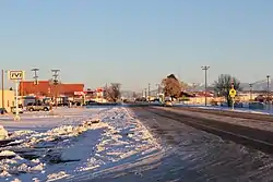 Center in winter. | |
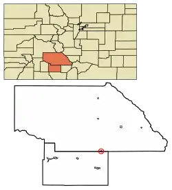 Location of Center in Rio Grande County and Saguache County, Colorado. | |
| Coordinates: 37°45′05″N 106°06′37″W[1] | |
| Country | |
| State | |
| Counties | Rio Grande[2] Saguache |
| Incorporated | January 19, 1907[3] |
| Government | |
| • Type | Statutory Town[2] |
| Area | |
| • Total | 0.86 sq mi (2.24 km2) |
| • Land | 0.86 sq mi (2.24 km2) |
| • Water | 0.00 sq mi (0.00 km2) |
| Elevation | 7,644 ft (2,330 m) |
| Population (2010) | |
| • Total | 2,230 |
| • Estimate (2019)[6] | 2,264 |
| • Density | 2,620.37/sq mi (1,011.84/km2) |
| Time zone | UTC−07:00 (MST) |
| • Summer (DST) | UTC−06:00 (MDT) |
| ZIP Code | 81125[7] |
| Area code(s) | 719 |
| FIPS code | 08-12855 |
| GNIS feature ID | 0203419 |
| Website | www |
Leach Airport is located 4 miles east and 3 miles north of town, at County Road 53 and County Road C.[8] The nearest college is Adams State College; 23 miles to Alamosa, Colorado.
The town lies near the center of the San Luis Valley, hence the name.[9]
Geography
According to the United States Census Bureau, Center has a total area of 0.8 square miles (2.1 km2), all of it land.
Demographics
| Historical population | |||
|---|---|---|---|
| Census | Pop. | %± | |
| 1910 | 385 | — | |
| 1920 | 547 | 42.1% | |
| 1930 | 1,011 | 84.8% | |
| 1940 | 1,515 | 49.9% | |
| 1950 | 2,024 | 33.6% | |
| 1960 | 1,600 | −20.9% | |
| 1970 | 1,470 | −8.1% | |
| 1980 | 1,630 | 10.9% | |
| 1990 | 1,963 | 20.4% | |
| 2000 | 2,392 | 21.9% | |
| 2010 | 2,230 | −6.8% | |
| 2019 (est.) | 2,264 | [6] | 1.5% |
| U.S. Decennial Census[10] | |||
As of the census[11] of 2012, there were 2,271 people, 768 households, and 603 families residing in the town. The population density was 2,854.3 people per square mile (1,099.5/km2). There were 848 housing units at an average density of 1,011.9 per square mile (389.8/km2). The racial makeup of the town was 10.3% White, 0.3% African American, 1% Native American, 0.09% from other races, and 0.09% from two or more races. Hispanic or Latino of any race were 87.4% of the population.
There were 768 households, out of which 47.8% had children under the age of 18 living with them, 56.3% were married couples living together, 17.4% had a female householder with no husband present, and 21.4% were non-families. 18.2% of all households were made up of individuals, and 7.8% had someone living alone who was 65 years of age or older. The average household size was 3.11 and the average family size was 3.56.
In the town, the population was spread out, with 35.2% under the age of 18, 11.1% from 18 to 24, 27.4% from 25 to 44, 17.0% from 45 to 64, and 9.3% who were 65 years of age or older. The median age was 28 years. For every 100 females, there were 99.2 males. For every 100 females age 18 and over, there were 96.8 males.
The median income for a household in the town was $23,780, and the median income for a family was $26,143. Males had a median income of $20,844 versus $18,036 for females. The per capita income for the town was $9,289. About 27.1% of families and 27.5% of the population were below the poverty line, including 31.6% of those under age 18 and 22.8% of those age 65 or over.
Education
- Public high schools:
- Center High School - grades 9 - 12
- The Academic Recovery Center of San Luis Valley - grades 9 - 12
- Public elementary/middle schools:
- Haskin Elementary School
- Skoglund Middle School - grades 6 - 8
- Private elementary/middle school in Center:
- High Valley Christian School[12]
See also
- Outline of Colorado
- State of Colorado
- Colorado cities and towns
- Colorado municipalities
- Colorado counties
- Colorado cities and towns
- San Luis Valley
References
- "2014 U.S. Gazetteer Files: Places". United States Census Bureau. July 1, 2014. Retrieved January 5, 2015.
- "Active Colorado Municipalities". State of Colorado, Department of Local Affairs. Archived from the original on 2009-12-12. Retrieved 2007-09-01.
- "Colorado Municipal Incorporations". State of Colorado, Department of Personnel & Administration, Colorado State Archives. 2004-12-01. Retrieved 2007-09-02.
- "2019 U.S. Gazetteer Files". United States Census Bureau. Retrieved July 1, 2020.
- "US Board on Geographic Names". United States Geological Survey. 2007-10-25. Retrieved 2008-01-31.
- "Population and Housing Unit Estimates". United States Census Bureau. May 24, 2020. Retrieved May 27, 2020.
- "ZIP Code Lookup". United States Postal Service. Archived from the original (JavaScript/HTML) on September 3, 2007. Retrieved September 5, 2007.
- Google.com: Leach Airport Map and Data
- Dawson, John Frank (1954). Place names in Colorado: why 700 communities were so named, 150 of Spanish or Indian origin. Denver, CO: The J. Frank Dawson Publishing Co. p. 13.
- "Census of Population and Housing". Census.gov. Retrieved June 4, 2015.
- "U.S. Census website". United States Census Bureau. Retrieved 2008-01-31.
- City-Data.com Center, CO - Education
External links
| Wikimedia Commons has media related to Center, Colorado. |
Municipalities and communities of Rio Grande County, Colorado, United States | ||
|---|---|---|
| City | 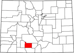 Map of Colorado highlighting Rio Grande County | |
| Towns | ||
| CDPs | ||
| Unincorporated community | ||
| Footnotes | ‡This populated place also has portions in an adjacent county or counties | |
| ||
Municipalities and communities of Saguache County, Colorado, United States | ||
|---|---|---|
| Towns | 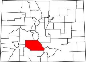 Map of Colorado highlighting Saguache County | |
| Unincorporated communities | ||
| Footnotes | ‡This populated place also has portions in an adjacent county or counties | |
| ||

| Authority control |
|
|---|
