Fotoksar
Fotoksar is a village in the Leh district of Ladakh, India.[1] It is located in the Khalsi tehsil.
Fotoksar
Photoksar | |
|---|---|
Village | |
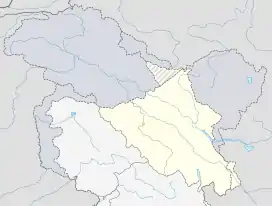 Fotoksar Location in Ladakh, India  Fotoksar Fotoksar (India) | |
| Coordinates: 34.073060°N 76.823723°E | |
| Country | India |
| Union Territory | Ladakh |
| District | Leh |
| Tehsil | Khalsi |
| Population (2011) | |
| • Total | 241 |
| Time zone | UTC+5:30 (IST) |
| Census code | 960 |
Location
Fotoksar is around 165 kilometres (103 mi) from the nearest airport city of Leh. While driving towards Lamayuru monastery from Leh, you turn left towards Wanla leaving the main Kargil-Leh highway. After 3 hours of driving, you will reach the foot of Sisir-La pass (4,760 metres (15,620 ft)). Drive further and beyond the pass, you'll get a great view of this remote village. The Sisir-La pass is open only in summers. So, in winters this village is cut off from the outside world.
Demographics
According to the 2011 census of India, Fotoksar has 48 households. The effective literacy rate (i.e. the literacy rate of population excluding children aged 6 and below) is 71.23%.[2]
| Total | Male | Female | |
|---|---|---|---|
| Population | 241 | 119 | 122 |
| Children aged below 6 years | 29 | 13 | 16 |
| Scheduled caste | 0 | 0 | 0 |
| Scheduled tribe | 241 | 119 | 122 |
| Literates | 151 | 83 | 68 |
| Workers (all) | 120 | 62 | 58 |
| Main workers (total) | 60 | 58 | 2 |
| Main workers: Cultivators | 59 | 57 | 2 |
| Main workers: Agricultural labourers | 0 | 0 | 0 |
| Main workers: Household industry workers | 0 | 0 | 0 |
| Main workers: Other | 1 | 1 | 0 |
| Marginal workers (total) | 60 | 4 | 56 |
| Marginal workers: Cultivators | 57 | 4 | 53 |
| Marginal workers: Agricultural labourers | 0 | 0 | 0 |
| Marginal workers: Household industry workers | 3 | 0 | 3 |
| Marginal workers: Others | 0 | 0 | 0 |
| Non-workers | 121 | 57 | 64 |
References
- "Blockwise Village Amenity Directory" (PDF). Ladakh Autonomous Hill Development Council. Retrieved 23 July 2015.
- "Leh district census". 2011 Census of India. Directorate of Census Operations. Retrieved 23 July 2015.
| History |
| ||||||||||||||||||
|---|---|---|---|---|---|---|---|---|---|---|---|---|---|---|---|---|---|---|---|
| Administration | |||||||||||||||||||
| Geography |
| ||||||||||||||||||
| Human settlements | |||||||||||||||||||
| Culture |
| ||||||||||||||||||
| Tourism and wildlife |
| ||||||||||||||||||
| Transport |
| ||||||||||||||||||
| Infrastructure |
| ||||||||||||||||||
| See also |
| ||||||||||||||||||