Sumoor
Sumoor is a village in the Leh district of Ladakh, India.[1][2]
Historically this village seems to be on the ancient trade route connecting Khasgar in China to Ladakh in India. There is an ancient fort at the top of the hill just above the monastery. The monastery is one of the biggest in the Nubra Valley, which was founded by Lama Tsultim Nima around 1830s. There is huge rock craving dating from 8-9th century AD. The village is biggest in terms of population in the whole Saichen belt. During the long winters people of the village observe various traditional cultural practices. On the 11th of Tibetan
Sumoor
Sum-yur | |
|---|---|
Village | |
| Etymology: 'Sum' in Ladakhi is three and 'yur'means stream or channel. It is said that there use to three major streams in the village and the name is driven from this. Some people also speculate that it is Sum_Yul, meaning three villages. | |
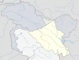 Sumoor Location in Ladakh, India  Sumoor Sumoor (India) | |
| Coordinates: 34.5973014°N 77.8584365°E | |
| Country | India |
| Union Territory | Ladakh |
| District | Leh |
| Tehsil | Nubra |
| Elevation | 6,033 m (19,793 ft) |
| Population (2011) | |
| • Total | 711 |
| Time zone | UTC+5:30 (IST) |
| 2011 census code | 932 |
Demographics
According to the 2011 census of India, Sumoor has 164 households. The effective literacy rate (i.e. the literacy rate of population excluding children aged 6 and below) is 66.14%.[3]
| Total | Male | Female | |
|---|---|---|---|
| Population | 711 | 385 | 326 |
| Children aged below 6 years | 76 | 36 | 40 |
| Scheduled caste | 0 | 0 | 0 |
| Scheduled tribe | 678 | 358 | 320 |
| Literates | 420 | 260 | 160 |
| Workers (all) | 251 | 185 | 66 |
| Main workers (total) | 120 | 83 | 37 |
| Main workers: Cultivators | 2 | 2 | 0 |
| Main workers: Agricultural labourers | 2 | 1 | 1 |
| Main workers: Household industry workers | 5 | 5 | 0 |
| Main workers: Other | 111 | 75 | 36 |
| Marginal workers (total) | 131 | 102 | 29 |
| Marginal workers: Cultivators | 98 | 81 | 17 |
| Marginal workers: Agricultural labourers | 16 | 6 | 10 |
| Marginal workers: Household industry workers | 1 | 1 | 0 |
| Marginal workers: Others | 16 | 14 | 2 |
| Non-workers | 460 | 200 | 260 |
References
- Leh tehsils.
- "Blockwise Village Amenity Directory" (PDF). Ladakh Autonomous Hill Development Council. Retrieved 23 July 2015.
- "Leh district census". 2011 Census of India. Directorate of Census Operations. Retrieved 23 July 2015.
| History |
| ||||||||||||||||||
|---|---|---|---|---|---|---|---|---|---|---|---|---|---|---|---|---|---|---|---|
| Administration | |||||||||||||||||||
| Geography |
| ||||||||||||||||||
| Human settlements | |||||||||||||||||||
| Culture |
| ||||||||||||||||||
| Tourism and wildlife |
| ||||||||||||||||||
| Transport |
| ||||||||||||||||||
| Infrastructure |
| ||||||||||||||||||
| See also |
| ||||||||||||||||||
This article is issued from Wikipedia. The text is licensed under Creative Commons - Attribution - Sharealike. Additional terms may apply for the media files.