National Register of Historic Places listings in Bristol County, Rhode Island
This is a list of the National Register of Historic Places listings in Bristol County, Rhode Island.

Location of Bristol County in Rhode Island
This is intended to be a complete list of the properties and districts on the National Register of Historic Places in Bristol County, Rhode Island, United States. Latitude and longitude coordinates are provided for many National Register properties and districts; these locations may be seen together in a map.[1]
There are 24 properties and districts listed on the National Register in the county, including one National Historic Landmark.
Current listings
- This National Park Service list is complete through NPS recent listings posted February 5, 2021.[2]
| [3] | Name on the Register[4] | Image | Date listed[5] | Location | City or town | Description |
|---|---|---|---|---|---|---|
| 1 | Alfred Drowne Road Historic District | 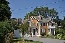 Alfred Drowne Road Historic District |
June 10, 2005 (#05000584) |
Alfred Drowne Rd., Annawamscutt Rd., Washington Rd. 41°44′38″N 71°20′38″W |
Barrington | |
| 2 | Allen-West House | 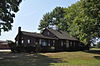 Allen-West House |
December 3, 2013 (#13000887) |
153 George St. 41°46′19″N 71°18′44″W |
Barrington | |
| 3 | Barrington Civic Center | 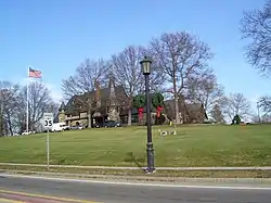 Barrington Civic Center |
December 12, 1976 (#76000198) |
County Rd. 41°44′29″N 71°18′33″W |
Barrington | |
| 4 | Belton Court | Belton Court |
June 30, 1976 (#76000037) |
Middle Highway 41°45′36″N 71°19′57″W |
Barrington | |
| 5 | Blithewold | 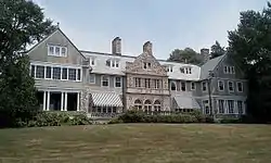 Blithewold |
June 27, 1980 (#80000074) |
Ferry Rd. 41°39′14″N 71°16′07″W |
Bristol | 1890s summer retreat established by Augustus Van Wickle, Pennsylvania coal magnate |
| 6 | Bristol County Courthouse | 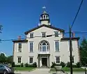 Bristol County Courthouse |
April 28, 1970 (#70000011) |
High St. 41°39′48″N 71°16′17″W |
Bristol | Built in 1816 and was used for RI State legislator meetings until 1854. |
| 7 | Bristol County Jail | 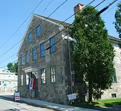 Bristol County Jail |
April 24, 1973 (#73000048) |
48 Court St. 41°40′10″N 71°16′32″W |
Bristol | |
| 8 | Bristol Customshouse and Post Office | 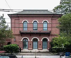 Bristol Customshouse and Post Office |
May 31, 1972 (#72000015) |
420-448 Hope St. 41°39′58″N 71°16′31″W |
Bristol | |
| 9 | Bristol Ferry Lighthouse | 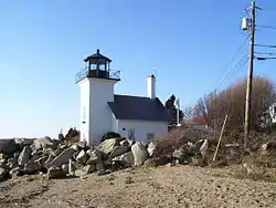 Bristol Ferry Lighthouse |
February 25, 1988 (#87001696) |
Ferry Rd. 41°38′35″N 71°15′37″W |
Bristol | |
| 10 | Bristol Waterfront Historic District | 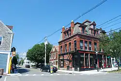 Bristol Waterfront Historic District |
March 18, 1975 (#75000053) |
Bristol Harbor to E side of Wood St. as far N as Washington St. and S to Walker Cove 41°40′10″N 71°16′31″W |
Bristol | |
| 11 | Benjamin Church House | 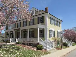 Benjamin Church House |
September 22, 1971 (#71000011) |
1014 Hope St. 41°41′09″N 71°16′43″W |
Bristol | |
| 12 | Benjamin Aborn Jackson House | 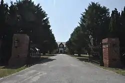 Benjamin Aborn Jackson House |
September 19, 2008 (#08000903) |
115 Nayatt Rd. 41°43′34″N 71°19′58″W |
Barrington | |
| 13 | Jennys Lane Historic District | 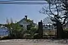 Jennys Lane Historic District |
March 6, 2008 (#08000152) |
Jennys Ln. and Mathewson and Rumstick Rds. 41°44′04″N 71°17′58″W |
Barrington | |
| 14 | Juniper Hill Cemetery |  Juniper Hill Cemetery |
June 3, 1998 (#98000632) |
24 Sherry Ave. 41°40′53″N 71°16′06″W |
Bristol | |
| 15 | Longfield | 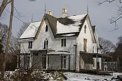 Longfield |
July 17, 1972 (#72000016) |
1200 Hope St. 41°41′49″N 71°16′47″W |
Bristol | |
| 16 | Mount Hope Bridge | 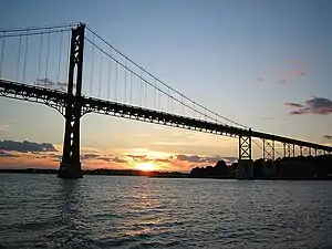 Mount Hope Bridge |
January 31, 1976 (#76000038) |
RI 114 over Narragansett Bay 41°38′25″N 71°15′32″W |
Bristol | Opened in 1929. Connects Bristol to the town of Portsmouth on Aquidneck Island. |
| 17 | Mount Hope Farm |  Mount Hope Farm |
May 2, 1977 (#77000023) |
Metacom Ave. 41°40′09″N 71°14′50″W |
Bristol | |
| 18 | Nayatt Point Lighthouse | 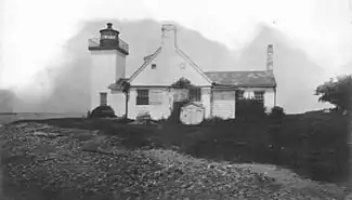 Nayatt Point Lighthouse |
February 25, 1988 (#87001694) |
Nayatt Point 41°43′30″N 71°20′23″W |
Barrington | |
| 19 | O'Bannon Mill | 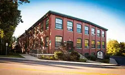 O'Bannon Mill |
July 23, 1996 (#96000891) |
90 Bay Spring Ave. 41°44′50″N 71°20′43″W |
Barrington | |
| 20 | Poppasquash Farms Historic District |  Poppasquash Farms Historic District |
June 27, 1980 (#80000075) |
Off RI 114 41°40′45″N 71°17′44″W |
Bristol | Includes Colt State Park and adjacent properties. |
| 21 | Joseph Reynolds House | 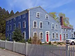 Joseph Reynolds House |
May 31, 1972 (#72000017) |
956 Hope St. 41°41′01″N 71°16′46″W |
Bristol | Oldest three-story frame house in New England, dating to 1700. Used as headquarters by Lafayette during 1778 Rhode Island campaign. |
| 22 | St. Matthew's Episcopal Church | 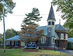 St. Matthew's Episcopal Church |
August 22, 1991 (#91001024) |
5 Chapel Rd. 41°44′34″N 71°20′37″W |
Barrington | |
| 23 | Warren United Methodist Church and Parsonage | 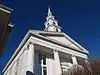 Warren United Methodist Church and Parsonage |
August 12, 1971 (#71000012) |
27 Church St. 41°43′49″N 71°17′02″W |
Warren | |
| 24 | Warren Waterfront Historic District | 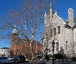 Warren Waterfront Historic District |
February 28, 1974 (#74000035) |
Bounded roughly by the Warren River, Belcher Cove, and the old town line (includes Main St. to Campbell St.) 41°43′51″N 71°17′04″W |
Warren |
See also
References
- The latitude and longitude information provided in this table was derived originally from the National Register Information System, which has been found to be fairly accurate for about 99% of listings. Some locations in this table may have been corrected to current GPS standards.
- "National Register of Historic Places: Weekly List Actions". National Park Service, United States Department of the Interior. Retrieved on February 5, 2021.
- Numbers represent an alphabetical ordering by significant words. Various colorings, defined here, differentiate National Historic Landmarks and historic districts from other NRHP buildings, structures, sites or objects.
- "National Register Information System". National Register of Historic Places. National Park Service. March 13, 2009.
- The eight-digit number below each date is the number assigned to each location in the National Register Information System database, which can be viewed by clicking the number.
External links
 Media related to National Register of Historic Places in Bristol County, Rhode Island at Wikimedia Commons
| Topics | _(extra_close)_(US48).svg.png.webp) | ||||||||||
|---|---|---|---|---|---|---|---|---|---|---|---|
| Lists by county | |||||||||||
| Lists by city |
| ||||||||||
| |||||||||||
Municipalities and communities of Bristol County, Rhode Island, United States | ||
|---|---|---|
| Towns | Map of Rhode Island highlighting Bristol County | |
| ||
This article is issued from Wikipedia. The text is licensed under Creative Commons - Attribution - Sharealike. Additional terms may apply for the media files.