National Register of Historic Places listings in Woonsocket, Rhode Island
This is a list of National Register of Historic Places listings in Woonsocket, Rhode Island.
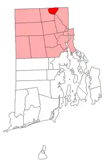
Location of Woonsocket in Providence County, Rhode Island
Included in the list are all properties and districts on the National Register of Historic Places in the city of Woonsocket, Rhode Island, United States. Woonsocket is home to 43 of the more than 400 properties and districts listed in Providence County. Properties and districts located in the county's other municipalities are listed separately. One Woonsocket listing, the Blackstone Canal, extends into other parts of Providence County, and appears on multiple lists. There is also one former listing.
Bristol | Kent | Newport | Providence | Washington |
- This National Park Service list is complete through NPS recent listings posted January 29, 2021.[1]
| [2] | Name on the Register[3] | Image | Date listed[4] | Location | Description |
|---|---|---|---|---|---|
| 1 | 1761 Milestone | 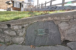 1761 Milestone |
November 24, 1982 (#82000131) |
640 S. Main St. 41°59′22″N 71°31′54″W |
|
| 2 | Allen Street Historic District |  Allen Street Historic District |
September 13, 1990 (#90001349) |
Allen St. 42°00′06″N 71°30′50″W |
|
| 3 | John Arnold House | 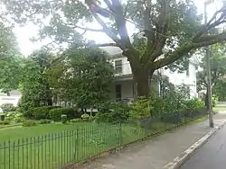 John Arnold House |
November 24, 1982 (#82000132) |
99 Providence St. 41°59′41″N 71°31′22″W |
|
| 4 | Bernon Worsted Mill | 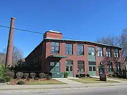 Bernon Worsted Mill |
June 10, 2005 (#05000585) |
828 Park Ave. 41°59′38″N 71°30′50″W |
|
| 5 | Blackstone Canal |  Blackstone Canal |
May 6, 1971 (#91001536) |
From Steeple and Promenade Sts. in Providence to the Massachusetts border in North Smithfield 41°55′16″N 71°25′21″W |
Initial listing extended from Providence, through Pawtucket, and as far north as Lincoln; a 1991 expansion (#91001536) extended it to the state line; the canal itself extended into Worcester County, Massachusetts, where it is the subject of separate listings. |
| 6 | Cato Hill Historic District | 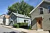 Cato Hill Historic District |
August 10, 1976 (#76002255) |
Bounded by Main, Railroad, Arnold and Blackstone Streets, including portions of Cato, Church, Boyden, and all of Clarkin Lane and Cato Lane 42°00′18″N 71°30′54″W |
|
| 7 | Henry Darling House | 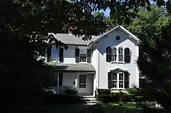 Henry Darling House |
November 26, 1982 (#82000136) |
786 Harris Ave. 42°00′50″N 71°31′40″W |
|
| 8 | First Universalist Church | March 27, 2020 (#100005156) |
78 Earle St. 42°00′27″N 71°30′44″W |
||
| 9 | French Worsted Company Mill Historic District | 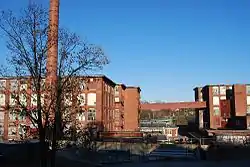 French Worsted Company Mill Historic District |
May 21, 2008 (#08000453) |
153 Hamlet Ave. 42°00′10″N 71°30′00″W |
Demolished in 2011.[5] |
| 10 | Alphonse Gaulin Jr. House | 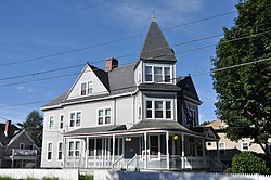 Alphonse Gaulin Jr. House |
November 24, 1982 (#82000137) |
311 Elm St. 42°00′25″N 71°29′55″W |
|
| 11 | Glenark Mills | 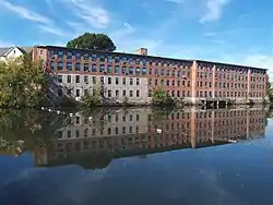 Glenark Mills |
May 15, 1989 (#89000409) |
64 East St. 41°59′54″N 71°31′09″W |
|
| 12 | Grove Street Elementary School | 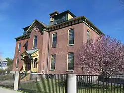 Grove Street Elementary School |
November 24, 1982 (#82000138) |
312 Grove St. 41°59′54″N 71°30′33″W |
|
| 13 | Hanora Mills | 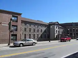 Hanora Mills |
November 24, 1982 (#82000139) |
1 Main St. 42°00′02″N 71°30′58″W |
|
| 14 | Harris Warehouse | 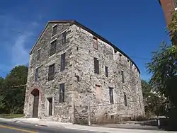 Harris Warehouse |
July 1, 1976 (#76000047) |
61 Railroad St. 42°00′14″N 71°30′54″W |
|
| 15 | Honan's Block and 112-114 Main Street |  Honan's Block and 112-114 Main Street |
August 3, 1989 (#89000941) |
110-114 Main St. 42°00′08″N 71°30′53″W |
|
| 16 | Hope Street School |  Hope Street School |
April 14, 2000 (#00000383) |
40 Hope St. 41°59′57″N 71°31′13″W |
|
| 17 | Island Place Historic District | 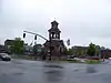 Island Place Historic District |
September 13, 1990 (#90001348) |
Island Place and S. Main St. at Market Sq. 41°59′57″N 71°30′59″W |
|
| 18 | Jenckes Mansion | 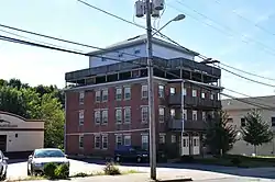 Jenckes Mansion |
November 24, 1982 (#82000140) |
837-839 Social St. 42°00′44″N 71°30′07″W |
|
| 19 | Jules Desurmont Worsted Company Mill | 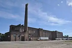 Jules Desurmont Worsted Company Mill |
January 12, 2007 (#06001257) |
84 Fairmount St. 42°00′09″N 71°31′21″W |
|
| 20 | L'Eglise du Precieux Sang |  L'Eglise du Precieux Sang |
July 26, 1982 (#82000142) |
94 Carrington Ave. and 61 Park Ave. 42°00′06″N 71°30′33″W |
|
| 21 | L'Union Saint Jean-Baptist d' Amerique | 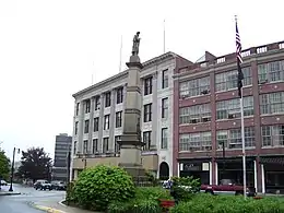 L'Union Saint Jean-Baptist d' Amerique |
March 12, 2018 (#100002194) |
1 Social St. 42°00′21″N 71°30′43″W |
|
| 22 | Lafayette Worsted Company Administrative Headquarters Historic District |  Lafayette Worsted Company Administrative Headquarters Historic District |
August 7, 2017 (#100001439) |
134 & 148 Hamlet Ave. 42°00′08″N 71°30′04″W |
|
| 23 | Linton Block | 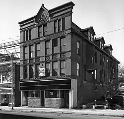 Linton Block |
November 24, 1982 (#82000143) |
3-5 Monument Sq. 42°00′19″N 71°30′48″W |
Destroyed by fire in 2000.[6] |
| 24 | Logee House | 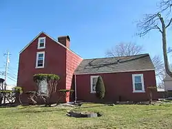 Logee House |
November 24, 1982 (#82000001) |
225 Logee St. 41°59′41″N 71°30′43″W |
|
| 25 | Main Street Historic District | 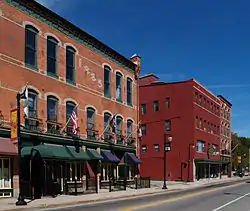 Main Street Historic District |
April 18, 1991 (#91000461) |
Roughly Main St. east of Market Sq. to Depot Sq. 42°00′09″N 71°30′52″W |
|
| 26 | North End Historic District |  North End Historic District |
November 24, 1982 (#82000002) |
Roughly bounded by Verry, Highland, Winter, and Summer Sts. 42°00′31″N 71°31′15″W |
|
| 27 | Philmont Worsted Company Mill | 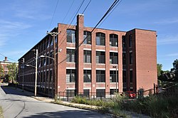 Philmont Worsted Company Mill |
April 19, 2006 (#06000296) |
685 Social St. 42°00′38″N 71°30′07″W |
|
| 28 | Pothier House |  Pothier House |
November 24, 1982 (#82000003) |
172 Pond St. 42°00′27″N 71°30′42″W |
|
| 29 | St. Andrews Episcopal Chapel |  St. Andrews Episcopal Chapel |
November 24, 1982 (#82000005) |
576 Fairmont St. 42°00′03″N 71°31′54″W |
|
| 30 | St. Ann's Church Complex |  St. Ann's Church Complex |
November 24, 1982 (#82000006) |
Cumberland and Elm Sts. and Gaulin Ave. 42°00′27″N 71°30′08″W |
|
| 31 | St. Charles Borromeo Church Complex | 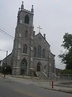 St. Charles Borromeo Church Complex |
February 24, 1983 (#83000003) |
N. Main, Daniels, and Earle Sts. 42°00′29″N 71°30′52″W |
|
| 32 | Smith-Ballou House | 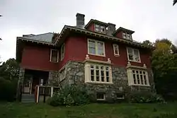 Smith-Ballou House |
June 6, 2003 (#03000184) |
641 Harris Avenue 42°00′45″N 71°31′28″W |
|
| 33 | Smithfield Friends Meeting House, Parsonage & Cemetery |  Smithfield Friends Meeting House, Parsonage & Cemetery |
November 24, 1982 (#82000008) |
126 Smithfield Rd. 41°59′21″N 71°31′49″W |
|
| 34 | South Main Street Historic District |  South Main Street Historic District |
November 24, 1982 (#82000009) |
Roughly bounded by Mason, Coe, Andrews St., and Bernice Ave. 41°59′37″N 71°31′35″W |
|
| 35 | Stadium Building |  Stadium Building |
June 30, 1976 (#76000006) |
329 Main St. 42°00′19″N 71°30′46″W |
|
| 36 | U.S. Post Office | 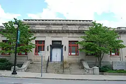 U.S. Post Office |
May 30, 1979 (#79003774) |
295 Main St. 42°00′17″N 71°30′46″W |
Now part of YMCA |
| 37 | Frank Wilbur House | 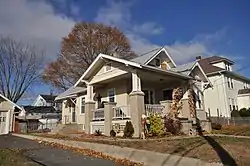 Frank Wilbur House |
November 24, 1982 (#82000012) |
1273 Park Ave. 41°59′08″N 71°30′59″W |
|
| 38 | Woonsocket City Hall | 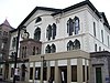 Woonsocket City Hall |
May 1, 1974 (#74000007) |
169 Main St. 42°00′08″N 71°30′53″W |
|
| 39 | Woonsocket Civil War Monument | Woonsocket Civil War Monument |
November 24, 1982 (#82000013) |
Monument Sq. 42°00′19″N 71°30′47″W |
|
| 40 | Woonsocket Company Mill Complex | 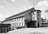 Woonsocket Company Mill Complex |
May 7, 1973 (#73000005) |
100-115 Front St. 42°00′05″N 71°30′46″W |
|
| 41 | Woonsocket District Courthouse |  Woonsocket District Courthouse |
November 24, 1982 (#82000014) |
24 Front St. 42°00′06″N 71°30′39″W |
|
| 42 | Woonsocket Rubber Company Mill | 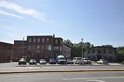 Woonsocket Rubber Company Mill |
May 1, 1989 (#89000334) |
60-82 S. Main St. 42°00′00″N 71°31′02″W |
|
| 43 | Woonsocket Senior High and Junior High Schools |  Woonsocket Senior High and Junior High Schools |
November 6, 2017 (#100001780) |
357 Park Place 42°00′15″N 71°30′16″W |
Former listing
| [2] | Name on the Register | Image | Date listed | Date removed | Location | Summary |
|---|---|---|---|---|---|---|
| 1 | Woonsocket Opera House | 1973 (#73002266) | Unknown | 37-41-45 N. Main St. |
Also known as the Park Theatre. Destroyed by fire September 22, 1975. |
See also
References
- "National Register of Historic Places: Weekly List Actions". National Park Service, United States Department of the Interior. Retrieved on January 29, 2021.
- Numbers represent an alphabetical ordering by significant words. Various colorings, defined here, differentiate National Historic Landmarks and historic districts from other NRHP buildings, structures, sites or objects.
- "National Register Information System". National Register of Historic Places. National Park Service. March 13, 2009.
- The eight-digit number below each date is the number assigned to each location in the National Register Information System database, which can be viewed by clicking the number.
- "Archived copy". Archived from the original on 2012-09-17. Retrieved 2012-05-24.CS1 maint: archived copy as title (link)
- "Woonsocket Multiple Resource Area Nomination" (PDF). State of Rhode Island. Retrieved 2013-09-06.
| Topics | _(extra_close)_(US48).svg.png.webp) | ||||||||||
|---|---|---|---|---|---|---|---|---|---|---|---|
| Lists by county | |||||||||||
| Lists by city |
| ||||||||||
| |||||||||||
This article is issued from Wikipedia. The text is licensed under Creative Commons - Attribution - Sharealike. Additional terms may apply for the media files.