National Register of Historic Places listings in Central Falls, Rhode Island
This is a list of Registered Historic Places in Central Falls, Rhode Island.
Bristol | Kent | Newport | Providence | Washington |
- This National Park Service list is complete through NPS recent listings posted January 29, 2021.[1]
| [2] | Name on the Register[3] | Image | Date listed[4] | Location | City or town | Description |
|---|---|---|---|---|---|---|
| 1 | Central Falls Congregational Church | 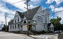 Central Falls Congregational Church |
July 12, 1976 (#76000042) |
376 High St. 41°53′05″N 71°23′04″W |
Central Falls | |
| 2 | Central Falls Mill Historic District | 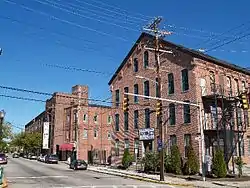 Central Falls Mill Historic District |
July 2, 1976 (#76000007) |
Between Roosevelt Avenue and the Blackstone River 41°53′11″N 71°22′55″W |
Central Falls | |
| 3 | Central Street School | 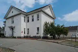 Central Street School |
April 6, 1979 (#79000004) |
379 Central St. 41°53′04″N 71°23′38″W |
Central Falls | |
| 4 | Samuel B. Conant House | 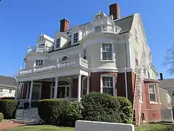 Samuel B. Conant House |
April 6, 1979 (#79000005) |
104 Clay St. 41°52′59″N 71°23′25″W |
Central Falls | |
| 5 | Conant Thread-Coats & Clark Mill Complex District | 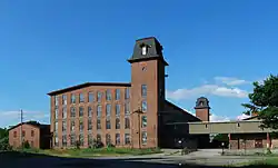 Conant Thread-Coats & Clark Mill Complex District |
November 18, 1983 (#83003809) |
Roughly bounded by Lonsdale Avenue, Rand and Pine Streets. 41°52′51″N 71°23′53″W |
Central Falls | Extends into Pawtucket |
| 6 | David G. Fales House | 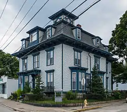 David G. Fales House |
April 6, 1979 (#79000006) |
476 High St. 41°53′10″N 71°23′05″W |
Central Falls | |
| 7 | Benjamin F. Greene House |  Benjamin F. Greene House |
April 6, 1979 (#79000007) |
85 Cross St. 41°53′08″N 71°23′11″W |
Central Falls | |
| 8 | Holy Trinity Church Complex | 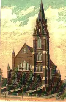 Holy Trinity Church Complex |
January 3, 1978 (#78000073) |
134 Fuller Ave. 41°53′19″N 71°23′47″W |
Central Falls | Church demolished; only the parish house is extant. |
| 9 | Jenks Park & Cogswell Tower | 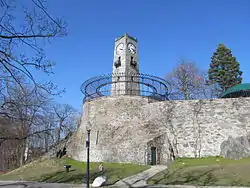 Jenks Park & Cogswell Tower |
April 6, 1979 (#79000057) |
Adjoining 580 Broad St. 41°53′15″N 71°23′21″W |
Central Falls | |
| 10 | St. Matthew's Church | 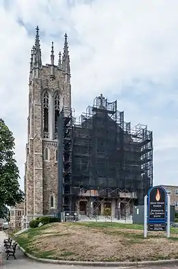 St. Matthew's Church |
April 6, 1979 (#79000008) |
Dexter and W. Hunt Sts. 41°53′21″N 71°24′07″W |
Central Falls | |
| 11 | South Central Falls Historic District | 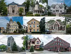 South Central Falls Historic District |
January 31, 1991 (#91000025) |
Roughly bounded by the Central Falls-Pawtucket boundary and Rand, Summit, Dexter and Broad Sts. 41°53′04″N 71°23′28″W |
Central Falls | |
| 12 | Valley Falls Mill | 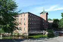 Valley Falls Mill |
April 26, 1978 (#78000012) |
1359 and 1361-63 Broad St. 41°53′55″N 71°23′20″W |
Central Falls | Boundary increase December 18, 1978. |
See also
References
- "National Register of Historic Places: Weekly List Actions". National Park Service, United States Department of the Interior. Retrieved on January 29, 2021.
- Numbers represent an alphabetical ordering by significant words. Various colorings, defined here, differentiate National Historic Landmarks and historic districts from other NRHP buildings, structures, sites or objects.
- "National Register Information System". National Register of Historic Places. National Park Service. March 13, 2009.
- The eight-digit number below each date is the number assigned to each location in the National Register Information System database, which can be viewed by clicking the number.
This article is issued from Wikipedia. The text is licensed under Creative Commons - Attribution - Sharealike. Additional terms may apply for the media files.
_(extra_close)_(US48).svg.png.webp)