National Register of Historic Places listings in Hopkinton, Rhode Island
This is a list of Registered Historic Places in Hopkinton, Rhode Island.
Bristol | Kent | Newport | Providence | Washington |
- This National Park Service list is complete through NPS recent listings posted January 29, 2021.[1]
| [2] | Name on the Register[3] | Image | Date listed[4] | Location | City or town | Description |
|---|---|---|---|---|---|---|
| 1 | Black Farm | November 7, 1995 (#95001268) |
Bounded by the Rockville-Alton Rd. (RI 112) and the Wood River 41°28′06″N 71°43′23″W |
Hopkinton | ||
| 2 | Bradford Village Historic District | 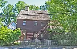 Bradford Village Historic District |
May 30, 1996 (#96000573) |
Roughly Bowling Ln. from the Pawcatuck River to Vars Ln. and Main St. from the Bradford Bridge to Church Ave. 41°24′08″N 71°45′06″W |
Hopkinton and Westerly | |
| 3 | Hope Valley Historic District | 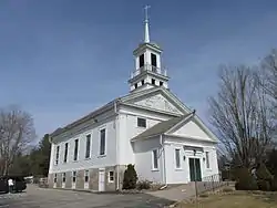 Hope Valley Historic District |
July 3, 2004 (#04000654) |
Main Street 41°30′28″N 71°43′00″W |
Hopkinton | |
| 4 | Hopkinton City Historic District | 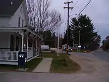 Hopkinton City Historic District |
May 1, 1974 (#74000010) |
Hopkinton 41°27′40″N 71°46′39″W |
Hopkinton | |
| 5 | Tomaquag Rock Shelters |  Tomaquag Rock Shelters |
August 12, 1977 (#77000011) |
Address Restricted |
Hopkinton | |
| 6 | Upper Rockville Mill | 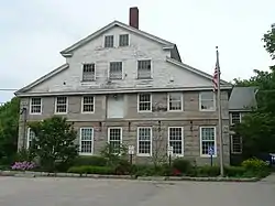 Upper Rockville Mill |
July 5, 2006 (#06000552) |
332 Canonchet Rd. 41°31′20″N 71°45′36″W |
Hopkinton | |
| 7 | Wyoming Village Historic District | 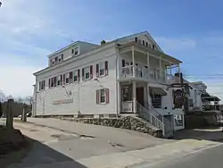 Wyoming Village Historic District |
May 2, 1974 (#74000014) |
Roughly bounded by RI 3, RI 138, Old Nooseneck Hill Rd., Bridge and Prospect Sts. 41°30′57″N 71°42′12″W |
Hopkinton and Richmond |
See also
References
- "National Register of Historic Places: Weekly List Actions". National Park Service, United States Department of the Interior. Retrieved on January 29, 2021.
- Numbers represent an alphabetical ordering by significant words. Various colorings, defined here, differentiate National Historic Landmarks and historic districts from other NRHP buildings, structures, sites or objects.
- "National Register Information System". National Register of Historic Places. National Park Service. March 13, 2009.
- The eight-digit number below each date is the number assigned to each location in the National Register Information System database, which can be viewed by clicking the number.
| Topics | _(extra_close)_(US48).svg.png.webp) | ||||||||||
|---|---|---|---|---|---|---|---|---|---|---|---|
| Lists by county | |||||||||||
| Lists by city |
| ||||||||||
| |||||||||||
This article is issued from Wikipedia. The text is licensed under Creative Commons - Attribution - Sharealike. Additional terms may apply for the media files.