National Register of Historic Places listings in Kent County, Rhode Island
This is a list of the National Register of Historic Places listings in Kent County, Rhode Island.

Location of Kent County in Rhode Island
This is intended to be a complete list of the properties and districts on the National Register of Historic Places in Kent County, Rhode Island, United States. Latitude and longitude coordinates are provided for many National Register properties and districts; these locations may be seen together in a map.[1]
There are 80 properties and districts listed on the National Register in the county, including 1 National Historic Landmark.
- This National Park Service list is complete through NPS recent listings posted January 29, 2021.[2]
Current listings
| [3] | Name on the Register[4] | Image | Date listed[5] | Location | City or town | Description |
|---|---|---|---|---|---|---|
| 1 | Stephen Allen House | 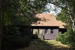 Stephen Allen House |
September 20, 1978 (#78000060) |
Sharp St. 41°38′40″N 71°41′30″W |
West Greenwich | |
| 2 | Anthony Village Historic District | 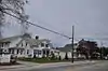 Anthony Village Historic District |
September 20, 2010 (#10000770) |
Washington St. between Battey Ave. and Hazard St. and various properties on 12 adjacent streets and the Pawtuxet River 41°41′39″N 71°33′13″W |
Coventry | |
| 3 | Apponaug Historic District | 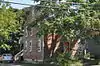 Apponaug Historic District |
February 23, 1984 (#84001833) |
3376, 3384, 3387, 3391, 3397-3399, and 3404 Post Rd. 41°38′18″N 71°27′04″W |
Warwick | |
| 4 | Arkwright Bridge | 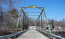 Arkwright Bridge |
December 12, 1978 (#78000061) |
Crosses the Pawtuxet River at Hill St.; closed. 41°43′49″N 71°32′49″W |
Coventry | Extends into Providence County |
| 5 | Armory of the Kentish Guards |  Armory of the Kentish Guards |
April 28, 1970 (#70000012) |
Armory and Peirce Sts. 41°39′40″N 71°27′04″W |
East Greenwich | |
| 6 | John Waterman Arnold House | 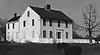 John Waterman Arnold House |
September 10, 1971 (#71000013) |
11 Roger Williams Ave. 41°45′18″N 71°23′56″W |
Warwick | |
| 7 | Isaac Bowen House |  Isaac Bowen House |
June 27, 1980 (#80000076) |
Northeast of Coventry on Maple Valley Rd. 41°43′09″N 71°41′53″W |
Coventry | |
| 8 | Joseph Briggs House-Coventry Town Farm | 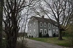 Joseph Briggs House-Coventry Town Farm |
June 18, 1987 (#87000997) |
Town Farm Rd. 41°42′30″N 71°36′55″W |
Coventry | |
| 9 | Richard Briggs Farm |  Richard Briggs Farm |
June 6, 2003 (#03000517) |
830 South Rd. 41°36′25″N 71°30′38″W |
East Greenwich | |
| 10 | Budlong Farm | 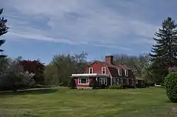 Budlong Farm |
August 18, 1983 (#83000165) |
595 Buttonwoods Ave. 41°41′24″N 71°25′38″W |
Warwick | |
| 11 | Buttonwoods Beach Historic District |  Buttonwoods Beach Historic District |
February 23, 1984 (#84001834) |
Roughly bounded by Brush Neck Cove, Greenwich Bay, Cooper and Promenade Aves. 41°41′09″N 71°24′49″W |
Warwick | |
| 12 | Carbuncle Hill Archaeological District, RI-1072-1079 | September 28, 1985 (#85002692) |
Address Restricted |
Coventry | ||
| 13 | Cedar Hill |  Cedar Hill |
December 22, 2014 (#14001077) |
4157 Post Rd. 41°40′42″N 71°27′10″W |
Warwick | Now the Clouds Hill Victorian Museum. |
| 14 | Centreville Mill | 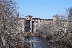 Centreville Mill |
June 10, 2005 (#05000582) |
3 Bridal Ave. 41°41′55″N 71°31′15″W |
West Warwick | |
| 15 | Silas Clapp House | 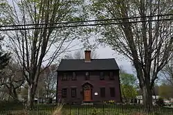 Silas Clapp House |
May 7, 1973 (#73000049) |
E. Greenwich Ave. 41°40′25″N 71°30′49″W |
West Warwick | |
| 16 | Conimicut Lighthouse | 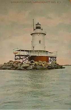 Conimicut Lighthouse |
March 30, 1988 (#88000269) |
East of Conimicut Pt. in the Providence River 41°43′01″N 71°20′45″W |
Warwick | |
| 17 | Cowesett Pound | 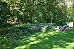 Cowesett Pound |
September 4, 1987 (#87000994) |
Cowesett Rd. 41°41′08″N 71°27′44″W |
Warwick | |
| 18 | Crompton Free Library |  Crompton Free Library |
November 20, 1978 (#78000062) |
Main St. 41°41′06″N 71°31′27″W |
West Warwick | |
| 19 | Crompton Mill Historic District |  Crompton Mill Historic District |
July 14, 2006 (#06000577) |
20 Remington St., 53 and 65 Manchester St. 41°41′10″N 71°31′31″W |
West Warwick | |
| 20 | District Four School |  District Four School |
April 14, 1997 (#97000318) |
1515 W. Shore Rd. 41°42′24″N 71°23′03″W |
Warwick | |
| 21 | East Greenwich Historic District |  East Greenwich Historic District |
June 13, 1974 (#74000036) |
Roughly bounded by Kenyon Ave., Division, Peirce, and London Sts., Greenwich Cove and Dark Entry Brook 41°39′43″N 71°27′17″W |
East Greenwich and Warwick | |
| 22 | Elizabeth Spring |  Elizabeth Spring |
August 18, 1983 (#83000166) |
Off Forge Rd. 41°38′51″N 71°27′25″W |
Warwick | |
| 23 | Forge Farm |  Forge Farm |
January 11, 1974 (#74000037) |
40 Forge Rd. 41°38′19″N 71°27′06″W |
Warwick | |
| 24 | Forge Road Historic District |  Forge Road Historic District |
February 23, 1984 (#84001861) |
Forge Rd. from Ives Rd. to the Potowomut River 41°38′18″N 71°27′04″W |
Warwick | |
| 25 | Fry's Hamlet Historic District |  Fry's Hamlet Historic District |
December 20, 1985 (#85003161) |
2068, 2153, 2196, and 2233 S. County Trail 41°38′21″N 71°29′58″W |
East Greenwich | |
| 26 | Capt. Oliver Gardiner House |  Capt. Oliver Gardiner House |
August 18, 1983 (#83000167) |
4451 Post Rd. 41°40′10″N 71°26′57″W |
Warwick | |
| 27 | Gaspee Point |  Gaspee Point |
June 8, 1972 (#72000018) |
Off Namquid Dr. 41°44′38″N 71°22′42″W |
Warwick | |
| 28 | Caleb Gorton House | 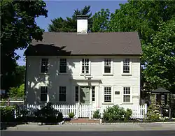 Caleb Gorton House |
August 18, 1983 (#83000168) |
987 Greenwich Ave. 41°42′30″N 71°27′53″W |
Warwick | |
| 29 | Caleb Greene House | 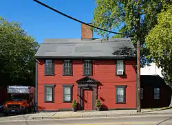 Caleb Greene House |
November 28, 1978 (#78000063) |
15 Centerville Rd. 41°41′55″N 71°27′39″W |
Warwick | |
| 30 | Christopher Rhodes Greene House | 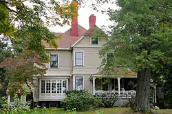 Christopher Rhodes Greene House |
August 30, 2007 (#07000891) |
2 Potter Court 41°43′49″N 71°32′25″W |
Coventry | |
| 31 | Gen. Nathanael Greene Homestead | 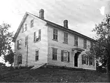 Gen. Nathanael Greene Homestead |
October 7, 1971 (#71000014) |
20 Taft St. 41°41′38″N 71°32′36″W |
Coventry | |
| 32 | Moses Greene House | 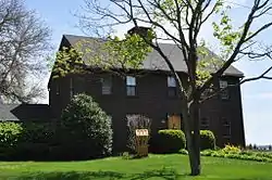 Moses Greene House |
August 18, 1983 (#83000169) |
11 Economy Ave. 41°42′49″N 71°22′16″W |
Warwick | |
| 33 | Peter Greene House | 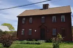 Peter Greene House |
August 18, 1983 (#83000170) |
1124 W. Shore Rd. 41°42′55″N 71°22′34″W |
Warwick | |
| 34 | Richard Wickes Greene House | 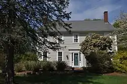 Richard Wickes Greene House |
August 18, 1983 (#83000171) |
27 Homestead Ave. 41°40′51″N 71°22′49″W |
Warwick | |
| 35 | Greene-Bowen House |  Greene-Bowen House |
May 2, 1974 (#74000038) |
100 Mill Wheel Rd. 41°41′26″N 71°25′19″W |
Warwick | |
| 36 | Greene-Durfee House | 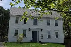 Greene-Durfee House |
August 18, 1983 (#83000172) |
1272 W. Shore Rd. 41°42′46″N 71°22′48″W |
Warwick | |
| 37 | Greenwich Cove Site | January 4, 1980 (#80000077) |
Southern end of Greenwich Cove 41°38′48″N 71°27′02″W |
Warwick | ||
| 38 | Greenwich Mills | 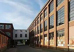 Greenwich Mills |
December 20, 2006 (#06001151) |
42 Ladd St. 41°40′01″N 71°26′52″W |
Warwick | |
| 39 | Harris Mill | 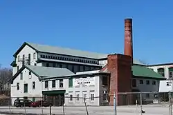 Harris Mill |
July 27, 2007 (#07000761) |
618 Main St. 41°43′29″N 71°32′11″W |
Coventry | |
| 40 | Hopelands | 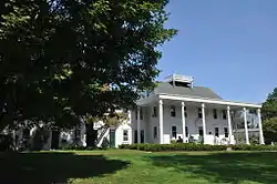 Hopelands |
August 18, 1983 (#83000173) |
Wampanoag Rd. 41°39′27″N 71°25′02″W |
Warwick | Now the campus of the Rocky Hill School. |
| 41 | Hopkins Hollow Village |  Hopkins Hollow Village |
January 27, 2010 (#09001290) |
Hopkins Hollow Rd., Narrow Ln., and Perry Hill Rd. 41°40′59″N 71°45′06″W |
Coventry and West Greenwich | |
| 42 | Indian Oaks | 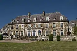 Indian Oaks |
August 18, 1983 (#83000174) |
836 Warwick Neck Ave. 41°40′55″N 71°22′35″W |
Warwick | |
| 43 | Interlaken Mill Bridge | 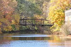 Interlaken Mill Bridge |
December 22, 1978 (#78000064) |
Spans the Pawtuxet River at Arkwright 41°43′41″N 71°32′39″W |
Coventry | |
| 44 | Kent County Courthouse |  Kent County Courthouse |
April 28, 1970 (#70000013) |
127 Main St. 41°39′39″N 71°27′02″W |
East Greenwich | Now East Greenwich Town Hall |
| 45 | Knight Estate | 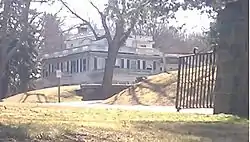 Knight Estate |
February 23, 1984 (#84001864) |
486 East Ave. 41°43′06″N 71°28′54″W |
Warwick | |
| 46 | Lambert Farm Site, RI-269 | November 3, 1983 (#83003798) |
Address Restricted |
Warwick | ||
| 47 | Lippitt Mill | 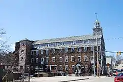 Lippitt Mill |
January 11, 1974 (#74000053) |
825 Main St. 41°43′12″N 71°31′38″W |
West Warwick | |
| 48 | Massie Wireless Station |  Massie Wireless Station |
October 22, 2001 (#01001157) |
1300 Frenchtown Rd. (New England Wireless and Steam Museum) 41°37′33″N 71°30′45″W |
East Greenwich | |
| 49 | Meadows Archeological District | November 3, 1983 (#83003800) |
Address Restricted |
Warwick | ||
| 50 | Moosup River Site (RI-1153) | December 10, 1987 (#87002083) |
Address Restricted |
Coventry | ||
| 51 | Paine House | 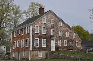 Paine House |
May 1, 1974 (#74000039) |
Station St. 41°41′29″N 71°33′54″W |
Coventry | |
| 52 | Pawtuxet Valley Dyeing Company | 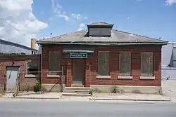 Pawtuxet Valley Dyeing Company |
November 16, 2005 (#05001296) |
9 Howard Ave. 41°43′25″N 71°32′17″W |
Coventry | |
| 53 | Pawtuxet Village Historic District | 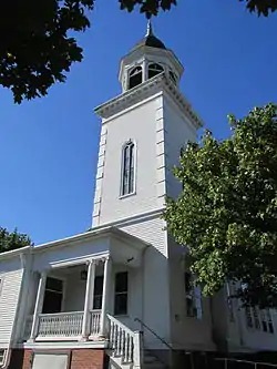 Pawtuxet Village Historic District |
April 24, 1973 (#73000050) |
Bounded roughly by Bayside, S. Atlantic, and Ocean Aves., Pawtuxet and Providence rivers, and Post Rd. 41°45′49″N 71°23′27″W |
Warwick | |
| 54 | Pontiac Mills | 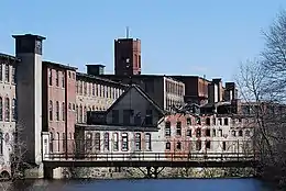 Pontiac Mills |
June 5, 1972 (#72000019) |
Knight St. 41°43′35″N 71°28′13″W |
Warwick | |
| 55 | Read School | 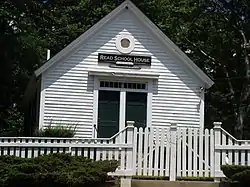 Read School |
March 20, 2002 (#02000231) |
1670 Flat River Rd. 41°42′20″N 71°35′50″W |
Coventry | |
| 56 | Rhode Island State Airport Terminal | 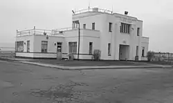 Rhode Island State Airport Terminal |
August 18, 1983 (#83000175) |
572 Occupasstuxet Rd. 41°43′54″N 71°25′44″W |
Warwick | |
| 57 | Christopher Rhodes House | 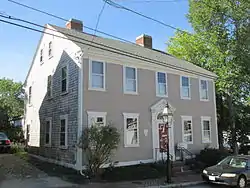 Christopher Rhodes House |
March 31, 1971 (#71000015) |
25 Post Rd. 41°45′49″N 71°23′29″W |
Warwick | |
| 58 | Rice City Historic District | 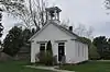 Rice City Historic District |
June 9, 1980 (#80000078) |
West of Coventry Center at RI 14 and RI 117 41°42′37″N 71°45′52″W |
Coventry | |
| 59 | Royal Mill Complex | 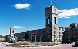 Royal Mill Complex |
April 29, 2004 (#04000377) |
125 Providence St. 41°42′49″N 71°31′00″W |
West Warwick | |
| 60 | St. Mary's Church and Cemetery | 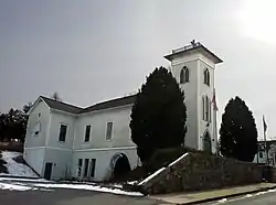 St. Mary's Church and Cemetery |
November 21, 1978 (#78000065) |
Church St. 41°41′12″N 71°31′08″W |
West Warwick | |
| 61 | South Main Street Historic District | 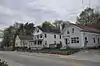 South Main Street Historic District |
July 10, 1987 (#87001064) |
Cady, S. Main, and Wood Sts. 41°41′17″N 71°34′03″W |
Coventry | |
| 62 | William B. Spencer House | 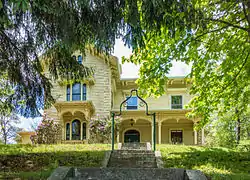 William B. Spencer House |
February 14, 2012 (#08000716) |
11 Fairview Ave. 41°43′11″N 71°31′59″W |
West Warwick | |
| 63 | Spencer–Shippee–Lillbridge House |  Spencer–Shippee–Lillbridge House |
April 20, 2011 (#11000207) |
12 Middle Rd. 41°39′16″N 71°27′51″W |
East Greenwich | |
| 64 | Tillinghast Mill Site | 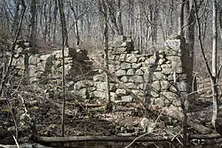 Tillinghast Mill Site |
March 10, 1988 (#88000164) |
Frenchtown Park 41°37′41″N 71°30′23″W |
East Greenwich | |
| 65 | Tillinghast Road Historic District |  Tillinghast Road Historic District |
March 9, 1988 (#88000167) |
Tillinghast Rd. 41°37′03″N 71°30′39″W |
East Greenwich | |
| 66 | Trafalgar Site, RI-639 | November 3, 1983 (#83003801) |
Address Restricted |
Warwick | ||
| 67 | Valley Queen Mill | 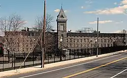 Valley Queen Mill |
January 19, 1984 (#84001880) |
700 Providence St. 41°43′11″N 71°29′29″W |
West Warwick | |
| 68 | Gen. James Mitchell Varnum House |  Gen. James Mitchell Varnum House |
August 12, 1971 (#71000016) |
57 Peirce St. 41°39′49″N 71°27′06″W |
East Greenwich | |
| 69 | Warwick Civic Center Historic District | 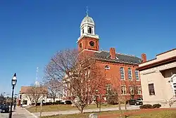 Warwick Civic Center Historic District |
June 27, 1980 (#80000079) |
Post Rd. 41°41′57″N 71°27′31″W |
Warwick | |
| 70 | Warwick Lighthouse | 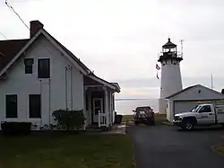 Warwick Lighthouse |
March 30, 1988 (#88000268) |
1350 Warwick Neck Ave. 41°40′01″N 71°22′43″W |
Warwick | |
| 71 | Waterman Tavern | 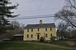 Waterman Tavern |
July 24, 1974 (#74000040) |
283 Maple Valley Rd. 41°43′10″N 71°39′37″W |
Coventry | |
| 72 | John R. Waterman House | 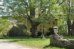 John R. Waterman House |
August 18, 1983 (#83000176) |
100 Old Homestead Rd. 41°43′16″N 71°23′43″W |
Warwick | |
| 73 | William Waterman House | 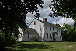 William Waterman House |
November 14, 1980 (#80000080) |
RI 102 41°42′13″N 71°41′51″W |
Coventry | |
| 74 | Clement Weaver-Daniel Howland House | 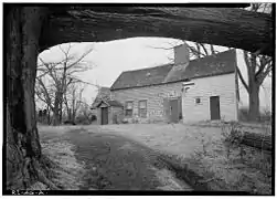 Clement Weaver-Daniel Howland House |
November 7, 1995 (#95001266) |
125 Howland Rd. 41°39′32″N 71°28′40″W |
East Greenwich | |
| 75 | West Greenwich Baptist Church and Cemetery |  West Greenwich Baptist Church and Cemetery |
November 28, 1978 (#78000066) |
Plain Meeting House and Liberty Hill Rds. 41°38′16″N 71°45′10″W |
West Greenwich Center | |
| 76 | West Winds | 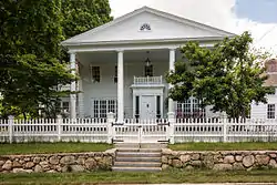 West Winds |
May 20, 1993 (#93000425) |
300 Wakefield St. 41°43′30″N 71°30′52″W |
West Warwick | |
| 77 | Col. Micah Whitmarsh House | 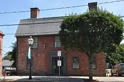 Col. Micah Whitmarsh House |
February 18, 1971 (#71000017) |
294 Main St. 41°39′34″N 71°27′01″W |
East Greenwich | |
| 78 | Oliver A. Wickes House | 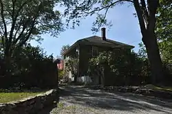 Oliver A. Wickes House |
August 18, 1983 (#83000177) |
794 Major Potter Rd. 41°40′25″N 71°28′30″W |
Warwick | |
| 79 | Wilson-Winslow House | 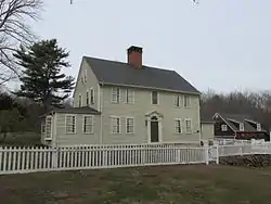 Wilson-Winslow House |
November 4, 1993 (#93001182) |
2414 Harkney Hill Rd. 41°41′09″N 71°40′45″W |
Coventry | |
| 80 | Windmill Cottage | 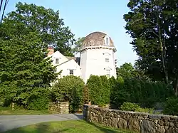 Windmill Cottage |
May 22, 1973 (#73000051) |
144 Division St. 41°39′49″N 71°27′23″W |
East Greenwich |
Former listings
| [3] | Name on the Register | Image | Date listed | Date removed | Location | City or town | Summary |
|---|---|---|---|---|---|---|---|
| 1 | Hopkins Mill | January 11, 1974 (#74002295) | Unknown | RI 3 |
West Greenwich | Demolished in 1978 for the Big River Reservoir project.[6] | |
| 2 | Phenix Baptist Church | June 30, 1976 (#76002272) | Unknown | 10 Fairview Ave. |
West Warwick |
See also
| Wikimedia Commons has media related to National Register of Historic Places in Kent County, Rhode Island. |
References
- The latitude and longitude information provided in this table was derived originally from the National Register Information System, which has been found to be fairly accurate for about 99% of listings. Some locations in this table may have been corrected to current GPS standards.
- "National Register of Historic Places: Weekly List Actions". National Park Service, United States Department of the Interior. Retrieved on January 29, 2021.
- Numbers represent an alphabetical ordering by significant words. Various colorings, defined here, differentiate National Historic Landmarks and historic districts from other NRHP buildings, structures, sites or objects.
- "National Register Information System". National Register of Historic Places. National Park Service. March 13, 2009.
- The eight-digit number below each date is the number assigned to each location in the National Register Information System database, which can be viewed by clicking the number.
- Army Corps of Engineers (1980). Pawcatuck River and Narragansett Bay Drainage Basins Water and Related Land Resources Study: Big River Reservoir Project. Army Corps of Engineers. p. 96.
| Topics | _(extra_close)_(US48).svg.png.webp) | ||||||||||
|---|---|---|---|---|---|---|---|---|---|---|---|
| Lists by county | |||||||||||
| Lists by city |
| ||||||||||
| |||||||||||
Municipalities and communities of Kent County, Rhode Island, United States | ||
|---|---|---|
| City | Map of Rhode Island highlighting Kent County | |
| Towns | ||
| CDP | ||
| Villages | ||
| ||
This article is issued from Wikipedia. The text is licensed under Creative Commons - Attribution - Sharealike. Additional terms may apply for the media files.