National Register of Historic Places listings in North Kingstown, Rhode Island
This is a list of Registered Historic Places in North Kingstown, Rhode Island.
Bristol | Kent | Newport | Providence | Washington |
- This National Park Service list is complete through NPS recent listings posted January 29, 2021.[1]
| [2] | Name on the Register[3] | Image | Date listed[4] | Location | City or town | Description |
|---|---|---|---|---|---|---|
| 1 | Allen-Madison House | 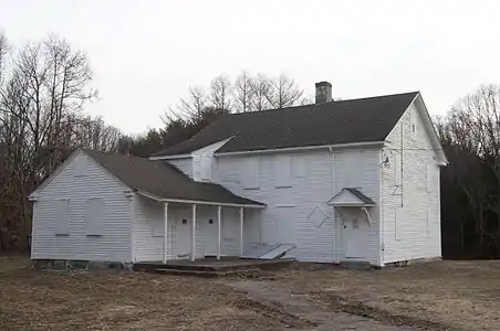 Allen-Madison House |
March 28, 1980 (#80000015) |
Post Rd. 41°37′06″N 71°25′16″W |
North Kingstown | |
| 2 | David S. Baker Estate | 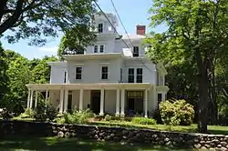 David S. Baker Estate |
August 4, 2011 (#11000512) |
51 & 67 Prospect Ave. 41°33′54″N 71°27′11″W |
North Kingstown | |
| 3 | Camp Endicott | Camp Endicott |
October 19, 1978 (#78000015) |
Between 7th and 10th Sts. 41°36′10″N 71°25′59″W |
North Kingstown | Mostly demolished; some Quonset huts survive at the Seabee Museum and Memorial Park |
| 4 | Silas Casey Farm | 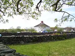 Silas Casey Farm |
August 14, 1973 (#73000006) |
Boston Neck Rd. 41°30′40″N 71°26′01″W |
North Kingstown | |
| 5 | Cocumscossoc Archeological Site | 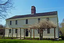 Cocumscossoc Archeological Site |
April 12, 1993 (#93000605) |
55 Richard Smith Drive 41°35′00″N 71°27′16″W |
North Kingstown | Area around one of state's oldest houses has yielded considerable information from digs |
| 6 | Crowfield Historic District | 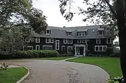 Crowfield Historic District |
July 19, 1985 (#85001646) |
Boston Neck Rd. 41°32′00″N 71°25′27″W |
North Kingstown | |
| 7 | Davisville Historic District | 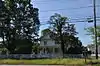 Davisville Historic District |
July 19, 1985 (#85001645) |
Davisville Rd. 41°37′17″N 71°28′52″W |
North Kingstown | |
| 8 | Devil's Foot Cemetery Archeological Site, RI-694 | 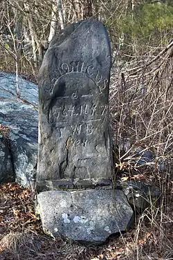 Devil's Foot Cemetery Archeological Site, RI-694 |
November 15, 1984 (#84000562) |
Address Restricted |
North Kingstown | |
| 9 | George Douglas House | 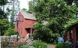 George Douglas House |
October 10, 1975 (#75000006) |
South of Allenton at Tower Hill and Gilbert Stuart Rds. 41°31′18″N 71°27′46″W |
North Kingstown | |
| 10 | Ezekial Gardner House | 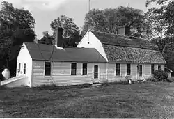 Ezekial Gardner House |
July 19, 1985 (#85001654) |
297 Pendar Rd. 41°31′47″N 71°28′35″W |
North Kingstown | |
| 11 | Hamilton Mill Village Historic District | 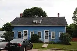 Hamilton Mill Village Historic District |
November 3, 1983 (#83003874) |
Boston Neck and Martha Rds., Salisbury and Web Aves. 41°32′56″N 71°26′19″W |
North Kingstown | |
| 12 | Lafayette Village | 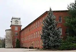 Lafayette Village |
November 14, 1978 (#78000019) |
Ten Rod Road 41°34′24″N 71°28′59″W |
North Kingstown | |
| 13 | Stephen Northup House | 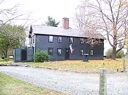 Stephen Northup House |
July 19, 1985 (#85001653) |
99 Featherbed Lane 41°33′05″N 71°26′52″W |
North Kingstown | Built by early Providence and Narragansett settler, Stephen Northup |
| 14 | Old Narragansett Cemetery | 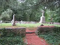 Old Narragansett Cemetery |
July 19, 1985 (#85001655) |
Shermantown Rd. 41°31′08″N 71°28′42″W |
North Kingstown | |
| 15 | Old Narragansett Church | 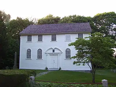 Old Narragansett Church |
July 2, 1973 (#73000009) |
60 Church Lane, Wickford 41°34′21″N 71°26′59″W |
North Kingstown | |
| 16 | Palmer-Northrup House | 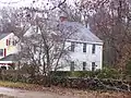 Palmer-Northrup House |
April 11, 1973 (#73000010) |
7919 Post Rd. 41°34′37″N 71°27′40″W |
North Kingstown | |
| 17 | Joseph Pierce Farm |  Joseph Pierce Farm |
July 19, 1985 (#85001652) |
933 Gilbert Stuart Rd. 41°31′22″N 71°26′42″W |
North Kingstown | |
| 18 | Plum Beach Lighthouse | 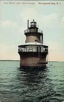 Plum Beach Lighthouse |
March 30, 1988 (#88000281) |
Off Plum Beach, western passage of Narragansett Bay 41°31′48″N 71°24′20″W |
North Kingstown | |
| 19 | Poplar Point Lighthouse | 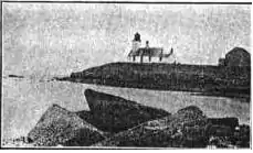 Poplar Point Lighthouse |
February 25, 1988 (#87001703) |
1 Poplar Ave. 41°34′15″N 71°26′23″W |
North Kingstown | |
| 20 | Rathbun House | 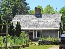 Rathbun House |
July 19, 1985 (#85001651) |
343 Beacon Dr. 41°34′20″N 71°30′20″W |
North Kingstown | |
| 21 | Benoni Ross House | 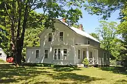 Benoni Ross House |
December 28, 2008 (#08000717) |
97 Lafayette Road 41°34′24″N 71°29′24″W |
North Kingstown | |
| 22 | St. Paul's Church | 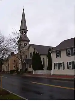 St. Paul's Church |
June 30, 1972 (#72000009) |
76 Main St. 41°34′17″N 71°27′01″W |
North Kingstown | |
| 23 | Esbon Sanford House | 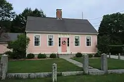 Esbon Sanford House |
July 19, 1985 (#85001649) |
88 Featherbed Lane 41°33′04″N 71°26′55″W |
North Kingstown | |
| 24 | Saunderstown Historic District | 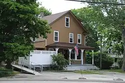 Saunderstown Historic District |
July 19, 1985 (#85001647) |
Roughly bounded by Stillman, Waterway, Willet, Boston Neck & Ferry Rds. 41°30′28″N 71°25′21″W |
North Kingstown | |
| 25 | Scrabbletown Historic and Archeological District | 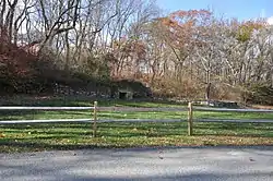 Scrabbletown Historic and Archeological District |
April 11, 1985 (#85000790) |
Address Restricted |
North Kingstown | |
| 26 | Shady Lea Historic District | 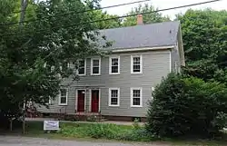 Shady Lea Historic District |
July 19, 1985 (#85001644) |
Shady Lea and Tower Hill Rds. 41°32′07″N 71°27′56″W |
North Kingstown | |
| 27 | Six Principle Baptist Church | 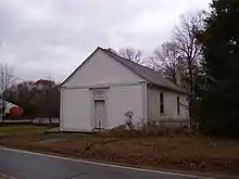 Six Principle Baptist Church |
November 21, 1978 (#78000022) |
85 Old Baptist Rd. 41°35′34″N 71°29′29″W |
North Kingstown | |
| 28 | Joseph Slocum House | 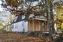 Joseph Slocum House |
July 19, 1985 (#85001648) |
Slocum Rd. 41°31′35″N 71°31′04″W |
North Kingstown | |
| 29 | Spink Farm | 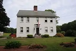 Spink Farm |
July 19, 1985 (#85001650) |
1325 Shermantown Rd. 41°30′34″N 71°29′50″W |
North Kingstown | |
| 30 | Gilbert Stuart Birthplace | 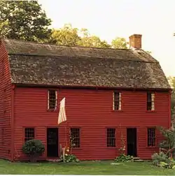 Gilbert Stuart Birthplace |
October 15, 1966 (#66000004) |
Gilbert Stuart Rd. 41°31′36″N 71°26′44″W |
North Kingstown | Birthplace of Gilbert Stuart, portraitist of George Washington and other Revolutionary figures. Preserved intact. |
| 31 | Wickford Historic District | 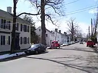 Wickford Historic District |
December 31, 1974 (#74000013) |
Roughly bounded by Tower Hill and Post Rds. as far N as Mill Cove and S to Lindley Ave 41°34′12″N 71°27′24″W |
North Kingstown | |
| 32 | YWCA Site | November 20, 1980 (#80000027) |
Address Restricted |
North Kingstown |
See also
References
- "National Register of Historic Places: Weekly List Actions". National Park Service, United States Department of the Interior. Retrieved on January 29, 2021.
- Numbers represent an alphabetical ordering by significant words. Various colorings, defined here, differentiate National Historic Landmarks and historic districts from other NRHP buildings, structures, sites or objects.
- "National Register Information System". National Register of Historic Places. National Park Service. March 13, 2009.
- The eight-digit number below each date is the number assigned to each location in the National Register Information System database, which can be viewed by clicking the number.
| Topics | _(extra_close)_(US48).svg.png.webp) | ||||||||||
|---|---|---|---|---|---|---|---|---|---|---|---|
| Lists by county | |||||||||||
| Lists by city |
| ||||||||||
| |||||||||||
Municipalities and communities of Washington County, Rhode Island, United States | ||
|---|---|---|
| Towns |  Map of Rhode Island highlighting Washington County | |
| CDPs | ||
| Other villages | ||
| Indian reservation | ||
| ||
This article is issued from Wikipedia. The text is licensed under Creative Commons - Attribution - Sharealike. Additional terms may apply for the media files.