National Register of Historic Places listings in South Kingstown, Rhode Island
This is a list of Registered Historic Places in South Kingstown, Rhode Island.
Bristol | Kent | Newport | Providence | Washington |
- This National Park Service list is complete through NPS recent listings posted January 29, 2021.[1]
| [2] | Name on the Register[3] | Image | Date listed[4] | Location | City or town | Description |
|---|---|---|---|---|---|---|
| 1 | Bouchard Archeological Site, RI-1025 | November 1, 1984 (#84000370) |
Address Restricted |
South Kingstown | Listed in Usquepaug. | |
| 2 | Browning's Beach Historic District | 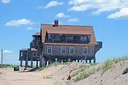 Browning's Beach Historic District |
September 5, 1997 (#97000952) |
Browning's Beach, 0.5 mi (0.80 km) west of the junction of Card Pond and Matunuck Beach Rds. 41°22′26″N 71°33′52″W |
South Kingstown | |
| 3 | Jireh Bull Blockhouse |  Jireh Bull Blockhouse |
November 3, 1983 (#83003869) |
Address Restricted |
South Kingstown | |
| 4 | Cottrell House | 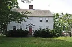 Cottrell House |
November 21, 1996 (#96001319) |
500 Waites Corner Rd. 41°29′22″N 71°33′55″W |
South Kingstown | |
| 5 | Dewey Cottage | 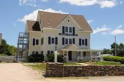 Dewey Cottage |
May 7, 1992 (#92000467) |
668 Matunuck Beach Rd. 41°22′42″N 71°32′56″W |
South Kingstown | |
| 6 | Henry Eldred Farm | 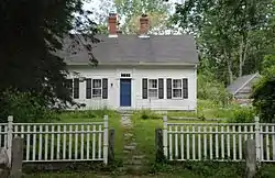 Henry Eldred Farm |
November 18, 1991 (#91001646) |
368 Old North Rd. 41°29′55″N 71°31′14″W |
South Kingstown | |
| 7 | George Fayerweather Blacksmith Shop | 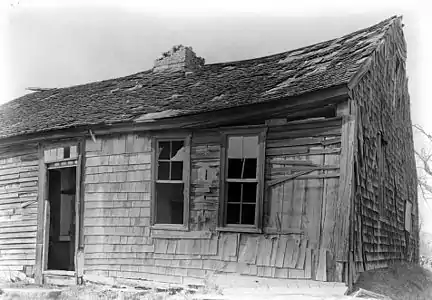 George Fayerweather Blacksmith Shop |
November 29, 1984 (#84000470) |
Intersection RI 108 and 138 41°28′49″N 71°31′13″W |
South Kingstown | |
| 8 | Fernwood Archeological Site, RI-702 | September 12, 1985 (#85002364) |
Address Restricted |
South Kingstown | ||
| 9 | R. R. Gardner House |  R. R. Gardner House |
November 21, 1996 (#96001320) |
700 Curtis Corner Rd. 41°27′10″N 71°31′54″W |
South Kingstown | |
| 10 | Hale House | 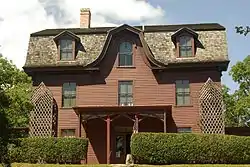 Hale House |
June 5, 2007 (#07000527) |
2625A Commodore Oliver Hazard Perry Highway 41°23′52″N 71°33′03″W |
South Kingstown | |
| 11 | Kenyon's Department Store | 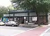 Kenyon's Department Store |
November 5, 1992 (#92001540) |
344 Main St. 41°26′17″N 71°29′59″W |
South Kingstown | |
| 12 | Kingston Hill Farm | 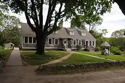 Kingston Hill Farm |
May 7, 1993 (#93000343) |
549 Old North Rd. 41°29′41″N 71°30′51″W |
South Kingstown | |
| 13 | Kingston Railroad Station | 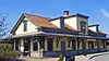 Kingston Railroad Station |
April 26, 1978 (#78000018) |
Kingston Rd. 41°29′03″N 71°33′39″W |
South Kingstown | Restored 1875 original station built by Providence and Stonington Railroad; still used today. |
| 14 | Kingston Village Historic District | 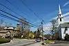 Kingston Village Historic District |
May 1, 1974 (#74000011) |
South Kingstown 41°28′48″N 71°31′29″W |
South Kingstown | |
| 15 | Lambda Chi Site, RI-704 | November 1, 1984 (#84000372) |
Address Restricted |
South Kingstown | ||
| 16 | Henry Marchant Farm | 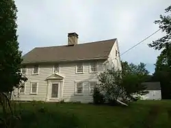 Henry Marchant Farm |
August 16, 1979 (#79000009) |
S. County Trail 41°28′52″N 71°35′56″W |
South Kingstown | |
| 17 | William Davis Miller House |  William Davis Miller House |
March 21, 1985 (#85000627) |
130 Main St. 41°26′08″N 71°30′27″W |
South Kingstown | |
| 18 | Ministerial Rd. Site, RI-781 | 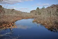 Ministerial Rd. Site, RI-781 |
November 15, 1984 (#84000565) |
Address Restricted |
South Kingstown | |
| 19 | Silas Mumford Site (Tappan Site RI-705) |  Silas Mumford Site (Tappan Site RI-705) |
November 1, 1984 (#84000382) |
Address Restricted |
South Kingstown | |
| 20 | Peace Dale Historic District | 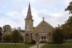 Peace Dale Historic District |
October 30, 1987 (#87000493) |
Roughly bounded by Kensey Rd., Oakwoods Dr., Kingstown Rd., School, Church and Railroad Sts. 41°27′04″N 71°29′42″W |
South Kingstown | |
| 21 | Commodore Oliver Perry Farm | 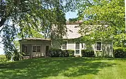 Commodore Oliver Perry Farm |
August 26, 1982 (#82000020) |
Commodore Perry Highway (US Route 1) 41°25′08″N 71°31′51″W |
South Kingstown | |
| 22 | Perry-Carpenter Grist Mill | 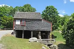 Perry-Carpenter Grist Mill |
February 22, 1990 (#90000106) |
364 Moonstone Beach Rd. 41°23′35″N 71°34′34″W |
South Kingstown | |
| 23 | Potter Pond Archeological District | 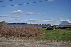 Potter Pond Archeological District |
December 8, 1987 (#87002102) |
Address Restricted |
South Kingstown | |
| 24 | Red House | 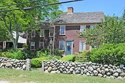 Red House |
November 21, 1996 (#96001323) |
2403 Post Rd. 41°24′02″N 71°34′15″W |
South Kingstown | |
| 25 | Gen. Isaac Peace Rodman House |  Gen. Isaac Peace Rodman House |
April 23, 1990 (#90000596) |
1789 Kingstown Rd. 41°27′48″N 71°30′33″W |
South Kingstown | |
| 26 | Shadow Farm | 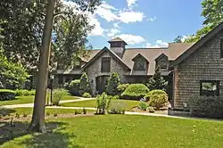 Shadow Farm |
February 7, 1986 (#86000785) |
Kingstown Rd. 41°26′15″N 71°29′28″W |
South Kingstown | |
| 27 | Theatre-By-the-Sea | 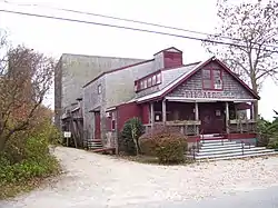 Theatre-By-the-Sea |
July 10, 1980 (#80004597) |
Card Ponds Rd. 41°22′37″N 71°33′46″W |
South Kingstown | |
| 28 | Tootell House | 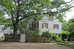 Tootell House |
May 26, 2000 (#00000552) |
1747 Mooresfield Rd. 41°28′51″N 71°31′02″W |
South Kingstown | |
| 29 | Usquepaug Road Historic District | 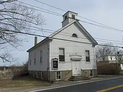 Usquepaug Road Historic District |
October 30, 1987 (#87001298) |
Usquepaug Rd. 41°30′14″N 71°36′01″W |
South Kingstown | |
| 30 | Wakefield Historic District | 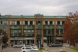 Wakefield Historic District |
May 30, 1996 (#96000572) |
Roughly, Main St. from Belmont Ave. to Columbia St. 41°26′15″N 71°30′04″W |
South Kingstown | |
| 31 | Washington County Court House | 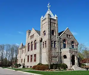 Washington County Court House |
November 5, 1992 (#92001542) |
3481 Kingstown Rd. 41°29′02″N 71°33′21″W |
South Kingstown | former county courthouse, now an arts center |
| 32 | Willow Dell | 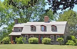 Willow Dell |
November 21, 1996 (#96001321) |
2700 Commodore Oliver Hazard Perry Highway 41°23′47″N 71°33′04″W |
South Kingstown |
See also
References
- "National Register of Historic Places: Weekly List Actions". National Park Service, United States Department of the Interior. Retrieved on January 29, 2021.
- Numbers represent an alphabetical ordering by significant words. Various colorings, defined here, differentiate National Historic Landmarks and historic districts from other NRHP buildings, structures, sites or objects.
- "National Register Information System". National Register of Historic Places. National Park Service. March 13, 2009.
- The eight-digit number below each date is the number assigned to each location in the National Register Information System database, which can be viewed by clicking the number.
| Topics | _(extra_close)_(US48).svg.png.webp) | ||||||||||
|---|---|---|---|---|---|---|---|---|---|---|---|
| Lists by county | |||||||||||
| Lists by city |
| ||||||||||
| |||||||||||
This article is issued from Wikipedia. The text is licensed under Creative Commons - Attribution - Sharealike. Additional terms may apply for the media files.