South Malabar
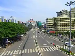
South Malabar refers to a geographical area of the southwestern coast of India covering some parts of the present-day Kerala. South Malabar covers the regions included in present-day Kozhikode district excluding Vatakara and Koyilandy subdistricts, whole area of the Malappuram district, the Chavakkad subdistrict of Thrissur district, and Palakkad district excluding parts of Chittur subdistrict.
South Malabar | |
|---|---|
Geographical / Historical Area | |
  | |
| Country | |
| State | Kerala |
| Government | |
| • Body | Government of Kerala |
| Area | |
| • Total | 7,416 km2 (2,863 sq mi) |
| Population (2011)(approx.)[1] | |
| • Total | 8,368,794 |
| • Density | 1,128/km2 (2,920/sq mi) |
| Languages | |
| • Official | Malayalam |
| Time zone | UTC+5:30 (IST) |
| PIN | 673***, 676***, 678***, 679*** and 680*** |
| ISO 3166 code | IN-KL |
| Vehicle registration | KL-08, KL-09, KL-10, KL-11, KL-46, KL-49, KL-50, KL-51, KL-52, KL-53, KL-54, KL-55, KL-57, KL-65, KL-71, KL-75, KL-76, KL-77, KL-84 & KL-85 |
| Niyamasabha constituencies | 36[2] |
The historical regions of Nediyiruppu Swaroopam, Eranad, Valluvanad, Parappanad, Kavalappara, Vettathunadu, and Nilambur Kingdom are included in the South Malabar.
Etymology
Until the arrival of British, the term Malabar was used as a general name for Kerala. From the time of Cosmas Indicopleustes (6th century CE) itself, the Arab sailors used to call Kerala as Male. Al-Biruni (AD 973 - 1048) must have been the first writer to call this country Malabar. The Arab writers had called this place Malibar, Manibar, Mulibar, and Munibar. Malabar is reminiscent of the word Malanad which means the land of hills. According to William Logan, the word Malabar comes from a combination of the Malayalam word Mala (hill) and the Persian/Arabic word Barr (country/continent). [3]
History
The northern parts of Kerala was unified under Tipu Sultan during the last decades of eighteenth century CE. When he was defeated by the East India Company through Third Anglo-Mysore War, the Treaty of Seringapatam was agreed and the regions included in Tipu's kingdom was annexed with the East India Company. British called the parts of Kerala and Lakshadweep annexed with the company as Malabar. They divided it into North Malabar and South Malabar on 30 March 1793 for administrative convenience. Though the general administrative headquarters of Malabar was at Calicut in South Malabar, the special headquarters of South Malabar was decided to be at Cherpulassery. South Malabar was the centre of the Malabar Rebellion in 1921. On 1 November 1956, this region was annexed with the Indian state of Kerala.[3]
References
- "District Census Handbooks of Kerala - 2011". censusindia.gov.in. Retrieved 26 July 2020.
- "Limits of assembly constituencies of Kerala" (PDF). www.keralaassembly.org. Retrieved 26 July 2020.
- Sreedhara Menon, A. (December 2019). A Survey of Kerala History (2019 ed.). Kottayam: DC Books. ISBN 9788126415786.