Shire of Coorow
The Shire of Coorow is a local government area located in the Mid West region of Western Australia, about 290 kilometres (180 mi) north of Perth, the state capital, and about 130 kilometres (81 mi) south of the city of Geraldton. The Shire covers an area of 4,194 square kilometres (1,619 sq mi) and its seat of government is the town of Coorow, with the largest settlement being Leeman.
| Shire of Coorow Western Australia | |||||||||||||||
|---|---|---|---|---|---|---|---|---|---|---|---|---|---|---|---|
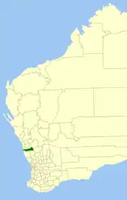 Location in Western Australia | |||||||||||||||
| Population | 1,036 (2016 census)[1] | ||||||||||||||
| • Density | 0.24703/km2 (0.6398/sq mi) | ||||||||||||||
| Established | 1962 | ||||||||||||||
| Area | 4,193.9 km2 (1,619.3 sq mi) | ||||||||||||||
| President | Moira Girando | ||||||||||||||
| Council seat | Coorow | ||||||||||||||
| Region | Mid West | ||||||||||||||
| State electorate(s) | Moore | ||||||||||||||
| Federal Division(s) | Durack | ||||||||||||||
 | |||||||||||||||
| Website | Shire of Coorow | ||||||||||||||
| |||||||||||||||
History
Historically, the area was part of the Carnamah Road District. On 19 April 1962, the Shire of Coorow was created.[2]
Wards
The Shire has eight councillors, elected at large. Wards were abolished in 2003.
Population
| Year | Population |
|---|---|
| 1966 | 808 |
| 1971 | 912 |
| 1976 | 1,136 |
| 1981 | 1,253 |
| 1986 | 1,393 |
| 1991 | 1,526 |
| 1996 | 1,389 |
| 2001 | 1,338 |
| 2006 | 1,199 |
| 2011 | 1,067 |
| 2016 | 1,036 |
Heritage-listed places
As of 2020, 76 places are heritage-listed in the Shire of Coorow,[3] of which none are on the State Register of Heritage Places.[4]
References
- Australian Bureau of Statistics (27 June 2017). "Coorow (S)". 2016 Census QuickStats. Retrieved 1 December 2017.

- WA Electoral Commission, Municipality Boundary Amendments Register (release 3.0), 31 July 2007.
- "Shire of Coorow Heritage Places". inherit.stateheritage.wa.gov.au. Heritage Council of Western Australia. Retrieved 23 March 2020.
- "Shire of Coorow State Register of Heritage Places". inherit.stateheritage.wa.gov.au. Heritage Council of Western Australia. Retrieved 23 March 2020.
This article is issued from Wikipedia. The text is licensed under Creative Commons - Attribution - Sharealike. Additional terms may apply for the media files.