Shire of Irwin
The Shire of Irwin is a local government area in the Mid West region of Western Australia, about 50 kilometres (30 mi) south of Geraldton and about 360 kilometres (220 mi) north of the state capital, Perth. The Shire covers an area of 2,374 square kilometres (917 sq mi), and its seat of government is the town of Dongara.
| Shire of Irwin Western Australia | |||||||||||||||
|---|---|---|---|---|---|---|---|---|---|---|---|---|---|---|---|
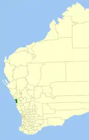 Location in Western Australia | |||||||||||||||
| Population | 3,569 (2016 census)[1] | ||||||||||||||
| • Density | 1.50312/km2 (3.8931/sq mi) | ||||||||||||||
| Area | 2,374.4 km2 (916.8 sq mi) | ||||||||||||||
| President | Michael Smith | ||||||||||||||
| Council seat | Dongara | ||||||||||||||
| Region | Mid West | ||||||||||||||
| State electorate(s) | Moore | ||||||||||||||
| Federal Division(s) | Durack | ||||||||||||||
| Website | Shire of Irwin | ||||||||||||||
| |||||||||||||||
History
The Irwin Road District was created on 24 January 1871 as one of the first regional local government areas in Western Australia. On 16 June 1916, Irwin received a large land area from the Upper Irwin Road Board shortly before that entity's dissolution. Sections of the district separated as part of the formation of the Carnamah Road District on 24 August 1923 and the Three Springs Road District on 2 November 1928.[2]
On 1 July 1961, it became a shire following the passage of the Local Government Act 1960, which reformed all remaining road districts into shires.[2]
| Year | Population |
|---|---|
| 1933 | 555 |
| 1947 | 465 |
| 1954 | 611 |
| 1961 | 657 |
| 1966 | 810 |
| 1971 | 941 |
| 1976 | 1,196 |
| 1981 | 1,578 |
| 1986 | 1,905 |
| 1991 | 2,100 |
| 1996 | 2,433 |
| 2001 | 2,810 |
| 2006 | 3,052 |
| 2011 | 3,567 |
| 2016 | 3,569 |
Wards
The Shire is divided into four wards:
- Denison Ward (four councillors)
- North Ward (two councillors)
- South East Ward (two councillors)
- Town Ward (two councillors)
Towns and localities
- Dongara
- Allanooka
- Arrowsmith
- Bookara
- Port Denison
- Springfield
- Yardarino
Notable councillors
- Samuel James Phillips, Irwin Road Board member 1883; later a state MP
- Charles Maley, Upper Irwin Road Board member 1907–1929; also a state MP
Heritage-listed places
As of 2020, 157 places are heritage-listed in the Shire of Irwin,[4] of which 16 are on the State Register of Heritage Places.[5]
References
- Australian Bureau of Statistics (27 June 2017). "Irwin (S)". 2016 Census QuickStats. Retrieved 28 October 2019.

- "Municipality Boundary Amendments Register" (PDF). Western Australian Electoral Distribution Commission. Retrieved 11 January 2020.
- http://www.lockthegate.org.au/fifth_midwest_wa_community_declares_itself_gasfield_free
- "Shire of Irwin Heritage Places". inherit.stateheritage.wa.gov.au. Heritage Council of Western Australia. Retrieved 23 March 2020.
- "Shire of Irwin State Register of Heritage Places". inherit.stateheritage.wa.gov.au. Heritage Council of Western Australia. Retrieved 23 March 2020.