Shire of Wiluna
The Shire of Wiluna is a local government area in the Mid West region of Western Australia, about 950 kilometres (590 mi) northeast of the state capital, Perth. The Shire covers an area of 182,155 square kilometres (70,330 sq mi), and its seat of government is the town of Wiluna.
| Shire of Wiluna Western Australia | |||||||||||||||
|---|---|---|---|---|---|---|---|---|---|---|---|---|---|---|---|
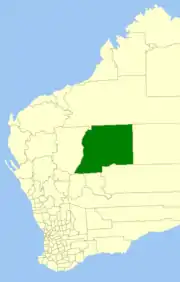 Location in Western Australia | |||||||||||||||
| Population | 742 (2016 census)[1] | ||||||||||||||
| • Density | 0.0040734/km2 (0.010550/sq mi) | ||||||||||||||
| Area | 182,155.8 km2 (70,330.7 sq mi) | ||||||||||||||
| President | Jim Quadrio | ||||||||||||||
| Council seat | Wiluna | ||||||||||||||
| Region | Mid West | ||||||||||||||
| State electorate(s) | Kalgoorlie | ||||||||||||||
| Federal Division(s) | Durack | ||||||||||||||
 | |||||||||||||||
| Website | Shire of Wiluna | ||||||||||||||
| |||||||||||||||
History
The Wiluna Road District was gazetted on 29 October 1909, largely formed out of part of the abolished Nannine Road District. On 1 July 1961, it became a shire following the passage of the Local Government Act 1960, which reformed all road districts into shires. On 1 July 1993, the eastern half of the Shire abutting the State's border with the Northern Territory was incorporated as the Shire of Ngaanyatjarraku.[2][3]
The shire is predominantly mining and pastoral land. There are 27 pastoral leases within the shire; 15 of which are owned by families or pastoral companies, ten of which are owned by mining companies, two are owned by the Department of Environment and Conservation (DEC). Both of the stations that are owned by the DEC are destocked and run as nature reserved, many of the leases owned by mining companies have also been destocked.[4]
Wards
The Shire is no longer divided into wards and the seven councillors sit at large.
Towns and localities
Heritage-listed places
As of 2020, 38 places are heritage-listed in the Shire of Wiluna,[5] of which two are on the State Register of Heritage Places.[6]
References
- Australian Bureau of Statistics (27 June 2017). "Wiluna (S)". 2016 Census QuickStats. Retrieved 26 November 2017.

- "Municipality Boundary Amendments Register" (PDF). Western Australian Electoral Distribution Commission. Retrieved 11 January 2020.
- "General News". Meekatharra Miner. Western Australia. 25 September 1909. p. 2. Retrieved 21 January 2020 – via Trove.
- Christina Lange (2009). "Incorporating cattle: governance and an Aboriginal pastoral enterprise". Australian National University. Retrieved 17 May 2014.
- "Shire of Wiluna Heritage Places". inherit.stateheritage.wa.gov.au. Heritage Council of Western Australia. Retrieved 23 March 2020.
- "Shire of Wiluna State Register of Heritage Places". inherit.stateheritage.wa.gov.au. Heritage Council of Western Australia. Retrieved 23 March 2020.