Shire of Morawa
The Shire of Morawa is a local government area in the Mid West region of Western Australia, about 170 kilometres (106 mi) east-southeast of the city of Geraldton and about 390 kilometres (242 mi) north of the state capital, Perth. The Shire covers an area of 3,516 square kilometres (1,358 sq mi), and its seat of government is the town of Morawa.
| Shire of Morawa Western Australia | |||||||||||||||
|---|---|---|---|---|---|---|---|---|---|---|---|---|---|---|---|
.jpg.webp) Morawa Town Hall, 2018 | |||||||||||||||
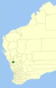 Location in Western Australia | |||||||||||||||
| Population | 750 (2016 census)[1] | ||||||||||||||
| • Density | 0.2133/km2 (0.553/sq mi) | ||||||||||||||
| Area | 3,515.8 km2 (1,357.5 sq mi) | ||||||||||||||
| President | K J (Karen) Chappel | ||||||||||||||
| Council seat | Morawa | ||||||||||||||
| Region | Mid West | ||||||||||||||
| State electorate(s) | Moore | ||||||||||||||
| Federal Division(s) | Durack | ||||||||||||||
| Website | Shire of Morawa | ||||||||||||||
| |||||||||||||||
History
The Shire of Morawa originated as the Morawa Road District, established on 27 April 1928 when the Perenjori-Morawa Road District (which had separated from the Upper Irwin Road District in 1916), split into separate Morawa and Perenjori road districts.[2]
On 1 July 1961, Morawa became a shire following the passage of the Local Government Act 1960, which reformed all remaining road districts into shires.[2]
On 18 September 2009, the Shires of Mingenew, Three Springs, Morawa and Perenjori announced their intention to amalgamate. A formal agreement was signed five days later, and the name Billeranga was later chosen.[3] However, by February 2011, community pressure had led to the negotiations stalling, and on 16 April 2011, voters from the Shire of Perenjori defeated the proposal at a referendum.[4][5]
Wards
The Shire is no longer divided into wards and the seven councillors sit at large. Prior to the 1997 election, the Shire was divided into wards:
- Town Ward (three councillors)
- Central Ward (two councillors)
- North Ward (two councillors)
- South Ward (two councillors)
- Pintharuka Ward (two councillors)
Towns and localities
Population
Prior to 1933 the census area was incorporated in the Perenjori-Morawa Road District.
| Year | Population[6] |
|---|---|
| 1933 | 1,141 |
| 1947 | 943 |
| 1954 | 1,223 |
| 1961 | 1,317 |
| 1966 | 1,718 |
| 1971 | 1,649 |
| 1976 | 1,466 |
| 1981 | 1,290 |
| 1986 | 1,165 |
| 1991 | 1,007 |
| 1996 | 1,058 |
| 2001 | 924 |
| 2006 | 824 |
| 2011 | 894 |
| 2016 | 750 |
Heritage-listed places
As of 2020, 54 places are heritage-listed in the Shire of Morawa,[7] of which six are on the State Register of Heritage Places.[8]
References
- Australian Bureau of Statistics (27 June 2017). "Morawa (S)". 2016 Census QuickStats. Retrieved 28 October 2019.

- "Municipality Boundary Amendments Register" (PDF). Western Australian Electoral Distribution Commission. Retrieved 11 January 2020.
- "Mid-West councils to amalgamate". ABC Online. 18 September 2009.
- "Archived copy" (PDF). Archived from the original (PDF) on 19 April 2013. Retrieved 28 March 2013.CS1 maint: archived copy as title (link)
- "Perenjori amalgamation not to proceed". Mid West News. 18 April 2011. Retrieved 26 May 2012.
- "Historical Census Data". Australian Bureau of Statistics. Canberra. 25 June 2017. Retrieved 9 March 2020.
- "Shire of Morawa Heritage Places". inherit.stateheritage.wa.gov.au. Heritage Council of Western Australia. Retrieved 23 March 2020.
- "Shire of Morawa State Register of Heritage Places". inherit.stateheritage.wa.gov.au. Heritage Council of Western Australia. Retrieved 23 March 2020.