City of Nedlands
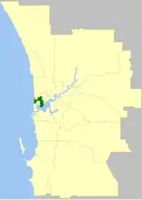
The City of Nedlands is a local government area in the inner western suburbs of the Western Australian capital city of Perth, about 7 kilometres (4 mi) west of Perth's central business district. The City covers an area of 20.0 square kilometres (7.7 sq mi), maintains 137 km of roads and a little over 380 hectares (939 acres) of parks and gardens, and has a population of over 21,000 as of 2016.
| City of Nedlands Western Australia | |||||||||||||||
|---|---|---|---|---|---|---|---|---|---|---|---|---|---|---|---|
 | |||||||||||||||
| Population |
| ||||||||||||||
| • Density | 1,060/km2 (2,700/sq mi) | ||||||||||||||
| Established | 1893 | ||||||||||||||
| Area | 20 km2 (7.7 sq mi) | ||||||||||||||
| Mayor | Cilla de Lacy | ||||||||||||||
| Council seat | Nedlands | ||||||||||||||
| Region | West Metropolitan Perth | ||||||||||||||
| State electorate(s) | Nedlands, Cottesloe | ||||||||||||||
| Federal Division(s) | Curtin | ||||||||||||||
| Website | City of Nedlands | ||||||||||||||
| |||||||||||||||
History
The City of Nedlands originated in the Claremont Road District, which was established on 30 March 1893 after a petition from ratepayers who lived in the areas of Nedlands and Claremont, which had grown substantially in population at the end of the 19th century. Seven men were nominated to the new Board, which became the first local government authority for the Nedlands/Claremont area.[3]
In 1898, Claremont itself split away to form a municipal government, which still exists today as the Town of Claremont.[3]
It was renamed the Nedlands Road District on 12 August 1932 and given municipal status as the Municipality of Nedlands on 17 February 1956. It then assumed its current name when it was granted city status on 1 July 1959.[3] The City was made up of four wards – Melvista, Hollywood, Dalkeith and Coastal. These wards continue to the present day.
Wards
The town is divided into four wards, each electing three councillors. The mayor is directly elected.
- Coastal Ward
- Dalkeith Ward
- Hollywood Ward
- Melvista Ward
Suburbs
* Shared with other council areas (Subiaco; Cambridge; Perth)
Population
|
|
Heritage listed places
As of 2020, there are 21 places on the State Register of Heritage Places in the City of Nedlands, among them the Captain Stirling Hotel and Graylands Hospital.[4]
References
- Australian Bureau of Statistics (27 June 2017). "Nedlands (C)". 2016 Census QuickStats. Retrieved 26 November 2017.

- "3218.0 – Regional Population Growth, Australia, 2017-18". Australian Bureau of Statistics. 27 March 2019. Retrieved 31 December 2019. Estimated resident population (ERP) at 30 June 2018.
- "Municipality Boundary Amendments Register" (PDF). Western Australian Electoral Distribution Commission. Retrieved 11 January 2020.
- "City of Nedlands State Register of Heritage Places". inherit.stateheritage.wa.gov.au. Heritage Council of Western Australia. Retrieved 30 April 2020.