Town of Bassendean
The Town of Bassendean is a local government area in the northeastern suburbs of the Western Australian capital city of Perth, 6 kilometres (4 mi) west of the industrial centre of Midland and about 12 kilometres (7 mi) northeast of Perth's central business district. The Town covers an area of 10.4 square kilometres (4.0 sq mi), maintains 97 km of roads and had a population of approximately 15,000 as at the 2016 Census. The Town of Bassendean is a member of the Eastern Metropolitan Regional Council.
| Town of Bassendean Western Australia | |||||||||||||||
|---|---|---|---|---|---|---|---|---|---|---|---|---|---|---|---|
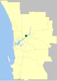 Location of Town of Bassendean within inner Perth metropolitan area | |||||||||||||||
| Population | 15,092 (2016 census)[1] | ||||||||||||||
| • Density | 1,451/km2 (3,758/sq mi) | ||||||||||||||
| Established | 1901 | ||||||||||||||
| Area | 10.4 km2 (4.0 sq mi) | ||||||||||||||
| Mayor | Renee McLennan | ||||||||||||||
| Council seat | Bassendean | ||||||||||||||
| Region | Eastern Metropolitan Perth | ||||||||||||||
| State electorate(s) | Bassendean | ||||||||||||||
| Federal Division(s) | Perth | ||||||||||||||
| Website | Town of Bassendean | ||||||||||||||
| |||||||||||||||
History
The West Guildford Road District was created on 10 May 1901. It was renamed the Bassendean Road District on 7 July 1922, and on 1 July 1961, became the Shire of Bassendean following the enactment of the Local Government Act 1960, which reformed all remaining road districts into shires. It assumed its current name when it gained town status on 1 July 1975.[2][3]
Wards
The Town does not have any wards however in the past it was divided into three wards.
Suburbs
Mayors
Population
|
|
Heritage listed places
As of 2020, 334 places are heritage-listed in the Town of Bassendean,[4] of which 13 are on the State Register of Heritage Places, among them the former Bassendean Fire Station and the Bassendean Oval.[5]
References
- Australian Bureau of Statistics (27 June 2017). "Bassendean (T)". 2016 Census QuickStats. Retrieved 26 November 2017.

- "Municipality Boundary Amendments Register" (PDF). Western Australian Electoral Distribution Commission. Retrieved 11 January 2020.
- "Local Government Act, 1960-1974. Shire of Bassendean. Change of Status. Order in Council. (per LG. BS-1-10)". Western Australia Government Gazette. 18 April 1975. p. 1975:1152.
- "Town of Bassendean Heritage Places". inherit.stateheritage.wa.gov.au. Heritage Council of Western Australia. Retrieved 29 April 2020.
- "Town of Bassendean State Register of Heritage Places". inherit.stateheritage.wa.gov.au. Heritage Council of Western Australia. Retrieved 29 April 2020.