Shire of Woodanilling
The Shire of Woodanilling is a local government area in the Great Southern region of Western Australia, about 30 kilometres (19 mi) south of Wagin and about 260 kilometres (162 mi) south-southeast of the state capital, Perth. The Shire covers an area of 1,129 square kilometres (436 sq mi), and its seat of government is the town of Woodanilling.
| Shire of Woodanilling Western Australia | |||||||||||||||
|---|---|---|---|---|---|---|---|---|---|---|---|---|---|---|---|
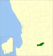 Location in Western Australia | |||||||||||||||
| Population | 409 (2016 census)[1] | ||||||||||||||
| • Density | 0.3623/km2 (0.9383/sq mi) | ||||||||||||||
| Area | 1,129.0 km2 (435.9 sq mi) | ||||||||||||||
| Mayor | H R (Russel) Thomson JP | ||||||||||||||
| Council seat | Woodanilling | ||||||||||||||
| Region | Great Southern | ||||||||||||||
| State electorate(s) | Roe | ||||||||||||||
| Federal Division(s) | O'Connor | ||||||||||||||
 | |||||||||||||||
| Website | Shire of Woodanilling | ||||||||||||||
| |||||||||||||||
History
The Woodanilling Road District was established on 2 February 1906. On 1 July 1961, it became a Shire under the Local Government Act 1960, which reformed all road districts into shires.[2]
Wards
The shire is divided into 3 wards:
- Central Ward (2 councillors)
- West Ward (3 councillors)
- East Ward (2 councillors)
Towns and localities
- Woodanilling
- Beaufort River
- Cartmeticup
Population
| Year | Population[3] |
|---|---|
| 1911 | 614 |
| 1921 | 639 |
| 1933 | 671 |
| 1947 | 697 |
| 1954 | 718 |
| 1961 | 639 |
| 1966 | 580 |
| 1971 | 529 |
| 1976 | 447 |
| 1981 | 461 |
| 1986 | 435 |
| 1991 | 391 |
| 1996 | 354 |
| 2001 | 394 |
| 2006 | 418 |
| 2011 | 419 |
References
- Australian Bureau of Statistics (27 June 2017). "Woodanilling (S)". 2016 Census QuickStats. Retrieved 28 October 2019.

- "Municipality Boundary Amendments Register" (PDF). Western Australian Electoral Distribution Commission. Retrieved 11 January 2020.
- Australian Bureau of Statistics (30 March 2010). "Regional Population Growth, Australia, 2008–09". Archived from the original on 5 June 2010. Retrieved 4 June 2010.
External links
This article is issued from Wikipedia. The text is licensed under Creative Commons - Attribution - Sharealike. Additional terms may apply for the media files.