Shire of Cue
The Shire of Cue is a local government area in the Mid West region of Western Australia, about 420 kilometres (260 mi) east-northeast of the port city of Geraldton and about 650 kilometres (400 mi) north-northeast of the state capital, Perth. The Shire covers an area of 13,623 square kilometres (5,260 sq mi), and its seat of government is the town of Cue.
| Shire of Cue Western Australia | |||||||||||||||
|---|---|---|---|---|---|---|---|---|---|---|---|---|---|---|---|
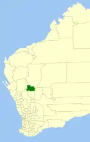 Location in Western Australia | |||||||||||||||
| Population | 194 (2016 census)[1] | ||||||||||||||
| • Density | 0.01424/km2 (0.03688/sq mi) | ||||||||||||||
| Area | 13,622.9 km2 (5,259.8 sq mi) | ||||||||||||||
| President | Ross Pigdon | ||||||||||||||
| Council seat | Cue | ||||||||||||||
| Region | Mid West | ||||||||||||||
| State electorate(s) | North West | ||||||||||||||
| Federal Division(s) | Durack | ||||||||||||||
| Website | Shire of Cue | ||||||||||||||
| |||||||||||||||
History
The Shire of Cue originated as the Cue Road District, which was established on 6 December 1895. Part of the road district separated with the formation of the Mount Magnet Road District on 20 September 1901 and the Mullewa Road District on 11 August 1911.[2]
The road district expanded to include the Cue and Day Dawn townships on 11 October 1912 through the Municipality of Cue and the Municipality of Day Dawn. It was renamed the Cue-Day Dawn Road District at that time.[2][3]
It reverted to the Cue Road District name on 24 January 1930. It absorbed part of the abolished Nannine Road District on the same day.[2]
On 1 July 1961, it became the Shire of Cue following following the passage of the Local Government Act 1960, which reformed all remaining road districts into shires.[2]
Wards
The shire is divided into three wards:
- Cue Ward (5 councillors)
- Daydawn Ward (1 councillor)
- Tuckanarra Ward (1 councillor)
Towns and localities
- Cue
- Austin
- Big Bell
- Cuddingwarra
- Day Dawn
- Mainland
- Reedy
- Tuckanarra
- Weld Range
Notable councillors
- Con O'Brien, Cue Municipality councillor 1896–1900, mayor 1897–1900; later a state MP
- Richard Burt, Cue Road Board member 1939–1959, chairman 1950–1959; later a state MP
- Cedric Wyatt, Cue shire president early 2000s; Aboriginal leader
Heritage-listed places
As of 2020, 127 places are heritage-listed in the Shire of Cue,[4] of which 18 are on the State Register of Heritage Places, all but one, the Great Fingall Mine office, located in Cue.[5]
References
- Australian Bureau of Statistics (27 June 2017). "Cue (S)". 2016 Census QuickStats. Retrieved 28 October 2019.

- "Municipality Boundary Amendments Register" (PDF). Western Australian Electoral Distribution Commission. Retrieved 11 January 2020.
- "Friday, October 11, 1912" (PDF). Government Gazette of Western Australia. Retrieved 27 January 2020.
- "Shire of Cue Heritage Places". inherit.stateheritage.wa.gov.au. Heritage Council of Western Australia. Retrieved 10 March 2020.
- "Shire of Cue State Register of Heritage Places". inherit.stateheritage.wa.gov.au. Heritage Council of Western Australia. Retrieved 10 March 2020.