Shire of Harvey
The Shire of Harvey is a local government area of Western Australia. Harvey is located in the state's South West region, approximately 140 km south of Perth, and includes some of Bunbury's northern suburbs. The shire covers an area of 1,728 km² and had a population of approximately 26,500 as at the 2016 Census. Around 12% of the population are of Southern or Eastern European origin.
| Shire of Harvey Western Australia | |||||||||||||||
|---|---|---|---|---|---|---|---|---|---|---|---|---|---|---|---|
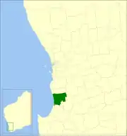 Location in Western Australia | |||||||||||||||
| Population | 26,553 (2016 census)[1] | ||||||||||||||
| • Density | 15.3637/km2 (39.7917/sq mi) | ||||||||||||||
| Established | 1894 | ||||||||||||||
| Area | 1,728.3 km2 (667.3 sq mi) | ||||||||||||||
| Shire President | Paul Gillett | ||||||||||||||
| Council seat | Harvey | ||||||||||||||
| Region | South West, Outer Bunbury | ||||||||||||||
| State electorate(s) | Murray-Wellington | ||||||||||||||
| Federal Division(s) | Forrest | ||||||||||||||
 | |||||||||||||||
| Website | Shire of Harvey | ||||||||||||||
| |||||||||||||||
It contains three large towns, Harvey, Australind and Brunswick Junction and a number of smaller towns. The shire office is located on Uduc Road, Harvey, and an administration centre is open at Mulgara Street, Australind.
History
It was established as the Brunswick Road District on 14 December 1894, when it separated from the larger Wellington Road District.[2] The first election was held on 11 February 1895.
It was renamed the Harvey Road District on 10 December 1909. It was made a shire with effect from 1 July 1961 following the passage of the Local Government Act 1960, which reformed all remaining road districts into shires.[2]
Wards
The shire does not have Wards, although is represented by Councillors from all around the Shire.
The Shire President is Paul Gillett.
Towns and localities
The Shire of Harvey contains the following towns and localities:
|
Population
| Year | Population |
|---|---|
| 1911 | 3,646 |
| 1921 | 3,950 |
| 1933 | 5,367 |
| 1947 | 5,589 |
| 1954 | 6,731 |
| 1961 | 6,834 |
| 1966 | 6,543 |
| 1971 | 6,460 |
| 1976 | 6,704 |
| 1981 | 8,027 |
| 1986 | 9,609 |
| 1991 | 12,367 |
| 1996 | 14,714 |
| 2001 | 17,224 |
| 2006 | 19,556 |
| 2011 | 23,237 |
| 2016 | 27,029 |
The ABS provides a breakdown for the Australind suburban area (Part A) and the remainder of the Shire (Part B):
| Year | Part A | Part B |
|---|---|---|
| 1991 | 5,816 | 6,551 |
| 1996 | 7,570 | 7,144 |
| 2001 | 9,574 | 7,650 |
| 2006 | 11,537 | 8,019 |
| 2011 | 14,779 | 8,455 |
Heritage-listed places
As of 2020, 198 places are heritage-listed in the Shire of Harvey,[3] of which nine are on the State Register of Heritage Places, among them the Yarloop Workshops which were destroyed in a 2016 bush fire.[4]
See also
References
- Australian Bureau of Statistics (27 June 2017). "Harvey (S)". 2016 Census QuickStats. Retrieved 26 November 2017.

- "Municipality Boundary Amendments Register" (PDF). Western Australian Electoral Distribution Commission. Retrieved 11 January 2020.
- "Shire of Harvey Heritage Places". inherit.stateheritage.wa.gov.au. Heritage Council of Western Australia. Retrieved 26 February 2020.
- "Shire of Harvey State Register of Heritage Places". inherit.stateheritage.wa.gov.au. Heritage Council of Western Australia. Retrieved 26 February 2020.
