Shire of Kojonup
The Shire of Kojonup is a local government area in the Great Southern region of Western Australia, about 250 kilometres (155 mi) southeast of the state capital, Perth, along Albany Highway. The Shire covers an area of 2,932 square kilometres (1,132 sq mi) and its seat of government is the town of Kojonup.
| Shire of Kojonup Western Australia | |||||||||||||||
|---|---|---|---|---|---|---|---|---|---|---|---|---|---|---|---|
.jpg.webp) Kojonup Memorial Hall, 2018 | |||||||||||||||
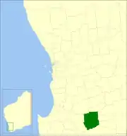 Location in Western Australia | |||||||||||||||
| Population | 1,985 (2016 census)[1] | ||||||||||||||
| • Density | 0.67697/km2 (1.7533/sq mi) | ||||||||||||||
| Established | 1871 | ||||||||||||||
| Area | 2,932.2 km2 (1,132.1 sq mi) | ||||||||||||||
| Mayor | Ronnie Fleay | ||||||||||||||
| Council seat | Kojonup | ||||||||||||||
| Region | Great Southern | ||||||||||||||
| State electorate(s) | Roe | ||||||||||||||
| Federal Division(s) | O'Connor | ||||||||||||||
| Website | Shire of Kojonup | ||||||||||||||
| |||||||||||||||
History
The Kojonup Road District was created on 5 December 1871. On 1 July 1961, it became the Shire of Kojonup following the passage of the Local Government Act 1960, which reformed all remaining road districts into shires.[2]
Wards
The shire has no wards, and all councillors serve 4-year terms. Previously, it was divided into 5 wards:
- Kojonup Ward (3 councillors)
- Balgarup Ward (2 councillors)
- Muradup Ward (2 councillors)
- Ongerup Ward (2 councillors)
- Namarillup Ward (2 councillors)
(Note: The town of Ongerup, unrelated to the ward, is located within the Shire of Gnowangerup.)
Towns and localities
References
- Australian Bureau of Statistics (27 June 2017). "Kojonup (S)". 2016 Census QuickStats. Retrieved 28 October 2019.

- "Municipality Boundary Amendments Register" (PDF). Western Australian Electoral Distribution Commission. Retrieved 11 January 2020.
External links
This article is issued from Wikipedia. The text is licensed under Creative Commons - Attribution - Sharealike. Additional terms may apply for the media files.