Shire of Nannup
The Shire of Nannup is a local government area in the South West region of Western Australia, approximately 280 kilometres (174 mi) south of the state capital, Perth and 60 kilometres (37 mi) southeast of the coastal resort town of Busselton. Its seat of government is the town of Nannup, where about half of the Shire's population reside.
| Shire of Nannup Western Australia | |||||||||||||||
|---|---|---|---|---|---|---|---|---|---|---|---|---|---|---|---|
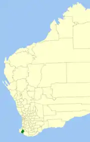 Location in Western Australia | |||||||||||||||
| Population | 1,328 (2016 census)[1] | ||||||||||||||
| • Density | 0.45253/km2 (1.1721/sq mi) | ||||||||||||||
| Established | 1890 | ||||||||||||||
| Area | 2,934.6 km2 (1,133.1 sq mi) | ||||||||||||||
| President | Tony Dean | ||||||||||||||
| Council seat | Nannup | ||||||||||||||
| Region | South West | ||||||||||||||
| State electorate(s) | Blackwood-Stirling | ||||||||||||||
| Federal Division(s) | Forrest | ||||||||||||||
| Website | Shire of Nannup | ||||||||||||||
| |||||||||||||||
The Shire has a land area of 2,935 square kilometres (1,133 sq mi), about 85% of which is covered in hardwood jarrah, karri and marri forests, while the southern coastline is mostly within the D'Entrecasteaux National Park.
History
The Lower Blackwood Road District was established on 20 February 1890. It was renamed the Nannup Road District on 21 August 1925. On 1 July 1961, it became the Shire of Nannup following the passage of the Local Government Act 1960, which reformed all remaining road districts into shires.[2]
Wards
The Shire is divided into three wards.
- Central Ward (three councillors)
- North Ward (three councillors)
- South Ward (two councillors)
Towns and localities
- Nannup
- Biddelia
- Carlotta
- Cundinup
- Darradup
- Donnelly River (Wheatley)
- East Nannup
- Jalbarragup
- Lake Jasper
- Peerabeelup
- Scott River East
Notable councillors
- Edmund Vernon Brockman, Nannup Roads Board member 1909–1935, 1937–1938, chairman 1915–1935; also a state MP
Heritage-listed places
As of 2020, 88 places are heritage-listed in the Shire of Nannup,[3] of which three are on the State Register of Heritage Places.[4]
References
- Australian Bureau of Statistics (27 June 2017). "Nannup (S)". 2016 Census QuickStats. Retrieved 26 November 2017.

- "Municipality Boundary Amendments Register" (PDF). Western Australian Electoral Distribution Commission. Retrieved 11 January 2020.
- "Shire of Nannup Heritage Places". inherit.stateheritage.wa.gov.au. Heritage Council of Western Australia. Retrieved 7 March 2020.
- "Shire of Nannup State Register of Heritage Places". inherit.stateheritage.wa.gov.au. Heritage Council of Western Australia. Retrieved 7 March 2020.