Shire of Northampton
The Shire of Northampton is a local government area in the Mid West region of Western Australia, about 50 kilometres (30 mi) north of Geraldton and about 460 kilometres (290 mi) north of the state capital, Perth. The Shire covers an area of 13,738 square kilometres (5,304 sq mi), and its seat of government is the town of Northampton, with the largest settlement being Kalbarri.
| Shire of Northampton Western Australia | |||||||||||||||
|---|---|---|---|---|---|---|---|---|---|---|---|---|---|---|---|
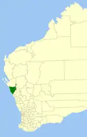 Location in Western Australia | |||||||||||||||
| Population | 3,319 (2016 census)[1] | ||||||||||||||
| • Density | 0.24160/km2 (0.62573/sq mi) | ||||||||||||||
| Established | 1871 | ||||||||||||||
| Area | 13,737.8 km2 (5,304.2 sq mi) | ||||||||||||||
| President | Craig Simkin | ||||||||||||||
| Council seat | Northampton | ||||||||||||||
| Region | Mid West | ||||||||||||||
| State electorate(s) | Moore, North West | ||||||||||||||
| Federal Division(s) | Durack | ||||||||||||||
| Website | Shire of Northampton | ||||||||||||||
| |||||||||||||||
The shire includes the Houtman Abrolhos, a chain of islands off the coast of Western Australia, as well as the Principality of Hutt River, a micronation which has no recognition by the state or federal governments.
History
The Mines Road District was constituted on 25 January 1871 under the Road Boards Act 1871. It was renamed the Northampton Road District on 10 February 1887. On 1 July 1961, it became a shire following the passage of the Local Government Act 1960, which reformed all remaining road districts into shires.[3]
Wards
The Shire is divided into six wards, most of which elect one councillor:
- Kalbarri Ward (four councillors)
- Central Ward (three councillors)
- Coastal Ward
- North East Ward
- South East Ward
- West Ward
Prior to May 2003, the Coastal Ward was known as the Horrocks Ward, the Kalbarri Ward had three councillors and all the others had two councillors.[4]
Towns and localities
Population
The population of the Shire of Northampton as at the 2006 census was 3,204 (Usual Residents) or 4,085 (Place of Enumeration). The disparity is due to holiday accommodation in Kalbarri being picked up in the latter count.
| Year | Population |
|---|---|
| 1911 | 1,412 |
| 1921 | 1,518 |
| 1933 | 1,677 |
| 1947 | 1,470 |
| 1954 | 1,753 |
| 1961 | 1,821 |
| 1966 | 2,021 |
| 1971 | 2,142 |
| 1976 | 2,422 |
| 1981 | 2,366 |
| 1986 | 3,034 |
| 1991 | 3,480 |
| 1996 | 3,697 |
| 2001 | 4,136 |
| 2006 | 4,085 |
Notable councillors
- Thomas Burges, Mines Road Board member 1871–1877, briefly chairman; later a colonial MP
- Samuel Mitchell, Mines Road Board member 1872–1879, chairman 1876–1879; later a colonial MP
- John Cunningham, Northampton Road Board member 1900s; later a state MP
- William Patrick, Northampton Road Board member 1918–1930; later a state MP
- Les Logan, Northampton Road Board member 1940–1945; later a state MP
Heritage-listed places
As of 2020, 223 places are heritage-listed in the Shire of Northampton,[5] of which 30 are on the State Register of Heritage Places, among them the Lynton Convict Hiring Depot.[6]
References
- Australian Bureau of Statistics (27 June 2017). "Northampton (S)". 2016 Census QuickStats. Retrieved 21 March 2018.

- "Change of shire for Mid-West pastoral stations". Media Statements. Perth, WA: Government of Western Australia. 30 July 2004. Retrieved 21 December 2015.
- "Municipality Boundary Amendments Register" (PDF). Western Australian Electoral Distribution Commission. Retrieved 11 January 2020.
- Shire of Northampton (31 August 2004). "Council". Retrieved 8 May 2007.
- "Shire of Northampton Heritage Places". inherit.stateheritage.wa.gov.au. Heritage Council of Western Australia. Retrieved 23 March 2020.
- "Shire of Northampton State Register of Heritage Places". inherit.stateheritage.wa.gov.au. Heritage Council of Western Australia. Retrieved 23 March 2020.