Amravati
Amravati (![]() pronunciation , formerly Oomrawutty[6]) is a city in the Indian state of Maharashtra. Amravati is the second largest city of Vidarbha region of Maharashtra after Nagpur. It is the administrative headquarters of the Amravati district. It is also the headquarters of the Amravati division (also known as Varhad) which is one of the six divisions of the state. Among the historical landmarks in the city are the temples of Shree Ambadevi, Shri Krishna, Gadge Maharaj and Shri Venkateshwara Swamy. The city is famous for Hanuman Vyayam Prasarak Mandal, one of the largest sports complexes in India, which is famous for its facility for different kinds of sports.
pronunciation , formerly Oomrawutty[6]) is a city in the Indian state of Maharashtra. Amravati is the second largest city of Vidarbha region of Maharashtra after Nagpur. It is the administrative headquarters of the Amravati district. It is also the headquarters of the Amravati division (also known as Varhad) which is one of the six divisions of the state. Among the historical landmarks in the city are the temples of Shree Ambadevi, Shri Krishna, Gadge Maharaj and Shri Venkateshwara Swamy. The city is famous for Hanuman Vyayam Prasarak Mandal, one of the largest sports complexes in India, which is famous for its facility for different kinds of sports.
Amravati | |
|---|---|
 Amravati  Amravati  Amravati | |
| Coordinates: 20°55′33″N 77°45′53″E | |
| Country | |
| State | Maharashtra |
| District | Amravati |
| Established | 1097 AD[1] |
| Government | |
| • Type | Municipal Corporation |
| • Body | Amravati Municipal Corporation |
| • Mayor | Chetan Gawande[2] |
| • Municipal Commissioner | Prashant Rode[3] |
| Area | |
| • Total | 280 km2 (110 sq mi) |
| Elevation | 343 m (1,125 ft) |
| Population (2011)[4] | |
| • Total | 646,801 |
| • Rank | India: 66th Maharashtra: 8th Vidarbha: 2nd |
| • Density | 3,819/km2 (9,890/sq mi) |
| Demonym(s) | Amravatikar |
| Languages | |
| • Official | Marathi |
| Time zone | UTC+5:30 (IST) |
| PIN | 444 601 - 444 607, 444701, 444901 |
| Telephone code | +91-721 |
| Vehicle registration | MH 27 (for entire Amravati district) |
| Distance from Nagpur | 152 kilometres (94 mi) (land) |
| Distance from Mumbai | 663 kilometres (412 mi) (land) |
| Literacy Rate | 93.03% |
| HDI | Medium[5] |
| Website | amravati |
History
The ancient name of Amravati is "Audumbaravati", in Prakrit, "Umravati". The variant "Amravati" is the presently accepted name. It is said that Amravati is named for its ancient Ambadevi temple. A mention of Amravati can be found on a stone inscription on the base of the marble statue of God Adinath (Jain God) Rhishabhnath. The statues date back to the year 1097. "Govind Maha Prabhu" visited Amravati in the 13th century, when Wardha was under the rule of Deogiri's Hindu King (Yadava dynasty). In the 14th century, there was drought and famine in Amravati, so people abandoned Amravati and left for Gujrat and Malwa. Though some locals returned after several years, this resulted in a scanty population. In the 17th century, Magar Aurangpura (today, 'Sabanpura') was allotted for a Jama Masjid by Mughal Aurangzeb. This indicates the existence of a Muslim population. In 1722, Chhattrapati Shahu presented Amravati and Badnera to Ranoji Bhosle; eventually, Amravati was known as Bhosle ki Amravati. The city was reconstructed and developed by Ranoji Bhosle after the treaty of Devgaon and Anjangaon Surji and victory over Gavilgad (Fort of Chikhaldara). The British general and author Wellesly camped in Amravati, the place is still known as the 'camp', by Amravati people. Amravati city was founded towards the end of the 18th century. The Union state of Nizam and Bhosle ruled Amravati. They appointed a revenue officer but neglected defence. The Gavilgad fort was conquered by the British on 15 December 1803. Under the Deogaon treaty, Warhad was presented as a token of the friendship to the Nizam.
Warhad was ruled by the Nizams thereafter. Around 1805, the Pendharies attacked Amravati city.
The Sahukars (bankers and merchants) of Amravati saved Amravati by presenting seven lakh rupees to Chittu Pendhari. The Nizam ruled for more than half-century. From 1859 to 1871, many government buildings were constructed by the British. The Railway Station was constructed in 1859; the Commissioner Bungalow in 1860, the Small Causes Court in 1886, (today, the S.D.O. OFFICE), the Tahsil Office & the Main Post Office were built in 1871. The Central Jail, Collector's Office, the Rest House, and Cotton Market were also built. During 1896, Dadasaheb Khaparde, Raghunath Narasinha Mudholkar, Sir Moropant Joshi, Pralhad Pant Jog were prominent men in Amravati. The 13th Congress Conference was held at Amravati on 27–29 Dec' 1897 due to their efforts.[1] The Municipal AV High School was inaugurated at the hands of Subhas Chandra Bose. Amravati housed the head office of 'Savinay Awagya Andolan '(The Civil Disobedience Movement). On 26 April 1930, water was taken from 'Dahihanda' for the famous 'Namak Satyagrah', Dr. Soman brought seawater from Mumbai for the occasion. About ten thousand people prepared salt under the leadership of Vamanrao Joshi.
Udumbaravati is the ancient name of Amravati. It was due to the presence of a large number of Audumber trees in the region. Umbravati, Umravati& Amravati are derivatives of Udumbaravati. The city grew rapidly at the end of the 18th century due to growth in businesses.
In 1853, the present-day territory of Amravati district, as a part of the Berar Province was assigned to the British East India Company, following a treaty with the Nizam of Hyderabad. After the Company took over the administration of the province, it was divided into two districts. The present-day territory of the district became part of North Berar district, with headquarters at Buldana. Later, the province was reconstituted and the territory of the present district became part of East Berar district, with headquarters at Amraoti. In 1864, Yavatmal District (initially known as Southeast Berar district and later Wun district) was separated. In 1867, Ellichpur District was separated but in August 1905, when the whole province was reorganized into six districts, it was again merged into the district. It became part of the newly constituted province of Central Provinces and Berar in 1903. In 1956, the Amravati district became part of Bombay State and after Bombay state's bifurcation in 1960, it became part of Maharashtra state.
Other historical facts
Amravati, in Sanskrit, literally means 'abode of immortals'. Amravati was the capital of Berar, which was part of present-day Vidharbha. Berar was part of the Mauryan emperor Ashoka's empire. In 1833, Berar was handed over to the British East India Company. It was divided into two districts, South Berar or Balaghat and North Berar. In 1956, due to the reorganisation of the states, Amravati was transferred from Madhya Pradesh to Bombay state. Later in 1960, with the creation of Maharashtra, Amravati became one of its districts.
Indian independence freedom fighters such as Rao Bahadur Raghunath Narasinha Mudholkar, Dadasaheb Khaparde, Moropant Vishvanath Joshi came from the city.
In 1897, the Indian National Congress assembled at Amraoti. It was headed by Chettur Sankaran Nair . In an address he referred to the high-handedness of foreign administration, called for reforms and asked for self-government for India with Dominion Status.[7]
Freedom fighter Bhagat Singh hid for 3 days in Amravati during his underground stint. He is known to have frequently visited the Hanuman Akhada (Gym) at this time.
Demographics
The population of Amravati city in 2011 was 646,801; of which males and females are 330,544 and 316,257 respectively. The sex ratio of Amravati city is 957 per 1000 males. The population in teh age range of 0-6 yeras was 62,497. Teh effective literacy rate (population over 7 years of age) was 93.03%.[4]
Geography
Amravati is located at 20.93°N 77.75°E.[8] It has an average elevation of 343 metres (1125 feet). It lies 156 km (97 mi) west of Nagpur and serves as the administrative centre of Amravati District and of Amravati Division. The city is located near the passes through the hills that separate the cotton-growing regions of the Purna basin to the West and the Wardha basin to the East. There are two lakes in the eastern part of the city, Chhatri Talao & Wadali Talao. Pohara & Chirodi hills are to the east of the city. The Maltekdi hill is inside the city, it is 60 meters high. It is 685.3 km from the capital of the state Mumbai.
Climate
Amravati has a tropical wet and dry climate with hot, dry summers and mild to cool winters. Summer lasts from March to June, monsoon season from July to October and winter from November to March.
The highest and lowest temperatures ever recorded were 49.1 °C on 25 May 2013 and 5.0 °C on 9 February 1887 respectively.
| Climate data for Amravati (1981–2010, extremes 1901–2012) | |||||||||||||
|---|---|---|---|---|---|---|---|---|---|---|---|---|---|
| Month | Jan | Feb | Mar | Apr | May | Jun | Jul | Aug | Sep | Oct | Nov | Dec | Year |
| Record high °C (°F) | 38.0 (100.4) |
38.9 (102.0) |
43.9 (111.0) |
46.1 (115.0) |
48.3 (118.9) |
46.7 (116.1) |
40.2 (104.4) |
40.5 (104.9) |
38.9 (102.0) |
42.6 (108.7) |
37.4 (99.3) |
35.6 (96.1) |
48.3 (118.9) |
| Average high °C (°F) | 29.2 (84.6) |
31.9 (89.4) |
36.2 (97.2) |
40.2 (104.4) |
41.7 (107.1) |
36.5 (97.7) |
31.0 (87.8) |
29.7 (85.5) |
31.4 (88.5) |
32.8 (91.0) |
30.9 (87.6) |
28.9 (84.0) |
33.4 (92.1) |
| Average low °C (°F) | 15.3 (59.5) |
17.0 (62.6) |
20.6 (69.1) |
23.4 (74.1) |
26.1 (79.0) |
24.3 (75.7) |
22.5 (72.5) |
22.0 (71.6) |
22.1 (71.8) |
20.4 (68.7) |
17.6 (63.7) |
15.1 (59.2) |
20.5 (68.9) |
| Record low °C (°F) | 6.1 (43.0) |
5.0 (41.0) |
8.9 (48.0) |
12.8 (55.0) |
17.0 (62.6) |
17.0 (62.6) |
16.8 (62.2) |
15.6 (60.1) |
16.8 (62.2) |
12.0 (53.6) |
8.9 (48.0) |
7.8 (46.0) |
5.0 (41.0) |
| Average rainfall mm (inches) | 11.4 (0.45) |
7.8 (0.31) |
15.4 (0.61) |
7.0 (0.28) |
8.2 (0.32) |
128.6 (5.06) |
188.2 (7.41) |
206.6 (8.13) |
125.1 (4.93) |
61.9 (2.44) |
14.3 (0.56) |
7.3 (0.29) |
781.8 (30.78) |
| Average rainy days | 0.8 | 0.6 | 0.8 | 0.7 | 1.2 | 6.3 | 10.3 | 10.9 | 8.4 | 2.7 | 0.8 | 0.5 | 44.0 |
| Average relative humidity (%) (at 17:30 IST) | 45 | 40 | 35 | 29 | 30 | 51 | 71 | 76 | 69 | 54 | 52 | 53 | 51 |
| Source 1: India Meteorological Department[9][10] | |||||||||||||
| Source 2: Government of Maharashtra[11] | |||||||||||||
Governance
Amravati Municipal Corporation is the local authority in the city. It is headed by a mayor who is assisted by a deputy mayor elected for a tenure of three years.[12] It was established on 15 August 1983. The area governed by the Municipal Corporation at that time was 121.65 km2 comprising the erstwhile Municipal Councils of Amravati and Badnera along with eighteen revenue villages. Now the total area of Amravati city is 270 km2 of which 181 km2 falls under municipal limits and about 89 km2 does not fall within the municipal limits.
Amravati district's police are headed by Police Commissioner. The city has ten police stations. Regarding Public Health System, The District General Hospital, Previously Known as The Lord Irwin Hospital is Situated at the Dr. Babasaheb Ambedkar Square, previously known as the Irwin Square. This Hospital is Headed by the civil Surgeon.
Education
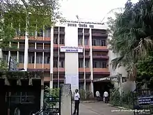
At the heart of the city is the Government Vidarbha Institute of Science And Humanities, formerly Vidarbha Mahavidyalaya established in -1923 It started out as King Edward College. It is a college serving Amravati with many branches for humanities at the undergraduate and post-graduate levels. The college has several renowned alumni. All the colleges in the city are affiliated to Sant Gadge Baba Amravati University[13] including Government College of Engineering, Amravati and Medical college named Dr. Panjabrao Deshmukh Memorial Medical College.
Shree Hanuman Vyayam Prasarak Mandal was established in 1914 and is serving as a sports institution. Its members are known to have participated in the Indian independence movement. It has diversified its activities to the field of Ayurveda, education (in tribal areas), Engineering and Technology.
In 2011, the prestigious Indian Institute of Mass Communication has set up its regional center at Amravati University.
Culture and Religion
Marathi Sahitya Sammelan, the conference on Marathi Literature was held twice in Amravati city. It was presided by Keshav Jagannath Purohit in 1989.
Temples of goddesses Amba and Ekvira are examples of religious architecture. There's a legend that when Lord Krishna ran away with Rukhamini from her wedding ceremony, he used a tunnel laid from Ambadevi temple to Koundinyapur (another spiritual place near Amravati). This tunnel is still in existence but it is now caved in.
An artistic mosque was built by the Nizam of Hyderabad, Mir Osman Ali Khan, this Masjid was named "Osmania Masjid".
There are well-known temples located in the city, examples include the Balkrishna temple, Someshwar Temple, Murlidhar, Vitthal Mandir, Laxmi Narayan Temple, Jain Shwetamber Temple, Kala Maroti Temple, Nilkanth Temple, Shri Krishna temple, and Mrugendraswami math.
Hinduism is the majority religion in Amravati city with 61.83% followers. There are several places of worship for Hindus, Buddhists, Muslims, Sikhs, Jains, and Christians in Amravati.
Transport
Road
The city bus service is run by the Amravati Municipal Corporation. Private auto rickshaws and cycle rickshaws are also popular. Amravati has also started a Women's Special City bus which is a first in the Vidarbha region.
The Maharashtra State Road Transport Corporation (MSRTC) provides transport services for intercity and interstate travel. Many private operators also ply on the highly traveled Amravati – Pune and Amravati – Indore route. Bus services to cities like Nagpur, Yavatmal, Bhopal, Harda, Indore, Raipur, Jabalpur, Mumbai, Pune, Akola, Dharni, Nanded, Aurangabad, Jalna, Burhanpur, Parbhani, Solapur, Khandwa, Gondia, Shirdi, Hyderabad, Paratwada (Achalpur) and Kolhapur are also available.
National Highway 6 (old numbering), which runs from Hazira (Surat) to Kolkata, passes through Amravati.
Recently new Star City Buses are launched in the city replacing the old city buses.
Railway

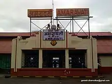
Amravati has three railway stations:
- Amravati railway station, situated in the heart of the city is a terminus. The railway line could not be extended beyond it. Therefore, a new station was constructed outside the city when a new railway line was laid to connect Badnera junction to Narkhed on the Nagpur-Itarsi main railway line. Amravati railway station is situated on the branch line from Badnera on Nagpur-Bhusawal section of Howrah-Nagpur-Mumbai line of Central Railways.
- New Amravati railway station building was inaugurated on 10 December 2011. Amravati railway station provides multiple shuttle services to Badnera throughout the day.
- Badnera Junction railway station serves the area of Badnera in Amravati. It is a junction station on the Howrah-Nagpur-Mumbai line. There is a broad gauge line to Narkhed.
Airport
Amravati Airport, located at Bellora, 15 kilometers from NH-6 towards Yavatmal, is operated by the Maharashtra Airport Development Company (MADC). Presently it has no commercial scheduled flights. The Nagpur Flying Club has applied to DGCA for permission to shift its flying operations to Amravati airport. [15] It also has a helipad facility. MADC is acquiring about 400 Hectares of land for developing the airport and related facilities at an estimated cost of Rs. 2.25 billion.[16]
Sports
Territorial Army Parade Ground
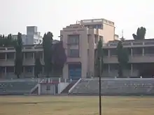
Territorial Army Parade Ground is a multi purpose stadium in the city, formerly known as the Reforms Club Ground.[17] 1958 First recorded Cricket match was held in 1958. The ground is owned and managed by the Territorial Army, a part-time branch of the Indian Army. The ground is mainly used for organising football and cricket matches and other sports.
The stadium hosted one Ranji Trophy match in 1976 when the Vidarbha cricket team played against the Rajasthan cricket team.[18]
Hanuman Vyayam Prasarak Mandal Ground
Hanuman Vyayam Prasarak Mandal Ground is a cricket ground that held a single first-class match when Vidarbha cricket team played Rajasthan cricket team in the 1980/81 Ranji Trophy,[19] which resulted in a Rajasthan victory by 7 wickets.[20]
Growth
The city has been rapidly expanded beyond Badnera, 10 km to the south, an important railway junction where the branch railway line serving Amravati joins the main Mumbai–Bhusawal–Akola–Nagpur railway line.
Amravati is growing as an industrial center, with cotton mills leading the way. Amravati district is home to Vidarbha Sugar Mills Ltd., Kurha. It is the sole surviving sugar factory in the Amravati region. A 2,700 MW Thermal Power Plant is being developed at Nandgaon Peth/Sawardi MIDC. Bharat Dynamics Limited (BDL) plans to make air defence missiles at a proposed site at Nandgaon Peth/Sawardi MIDC. Many major textile industries such as siyaram's, Raymonds, Finlay mills have been established on the outskirts of the city.
Warehousing
Amravati is the main city in the Vidarbha region and division in Maharashtra. Warehousing facility is available provided by Central Warehousing Corporation and for agricultural produce, APMC godowns are available which is not sufficient for this huge city. Maharashtra state warehousing Corporation doesn't have any warehousing center in the city.
Infrastructure development is also being seen in the city as the construction of new flyovers, malls leading their way. The main attraction is 'Y' flyover situated at Panchavati - Gadge Nagar link road.
Work on Amravati Airport will start soon as it has been handed over to the Airports Authority of India for the development. AAI is planning to develop the Airport in Amravati city within 2–3 years. The runway will be extended and night landing facilities will be provided.
Places of interest
This includes places in Amravati and surrounding areas.
- Ambadevi Temple – the city gets its name from 'Ambadevi', the temple is situated in the center of the city. The construction date of Ambadevi temple is unknown.
- Bamboo Garden – park having a collection of 11 species of bamboo plants.[21]
- Bhim Tekadi Hill – This hill is situated on the east side of the city. Notable Buddhist temples are built on the hill.
- Maltekdi – This hill is situated in the heart of the city. It has now become a notable picnic spot. It does owe a jogging track in its premises.
- Wadali Talao – picnic spot with recreational facilities.
- DCS Badnera CAD CAM Training Center - Design institute for engineers
Tourism
Chikhaldara
Chikhaldara is a hill station and a municipal council in Amravati district in the Indian state of Maharashtra. It is near 80 km north from Amravati. The scenic beauty of Chikhaldara can be enjoyed from Hurricane Point, Prospect Point, and Devi Point. Other interesting excursions include Gavilgad and Narnala Fort, the Pandit Nehru Botanical Gardens, the Tribal Museum, and the Semadoh Lake. July to September is the best time to visit Chikhaldara.
Melghat Tiger Reserve
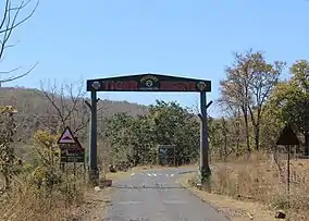
Amravati district is the home for Melghat Tiger Reserve. At the northern extreme of the Amravati district of Maharashtra, on the border of Madhya Pradesh, lies the Melghat in the South-western Satpura mountain ranges. Melghat means 'meeting of the ghats', which describes the area as a large tract of unending hills and ravines scarred by jagged cliffs and steep climbs. It was among the first nine tiger reserves notified in 1973-74 under Project Tiger, a wildlife conservation project initiated in India in 1972 to protect Bengal tigers. Apart from Tigers the other prominent animals are Sloth Bear, Indian Gaur, Sambar deer, Leopard, Nilgai, etc. The endangered and 'back from extinction' Forest Owlet is also found in various areas of Melghat. Melghat Tiger reserve has been recorded 41 tigers in 2017 approx. in around 2,000 Sq.km.
Muktagiri
Muktagiri, or Mendhagiri, is a Jain pilgrimage center, located on the border of Madhya Pradesh and Maharashtra in India. Muktagiri Siddha Kshetra is the complex of 52 Jain temples located in the green nature of Satpuda Mountain ranges on the backdrop of waterfalls. Muktagiri is 60 Km from the Amravati.
Kondeshwar Temple
Kondeshwar temple, dedicated to Lord Shiva, is an ancient elephant temple located in the South Amravati amongst the middle of a dense forest. This temple represents the ancient Hemadpanthi style of architecture and is constructed using black stones. The temple is surrounded by Satpura hill ranges. .
Notable people
References
- "Amravati District Collector Office". Amravati.nic.in. Archived from the original on 1 December 2011. Retrieved 6 December 2011.
- "BJP wins mayoral polls in Akola, Chanda, Amravati | Nagpur News - Times of India". The Times of India. 23 November 2019. Retrieved 7 February 2020.
- "Who's Who | Amravati District". amravati.gov.in. District Administration, Amravati. Retrieved 3 September 2018.
- "Cities having population 1 lakh and above, Census 2011" (PDF). census.gov.in. Retrieved 30 October 2020.
- "Economic Survey of Maharashtra 2014-15" (PDF). maharashtra.gov.in. Retrieved 27 December 2020.
- "The India Cotton Crop, The Chronicle". St. Louis Fed.
- "Past Presidents of INC". Congress Sandesh website. Archived from the original on 15 January 2002. Retrieved 24 February 2010.
- "Falling Rain Genomics, Inc – Amravati". Fallingrain.com. Retrieved 7 September 2010.
- "Station: Amravati Climatological Table 1981–2010" (PDF). Climatological Normals 1981–2010. India Meteorological Department. January 2015. pp. 41–42. Archived from the original (PDF) on 5 February 2020. Retrieved 30 March 2020.
- "Extremes of Temperature & Rainfall for Indian Stations (Up to 2012)" (PDF). India Meteorological Department. December 2016. p. M137. Archived from the original (PDF) on 5 February 2020. Retrieved 30 March 2020.
- "Climate". Government of Maharashtra. Archived from the original on 14 June 2011. Retrieved 30 March 2020.
- "Microsoft Word – CSP AMRAVATI 29.04.11" (PDF). Retrieved 6 December 2011.
- "Amravati University". Sgbau.ac.in. Archived from the original on 3 September 2010. Retrieved 7 September 2010.
- "C-1 Population By Religious Community - Maharahstra". Census. Retrieved 29 December 2019.
- "Flying Club shifting ops to Amravati". The Times of India. 23 February 2011. Retrieved 2 March 2012.
- "MADC website". Archived from the original on 18 November 2011. Retrieved 11 December 2011.
- "Territorial Army Parade Ground | India | Cricket Grounds | ESPNcricinfo.com". Cricinfo.
- "Scorecard". CricketArchive. Retrieved 12 September 2015.
- "First-class Matches played on Hanuman Vyayam Prasarak Mandal Ground, Amravati". CricketArchive. Retrieved 30 October 2011.
- "Vidarbha v Rajasthan, 1980/81 Ranji Trophy". CricketArchive. Retrieved 30 October 2011.
- Pinjarkar, Vijay (9 May 2018). "Bamboo garden to come up at Seminary Hills: Bamboo garden to come up at Seminary Hills | Nagpur News - Times of India". The Times of India. Retrieved 5 July 2019.
External links
Places adjacent to Amravati | |
|---|---|
| Districts of Vidarbha | |
|---|---|
| Cities with municipal corporations | |
Portal:India | |
| Topics | |||||||||||||
|---|---|---|---|---|---|---|---|---|---|---|---|---|---|
| Regions | |||||||||||||
| Divisions and Districts |
| ||||||||||||
| Million-plus cities in Maharashtra | |||||||||||||
| Other cities with municipal corporations | |||||||||||||
Portal:India | |||||||||||||