Beed district
Beed district is an administrative district in the state of Maharashtra in India. The district headquarters are located at Beed. The district occupies an area of 10,693 km² and has a population of 2,585,049 of which 17.91% were urban (as of 2011).[1]
Beed district | |
|---|---|
District of Maharashtra | |
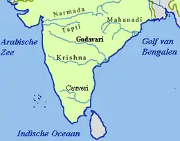
 Location of Beed district in Maharashtra | |
| Country | India |
| State | Maharashtra |
| Division | Aurangabad Division |
| Headquarters | Beed |
| Tehsils | 1. Beed, 2. Ashti, 3. Patoda, 4. Shirur Kasar, 5. Georai, 6. Ambajogai, 7. Wadwani, 8. Kaij, 9. Dharur, 10. Parali, 11. Majalgaon |
| Government | |
| • Lok Sabha constituencies | Beed (Based on Election Commission website) |
| • Vidhan Sabha constituencies | 6 |
| Area | |
| • Total | 10,693 km2 (4,129 sq mi) |
| Population (2011) | |
| • Total | 2,585,049 |
| • Density | 240/km2 (630/sq mi) |
| • Urban | 17.91% |
| Time zone | UTC+05:30 (IST) |
| Website | beed |
History
Beed district has a long history of many rulers and kingdoms. In the ancient era, this city was called as Champavati nagari. The city still proudly shows some old monuments showing the signs of past glory in the form of many city entry doors (called Ves in local language) and city protection walls. Until the 19th century, this part of Marathwada was under the Nizam monarchy, but was later included into the Indian Republic after a fierce struggle between Indian freedom fighters and Nizam soldiers. The name of Bhir is given by Mohammad Tughlaq.
Economy
Agriculture is the main business in Beed, and it is largely dependent on monsoon rain. Beed also is a district which provides a large number of laborers in India specially in the form of sugarcane cutters.
Demographics
According to the 2011 census Beed district has a population of 2,585,049,[2] roughly equal to the nation of Kuwait[3] or the US state of Nevada.[4] This gives it a ranking of 160th in India (out of a total of 640).[2] The district has a population density of 242 inhabitants per square kilometre (630/sq mi) .[2] Its population growth rate over the decade 2001-2011 was 19.65%.[2] Beed has a sex ratio of 912 females for every 1000 males.[2]
At the time of the 2011 Census of India, 83.38% of the population in the district spoke Marathi, 8.62% Urdu, 6.88% Urdu and 0.48% Telugu as their first language.[5]
| Year | Pop. | ±% p.a. |
|---|---|---|
| 1901 | 481,140 | — |
| 1911 | 606,104 | +2.34% |
| 1921 | 453,844 | −2.85% |
| 1931 | 616,675 | +3.11% |
| 1941 | 691,946 | +1.16% |
| 1951 | 784,920 | +1.27% |
| 1961 | 949,673 | +1.92% |
| 1971 | 1,223,694 | +2.57% |
| 1981 | 1,412,990 | +1.45% |
| 1991 | 1,822,072 | +2.58% |
| 2001 | 2,161,250 | +1.72% |
| 2011 | 2,585,049 | +1.81% |
| source:[6] | ||
See also
References
- "Archived copy". Archived from the original on 11 January 2010. Retrieved 27 August 2009.CS1 maint: archived copy as title (link)
- "District Census 2011". Census2011.co.in. 2011. Retrieved 30 September 2011.
- US Directorate of Intelligence. "Country Comparison:Population". Retrieved 1 October 2011.
Kuwait 2,595,62
- "2010 Resident Population Data". U. S. Census Bureau. Archived from the original on 19 October 2013. Retrieved 30 September 2011.
Nevada 2,700,551
- 2011 Census of India, Population By Mother Tongue
- Decadal Variation In Population Since 1901
External links
| Wikimedia Commons has media related to Beed district. |
Places adjacent to Beed district | |
|---|---|
| Topics | |||||||||||||
|---|---|---|---|---|---|---|---|---|---|---|---|---|---|
| Regions | |||||||||||||
| Divisions and Districts |
| ||||||||||||
| Million-plus cities in Maharashtra | |||||||||||||
| Other cities with municipal corporations | |||||||||||||
Portal:India | |||||||||||||