Akola
Akola (/əˈkoʊlɑː/) is located about 580 kilometres (360 mi) east of the state capital, Mumbai, and 250 kilometres (160 mi) west of the second capital, Nagpur. Akola is the administrative headquarters of the Akola district located in the Amravati division, and is governed by the Akola Municipal Corporation.
Akola | |
|---|---|
City | |
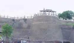 Akola Fort | |
| Nicknames: Rajrajeshwar Nagari | |
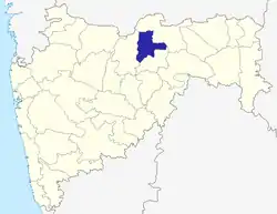
 Akola Location of Akola city.  Akola Akola (India) 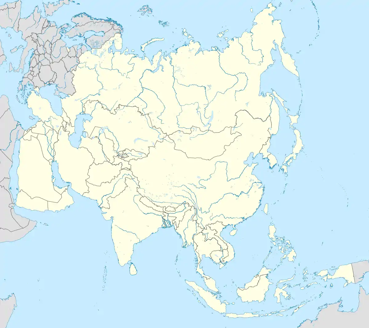 Akola Akola (Asia) | |
| Coordinates: 20.7°N 77.00°E | |
| Country | |
| State | |
| District | Akola |
| Established | 18th century |
| Government | |
| • Type | Municipal Corporation |
| • Body | AMC |
| • Mayor | Archana Mhaisane |
| • Municipal Commissioner | Nima Arora (IAS) |
| Area | |
| • Total | 128 km2 (49 sq mi) |
| Highest elevation | 316 m (1,037 ft) |
| Lowest elevation | 287 m (942 ft) |
| Population (2019)[2] | |
| • Total | 537,137 |
| • Rank | IN: 84th MH: 14th |
| • Density | 4,200/km2 (11,000/sq mi) |
| Language | |
| • Official | Marathi |
| Time zone | UTC+5:30 (IST) |
| PIN | 444001, 444002, 444003, 444004, 444005, 444006, 444007, 444104, 444109, 444302 |
| Telephone code | 0724 |
| Vehicle registration | MH-30 |
| Literacy | 92% |
| Sex ratio | 0.968 |
| HDI | High[3] |
| Website | https://akola.gov.in/ |
Akola is located north-central of Maharashtra state, western India, on the banks of the Morna River. Although it is not considered a common tourist destination, Akola is an important city due to its history, culture, politics, and agriculture. It also has a prominent road and rail junction in the Tapti River valley that functions as a commercial trading center.
Akola is an important educational center with several colleges affiliated with the Sant Gadge Baba Amravati University. The city is developing into a market center. The primary language spoken by the people of Akola is Marathi; some communities also speak Urdu and Hindi.
History
Early medieval history (Classical)
Akola is mentioned to be a part of Berar province and the legendary kingdom of Vidarbha in the Sanskrit epic Mahabharata. Berar also formed part of the Mauryan Empire during the reign of Ashoka (272 to 231 BCE), before being ruled by the Satavahana dynasty (2nd century BCE – 2nd century CE), the Vakataka dynasty (3rd to 6th centuries), the Chalukya dynasty (6th to 8th centuries), the Rashtrakuta dynasty (8th to 10th centuries), the Chalukya dynasty (10th to 12th centuries), and the Yadava dynasty of Devagiri (late 12th to early 14th centuries).
Late medieval history
A period of Muslim rule began when Alauddin Khalji, Sultan of Delhi, conquered the region in the early 14th century. The region was part of the Bahmani Sultanate, which broke away from the Delhi Sultanate in the middle of the 14th century. The Bahmani Sultanate itself broke up into smaller sultanates at the end of the 15th century, and in 1572 Berar became part of the Nizam Shahi sultanate, based at Ahmednagar. The Nizam Shahis ceded Berar to the Mughal Empire in 1595, and the Mughals ruled the Berar province during the 17th century. The Akola fort was heavily fortified during the Mughal king Aurangzeb's rule.[4] As Mughal rule started to unravel at the start of the 18th century, Asif Jah I, Nizam of Hyderabad seized the southern provinces of the empire (including Berar) in 1724 to form an independent state.[5]
Maratha Empire
The region came under the rule of Chhatrapati Shivaji, and later his sons as the Maratha Empire rose from 1674 to 1760. When Shahu I died in 1749, he appointed Peshwa as the head of the Maratha Empire with certain conditions. The third battle of Panipat in 1761 crippled the Maratha Empire and weakened the power of Peshwa, but Berar remained under Maratha rule.
The Battle of Argaon in 1803 was fought in Akola between the British and the Marathas during the Second Anglo-Maratha War. In the third Anglo-Maratha War, the last Peshwa, Baji Rao II, was defeated. In 1853, the Akola district together with the rest of Berar came under the administration of the British East India Company.[6] Berar was divided into East and West Berar with the Akola district being included in the west. In 1903, Berar was leased to the Nizam of Hyderabad by the British East India Company in return for the debt.
Post-independence
After India's independence in 1947 from the British Government, the newly formed country was divided into different states. The Congress's proposed linguistic provinces plan before the Independence of India had positioned Akola as the headquarters of the Berar region.[7][8]
The states and provinces of India were reorganized in 1956, and the region of Berar was divided among different states. Akola became a part of bilingual state of Bombay which was further divided into two states in 1960 when Akola became a part of the new state of Maharashtra.
Demographics
| Population growth | |||
|---|---|---|---|
| Census | Population | %± | |
| 1981 | 225,412 | — | |
| 1991 | 328,043 | 45.5% | |
| 2001 | 400,520 | 22.1% | |
| 2011 | 427,146 | 6.6% | |
| Source:Census of India[9] | |||
According to the 2011 Census of India,[10] Akola City had a population of 427,146 and an area of about 128 square kilometres (49 sq mi). After the city's municipal limits were extended in Aug 2016, it was recorded to have a population of 537,137.
Geography and climate
Akola is located at latitude 20.7°N and longitude 77.07°E. It is 925 ft (287 m) to 1036 ft (316 m) above sea level, and has a tropical savanna climate (Köppen climate classification Aw) bordering humid subtropical climate (Köppen climate classification Cwa). Akola has a national weather station that serves as the local weather center. Annual temperatures range from a high of 47.6 °C (117.68 °F) to a low of 2.2 °C (35.96 °F). Akola lies near the Tropic of Cancer and becomes very hot during the summer, especially in May. The annual rainfall averages 800 millimetres (31 in). Most of the rainfall occurs in the monsoon season between June and September, but there is some rainfall in January and February.
| Climate data for Akola (1981–2010, extremes 1901–2012) | |||||||||||||
|---|---|---|---|---|---|---|---|---|---|---|---|---|---|
| Month | Jan | Feb | Mar | Apr | May | Jun | Jul | Aug | Sep | Oct | Nov | Dec | Year |
| Record high °C (°F) | 38.2 (100.8) |
40.5 (104.9) |
44.4 (111.9) |
47.0 (116.6) |
47.8 (118.0) |
47.2 (117.0) |
40.6 (105.1) |
40.0 (104.0) |
40.0 (104.0) |
40.0 (104.0) |
38.9 (102.0) |
36.7 (98.1) |
47.8 (118.0) |
| Average high °C (°F) | 30.0 (86.0) |
32.9 (91.2) |
37.2 (99.0) |
41.0 (105.8) |
42.2 (108.0) |
37.6 (99.7) |
32.3 (90.1) |
30.6 (87.1) |
32.3 (90.1) |
33.5 (92.3) |
31.8 (89.2) |
30.0 (86.0) |
34.3 (93.7) |
| Average low °C (°F) | 14.2 (57.6) |
16.2 (61.2) |
20.2 (68.4) |
24.8 (76.6) |
27.9 (82.2) |
26.3 (79.3) |
24.5 (76.1) |
23.7 (74.7) |
23.5 (74.3) |
20.9 (69.6) |
17.0 (62.6) |
13.7 (56.7) |
21.1 (70.0) |
| Record low °C (°F) | 3.9 (39.0) |
2.2 (36.0) |
5.6 (42.1) |
11.1 (52.0) |
11.9 (53.4) |
19.8 (67.6) |
20.0 (68.0) |
18.3 (64.9) |
15.4 (59.7) |
10.0 (50.0) |
5.6 (42.1) |
3.9 (39.0) |
2.2 (36.0) |
| Average rainfall mm (inches) | 12.2 (0.48) |
8.6 (0.34) |
12.9 (0.51) |
3.4 (0.13) |
13.1 (0.52) |
139.4 (5.49) |
213.6 (8.41) |
195.2 (7.69) |
132.1 (5.20) |
46.9 (1.85) |
17.6 (0.69) |
6.8 (0.27) |
801.7 (31.56) |
| Average rainy days | 1.0 | 0.7 | 1.1 | 0.4 | 1.2 | 6.8 | 10.8 | 9.9 | 6.3 | 2.9 | 1.1 | 0.5 | 42.7 |
| Average relative humidity (%) (at 17:30 IST) | 37 | 26 | 22 | 18 | 22 | 45 | 66 | 71 | 63 | 46 | 43 | 40 | 42 |
| Source: India Meteorological Department[11][12] | |||||||||||||
| Climate data for Akola Airport (1981–2010, extremes 1961–2002) | |||||||||||||
|---|---|---|---|---|---|---|---|---|---|---|---|---|---|
| Month | Jan | Feb | Mar | Apr | May | Jun | Jul | Aug | Sep | Oct | Nov | Dec | Year |
| Record high °C (°F) | 35.4 (95.7) |
40.5 (104.9) |
43.0 (109.4) |
45.9 (114.6) |
47.7 (117.9) |
46.9 (116.4) |
40.5 (104.9) |
36.8 (98.2) |
38.4 (101.1) |
39.0 (102.2) |
35.5 (95.9) |
35.7 (96.3) |
47.7 (117.9) |
| Average high °C (°F) | 29.9 (85.8) |
32.4 (90.3) |
37.2 (99.0) |
41.0 (105.8) |
42.4 (108.3) |
37.7 (99.9) |
32.3 (90.1) |
30.6 (87.1) |
32.5 (90.5) |
33.7 (92.7) |
31.6 (88.9) |
29.7 (85.5) |
34.2 (93.6) |
| Average low °C (°F) | 14.0 (57.2) |
15.8 (60.4) |
20.2 (68.4) |
25.1 (77.2) |
27.8 (82.0) |
26.2 (79.2) |
24.1 (75.4) |
23.5 (74.3) |
23.1 (73.6) |
20.2 (68.4) |
16.1 (61.0) |
12.9 (55.2) |
20.8 (69.4) |
| Record low °C (°F) | 4.9 (40.8) |
7.7 (45.9) |
9.0 (48.2) |
12.6 (54.7) |
18.6 (65.5) |
18.3 (64.9) |
17.7 (63.9) |
19.6 (67.3) |
12.5 (54.5) |
10.8 (51.4) |
5.1 (41.2) |
4.4 (39.9) |
4.4 (39.9) |
| Average rainfall mm (inches) | 13.8 (0.54) |
9.9 (0.39) |
11.9 (0.47) |
3.9 (0.15) |
13.0 (0.51) |
150.4 (5.92) |
212.6 (8.37) |
183.3 (7.22) |
122.4 (4.82) |
68.0 (2.68) |
15.9 (0.63) |
7.0 (0.28) |
812.1 (31.97) |
| Average rainy days | 0.8 | 0.8 | 1.0 | 0.4 | 1.4 | 7.2 | 10.8 | 9.9 | 6.0 | 3.0 | 0.9 | 0.6 | 42.9 |
| Average relative humidity (%) (at 17:30 IST) | 37 | 32 | 23 | 18 | 21 | 44 | 66 | 71 | 62 | 47 | 40 | 39 | 41 |
| Source: India Meteorological Department[11][12] | |||||||||||||
Governance
Civic government
Akola is divided into 80 electoral wards and four zones that extend across an area of 124 square kilometres (48 sq mi). The Akola Municipal Corporation was established on 1 October 2001 and is headed by a Municipal Commissioner and Mayor who is assisted by the Deputy Mayor. Akola Municipal Transport (AMT) runs Akola's public transport service. Neighbouring suburbs like Umri, Gurdhi, Khadki, Shivani (Shioni), Malkapur, Akoli, and Kharap were included into municipal limits.
Police administration
Akola Police maintains eight police stations in the Akola city subdivision that cover the metropolitan area of the city.[13]
The government also approved the creation of a new Railway Police Akola subdivision that will include Akola, Wardha, and Badnera railway police units. The Akola Police subdivision falls under the Nagpur District of Railway.[14]
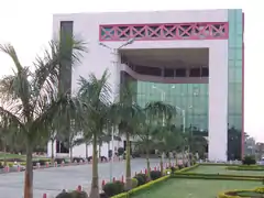
Akola MIDC Industrial Area
The Akola MIDC Industrial Area is the largest and most economical industrial area in the division. It has four prominent industrial zones on the outskirts of the city. Cotton and jowar are the predominant crops grown in the district. Oil and dal mills are also abundant. The economy is mostly agriculture-based. Today, the soybean crop is an important crop as major soybean plants have come up in the area. The total land under Akola MIDC Industrial area is 6.25 km2. There are about 25 factories (3 large factories and 22 small factories) currently in production and another 10 small factories are in the process of being constructed. Maharashtra Government has sanctioned growth centers close to the Akola MIDC area. An application of the Maharashtra Industrial Development Corporation (MIDC) for setting up an agro-processing Special Economic Zone (SEZ) in Akola district has been approved. Maharashtra State Seeds Corporation (Mahabeej) has head office at Akola. There is a growing demand for setting up divisional MIDC office at Akola to cater to Akola, Washim, and Buldhana districts which are away from the current divisional office and also lack good industrial growth.
Transportation
Air
Akola Airport (also known as Shioni Airport) (IATA: AKD, ICAO: VAAK) is the domestic airport of Akola and is 304 metres (999 ft) above sea level. It was built by British authorities in the 1940s and regularly sent flights to Mumbai. Now it is non-functional and has one runway (4,600×145 ft). The airport's expansion and use have been delayed as it is unable to get land from the university of Dr. Panjabrao Deshmukh Krishi Vidyapeeth.[15] It is one of the oldest airports in India, and is 7 kilometres (4.3 mi) from the city via National Highway No. 6. The nearest international airport is in Nagpur (230 kilometres (140 mi)). The renovation and operation of Akola Airport are supervised by Airport Authority of India.
Road
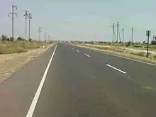
Akola city is well connected to major cities by road. National Highway No. 6 runs through Akola from Hazira (Surat) to Kolkata, and is a part of Asian Highway 46. National Highway 161 starts in Akola and connects Nanded with Sangareddy (Telangana).
State Highways No. 68 and 69 also pass through the municipal limits. Other highways include State Highway 204, State Highway 200: Akola – Amravati, and State Highway 197.[16] Akola has the vehicle registration code MH-30.
Education
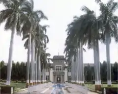
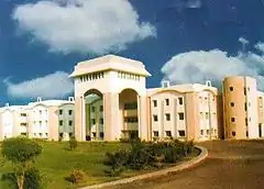
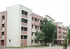
Akola city has been the education hub for students in the Western Vidarbha region. Akola city hosts colleges that focus on engineering, medical, pharmacy, and law. Akola is the main campus of Dr. Panjabrao Deshmukh Krishi Vidyapeeth (PDKV).
Agricultural university
Akola is home to Dr. Panjabrao Deshmukh Krishi Vidyapeeth (PDKV), established by the government of Maharashtra on 20 October 1969. Earlier, it was part of Maharashtra Krishi Vidyapeeth since 1968. It is known for its agricultural science and agricultural engineering and technology courses. PDKV jurisdiction covers all eleven districts of Vidarbha.[17]
Major colleges in Akola City associated with PDKV are:[18]
- College of Agriculture, Akola – BSc (Agriculture)[19]
- College of Horticulture, Akola – BSc (Horticulture)[20]
- College of Forestry, Akola – BSc (Forestry)[21]
- College of Agri. Engineering & Technology, Akola – BTech (Agri. Engineering)[22]
- University Post Graduate Institute, Akola – MTech (Agri. Engineering)[23]
- University Post Graduate Institute, Akola – MSc (Agriculture)[23]
- University Post Graduate Institute, Akola – PhD[23]
Veterinary colleges
- Post Graduate Institute of Veterinary & Animal Sciences, Akola (PGIVAS)[24] PGIVAS is affiliated to Maharashtra Animal and Fishery Sciences University (MAFSU)[25]
Engineering colleges
- Shivaji Engineering College, Akola COETA
- Manav School of Engineering & Management, Vyala
Medical science colleges
- Government Medical College, Akola
- Ramesh Ramdasji Kambe Dental College, Akola[26]
- R.T. Ayurved Mahavidyalaya
- Homeopathic Medical College[27]
- Shri Janta Homeopathic Medical College[27]
Schools in Akola
Jawahar Navodaya Vidyalaya Akola
Jawahar Navodaya Vidyalaya (JNV) is a system of alternate schools for gifted students in India. They are run by Navodaya Vidyalaya Samiti, New Delhi, an autonomous organization under the Department of School Education and Literacy, Ministry of Human Resource Development, Government of India. JNVs are fully residential and co-educational schools affiliated to the Central Board of Secondary Education (CBSE), New Delhi, with classes from VI to XII standard. JNVs are specifically tasked with finding talented children in rural areas of India to provide them with an education equivalent to the best residential school system without regard to their families' socioeconomic status.
Pharmacy colleges
Other prominent colleges of Akola city
- Shankarlal Khandelwal College of Science, Commerce, and Arts[35]
- Smt Maherbanu College of Science and Commerce[36]
- RLT College of Science[37]
- LRT Commerce College[38]
- Shri Shivaji Arts, Commerce and Science College[39]
- Sitabai Arts and Commerce College[40]
- Radha Devi Goenka Mahila Mahavidyalaya (RDG)[41]
- Sudhakarrao Naik Arts and Commerce College
- Government College of Education[42]
- Tirupati Tantra Niketan
- KM Asghar Husain Junior Art, Commerce and Science College
- Akola Law College
- Gajanan Maharaj College of Engineering[43] (SSGMCE) at Shegaon (in Buldhana District) is a renowned engineering college of the region, 38 km away from Akola city.
- NCC's 11 MAH Battalion is based in Akola, on the outskirts of the city near Jawaharlal Nehru Public Park.
Notable people
- Vijay P. Bhatkar, an architect of India's national initiative in supercomputing
- Patrick Barr (1908–1985) was a British film and television actor,[44]
- Vitthal Wagh, Marathi poet, writer, and craft artist.
- Sudharak Olwe, a Mumbai-based documentary photographer
- Shri Anil Subhash Paraskar, an IPS Officer of 2009 Batch
- Shivdeep Lande, an IPS Officer of 2006 Batch
- Shri Ranjit Patil, Former Home Minister of Maharashtra
- Sanjay Shamrao Dhotre, Minister of State for Human Resource Development, Communications and Electronics and Information Technology
- Vaibhav Palhade[45](Marathi: वैभव पल्हाडे), Indian Author & Film Director
Medical facilities
Major hospitals in Akola include:
- Government District Hospital and Medical College, Akola[46]
- District Ladies Hospital[47]
- Sant Tukaram Cancer Hospital,[48]
- Damani Eye Hospital, Akola[49]
- Reliance Hospital, Cancer Care, Akola[50][51]
- Cotton City Hospital,[52]
- Icon Hospital,[53]
- Ozone Multi-Speciality & Critical Care Center,[54]
- Smile Institute of Child Health and Akola Test tube Baby Centre[55]
- Radhakisan Toshniwal Ayurvedic Hospital[56]
- Superspeciality Hospital.
- Rajeshwar eye surgery, child care Akola
- Ekdant Dod Multispeciality Dental clinic Akola
Media and communication
- Telecommunication: STD code of Akola tehsil is (0724).
- Newspapers: Dainik Deshonnati, one of the well-known Marathi newspapers in the Vidharbha region, originated from Akola. Other prominent newspapers published from Akola include Dainik Matrubhumi, Samrat, Divya Marathi, Dainik Sakal, and City News Superfast.
- Radio: Akola Aakashwani 102.4, Radio City 91.1 FM, Radio Orange 91.9 FM, My FM 94.3, Radio Mirchi 95 FM, Radio Cotton City Akola 90.4 FM
- Entertainment: There is one four-screen multiplex, Miraj Cinemas, situated on Murtizapur Road. There are also many single-screen theaters situated in Akola including Manek Talkies, Vasant Talkies, Uday Theater, and Regal Talkies.
Sports
Several state-level tournaments as well as national tournaments of various indoor and outdoor games are hosted in Akola. The most played sports in the city include football, cricket, baseball, carrom, hockey, volleyball, boxing, kabaddi, chess, and badminton.
Akola Cricket Club Ground (ACC) is the prominent cricket ground in the region and is the home ground of the Akola cricket club. It has held two first-class matches, the first of which came in the 1983–84 Ranji Trophy when Vidarbha played the Railways, while the second saw Rajasthan as the visitors in the 1984/85 Ranji Trophy.[57]
Vasant Desai Stadium is famous in the region as it always hosts the district level tournaments of games such as running, volleyball, swimming, boxing, and kabaddi.
Lal Bahadur Shastri Stadium is located near Sundarabai Khandelwal Tower which is a landmark of Akola city. The stadium hosts football and cricket games. Other prominent stadiums include the Officer's Club, PDKV's Sports Stadium, Lal Bahadur Shastri Stadium, Akola Cricket Club Stadium, Umri Kabaddi Stadium, Mitra Samaj Club Stadium, and the City Sports Club.
Culture and religion
Marathi Sahitya Sammelan, the conference on Marathi literature, was held twice in Akola. They were presided over by Hari Narayan Apte in 1912 and Gopal Nilkanth Dandekar in 1981.
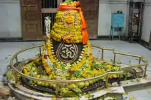
Akola is a city with a mix of religions and cultures. There are several places of worship for Hindus, Buddhists, Muslims, Sikhs, Jains, and Christians in Akola.

See also
References
- http://www.demographia.com/db-worldua.pdf
- http://www.ijpret.com/publishedarticle/2016/4/IJPRET%20-%20Civil%20138.pdf
- https://www.maharashtra.gov.in/Site/upload/WhatsNew/Economic%20Survey%20of%20Maharashtra...pdf
- "Friends of Forts". Archived from the original on 5 April 2009. Retrieved 4 February 2009.
- "Berar | region, India". Encyclopedia Britannica. Retrieved 6 August 2020.
- "Akola District Gazetteer, Mediaeval Period History". Maharashtra State Gazetteers, Akola District. Retrieved 24 July 2020.
- "101". Retrieved 19 September 2014.
- "101a". Retrieved 19 September 2014.
- "Mahapopulation" (PDF). Census of India (in Marathi). maharashtra.gov.in. Archived from the original (PDF) on 3 March 2009. Retrieved 4 June 2008.
- "Census of India 2001: Data from the 2001 Census, including cities, villages and towns (Provisional)". Census Commission of India. Archived from the original on 16 June 2004. Retrieved 1 November 2008.
- "Climatological Normals 1981–2010" (PDF). India Meteorological Department. January 2015. pp. 21–24. Archived from the original (PDF) on 5 February 2020. Retrieved 30 March 2020.
- "Extremes of Temperature & Rainfall for Indian Stations (Up to 2012)" (PDF). India Meteorological Department. December 2016. p. M135-M136. Archived from the original (PDF) on 5 February 2020. Retrieved 30 March 2020.
- "Akola Police". akolapolice.gov.in.
- "Akola Railway Police". 13 November 2020. Retrieved 13 November 2020.
- "AAI red flags Akola airport extension – Times of India".
- "अकोला जिल्हा शासकीय संकेत स्थळ". akola.nic.in. Retrieved 5 November 2017.
- https://www.pdkv.ac.in/?page_id=69#sthash.vqqIHqmN.dpbs
- https://www.pdkv.ac.in/?page_id=141#sthash.nWg2vDCB.dpbs
- https://www.pdkv.ac.in/?page_id=3772#sthash.OcqE8psi.dpbs
- https://www.pdkv.ac.in/?page_id=3798#sthash.eTdhTiXm.dpbs
- https://www.pdkv.ac.in/?page_id=3811#sthash.3gPiesX7.dpbs
- https://www.pdkv.ac.in/?page_id=3838#sthash.IIgrCPQb.dpbs
- https://www.pdkv.ac.in/?page_id=3898#sthash.zA8ZNuzK.dpbs
- "Welcome to PGIVAS, Akola". www.pgivasakola.in.
- "Maharashtra Animal & Fishery Sciences University". www.mafsu.in.
- http://rrkdental.info/
- http://www.dmer.org/bhms.htm
- "History – MOUNT CARMEL HIGH SCHOOL,AKOLA". Retrieved 18 November 2020.
- "about". holycrossconventhighschool.com. Retrieved 18 November 2020.
- "BAL SHIVAJI PRIMARY SCHOOL - Ward No. 5, District Akola (Maharashtra)". schools.org.in. Retrieved 18 November 2020.
- "Best School in Akola | State Board |SOS Akola State". sosakolastate.edu.in. Retrieved 18 November 2020.
- "Best CBSE School in Akola, Maharashtra - Podar International School". www.podareducation.org. Retrieved 18 November 2020.
- "gspsiop.com".
- Administrator. "Course Offering". gkipakola.com.
- "Shankarlal Khandelwal Arts, Science and Commerce College, Akola". www.khandelwalcollege.edu.in. Retrieved 18 November 2020.
- "SMT.MAHERBANU COLLEGE, AKOLA". smtmaherbanu.edu.in. Retrieved 18 November 2020.
- http://rltsc.org RLT Science College, Akola
- "SMT. LAXMIBAI RADHAKISAN TOSHNIWAL COLLEGE OF COMMERCE,AKOLA". smtlrtcc.org. Retrieved 18 November 2020.
- "shivajiakola.org". Retrieved 19 September 2014.
- "Sitabai Art College Akola". www.sitabaiartscollege.com. Retrieved 18 November 2020.
- "Home | Smt.RDG College for Women, Akola". www.rdgakola.ac.in. Retrieved 18 November 2020.
- "Government College of Education, Akola". gceakola.org. Retrieved 18 November 2020.
- "BFI | Film & TV Database | BARR, Patrick". Ftvdb.bfi.org.uk. Archived from the original on 15 October 2008. Retrieved 23 July 2013.
- https://mr.wikipedia.org/s/4mgk
- Akola, Government Medical College. "Govt. Medical College & Hospital Akola – 444001 Mshsrashtra State INDIA". www.gmcakola.in.
- https://www.nhp.gov.in/hospital/zailla-stree-rugnalay,-akola-akola-maharashtra
- "Sant Tukaram Cancer Hospital in Akola – Sehat". www.sehat.com.
- "Damanieyehospital.com". www.damanieyehospital.com.
- https://www.reliancehospitals.com/akola/
- http://www.lokmat.com/akola/akolas-hospital-will-be-important-anti-cancer-fight-chief-minister/
- https://www.nhp.gov.in/hospital/cotton-city-hospital-and-critical-care-centre-akola-maharashtra
- https://www.justdial.com/Akola/Icon-Hospital-Ratnanlal-Plot-Chowk-Akola-City/9999PX724-X724-120618130305-B2J5_BZDET
- "Contact Us – Ozone Multispeciality Hospital". ozonehospitals.org.
- "Smile Children Hospital and Akola Test Tube Center, Akola". www.smileich.com.
- http://rtam.in/contactus.aspx
- "First-class Matches played on Akola Cricket Club Ground, Akola". CricketArchive. Retrieved 29 October 2011.
- "C-1 Population By Religious Community – Maharahstra". Census. Retrieved 29 December 2019.
