Wardha district
Wardha district is in the state of Maharashtra in western India. This district is a part of Nagpur Division. The city of Wardha is the administrative headquarters of the district. Hinganghat, Arvi and Wardha are the major cities in district. The district had a population of 1,300,774, of which 26.28% were urban as of 2011.
Wardha district | |
|---|---|
District of Maharashtra | |
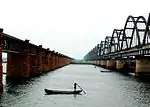
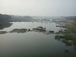 Wardha river at Pulgaon | |
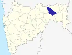 Location of Wardha district in Maharashtra | |
| Country | |
| State | Maharashtra |
| Division | Nagpur Division |
| Headquarters | Wardha |
| Tehsils | 1. Wardha, 2. Deoli, 3. Seloo, 4. Arvi 5. Ashti 6. Karanja 7. Hinganghat, 8. Samudrapur. |
| Government | |
| • Lok Sabha constituencies | Wardha (Lok Sabha constituency) |
| • Vidhan Sabha constituencies | Wardha, Deoli, Arvi, Hinganghat |
| Area | |
| • Total | 6,310 km2 (2,440 sq mi) |
| Population (2011) | |
| • Total | 1,300,774 |
| • Density | 210/km2 (530/sq mi) |
| Demographics | |
| • Literacy | 86.99% |
| • Sex ratio | 946:1000 (Female:Male) |
| Time zone | UTC+05:30 (IST) |
| Major highways | [[National Highway 44 (India)(old numbering)|NH7](Hinganghat)] |
| Average annual precipitation | 1062.8 mm |
| Website | wardha |
History
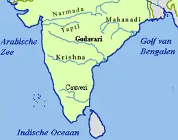
The history of the Wardha district dates back to ancient times. It was included in the empire of Mauryas, Shungas, Satavahanas and Vakatakas. Pravarpur, now modern-day Pavnar, was once the capital of the Vakataka dynasty. Vakatakas were contemporaries of the Imperial Guptas. The daughter of Chandragupta II, Prabhavatigupta, was married to the Vakataka ruler Rudrasena II. The Vakataka Dynasty lasted from the 2nd to 5th centuries AD. Their state stretched from the Arabian Sea in the west to the Bay of Bengal in the east and from the Narmada River in the north to the Krishna-Godavari Delta in the south.
Later on, Wardha was ruled by Chalukyas, Rashtrakutas, Yadavas, Delhi Sultanate, Bahamani Sultanate, Muslim ruler of Berar, Gonds and Maratha. Raja Buland Shaha of Gonds, Raghuji of Bhonsale were the prominent rulers in Medieval period. Nearby 1850s Wardha, (then a part of Nagpur) fell into the hands of British. They included Wardha in the Central Provenance. Wardha is a sister city for Sevagram, and both were used as major centers for the Indian Independence Movement, especially as headquarters for an annual meet of the Indian National Congress in 1934, and Mahatma Gandhi's Ashram.
The existing Wardha district was part of Nagpur district till 1862. Further it was separated for convenient administrative purpose and Kawatha near Pulgaon was the district headquarters. In the year 1866, the district headquarters moved at Palakwadi village which was rebuilt as Wardha city.
Demographics
According to the 2011 census, Wardha district has a population of 1,300,774,[1] roughly equal to the nation of Mauritius[2] or the US state of New Hampshire.[3] This gives it a ranking of 377th in India (out of a total of 640).[1] The district has a population density of 205 inhabitants per square kilometre (530/sq mi) .[1] Its population growth rate over the decade 2001-2011 was 4.8%.[1] Wardha has a sex ratio of 946 females for every 1000 males,[1] and a literacy rate of 87.22%. Scheduled Castes and Scheduled Tribes make up 14.5% and 11.5% of the population respectively.[1]
At the time of the 2011 Census of India, 87.78% of the population in the district spoke Marathi, 6.88% Hindi and 1.26% Urdu as their first language.[4]
| Year | Pop. | ±% p.a. |
|---|---|---|
| 1901 | 386,012 | — |
| 1911 | 460,775 | +1.79% |
| 1921 | 463,696 | +0.06% |
| 1931 | 516,266 | +1.08% |
| 1941 | 519,330 | +0.06% |
| 1951 | 538,903 | +0.37% |
| 1961 | 634,277 | +1.64% |
| 1971 | 779,562 | +2.08% |
| 1981 | 926,618 | +1.74% |
| 1991 | 1,067,357 | +1.42% |
| 2001 | 1,236,736 | +1.48% |
| 2011 | 1,300,774 | +0.51% |
| source:[5] | ||
Politics
Lok Sabha Seat
- Wardha = Ramdas Tadas (BJP)
Assembly Seats
- Wardha = Dr. Pankaj Rajesh Bhoyar (BJP)
- Deoli = Ranjit Kamble (INC)
- Arvi = Dadarao Keche (BJP)
- Hinganghat = Samir Trambakrao Kunawar (BJP)
Prominent people
- Abdul Shafee, Senior Politician of Indian National Congress
- Baba Amte, India's Social and moral leader (born 24 December 1914 ) at Hinganghat
- Vinoba Bhave, Freedom fighter and social worker
- Jamnalal Bajaj, Freedom Fighter
- Abhay and Rani Bang, Social Workers, rendering medical services to the poor adiwasi people of Gadchiroli district.
- Dr. Rajat Kinhekar
References
- "District Census 2011". Census2011.co.in. 2011. Retrieved 30 September 2011.
- US Directorate of Intelligence. "Country Comparison:Population". Retrieved 1 October 2011.
Mauritius 1,303,717 July 2011 est.
- "2010 Resident Population Data". U. S. Census Bureau. Retrieved 30 September 2011.
New Hampshire 1,316,470
- 2011 Census of India, Population By Mother Tongue
- Decadal Variation In Population Since 1901
External links
| Wikimedia Commons has media related to Wardha district. |
Places adjacent to Wardha district | ||||||||||
|---|---|---|---|---|---|---|---|---|---|---|
| ||||||||||
| Topics | |||||||||||||
|---|---|---|---|---|---|---|---|---|---|---|---|---|---|
| Regions | |||||||||||||
| Divisions and Districts |
| ||||||||||||
| Million-plus cities in Maharashtra | |||||||||||||
| Other cities with municipal corporations | |||||||||||||
Portal:India | |||||||||||||
| Districts of Vidarbha | |
|---|---|
| Cities with municipal corporations | |
Portal:India | |